
Niederstadtfeld
| coat of arms | Germany map | |
|---|---|---|

|
Coordinates: 50 ° 10 ' N , 6 ° 46' E |
|
| Basic data | ||
| State : | Rhineland-Palatinate | |
| County : | Vulkaneifel | |
| Association municipality : | Down | |
| Height : | 400 m above sea level NHN | |
| Area : | 9.13 km 2 | |
| Residents: | 431 (Dec. 31, 2019) | |
| Population density : | 47 inhabitants per km 2 | |
| Postal code : | 54570 | |
| Area code : | 06596 | |
| License plate : | DAU | |
| Community key : | 07 2 33 052 | |
| Association administration address: | Leopoldstrasse 29 54550 Daun |
|
| Website : | ||
| Local Mayor : | Günter Horten | |
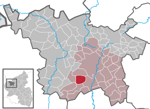
| Location of the local community Niederstadtfeld in the Vulkaneifel district | ||
  |
||

Niederstadtfeld is a municipality in the Vulkaneifel district in Rhineland-Palatinate . She belongs to the community of Daun .
geography
Geographical location
The place Niederstadtfeld is about 8 km from Daun, southwest in the direction of Bitburg near the B 257 and can be reached directly via the road 27. The original village (today's center) is located on an elevation between the brook valleys Kälberbach and Schwemmbach in a side valley of the " Kleinen Kyll ".
The valley of the "Kleine Kyll" is part of the landscape protection area "Between Ueß and Kyll ". The newer development extends today over this elevation between Schwemmbachtal and Kälberbachtal as well as along the slope of the "Kleine Kyll", whereby the sports facility, the elementary and secondary school and the tennis facility have found their place in the valley.
The altitude of the place moves between 386 and 420 m above sea level. NHN with a total cadastral area of 913 ha, of which 465 ha alone represent forest areas and 345 ha are agricultural areas.
Districts and residential areas
The Altenberger Hof, Heilsberger Hof and Trombacher Hof residential areas also belong to Niederstadtfeld .
Neighboring places
Bleckhausen , Deudesfeld , Meisburg , Neroth , Oberstadtfeld , Salm , Schutz , Üdersdorf , Wallenborn , Weidenbach .
history
- Historical data
- 1016 first documented mention of the town of Stadefeld
- 1330 first mention of the church in Stadefeld
- 1794 fire in the lower village
- Population development
The development of the population of Niederstadtfeld, the values from 1871 to 1987 are based on censuses:
|
|
politics
Municipal council
The council in Niederstadtfeld consists of eight council members, who in the local elections on May 26, 2019 in a majority vote were elected, and the honorary mayor as chairman. Until 2009 the council had twelve council members.
coat of arms
|
|
Blazon : "Divided twice by gold, red and silver, a red zigzag bar at the top, a silver scale in the middle, a blue gear wheel at the bottom." |
| Foundation of the coat of arms: Niederstadtfeld has belonged to the Counts of Manderscheid since 1565 and was a place in the Kurtrierisches Amt Manderscheid until the end of the 18th century . The red zigzag bar is taken from the coat of arms of the Lords of Manderscheid . In the Manderscheid High Court , Niederstadtfeld had its own court for Niederstadtfeld, Schutz and Deudesfeld . The silver scales should document this. The cog wheel in the lower part of the coat of arms refers to the early manual beginnings in Niederstadtfeld, but also to the industrial company located there today. |
Culture and sights

Buildings
- Parish Church of St. Sebastian (first mentioned in 1330)
- Former mill at the entrance to Niederstadtfeld on Landesstraße 27 coming from Oberstadtfeld (first mentioned in 1508)
See also: List of cultural monuments in Niederstadtfeld
Green spaces and recreation
- Hiking in and around Niederstadtfeld
- Carbonated drinking water source Niederstadtfelder Drees , on the road 27 in the direction of Schutz, approx. 50 m from the village
- Since 2007 the Kosmos cycle path has been running from Daun to Meerfeld through Niederstadtfeld. There is an information point on the planet Neptune at the bus station.
Regular events
- Annual fair or parish fair
- Traditional rattling or rattling on Good Friday and Holy Saturday
- Hut burning on the first weekend after Ash Wednesday (so-called Scheef-Sunisch)
education
The town's primary and full-day secondary school was closed in 2011.
Web links
- Internet presence of the local community Niederstadtfeld
- To search for cultural assets of the Niederstadtfeld community in the database of cultural assets in the Trier region .
Individual evidence
- ↑ a b State Statistical Office of Rhineland-Palatinate - population status 2019, districts, municipalities, association communities ( help on this ).
- ↑ State Statistical Office Rhineland-Palatinate (ed.): Official directory of the municipalities and parts of the municipality. Status: January 1, 2017 [ Version 2020 is available. ] . S. 70 (PDF; 1.9 MB).
- ^ The Regional Returning Officer Rhineland-Palatinate: Local elections 2019, city and municipal council elections
- ↑ Niederstadtfeld coat of arms
- ↑ Vulkaneifel path, Hinterbüsch path, Niederstadtfeld. Retrieved February 6, 2018 .
- ^ Niederstadtfeld mineral spring. Retrieved February 8, 2018 .
- ^ Scheef-Sundisch in Niederstadtfeld. Retrieved August 6, 2018 .
- ↑ Hüttenbrennen in the Eifel. Retrieved May 1, 2016 .
- ↑ Hut Sunday in the Eifel. Retrieved August 10, 2017 .
- ↑ volksfreund.de, accessed February 8, 2016

Arbach | Basberg | Beinhausen | Bereborn | Berenbach | Berlingen | Berndorf | Betteldorf | Birgel | Birresborn | Bleckhausen | Bodenbach | Bongard | Borler | Boxberg | Brockscheid | Brückal | Darscheid | Down | Demerath | Densborn | Deudesfeld | Dockweiler | Dohm-Lammersdorf | Drees | Dreis-Brück | Duppach | Ellscheid | Esch | Feusdorf | Gefell | Gelenberg | Gerolstein | Gillenfeld | Gönnersdorf | Gunderath | Reverberation | Hillesheim | Hinterweiler | Höchstberg | Hohenfels-Essingen | Horperath | Hörscheid | Hörschhausen | Immerath | Jünkerath | Kalenborn scrubbing | Caperich | Katzwinkel | Kelberg | Kerpen (Eifel) | Kerschenbach | Kirchweiler | Kirsbach | Kolverath | Kopp | Kötterichen | Kradenbach | Lirstal | Lissendorf | Mannebach | More | Meisburg | Mosbruch | Mosquitoes | Mürlenbach | Neichen | Nerd | Neroth | Niederstadtfeld | Nitz | Nohn | Oberbettingen | Oberehe-Stroheich | Oberelz | Oberstadtfeld | Ormont | Pelm | Reimerath | Retterath | Reuth | Rockeskyll | Salm | Sarmersbach | Sassen | Saxler | Schalkenmehren | Scheid | Schönbach | Schüller | Protection | Stadtkyll | Steffeln | Steineberg | Steiningen | Strohn | Strotzbüsch | Üdersdorf | Udler | Uersfeld | Ueß | Utzerath | Üxheim | Wallenborn | Walsdorf | Weidenbach | Which council | Wiesbaum | Winkel (Eifel)