
Ellscheid
| coat of arms | Germany map | |
|---|---|---|

|
Coordinates: 50 ° 9 ′ N , 6 ° 55 ′ E |
|
| Basic data | ||
| State : | Rhineland-Palatinate | |
| County : | Vulkaneifel | |
| Association municipality : | Down | |
| Height : | 450 m above sea level NHN | |
| Area : | 5.21 km 2 | |
| Residents: | 264 (Dec. 31, 2019) | |
| Population density : | 51 inhabitants per km 2 | |
| Postal code : | 54552 | |
| Area code : | 06573 | |
| License plate : | DAU | |
| Community key : | 07 2 33 021 | |
| Association administration address: | Leopoldstrasse 29 54550 Daun |
|
| Website : | ||
| Local Mayor : | Dieter Ackermann | |
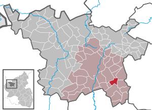
| Location of the local community Ellscheid in the Vulkaneifel district | ||
  |
||


Ellscheid is a municipality in the Vulkaneifel district in Rhineland-Palatinate . She belongs to the community of Daun .
geography
Ellscheid is located in the middle of the Vulkaneifel and in the east of the landscape protection area “Between Ueß and Kyll ” north of the powder maar . The destination for an excursion is the Mürmes nature reserve . The Mürmes is a marsh area between Ellscheid, Saxler and Mehren . The Hünenhof and Waldhof residential areas also belong to Ellscheid .
archeology
In the area around Ellscheid there are a number of Celtic barrows , the oldest of which are from the Hallstatt period (6th to 7th centuries BC) and are assigned to the Hunsrück-Eifel culture . For some, the time of origin is still undetermined. Finds from Roman times were also made.
In the “Stackenbruch” burial mound field to the north of the village, there are over 30 burial mounds of unknown time, which have a height of up to 2 meters and a circumference of about 30 meters.
An extensive burial mound necropolis of at least 35 burial mounds in two groups is located in the "Rothreisern", also north of Ellscheid. They date from the early Iron Age (6th century BC). Three of the grave mounds were excavated by Felix Hettner in 1888 . Two body graves with small additions were discovered.
Five other burial mounds are located northwest of the village in the "Moosholz" district. During an excavation in 1966, only small remains of charcoal and ceramic were found. In the vicinity, a cremation grave richly decorated with ceramics and with brick slabs was discovered, which was assigned to the last quarter of the 1st century AD.
A burial mound was leveled south-east of Ellscheid in the direction of Gillenfeld in 1961, which had previously been examined by the Rheinisches Landesmuseum Trier . Two pits were found, based on the grave goods, the burial mound was dated to the second half of the 1st century AD.
A site in the "Strothflur" (south of the town towards Gillenfeld), which has been known since 1854, was geomagnetically investigated by scientists from the University of Cologne . The measurements suggest a Roman villa , the main building of which is about 36 meters long and 29 meters wide. The manor was used between the 1st and 4th centuries.
history
The first documentary mention under the name "Hedelscheit" took place in 1136, when Adalbero von Basel (1131–1136) donated a forest to the Sankt Marien monastery in Prüm and confirmed earlier donations. In 1563 the village was named Elscheid 13 and in 1684 there were twelve fire places . Wonderfully country they belonged to the late 18th century to the Electorate of Trier and shelter as part of the centering Ellscheid the management of the Office and High Court Daun. Cent Ellscheid also included the village of Immerath with the Heckenhof. In 1787 Ellscheid had 127 inhabitants.
- Population development
The development of the population of Ellscheid, the values from 1871 to 1987 are based on censuses:
|
|
politics
Municipal council
The council in Ellscheid consists of six council members, who in the local elections on May 26, 2019 in a majority vote were elected, and the honorary mayor as chairman.
coat of arms
|
|
Blazon : “Divided by silver and blue obliquely to the left; above a red St. Anthony cross with 2 bells below 3 (1: 1: 1) silver fish " |
| Justification of the coat of arms: The Antonius cross with the two pilgrim bells refers to the local and church patron, St. Antonius , go. The three fish symbolize the three former electoral fish ponds: Mürmesweiher, Finkenweiher and Mittelweiher. |
Culture and sights
Buildings
See the list of cultural monuments in Ellscheid
societies
There are many clubs in Ellscheid, for example for sporting interests or other leisure activities. There is a sports club, which in turn is divided into the various branches of soccer, running, tennis and volleyball. There is also a singing group and some associations such as the village development working group, which deal with the design of the townscape.
Web links
- Internet presence of the local community Ellscheid
- To search for cultural assets of the local community Ellscheid in the database of cultural assets in the Trier region .
- Short portrait of Ellscheid on SWR television .
Individual evidence
- ↑ State Statistical Office of Rhineland-Palatinate - population status 2019, districts, communities, association communities ( help on this ).
- ↑ State Statistical Office Rhineland-Palatinate (ed.): Official directory of the municipalities and parts of the municipality. Status: January 2018 [ Version 2020 is available. ] . S. 70 (PDF; 2.2 MB).
- ↑ a b c d Dirk Lutz Krauße : German Archaeological Institute: Iron Age Cultural Change and Romanization in the Mosel-Eifel Region , catalog of sites, 2006, p. 148 ( memento of March 8, 2014 in the Internet Archive ), accessed in the Internet archive on 6 February 2016 (PDF; 1.2 MB)
- ↑ a b History of Ellscheid at www.ellscheid-vulkaneifel.de
- ↑ The Romans in Ellscheid (PDF; 322 kB) at www.ellscheid-vulkaneifel.de
- ^ Heinrich Beyer : Rheinisches Urkundenbuch , Volume 1, Coblenz: Hölscher, 1860, Certificate 488 ( online edition at dilibri )
- ↑ Name and origin of the village (PDF; 29 kB) on www.ellscheid-vulkaneifel.de
- ^ Wilhelm Fabricius : Explanations of the historical atlas of the Rhine province, Volume 2: The map of 1789. Bonn 1898, p. 112, 149.
- ↑ State Statistical Office Rhineland-Palatinate - regional data
- ^ The Regional Returning Officer Rhineland-Palatinate: Local elections 2019, city and municipal council elections

Arbach | Basberg | Beinhausen | Bereborn | Berenbach | Berlingen | Berndorf | Betteldorf | Birgel | Birresborn | Bleckhausen | Bodenbach | Bongard | Borler | Boxberg | Brockscheid | Brückal | Darscheid | Down | Demerath | Densborn | Deudesfeld | Dockweiler | Dohm-Lammersdorf | Drees | Dreis-Brück | Duppach | Ellscheid | Esch | Feusdorf | Gefell | Gelenberg | Gerolstein | Gillenfeld | Gönnersdorf | Gunderath | Reverberation | Hillesheim | Hinterweiler | Höchstberg | Hohenfels-Essingen | Horperath | Hörscheid | Hörschhausen | Immerath | Jünkerath | Kalenborn scrubbing | Caperich | Katzwinkel | Kelberg | Kerpen (Eifel) | Kerschenbach | Kirchweiler | Kirsbach | Kolverath | Kopp | Kötterichen | Kradenbach | Lirstal | Lissendorf | Mannebach | More | Meisburg | Mosbruch | Mosquitoes | Mürlenbach | Neichen | Nerd | Neroth | Niederstadtfeld | Nitz | Nohn | Oberbettingen | Oberehe-Stroheich | Oberelz | Oberstadtfeld | Ormont | Pelm | Reimerath | Retterath | Reuth | Rockeskyll | Salm | Sarmersbach | Sassen | Saxler | Schalkenmehren | Scheid | Schönbach | Schüller | Protection | Stadtkyll | Steffeln | Steineberg | Steiningen | Strohn | Strotzbüsch | Üdersdorf | Udler | Uersfeld | Ueß | Utzerath | Üxheim | Wallenborn | Walsdorf | Weidenbach | Which council | Wiesbaum | Winkel (Eifel)