
Bereborn
| coat of arms | Germany map | |
|---|---|---|

|
Coordinates: 50 ° 17 ' N , 6 ° 58' E |
|
| Basic data | ||
| State : | Rhineland-Palatinate | |
| County : | Vulkaneifel | |
| Association municipality : | Kelberg | |
| Height : | 501 m above sea level NHN | |
| Area : | 2.57 km 2 | |
| Residents: | 114 (Dec. 31, 2019) | |
| Population density : | 44 inhabitants per km 2 | |
| Postal code : | 56769 | |
| Area code : | 02692 | |
| License plate : | DAU | |
| Community key : | 07 2 33 202 | |
| LOCODE : | DE B5P | |
| Association administration address: | Dauner Strasse 22 53539 Kelberg |
|
| Website : | ||
| Local Mayor : | Johannes Schu | |
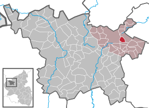
| Location of the local community of Bereborn in the Vulkaneifel district | ||
  |
||

Bereborn is a municipality in the Vulkaneifel district in Rhineland-Palatinate . It belongs to the association community Kelberg .
geography
The place is located in the High Eifel at the foot of the Hochkelberg nature reserve , about 18 kilometers northeast of the district town of Daun . The Elzbach rises north of the village .
The Weilcheswieserhof residential area also belongs to Bereborn .
history
Until the end of the 18th century Bereborn belonged to the county of Virneburg . During the so-called French period , the place was a municipality in the Mairie Virneburg .
In the course of the municipal reorganization of Rhineland-Palatinate and the reorganization of the association municipality Kelberg, the municipality of Bereborn came on November 7, 1970 from the district of Mayen, which was dissolved at the same time, to the district of Daun (today the district of Vulkaneifel ).
- Population development
The development of the population of Bereborn, the values from 1871 to 1987 are based on censuses:
|
|
politics
Municipal council
The council in Bereborn consists of six council members, who in the local elections on May 26, 2019 in a majority vote were elected, and the honorary mayor as chairman.
coat of arms
|
|
Blazon : "Divided by silver and blue, above 7 (4: 3) red diamonds, below a silver drawing well." |
Cultural and natural monuments

In the center of the village, the Kaiserlinde with a memorial stone commemorates the 100th anniversary of the victory over Napoleon in the Battle of Leipzig in 1813.
The Catholic Church of St. Quirinus was built in 1777 as a two-axis hall structure.
traffic
In the north the federal highway 410 leads past the community.
literature
- Erich Mertes-Kolverath: The villages of the Verbandsgemeinde Kelberg, your first mention and mention in the literature. In: Regional history quarterly papers. Volume 32, 1986, issue 3
- Literature about Bereborn in the Rhineland-Palatinate State Bibliography
Web links
- Internet presence of the local community Berenborn
- Local community Berenborn on the website of the association community Kelberg
- To search for cultural assets of the local community of Bereborn in the database of cultural assets in the Trier region .
Individual evidence
- ↑ State Statistical Office of Rhineland-Palatinate - population status 2019, districts, communities, association communities ( help on this ).
- ↑ State Statistical Office Rhineland-Palatinate (ed.): Official directory of the municipalities and parts of the municipality. Status: January 2018 [ Version 2020 is available. ] . S. 73 (PDF; 2.2 MB).
- ↑ Official municipality directory (= State Statistical Office of Rhineland-Palatinate [Hrsg.]: Statistical volumes . Volume 407 ). Bad Ems February 2016, p. 156 (PDF; 2.8 MB).
- ↑ State Statistical Office Rhineland-Palatinate - regional data
- ^ The Regional Returning Officer Rhineland-Palatinate: Local elections 2019, city and municipal council elections

Arbach | Basberg | Beinhausen | Bereborn | Berenbach | Berlingen | Berndorf | Betteldorf | Birgel | Birresborn | Bleckhausen | Bodenbach | Bongard | Borler | Boxberg | Brockscheid | Brückal | Darscheid | Down | Demerath | Densborn | Deudesfeld | Dockweiler | Dohm-Lammersdorf | Drees | Dreis-Brück | Duppach | Ellscheid | Esch | Feusdorf | Gefell | Gelenberg | Gerolstein | Gillenfeld | Gönnersdorf | Gunderath | Reverberation | Hillesheim | Hinterweiler | Höchstberg | Hohenfels-Essingen | Horperath | Hörscheid | Hörschhausen | Immerath | Jünkerath | Kalenborn scrubbing | Caperich | Katzwinkel | Kelberg | Kerpen (Eifel) | Kerschenbach | Kirchweiler | Kirsbach | Kolverath | Kopp | Kötterichen | Kradenbach | Lirstal | Lissendorf | Mannebach | More | Meisburg | Mosbruch | Mosquitoes | Mürlenbach | Neichen | Nerd | Neroth | Niederstadtfeld | Nitz | Nohn | Oberbettingen | Oberehe-Stroheich | Oberelz | Oberstadtfeld | Ormont | Pelm | Reimerath | Retterath | Reuth | Rockeskyll | Salm | Sarmersbach | Sassen | Saxler | Schalkenmehren | Scheid | Schönbach | Schüller | Protection | Stadtkyll | Steffeln | Steineberg | Steiningen | Strohn | Strotzbüsch | Üdersdorf | Udler | Uersfeld | Ueß | Utzerath | Üxheim | Wallenborn | Walsdorf | Weidenbach | Which council | Wiesbaum | Winkel (Eifel)