
Kerschenbach (Eifel)
| coat of arms | Germany map | |
|---|---|---|

|
Coordinates: 50 ° 21 ' N , 6 ° 30' E |
|
| Basic data | ||
| State : | Rhineland-Palatinate | |
| County : | Vulkaneifel | |
| Association municipality : | Gerolstein | |
| Height : | 540 m above sea level NHN | |
| Area : | 6.92 km 2 | |
| Residents: | 199 (Dec. 31, 2019) | |
| Population density : | 29 inhabitants per km 2 | |
| Postal code : | 54589 | |
| Area code : | 06597 | |
| License plate : | DAU | |
| Community key : | 07 2 33 219 | |
| Association administration address: | Kyllweg 1 54568 Gerolstein |
|
| Website : | ||
| Local Mayor : | Walter Schneider | |
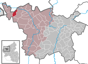
| Location of the local community of Kerschenbach in the Vulkaneifel district | ||
  |
||

;_Panoramablick_a.jpg)
Kerschenbach is a municipality in the Vulkaneifel district in Rhineland-Palatinate . It belongs to the Gerolstein community .
history
The place was first mentioned in a document at the beginning of the 14th century as part of the Kronenburg rule . From the middle of the 14th century, Kerschenbach belonged to Hof Stadtkyll and thus to the court there in the county of Gerolstein . Kerschenbach also belonged to the parish of Kronenburg until the 18th century. Around 1790 Kerschenbach came to the parish of Stadtkyll.
As part of the Rhineland-Palatinate functional and territorial reform , Kerschenbach was reclassified together with 14 other communities on November 7, 1970 from the district of Prüm , which was dissolved at the same time, to the district of Daun (since 2007 district of Vulkaneifel).
- Population development
The development of the population of Kerschenbach, the values from 1871 to 1987 are based on censuses:
|
|
politics
Municipal council
The municipal council in Kerschenbach consists of six council members, who were elected by a majority vote in the local elections on May 26, 2019 , and the honorary local mayor as chairman.
coat of arms
;_Dorfplatz_a.jpg)
|
|
Blazon : "Under a golden shield head, inside a red zigzag bar, split in red by a silver wavy strip, in front a raised golden sword, behind a golden ear." |
| Justification of the coat of arms: The red zigzag bar on a golden background in the main shield indicates that the place belonged to the county of Gerolstein . The Manderscheid-Gerolsteiner counts used the red zigzag bar on gold in their coat of arms. The silver wavy bar that splits the coat of arms indicates the Kerschenbach, which gave the place its name. The golden sword stands for Saint Lucia , who died by the sword as a martyr for her faith and is the patroness of the place and the chapel in Kerschenbach. At the same time, however, the sword also points to the medieval high court in Kerschenbach, which is still reminiscent of the hall designation “At the court”. The golden ear symbolizes the rural character of the community and agriculture as a livelihood for many centuries for the people of Kerschenbach. |
Culture and sights
;_katholische_Filialkirche_St._Lucia_a.jpg)
- Catholic branch church Sankt Luzia with graveyard from the 16th century.
- Village square and youth club with leisure facilities
- Traditional rattling or rattling on Good Friday and Holy Saturday
- Hut burning on the first Sunday of Lent (so-called Scheef Sunday)
- Annual fair or parish fair, usually on the second weekend in August.
- Hiking routes in and around Kerschenbach
See also: List of cultural monuments in Kerschenbach (Eifel)
literature
- Hubert Pitzen: Kerschenbach. In: Yearbook of the district of Daun. 2005, pp. 147-153.
Web links
- Internet presence of the local community Kerschenbach
- Representation of the local community Kerschenbach on the website of the Verbandsgemeinde Obere Kyll
- To search for cultural assets of the local community Kerschenbach in the database of cultural assets in the Trier region .
Individual evidence
- ↑ a b State Statistical Office of Rhineland-Palatinate - population status 2019, districts, municipalities, association communities ( help on this ).
- ↑ Official municipality directory (= State Statistical Office of Rhineland-Palatinate [Hrsg.]: Statistical volumes . Volume 407 ). Bad Ems February 2016, p. 156 (PDF; 2.8 MB).
- ↑ State Statistical Office Rhineland-Palatinate - regional data
- ^ The Regional Returning Officer Rhineland-Palatinate: Local elections 2019, city and municipal council elections .
- ↑ Declaration of the coat of arms. Verbandsgemeinde Obere Kyll, accessed on June 19, 2017 .
- ↑ Hüttenbrennen in the Eifel. Retrieved May 1, 2016 .
- ↑ Stadtkyll-Kerschenbach-Dahlem-Hammerhütte hiking route. Retrieved June 20, 2017 .

Arbach | Basberg | Beinhausen | Bereborn | Berenbach | Berlingen | Berndorf | Betteldorf | Birgel | Birresborn | Bleckhausen | Bodenbach | Bongard | Borler | Boxberg | Brockscheid | Brückal | Darscheid | Down | Demerath | Densborn | Deudesfeld | Dockweiler | Dohm-Lammersdorf | Drees | Dreis-Brück | Duppach | Ellscheid | Esch | Feusdorf | Gefell | Gelenberg | Gerolstein | Gillenfeld | Gönnersdorf | Gunderath | Reverberation | Hillesheim | Hinterweiler | Höchstberg | Hohenfels-Essingen | Horperath | Hörscheid | Hörschhausen | Immerath | Jünkerath | Kalenborn scrubbing | Caperich | Katzwinkel | Kelberg | Kerpen (Eifel) | Kerschenbach | Kirchweiler | Kirsbach | Kolverath | Kopp | Kötterichen | Kradenbach | Lirstal | Lissendorf | Mannebach | More | Meisburg | Mosbruch | Mosquitoes | Mürlenbach | Neichen | Nerd | Neroth | Niederstadtfeld | Nitz | Nohn | Oberbettingen | Oberehe-Stroheich | Oberelz | Oberstadtfeld | Ormont | Pelm | Reimerath | Retterath | Reuth | Rockeskyll | Salm | Sarmersbach | Sassen | Saxler | Schalkenmehren | Scheid | Schönbach | Schüller | Protection | Stadtkyll | Steffeln | Steineberg | Steiningen | Strohn | Strotzbüsch | Üdersdorf | Udler | Uersfeld | Ueß | Utzerath | Üxheim | Wallenborn | Walsdorf | Weidenbach | Which council | Wiesbaum | Winkel (Eifel)