
Dockweiler
| coat of arms | Germany map | |
|---|---|---|

|
Coordinates: 50 ° 15 ' N , 6 ° 47' E |
|
| Basic data | ||
| State : | Rhineland-Palatinate | |
| County : | Vulkaneifel | |
| Association municipality : | Down | |
| Height : | 535 m above sea level NHN | |
| Area : | 6.05 km 2 | |
| Residents: | 643 (Dec. 31, 2019) | |
| Population density : | 106 inhabitants per km 2 | |
| Postal code : | 54552 | |
| Area code : | 06595 | |
| License plate : | DAU | |
| Community key : | 07 2 33 018 | |
| LOCODE : | DE DWE | |
| Association administration address: | Leopoldstrasse 29 54550 Daun |
|
| Website : | ||
| Local Mayor : | Ralf Schüller | |
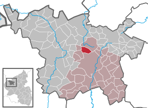
| Location of the local community Dockweiler in the Vulkaneifel district | ||
  |
||


Dockweiler is a municipality in the Vulkaneifel district in Rhineland-Palatinate . It belongs to the community of Daun .
history
Dockweiler ("Dochwilre") was first mentioned in a document from King Konrad III. when he confirmed his rights and possessions to the Springiersbach monastery on August 1, 1144 after the death of Count Palatine Wilhelm and took it under his protection. Until the end of the 18th century, Dockweiler belonged to the imperial rule of Kerpen , which was last owned by the Duke of Arenberg .
In 1794 the Left Bank of the Rhine was occupied by French revolutionary troops in the First Coalition War. From 1798 to 1814 Dockweiler belonged to the canton of Daun in the Saardepartement .
At the Congress of Vienna (1815), the region came to the Kingdom of Prussia , Dockweiler in 1816 the newly built district down in Trier assigned and was the seat of the same name mayoralty .
After the Second World War , the Dockweiler community within the French occupation zone became part of the then newly formed state of Rhineland-Palatinate.
- Population development
The development of the population of Dockweiler, the values from 1871 to 1987 are based on censuses:
|
|
politics
Municipal council
The council in Dockweiler consists of twelve council members, who in the local elections on May 26, 2019 in a majority vote were elected, and the honorary mayor as chairman.
coat of arms
|
|
Blazon : “Under a red shield head, inside a golden zigzag bar, diagonally left divided by silver and red; in front a black grate, behind a double-petaled, golden rose with a red clasp. " |
| Justification for the coat of arms: The golden rafter bar on a red background stands for the centuries-long manorial rule of the Counts of Manderscheid . The grate symbolizes the church and local patron St. Laurentius . The empire-direct rule of Kerpen , to which Dockweiler belonged, came about through the division of inheritance . to the dukes of Arenberg . The Arenbergers had three roses in their coat of arms. For this reason the rose was included in the coat of arms. |
Location description
At the Romanesque church (around 1200) there are linden and chestnut trees, which are around 200 years old and are considered natural monuments . There is a sour well in the Dockweiler forest . A block lava field (natural monument) is located south of the village. There are hiking opportunities in the forest area in the Dockweiler - Daun - Kelberg triangle .
Transport links
- Road: via B 421 and B 410
- Railway: Stop at the old train station in Dauner Straße ( Eifelquerbahn ), there is currently no railway traffic
- Bus: two regional lines: 500/9311 Gerolstein-Daun-Cochem and 511/9367 partly Jünkerath-Hillesheim-Daun
People born in Dockweiler
- Herbert Schneider OFM (* 1938), Roman Catholic priest and spiritual writer
- Matthias Utters OFM (1934–1986), Roman Catholic priest
See also
Web links
- Internet presence of the local community Dockweiler
- To search for cultural assets of the local community Dockweiler in the database of cultural assets in the Trier region .
Individual evidence
- ↑ State Statistical Office of Rhineland-Palatinate - population status 2019, districts, communities, association communities ( help on this ).
- ^ Heinrich Beyer : Rheinisches Urkundenbuch , Volume 1, Coblenz: Hölscher, 1860, Certificate 532 ( dilibri.de )
- ↑ State Statistical Office Rhineland-Palatinate: Regional data.
- ^ The Regional Returning Officer Rhineland-Palatinate: Local elections 2019, city and municipal council elections
- ↑ Friedbert Wißkirchen: Local and community coats of arms are "in" again. In: Heimatjahrbuch 1988. Vulkaneifel district, accessed on April 5, 2019 .

Arbach | Basberg | Beinhausen | Bereborn | Berenbach | Berlingen | Berndorf | Betteldorf | Birgel | Birresborn | Bleckhausen | Bodenbach | Bongard | Borler | Boxberg | Brockscheid | Brückal | Darscheid | Down | Demerath | Densborn | Deudesfeld | Dockweiler | Dohm-Lammersdorf | Drees | Dreis-Brück | Duppach | Ellscheid | Esch | Feusdorf | Gefell | Gelenberg | Gerolstein | Gillenfeld | Gönnersdorf | Gunderath | Reverberation | Hillesheim | Hinterweiler | Höchstberg | Hohenfels-Essingen | Horperath | Hörscheid | Hörschhausen | Immerath | Jünkerath | Kalenborn scrubbing | Caperich | Katzwinkel | Kelberg | Kerpen (Eifel) | Kerschenbach | Kirchweiler | Kirsbach | Kolverath | Kopp | Kötterichen | Kradenbach | Lirstal | Lissendorf | Mannebach | More | Meisburg | Mosbruch | Mosquitoes | Mürlenbach | Neichen | Nerd | Neroth | Niederstadtfeld | Nitz | Nohn | Oberbettingen | Oberehe-Stroheich | Oberelz | Oberstadtfeld | Ormont | Pelm | Reimerath | Retterath | Reuth | Rockeskyll | Salm | Sarmersbach | Sassen | Saxler | Schalkenmehren | Scheid | Schönbach | Schüller | Protection | Stadtkyll | Steffeln | Steineberg | Steiningen | Strohn | Strotzbüsch | Üdersdorf | Udler | Uersfeld | Ueß | Utzerath | Üxheim | Wallenborn | Walsdorf | Weidenbach | Which council | Wiesbaum | Winkel (Eifel)