Caperich
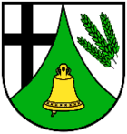
| coat of arms | Germany map | |
|---|---|---|

|
Coordinates: 50 ° 15 ' N , 7 ° 2' E |
|
| Basic data | ||
| State : | Rhineland-Palatinate | |
| County : | Vulkaneifel | |
| Association municipality : | Kelberg | |
| Height : | 470 m above sea level NHN | |
| Area : | 2.69 km 2 | |
| Residents: | 176 (Dec. 31, 2019) | |
| Population density : | 65 inhabitants per km 2 | |
| Postal code : | 56767 | |
| Area code : | 02657 | |
| License plate : | DAU | |
| Community key : | 07 2 33 217 | |
| Community structure: | 2 districts | |
| Association administration address: | Dauner Strasse 22 53539 Kelberg |
|
| Website : | ||
| Local Mayor : | Robert Karst | |
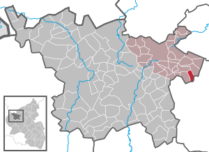
| Location of the local community of Kaperich in the Vulkaneifel district | ||
Kaperich is a municipality in the Vulkaneifel district in Rhineland-Palatinate . It belongs to the association community Kelberg .
geography
The place is in the Eifel . Neighboring communities are Lirstal , Höchstberg and Uersfeld .
The hamlet of Kölnische Höfe belongs to the municipality of Kaperich .
Municipal council
The municipal council in Kaperich consists of six council members, who were elected by a majority vote in the local elections on May 26, 2019 , and the honorary local mayor as chairman.
See also
Web links
- To search for cultural assets of the local community Kaperich in the database of cultural assets in the Trier region .
Individual evidence
- ↑ State Statistical Office of Rhineland-Palatinate - population status 2019, districts, communities, association communities ( help on this ).
- ^ The Regional Returning Officer Rhineland-Palatinate: Local elections 2019, city and municipal council elections


