
Udler
| coat of arms | Germany map | |
|---|---|---|

|
Coordinates: 50 ° 8 ' N , 6 ° 53' E |
|
| Basic data | ||
| State : | Rhineland-Palatinate | |
| County : | Vulkaneifel | |
| Association municipality : | Down | |
| Height : | 420 m above sea level NHN | |
| Area : | 6.3 km 2 | |
| Residents: | 252 (Dec. 31, 2019) | |
| Population density : | 40 inhabitants per km 2 | |
| Postal code : | 54552 | |
| Area code : | 06573 | |
| License plate : | DAU | |
| Community key : | 07 2 33 074 | |
| Association administration address: | Leopoldstrasse 29 54550 Daun |
|
| Website : | ||
| Local Mayor : | Alfred Borsch | |
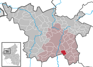
| Location of the local community Udler in the Vulkaneifel district | ||
  |
||


Udler is a municipality in the Vulkaneifel district in Rhineland-Palatinate . She belongs to the community of Daun . The Berghof and Waldhof residential areas also belong to Udler .
history
Udler, formerly also "Odeler" and "Oudler", belonged to the Kurtrierischen Amt Daun since 1357 . After Prussia took over the Rhineland , to which Udler was one at that time, the place came to the then newly formed Daun district in 1815/1816 and belonged to the mayor's office of Gillenfeld . At the beginning of the 19th century the place had 188 inhabitants who lived in 33 houses.
- Population development
The development of the population of Udler, the values from 1871 to 1987 are based on censuses:
|
|

politics
Municipal council
The municipal council in Udler consists of six council members, who were elected by a majority vote in the local elections on May 26, 2019 , and the honorary local mayor as chairman. Until 2014, the council had eight councilors.
coat of arms
|
|
Blazon : "Under a silver shield head, inside a red bar cross, in blue on a silver stone standing silver dove." |
Attractions
In Udler there are some listed cultural monuments:
- The former Catholic branch church of St. Stephen, the choir tower is described as late medieval, the nave was renewed in 1734
- The former bakery , a single-storey plastered building from the end of the 19th century (Schalkenmehrener Straße)
- A house from around 1751 (Schalkenmehrener Straße)
Web links
- To search for cultural assets of the local community Udler in the database of cultural assets in the Trier region .
Individual evidence
- ↑ a b State Statistical Office of Rhineland-Palatinate - population status 2019, districts, municipalities, association communities ( help on this ).
- ↑ State Statistical Office Rhineland-Palatinate (ed.): Official directory of the municipalities and parts of the municipality. Status: January 2018. S. 71 (PDF; 2.2 MB; municipality is missing in the 2019 directory!).
- ^ A b Friedbert Wißkirchen: New community coat of arms in the Daun district. In: Heimatjahrbuch 1990. Retrieved April 6, 2019 .
- ^ Friedrich von Restorff : Topographical-Statistical Description of the Royal Prussian Rhine Province. Nicolai, Berlin and Stettin 1830, p. 888 ( Google Books ).
- ↑ State Statistical Office Rhineland-Palatinate: My village, my city. Retrieved May 10, 2020 .
- ^ The Regional Returning Officer Rhineland-Palatinate: Local elections 2019, city and municipal council elections.
- ↑ General Directorate for Cultural Heritage Rhineland-Palatinate (ed.): Informational directory of cultural monuments - Vulkaneifel district. Mainz 2020, p. 53 (PDF; 4.6 MB).

Arbach | Basberg | Beinhausen | Bereborn | Berenbach | Berlingen | Berndorf | Betteldorf | Birgel | Birresborn | Bleckhausen | Bodenbach | Bongard | Borler | Boxberg | Brockscheid | Brückal | Darscheid | Down | Demerath | Densborn | Deudesfeld | Dockweiler | Dohm-Lammersdorf | Drees | Dreis-Brück | Duppach | Ellscheid | Esch | Feusdorf | Gefell | Gelenberg | Gerolstein | Gillenfeld | Gönnersdorf | Gunderath | Reverberation | Hillesheim | Hinterweiler | Höchstberg | Hohenfels-Essingen | Horperath | Hörscheid | Hörschhausen | Immerath | Jünkerath | Kalenborn scrubbing | Caperich | Katzwinkel | Kelberg | Kerpen (Eifel) | Kerschenbach | Kirchweiler | Kirsbach | Kolverath | Kopp | Kötterichen | Kradenbach | Lirstal | Lissendorf | Mannebach | More | Meisburg | Mosbruch | Mosquitoes | Mürlenbach | Neichen | Nerd | Neroth | Niederstadtfeld | Nitz | Nohn | Oberbettingen | Oberehe-Stroheich | Oberelz | Oberstadtfeld | Ormont | Pelm | Reimerath | Retterath | Reuth | Rockeskyll | Salm | Sarmersbach | Sassen | Saxler | Schalkenmehren | Scheid | Schönbach | Schüller | Protection | Stadtkyll | Steffeln | Steineberg | Steiningen | Strohn | Strotzbüsch | Üdersdorf | Udler | Uersfeld | Ueß | Utzerath | Üxheim | Wallenborn | Walsdorf | Weidenbach | Which council | Wiesbaum | Winkel (Eifel)