
Schönbach (Eifel)
| coat of arms | Germany map | |
|---|---|---|

|
Coordinates: 50 ° 13 ' N , 6 ° 57' E |
|
| Basic data | ||
| State : | Rhineland-Palatinate | |
| County : | Vulkaneifel | |
| Association municipality : | Down | |
| Height : | 395 m above sea level NHN | |
| Area : | 4.67 km 2 | |
| Residents: | 261 (Dec. 31, 2019) | |
| Population density : | 56 inhabitants per km 2 | |
| Postal code : | 54552 | |
| Area code : | 02676 | |
| License plate : | DAU | |
| Community key : | 07 2 33 064 | |
| Association administration address: | Leopoldstrasse 29 54550 Daun |
|
| Website : | ||
| Local Mayor : | Martin Knüvener | |
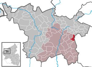
| Location of the local community Schönbach in the Vulkaneifel district | ||
  |
||

_002x.jpg)

Schönbach is a municipality in the Vulkaneifel district in Rhineland-Palatinate . She belongs to the community of Daun .
geography
The community lies in the Vulkaneifel Nature Park , and some in the conservation area "between Ueß and Kyll ". The residential areas Berghof, Hubertushof and Schönbacher Mühle also belong to Schönbach.
history
Schönbach was first mentioned in the 14th century: On the Sunday after St. Viti in 1364, Arnold von Dune , called von dem Marte (market), Burchhard von Vinstingen , transferred Mr. zu Schönecken , and his wife Blancheflor, seven guilders of annual pensions from his half Hof zu "Schonnbach" and gave him the same as a fief.
From 1357 until the end of the 18th century Schönbach belonged to the Electorate of Daun . Ecclesiastically, the place belonged to the Archdiocese of Cologne .
In 1794, Kurköln and Kurtrier owned lands in Schönbach, which the French government had auctioned off. In 1840 the community of Schönbach owned 47 acres of woodlands and 567 acres of wilderness.
- Name in local dialect
In the dialect spoken today, the name of the village is Schimmich .
- Statistics on population development
In 1563 Schönbach had 13 houses with around 60 to 70 inhabitants. After the Thirty Years War (1654) only five fireplaces were counted, which corresponds to a population of 20 to 30 people.
The further development of the population of Schönbach, the values from 1871 to 1987 are based on censuses:
|
|
politics
Municipal council
The municipal council in Schönbach consists of six council members, who were elected by a majority vote in the local elections on May 26, 2019 , and the honorary local mayor as chairman.
coat of arms
|
|
Blazon : “Divided in silver by angled, blue wavy bar; above a red bar cross, below a red shield covered with 9 (3: 3: 3) golden balls. " |
| Justification of the coat of arms: The blue wavy bar indicates the "Schönbach", which gave the place its name. The Schönbach is a tributary of the Üßbach . The red bar cross indicates the former sovereign belonging to Kurtrier . The shield with the nine balls is an attribute of the patron saint, St. Quirinus . |
See also
Web links
- Chronicle of Schönbach on www.schoenbach-eifel.de
- To search for cultural assets of the local community Schönbach in the database of cultural assets in the Trier region .
Individual evidence
- ↑ State Statistical Office of Rhineland-Palatinate - population status 2019, districts, communities, association communities ( help on this ).
- ↑ State Statistical Office Rhineland-Palatinate (ed.): Official directory of the municipalities and parts of the municipality. Status: January 2018 [ Version 2020 is available. ] . S. 70 (PDF; 2.2 MB).
- ^ A b Johann Friedrich Schannat , Georg Bärsch : Eiflia illustrata or geographical and historical description of the Eifel , Volume 3, Issue 2, Part 1, Mayer, 1854, p. 158 ( online )
- ↑ State Statistical Office Rhineland-Palatinate - regional data
- ^ The Regional Returning Officer Rhineland-Palatinate: Local elections 2019, city and municipal council elections

Arbach | Basberg | Beinhausen | Bereborn | Berenbach | Berlingen | Berndorf | Betteldorf | Birgel | Birresborn | Bleckhausen | Bodenbach | Bongard | Borler | Boxberg | Brockscheid | Brückal | Darscheid | Down | Demerath | Densborn | Deudesfeld | Dockweiler | Dohm-Lammersdorf | Drees | Dreis-Brück | Duppach | Ellscheid | Esch | Feusdorf | Gefell | Gelenberg | Gerolstein | Gillenfeld | Gönnersdorf | Gunderath | Reverberation | Hillesheim | Hinterweiler | Höchstberg | Hohenfels-Essingen | Horperath | Hörscheid | Hörschhausen | Immerath | Jünkerath | Kalenborn scrubbing | Caperich | Katzwinkel | Kelberg | Kerpen (Eifel) | Kerschenbach | Kirchweiler | Kirsbach | Kolverath | Kopp | Kötterichen | Kradenbach | Lirstal | Lissendorf | Mannebach | More | Meisburg | Mosbruch | Mosquitoes | Mürlenbach | Neichen | Nerd | Neroth | Niederstadtfeld | Nitz | Nohn | Oberbettingen | Oberehe-Stroheich | Oberelz | Oberstadtfeld | Ormont | Pelm | Reimerath | Retterath | Reuth | Rockeskyll | Salm | Sarmersbach | Sassen | Saxler | Schalkenmehren | Scheid | Schönbach | Schüller | Protection | Stadtkyll | Steffeln | Steineberg | Steiningen | Strohn | Strotzbüsch | Üdersdorf | Udler | Uersfeld | Ueß | Utzerath | Üxheim | Wallenborn | Walsdorf | Weidenbach | Which council | Wiesbaum | Winkel (Eifel)