
Pelm
| coat of arms | Germany map | |
|---|---|---|

|
Coordinates: 50 ° 14 ' N , 6 ° 41' E |
|
| Basic data | ||
| State : | Rhineland-Palatinate | |
| County : | Vulkaneifel | |
| Association municipality : | Gerolstein | |
| Height : | 370 m above sea level NHN | |
| Area : | 10.06 km 2 | |
| Residents: | 970 (Dec. 31, 2019) | |
| Population density : | 96 inhabitants per km 2 | |
| Postal code : | 54570 | |
| Area code : | 06591 | |
| License plate : | DAU | |
| Community key : | 07 2 33 056 | |
| LOCODE : | DE PLM | |
| Association administration address: | Kyllweg 1 54568 Gerolstein |
|
| Website : | ||
| Local Mayor : | Leo Meeth | |
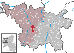
| Location of the local community of Pelm in the Vulkaneifel district | ||
  |
||


Pelm is a municipality in the Vulkaneifel district in Rhineland-Palatinate . It belongs to the Gerolstein community .
geography

The village lies on the Kyll and in the Vulkaneifel Nature Park, as well as in the conservation area "Gerolstein and the surrounding area".
The residential areas Jagdhaus Flemmingshöh, Kasselburg, Haus Sanddorn, Am Mühlenbach and Schloßbrunnen Gerolstein also belong to Pelm .
Neighboring communities are Gerolstein , Rockeskyll , Berlingen , Dohm-Lammersdorf and Hohenfels-Essingen .
Population development
The development of the population of Pelm, the values from 1871 to 1987 are based on censuses:
|
|
politics
Municipal council
The local council in Pelm consists of 16 council members, who were elected in a personalized proportional representation in the local elections on May 26, 2019 , and the honorary local mayor as chairman.
The distribution of seats in the municipal council:
| choice | CDU | FWG | total |
|---|---|---|---|
| 2019 | 4th | 8th | 12 seats |
| 2014 | 4th | 12 | 16 seats |
| 2009 | 4th | 12 | 16 seats |
| 2004 | 6th | 10 | 16 seats |
coat of arms
|
|
Blazon : "Split by green and silver, above a wavy beam split by silver and blue, two golden tin towers, flanking a golden battlement wall, gate and window illuminated with daylight, behind a red lecture cross." |
Culture and sights
The ruins of the Kasselburg lie near Pelm .
Economy and Infrastructure
The Pelm stop was on the now no longer used Eifelquerbahn and earlier on the Hillesheim – Gerolstein line .

Web links
- Internet presence of the local community Pelm
- To search for cultural assets of the local community Pelm in the database of cultural assets in the Trier region .
Individual evidence
- ↑ State Statistical Office of Rhineland-Palatinate - population status 2019, districts, communities, association communities ( help on this ).
- ↑ State Statistical Office Rhineland-Palatinate (ed.): Official directory of the municipalities and parts of the municipality. Status: January 2018 [ Version 2020 is available. ] . S. 72 (PDF; 2.2 MB).
- ↑ State Statistical Office Rhineland-Palatinate - regional data
- ^ The Regional Returning Officer Rhineland-Palatinate: Local elections 2019, city and municipal council elections

Arbach | Basberg | Beinhausen | Bereborn | Berenbach | Berlingen | Berndorf | Betteldorf | Birgel | Birresborn | Bleckhausen | Bodenbach | Bongard | Borler | Boxberg | Brockscheid | Brückal | Darscheid | Down | Demerath | Densborn | Deudesfeld | Dockweiler | Dohm-Lammersdorf | Drees | Dreis-Brück | Duppach | Ellscheid | Esch | Feusdorf | Gefell | Gelenberg | Gerolstein | Gillenfeld | Gönnersdorf | Gunderath | Reverberation | Hillesheim | Hinterweiler | Höchstberg | Hohenfels-Essingen | Horperath | Hörscheid | Hörschhausen | Immerath | Jünkerath | Kalenborn scrubbing | Caperich | Katzwinkel | Kelberg | Kerpen (Eifel) | Kerschenbach | Kirchweiler | Kirsbach | Kolverath | Kopp | Kötterichen | Kradenbach | Lirstal | Lissendorf | Mannebach | More | Meisburg | Mosbruch | Mosquitoes | Mürlenbach | Neichen | Nerd | Neroth | Niederstadtfeld | Nitz | Nohn | Oberbettingen | Oberehe-Stroheich | Oberelz | Oberstadtfeld | Ormont | Pelm | Reimerath | Retterath | Reuth | Rockeskyll | Salm | Sarmersbach | Sassen | Saxler | Schalkenmehren | Scheid | Schönbach | Schüller | Protection | Stadtkyll | Steffeln | Steineberg | Steiningen | Strohn | Strotzbüsch | Üdersdorf | Udler | Uersfeld | Ueß | Utzerath | Üxheim | Wallenborn | Walsdorf | Weidenbach | Which council | Wiesbaum | Winkel (Eifel)