
Üxheim
| coat of arms | Germany map | |
|---|---|---|

|
Coordinates: 50 ° 21 ' N , 6 ° 46' E |
|
| Basic data | ||
| State : | Rhineland-Palatinate | |
| County : | Vulkaneifel | |
| Association municipality : | Gerolstein | |
| Height : | 428 m above sea level NHN | |
| Area : | 30.98 km 2 | |
| Residents: | 1336 (Dec. 31, 2019) | |
| Population density : | 43 inhabitants per km 2 | |
| Postal code : | 54579 | |
| Primaries : | 02696, 06595 (Heyroth) | |
| License plate : | DAU | |
| Community key : | 07 2 33 076 | |
| LOCODE : | DE UHM | |
| Community structure: | 7 districts | |
| Association administration address: | Kyllweg 1 54568 Gerolstein |
|
| Website : | ||
| Local Mayor : | Alois Reinarz | |
| Location of the local community Üxheim in the Vulkaneifel district | ||
  |
||


Üxheim is a municipality in the Vulkaneifel district in Rhineland-Palatinate . It belongs to the Gerolstein community . The district of Niederehe is a state-approved resort .
geography
Geographical location
The municipality is located in the Hillesheimer Kalkmulde in the Volcanic West Eifel , one of three subregions into which the Vulkaneifel is divided, on the border between Rhineland-Palatinate and North Rhine-Westphalia .
Community structure
Üxheim consists of the districts of Üxheim, Ahütte , Leudersdorf (with Flesten and Nollenbach), Niederehe and Heyroth . The places Üxheim, Ahütte and Leudersdorf with Flesten form the parish of Üxheim. They are collectively called "Kijeschbel" ( parish ) in the area . The parish of Niederehe consists of the towns of Kerpen with Loogh, Heyroth and Niederehe. The historically interesting monastery church in Niederehe houses one of the oldest König organs .
history
Üxheim was first mentioned in a document in 844.
In 1175 the monastery Niederehe was founded, which was inhabited by Premonstratensian women.
Until the end of the 18th century, the village of Üxheim belonged to the imperial rule of Kerpen , which was owned by the Dukes of Arenberg .
The community of Üxheim was newly formed by the municipal reform in Rhineland-Palatinate on January 1, 1968 from the previously independent communities of Leudersdorf, Niederehe and Üxheim-Ahütte. The Heyroth community was incorporated on February 1, 1968.
Population development
The development of the population of Üxheim in relation to today's municipality; the values from 1871 to 1987 are based on censuses:
|
|
politics
Municipal council
The municipality council in Üxheim consists of 16 council members, who were elected in the local elections on May 26, 2019 in a personalized proportional representation, and the honorary local mayor as chairman. The 16 seats in the local council are divided between four groups of voters .
coat of arms
|
|
Blazon : "Under a silver shield head with a red zigzag bar, divided obliquely from red to silver, above 4 (3: 1) golden medlar flowers with blue clusters, below a black rust." |
| Justification of the coat of arms: The red zigzag bar on a silver background indicates the Knights of Kerpen, whose coat of arms was recorded as a regional gender. The four golden medlar blossoms on a red background stand for the four formerly independent communities Heyroth, Leudersdorf, Niederehe and Üxheim-Ahütte, which as districts make up the local community Üxheim. The medlar flowers are borrowed from the coat of arms of the Counts and Dukes of Aremberg , to whose rule Kerpen the districts of Üxheim belonged. The black rust on a silver background is the attribute of St. Lawrence . |
Culture and sights

Natural monument ND-7233-428 Dreimühlen waterfall

Cultural monument
ruin Dreimühlen
Cultural monument
Neublankenheim Castle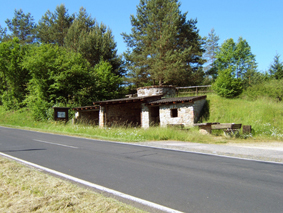
Lime kiln cultural monument near Niederehe
Cultural monument
Niederehe monastery
Cultural monument of the
baroque wayside shrine Niederehe
Cultural monument
Wegekreuz Niederehe

.jpg)


Dreimühlen waterfall natural monument
The Dreimühlen waterfall is located in the Ahbachtal, 1.0 km from Ahütte and 2.8 km from Niederehe . Sintered calcareous rock forms through evaporation and deposits in the moss , which makes the waterfall grow by six to eight centimeters per year. The natural monument can be reached on hiking trails as well as on the mineral spring route and the Kalkeifel cycle path .
Lime kiln
A restored lime kiln can be found on the road from Stroheich to Nohn , about halfway between Niederehe and Nohn.
Personalities
- Peter Anth (* 1745 Ahütte; † 1810 Cologne ), pseudonym: Theodulphus Joseph van den Elsken, was cathedral preacher, canon of St. Andreas (Cologne) in Cologne and author of numerous pamphlets
- Johann Jakob Schmitz (1755–1814), was a councilor and professor of constitutional law
- Thomas Dürr (* 1968 in Ditzingen ), known as Thomas D , German musician of the group Die Fantastischen Vier , lives in Heyroth
traffic
The now closed Dümpelfeld – Lissendorf railway ("Middle Ahr Valley Railway") ran through the area of Üxheim at Ahütte station .
literature
- Ortgemeinde Üxheim (Ed.): Heimatbuch Gemeinde Üxheim , Daun 1998.
- Local community Üxheim (ed.): Leudersdorf, Flesten, Nollenbach. House stories in words and pictures , Üxheim 2002.
- Niederehe Abbey in the community of Üxheim (Eifel) , brochure, ISBN 3-88094-708-2 .
- Paul Hilgers: Niedereher family book. (Heyroth, Kerpen, Loogh, Niederehe, Mirbach). 1655-1798. Compiled from the notarizations in the church records of the parish of St. Leodegar in Niederehe / Eifel , Aachen 1990.
Web links
- Internet presence of the local community Üxheim
- Representation of the local community Üxheim on the website of the Verbandsgemeinde Hillesheim
- To search for cultural assets of the local community Üxheim in the database of cultural assets in the Trier region .
Individual evidence
- ↑ State Statistical Office of Rhineland-Palatinate - population status 2019, districts, communities, association communities ( help on this ).
- ^ Wilhelm Fabricius : Explanations of the historical atlas of the Rhine province, 2nd volume: The map of 1789. Bonn 1898, p. 501.
- ↑ Official municipality directory (= State Statistical Office of Rhineland-Palatinate [Hrsg.]: Statistical volumes . Volume 407 ). Bad Ems February 2016, p. 181 (PDF; 2.8 MB).
- ↑ State Statistical Office Rhineland-Palatinate - regional data
- ^ The Regional Returning Officer Rhineland-Palatinate: Local elections 2019, city and municipal council elections
- ↑ Description of the coat of arms on the website of the Verbandsgemeinde Hillesheim
- ^ FX Münch: The Cologne city pastor Peter Anth (Theodulphus Joseph van den Elsken) . In: Annals of the Historical Association for the Lower Rhine . tape 82 , 1907, pp. 96 ( Wikisource [accessed October 14, 2015]).
- ↑ "The world can only be as big as your dreams". Retrieved November 26, 2017 .

Arbach | Basberg | Beinhausen | Bereborn | Berenbach | Berlingen | Berndorf | Betteldorf | Birgel | Birresborn | Bleckhausen | Bodenbach | Bongard | Borler | Boxberg | Brockscheid | Brückal | Darscheid | Down | Demerath | Densborn | Deudesfeld | Dockweiler | Dohm-Lammersdorf | Drees | Dreis-Brück | Duppach | Ellscheid | Esch | Feusdorf | Gefell | Gelenberg | Gerolstein | Gillenfeld | Gönnersdorf | Gunderath | Reverberation | Hillesheim | Hinterweiler | Höchstberg | Hohenfels-Essingen | Horperath | Hörscheid | Hörschhausen | Immerath | Jünkerath | Kalenborn scrubbing | Caperich | Katzwinkel | Kelberg | Kerpen (Eifel) | Kerschenbach | Kirchweiler | Kirsbach | Kolverath | Kopp | Kötterichen | Kradenbach | Lirstal | Lissendorf | Mannebach | More | Meisburg | Mosbruch | Mosquitoes | Mürlenbach | Neichen | Nerd | Neroth | Niederstadtfeld | Nitz | Nohn | Oberbettingen | Oberehe-Stroheich | Oberelz | Oberstadtfeld | Ormont | Pelm | Reimerath | Retterath | Reuth | Rockeskyll | Salm | Sarmersbach | Sassen | Saxler | Schalkenmehren | Scheid | Schönbach | Schüller | Protection | Stadtkyll | Steffeln | Steineberg | Steiningen | Strohn | Strotzbüsch | Üdersdorf | Udler | Uersfeld | Ueß | Utzerath | Üxheim | Wallenborn | Walsdorf | Weidenbach | Which council | Wiesbaum | Winkel (Eifel)