Pulvermaar
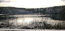
The powder maar is a maar filled with water and is located southeast of Daun in Rhineland-Palatinate . In addition to the Holzmaar, it belongs to the Gillenfeld Maars.
particularities
One in Moor education of the neighboring Strohner Maar contained Tufflage is attributed to the Pulvermaar, this is thus older than the Pulvermaar. Earlier pollen analyzes of the moor formation showed an age of the tufflage - and thus the powder maar - of around 10,050 years. However, recent studies have shown underwater terraces at greater depths as well as ice wedges within the tephra layers, both of which suggest that the maar was formed in the last glacial period 20,000 to 30,000 years ago. Vulcanologists from the Smithsonian Institution place the last eruption of the Strohner and the Pulvermaar between 8600 and 8000 BC. A.
The almost circular maar has steep funnel-shaped walls. The Maarsee lies at an altitude of 411 m above sea level. NHN and with a maximum water depth of 72 m it is the deepest in the Vulkaneifel . With a diameter of around 700 m and a lake area of approx. 38.48 hectares , the lake also has the largest water surface in the Eifel maars, even if the entire volcanic structure of 900 × 950 m is exceeded by many other Eifel maars.
After Lake Constance , the pre-Alpine lakes ( Königssee , Walchensee , Starnberger See , Ammersee , Chiemsee , Tegernsee ) and Schaalsee (Mecklenburg-Western Pomerania / Schleswig-Holstein), the Pulvermaar is the deepest natural lake in Germany. It is estimated that the powder maar was originally 200 m deep than it is today. Its ring wall is said to have had a height of 50 m.
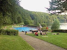
The maar is surrounded by forest on the crater wall, through which a hiking trail leads around the lake. There is a bathing establishment on the east bank.
See also
literature
- Werner D'hein: Nature and culture guide Vulkanlandeifel. With 26 stations on the "German Volcano Road". Gaasterland-Verlag, Düsseldorf 2006, ISBN 3-935873-15-8 .
Web links
Individual evidence
- ^ A b Wilhelm Meyer: Geology of the Eifel . 3. Edition. Schweizerbarts'che Verlagbuchhandlung, Stuttgart 1994, ISBN 3-510-65161-8 , pp. 322 f .
- ↑ Meyer 1994, p. 309
- ^ Ludwig Zöller and Henrik Blanchard: The partial heat - longest plateau technique: Testing TL dating of Middle and Upper Quaternary volcanic eruptions in the Eifel Area, Germany . In: Ice Age and the Present - Quaternary Science Journal . Hanover 2009, p. 86–106 (English, publiss.net [PDF; accessed June 16, 2017]). The partial heat - longest plateau technique: Testing TL dating of Middle and Upper Quaternary volcanic eruptions in the Eifel Area, Germany ( Memento of the original from March 5, 2016 in the Internet Archive ) Info: The archive link was inserted automatically and has not yet been checked. Please check the original and archive link according to the instructions and then remove this notice.
- ↑ Lee Siebert, Tom Simkin and Paul Kimberly: Volcanoes of the World . 3. Edition. Smithsonian Institution / University of California Press, Washington, Berkeley, Los Angeles, London 2010, ISBN 978-0-520-26877-7 , pp. 50 (English).
- ↑ Westeifel-Vulkanfeld in the Global Volcanism Program of the Smithsonian Institution (English). Retrieved June 16, 2017.
Coordinates: 50 ° 7 ′ 52 ″ N , 6 ° 55 ′ 34 ″ E


