
Schaalsee
| Schaalsee | ||
|---|---|---|

|
||
| GKZ | DE: 5936839 | |
| Geographical location | Border between the Duchy of Lauenburg u. Ludwigslust-Parchim district | |
| Tributaries | Known | |
| Drain | Schaalsee Canal , Schaale | |
| Islands | Kampenwerder , Stintenburginsel , Rethwiese | |
| Places on the shore | Zarrentin at the Schaalsee | |
| Data | ||
| Coordinates | 53 ° 35 '25 " N , 10 ° 54' 52" E | |
|
||
| Altitude above sea level | 34.8 m above sea level NHN | |
| surface | 23.5 km² | |
| volume | 0.391 km³ | |
| Maximum depth | 72.0 m | |
| Middle deep | 17 m | |
| Catchment area | 180 km² | |

|
||

The 24 km² large Schaalsee is a lake on the border between Schleswig-Holstein and Mecklenburg-Western Pomerania in Germany . It is one of the deepest German lakes and was named Living Lake of the Year in 2019 ,
description


On a straight line between Hamburg and Schwerin , the Schaalsee is 62 km from Hamburg and 32 km from Schwerin. In north-south direction it is 14.3 kilometers long and with 72.0 meters the deepest clear water lake in northern Germany. The water level is 34.8 m above sea level. NHN .
The entire Schaalsee consists of several connected partial lakes, named
in the north: Dutzower See, Bernstorfer Binnensee , Niendorfer Binnensee
in the west: Priestersee , Seedorfer Küchensee ;
in the south: Lassahner See, Borgsee, Techiner See, Kirchensee.
The Schaalsee is connected via the Phulsee , the Pipersee , the Salemer See and finally via the Schaalseekanal , which was built between 1923 and 1925, with the Großer Küchensee, a section of the Ratzeburg Lake , at the end of which one of the few hydropower plants in Schleswig-Holstein has the gradient to the lower Taking advantage of the lake level of the Ratzeburg lake. It is operated by E.ON Hanse .
During the division of Germany, the inner-German border ran through the Schaalsee.
The town of Zarrentin on the south bank is the largest town on the lake. There the Schaale drains the Schaalsee as a natural runoff. The Schaale flows further south and flows into the Sude , which flows into the Elbe after a few kilometers.
There are several islands and peninsulas in the Schaalsee , of which the Kampenwerder peninsula is the largest. Furthermore, the Stintenburginsel and some other uninhabited islands such as the Rethwiese are located in the lake .
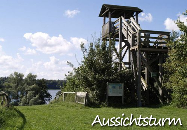
In Dargow, a village on the north bank of the Schaalsee, there has been a wooden observation tower ( ⊙ ) since 2001 , which offers a good view over the lake.
Schaalsee and inner German border
Until the end of 1989, the east bank was in the restricted border area of the GDR. Because of this separation, a special natural landscape has developed. Dutzow was one of the border villages that were divided in two by the border. Forced relocation took place in the village of Lankow . In 1964, Wolfgang Buchhorn managed to escape across the frozen lake. The border opening took place at the turn of the year 1989/1990. In the period after that, economic development on the eastern side was sometimes more favorable than on the western side.
Fish fauna
The Schaalsee is home to a good population of large predatory fish. Thus pike around 90 centimeters and 30 centimeters long perch relatively common. In terms of their way of life, the capital pike belong to the so-called "open water pike", which follow the swarms of whitefish . Eel tadpoles can be found at depths of 15 meters or more. In the case of non-predatory fish, it is mainly bream , which can weigh three to five kilograms and are found in large numbers in the bank region in spring during spawning. There are also said to be carp weighing 15 kilograms and tench weighing four kilograms. Fishing permits and boats are issued by the Rehboom fishery in Zarrentin, the Schleswig-Holstein State Sport Fishing Association or the Groß Zecher campsite.
See also
- List of lakes in Mecklenburg-Western Pomerania
- Schaalsee biosphere reserve
- Lauenburg Lakes Nature Park
- List of lakes in Schleswig-Holstein
literature
- Uwe Muuß, Marcus Petersen, Dietrich König: The inland waters of Schleswig-Holstein. Wachholtz-Verlag Neumünster, 1973, ISBN 3-529-05302-3 .
Web links
- Schaalsee biosphere reserve
- Environmental report of the state of Schleswig-Holstein - Schaalsee
- Detailed map of the Schaalsee (PDF; 1.96 MB)
Individual evidence
- ↑ Schaalsee awarded as «Lebendiger See 2019». In: The world. ( welt.de ).
- ↑ Lookout tower on schaalseehof.de.
- ↑ Schaalsee. Nature oasis between two countries. - Deutschlandfunk.
- ↑ Schaalsee: Green oasis between two countries. - NDR. July 22, 2019.
- ↑ Splinter. The village on the border. In: Schweriner People's Newspaper. November 23, 2015 ( svz.de ).
- ↑ Memory of the border village. Searching for traces in Lankow. In: Gadebusch-Rehnaer Zeitung. October 3, 2013 ("The ravaged village of Lankow on the former inner-German border has not been forgotten. The office, the municipality of Dechow and the Grenzhus keep the history of the forcibly evacuated people alive." Svz.de ).
- ^ Lauenburg Groß Zecher / Zarrentin. Buchhorn's escape from the GDR across the frozen Schaalsee. In: Lübecker Nachrichten. Online, October 6, 2014 ( ln-online.de ).
- ↑ Photos of the opening of the GDR border at Schaalsee
- ↑ The divided sky over the Schaalsee. In: Die Welt am Sonntag. August 13, 2006 ( welt.de ).
- ↑ Schaalsee district report. Robbers without borders. In: blinker. Edition September 2019.


Besenhorster sand mountains and Elbe sand meadows | Billetal | Bristle grass lawn near Alt-Mölln | Büchener Sander | Culpiner See | Dalbek Gorge | Former excavation pit east of Basedow | Goldenseeufer, Heidberg and surroundings | Grönauer Heide, Grönauer Moor and Blankensee | Hakendorfer forests | Hellbachtal with Lottsee, Krebssee and Schwarzsee | Hevenbruch | High banks of the Elbe between Tesperhude and Lauenburg | Kittlitzer Hofsee and surroundings | Lankower Seeufer, Grammsee and surroundings | Lanken | Lauenburger Elbe foreland | Maura and Krukenbek | Mechower lakeside and adjacent areas | Oldenburger See and surroundings | East bank of the Great Ratzeburg Lake | Pantener Moorweiher and surroundings | Ritzerauer Hofsee and Duvenseebach valley | Salem Moor with adjacent forests and lakes | Schaalsee with Niendorfer Binnensee, Priestersee and Großzecher Küchensee, Phulsee, Seedorfer Küchensee and surroundings | Stecknitz-Delvenau-Niederung | Stone gutter and Mechower wood | Valley slopes at goddess | Trendelmoor | Wakenitz