Salem lake
| Salem lake | ||
|---|---|---|

|
||
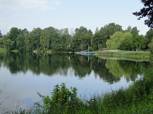
| Salem Lake from the shore in Salem | ||
| Geographical location | Lauenburg Lakes Nature Park | |
| Tributaries | from the Pipersee | |
| Drain | Schaalseekanal to the Küchensee | |
| Places on the shore | Salem | |
| Location close to the shore | Ratzeburg | |
| Data | ||
| Coordinates | 53 ° 38 '57 " N , 10 ° 49' 55" E | |
|
|
||
| Altitude above sea level | 34.8 m above sea level NN | |
| surface | 35.5 ha | |
| volume | 1,720,000 m³ | |
| scope | 4.03 km | |
| Maximum depth | 9.6 m | |
| Middle deep | 4.85 m | |
| Catchment area | 180 km² | |
The Salem Lake is a lake in the Duchy of Lauenburg in the German state of Schleswig-Holstein south of the village Salem . The lake is about 36 hectares and up to 9.6 m deep.
The lake, including the Piper lake, can be walked almost close to the bank (approx. 7 km). On the local side of Salem, around 500 meters are blocked by private buildings. In the east of the lake there is a spacious campsite with a public swimming area. Salem itself also has a small sandy beach and restaurants close by.
See also
Web links
Commons : Salemer See - Collection of pictures, videos and audio files
Individual evidence
- ↑ Ministry for Energy Transition, Agriculture, Environment and Rural Areas Schleswig-Holstein: Lakes. Retrieved June 16, 2015 .
- ↑ Salemer See campsite. Retrieved June 16, 2015 .
