
Mayen
| coat of arms | Germany map | |
|---|---|---|

|
Coordinates: 50 ° 20 ' N , 7 ° 13' E |
|
| Basic data | ||
| State : | Rhineland-Palatinate | |
| County : | Mayen-Koblenz | |
| Height : | 230 m above sea level NHN | |
| Area : | 58.12 km 2 | |
| Residents: | 19,162 (Dec. 31, 2019) | |
| Population density : | 330 inhabitants per km 2 | |
| Postcodes : | 56727, 56729 (Geisbüschhof, Wüsteratherhof) |
|
| Area code : | 02651 | |
| License plate : | MYK, MY | |
| Community key : | 07 1 37 068 | |
| City structure: | Core city and 4 local districts | |
City administration address : |
Town hall Rosengasse 56727 Mayen |
|
| Website : | ||
| Lord Mayor : | Wolfgang Treis ( Alliance 90 / The Greens ) | |
| Location of the city of Mayen in the Mayen-Koblenz district | ||
 |
||


Mayen is a large district town in the Rhineland-Palatinate district of Mayen-Koblenz in the Vulkaneifel . It is the administrative seat of the community of Vordereifel , until November 6, 1970 Mayen was also the administrative seat of the Mayen district . With almost 20,000 inhabitants, Mayen is the largest city in the Rhineland-Palatinate Eifel .
geography
location
The Eifel rises in a step to the west, north and south-west of Mayen . In an easterly direction, the landscape opens up to the flat Koblenz-Neuwied basin, which in turn can be subdivided into the northern part Pellenz and the southern part Maifeld , which are still commonly included in the Eifel. Hence the name “Mayen, the gateway to the Eifel”.
The river Nette (Middle Rhine) flows through the city from the Eifel in the direction of Weißenthurm on the Rhine .
City structure
Mayen is divided into the core city and four districts or local districts and a number of hamlets and residential areas (population as of January 16, 2012):
- Core town Mayen (14,837 inhabitants; area 3,209 ha) with the place names Ahl, Am Fichtenwäldchen, Bernardshof, Cond, Conderhöhe, Eiterbach, Geisbüschhof, Geisheckerhof, Im Stocktal, Helgoland Monastery, Kalenbornerhof, Katzenberg, Kirchershof, Müllershof, paper mill, Rech and Thomashof
- Alzheim (1,327 inhabitants; area 1,004 ha) with the villages of In der Pluns and Wüsteratherhof
- Hausen (1,755 inhabitants; area 499 ha) with the villages of Betzing, Grube Glückauf, Im Nettetal, Mosellaschacht, Nettehof, Wölwerhöfe, Zährensmühle I and Zährensmühle II
- Kürrenberg (1,212 inhabitants; area 772 ha) with the village of Karbachsberg
- Nitztal (167 inhabitants; area 320 ha)
climate
Mayen's climate is classified as warm and temperate. The average annual temperature in Mayen is 9.1 ° C. 717 mm of precipitation falls annually on average. The lowest precipitation falls in April with 45 mm, most with 74 mm in July. In July the average temperature is 17.2 ° C and in January 0.7 ° C.
history


Already at the turn of the century, Mayen was on the important Roman road Trier – Andernach and later became a small business location. From the end of the 3rd century to the Middle Ages, potteries were located here, the products of which were distributed throughout Central Europe. Another prehistoric use was the quarries in the area, whose basalt was processed into millstones in Mayen and the tuff into sarcophagi . These sarcophagi were found with important glass additions on the burial ground (today in the museum on Genoveva Castle). In late antiquity there was a late Roman fortification on the nearby, 290 meter high Katzenberg.
The name Mayen is probably derived from the name Megina , which was first documented in 847 as the place in the plain or in the field (Celtic magos ). Mayen was first mentioned in a document in 1041 and on May 29, 1291 received city rights from Rudolf I of Habsburg alongside Bernkastel , Welschbillig , Montabaur and Saarburg . In particular, Mayen is possibly related to the south-east lying Maifeld, since Mayen was also called the capital of Meiengau in the Middle Ages. A connection with the family name "von Mayen" can be assumed, but has not been researched.
In the Palatinate War of Succession , the town belonging to Kurtrier was occupied and heavily destroyed. In the late autumn of 1794, French revolutionary troops again occupied the left bank of the Rhine. At the Congress of Vienna in 1814/15, Prussia received the entire left and right bank of the Rhine. Mayen became a district seat. About the atmosphere in the city around 1900, the "Eifel" poet Philipp Gottfried Maler (actually Gottfried Stein) wrote his now largely forgotten key novel Philipp Between Yesterday and Tomorrow , in which he spoke of the disorientation of young people in the era before and during the First Told of World War.
During the Second World War, Mayen was destroyed by almost 90 percent, especially in the air raids of December 12, 1944 and January 2, 1945, killing 395 residents. Shortly after the end of the war, the residents of Mayen began to rebuild their city under the direction of the city architect Fritz Braun. While maintaining the historical streets and old buildings, a new cityscape developed in a few years.
Since 1946 the city has been part of the then newly formed state of Rhineland-Palatinate .
The current city of Mayen was formed as part of the Rhineland-Palatinate administrative and territorial reform that began in the mid-1960s. On November 7, 1970, the four previously independent communities Alzheim (849 inhabitants), Hausen bei Mayen (1242), Kürrenberg (686) and Nitztal (171) were incorporated into the city of Mayen. Previously, on January 1, 1967, the municipality of Nitztal was formed from the districts of Sankt Johann-Nitz of the municipality of Sankt Johann and Kürrenberg-Nitz of the municipality of Kürrenberg, and on June 7, 1969, the municipality of Alzheim was formed from the two municipalities of Allenz and Berresheim.
Until November 6, 1970 Mayen was the county seat of the Mayen district , with the MY license plate assigned on July 1, 1956. The district administration was then relocated to Koblenz and the district was renamed Mayen-Koblenz district with the MYK license plate introduced on February 12, 1979. For a short time, from June 12, 1973 to February 11, 1979, the KO mark was issued for the entire district, but this met with fierce resistance from the population and was then converted into MYK. Koblenz kept the KO mark. As part of the license plate liberalization , the Mayen city council voted unanimously on December 12, 2012 for the reintroduction of the MY license plate, which was confirmed by the district council on March 18, 2013. Since May 6, 2013, the MY license plate has been available again for the city of Mayen and the entire Mayen-Koblenz district . As of December 31, 2017, 49,604 MY license plates were already registered.
Development of the population
The following table shows the development of the population in the area of the city.
|
|
|

politics

City council
The Mayen City Council consists of 32 honorary council members, who were elected in a personalized proportional representation in the local elections on May 26, 2019 , and the chairman.
Distribution of seats:
| choice | SPD | CDU | AfD | GREEN | FDP | FWM | total |
|---|---|---|---|---|---|---|---|
| 2019 | 8th | 10 | 3 | 5 | 3 | 3 | 32 seats |
| 2014 | 10 | 13 | - | 4th | 2 | 3 | 32 seats |
| 2009 | 11 | 13 | - | - | 3 | 5 | 32 seats |
| 2004 | 11 | 15th | - | - | 3 | 3 | 32 seats |
- FWM = Free Voters Mayen e. V.
Lord Mayor and Mayor
Wolfgang Treis ( GREEN ) was elected on September 9, 2012 in the runoff election for the office of Lord Mayor against Rolf Koch (CDU) with 56.30% to 43.70% with a voter turnout of 45.51%. The inauguration took place on November 5th. This makes him the first green mayor in Rhineland-Palatinate.
The mayor was elected in direct election on May 26, 2019. They are Lothar Geisen (Alzheim), Karl-Josef Weber (Hausen), Siegmar Stenner (Kürrenberg) and Stefan Wagner (Nitztal).
Former Lord Mayor / Mayor
- 2008–2012 Veronika Fischer
- 1990-2008 Günter Laux
- 1976–1990 Albert Nell
- 1966–1976 Elmar Vogels
- 1949–1966 Heinrich Dahmen
- 1948–1949 Paul Keuser
- 1947–1948 Wilhelm Koll
- 1945–1947 Anton Schwindenhammer
- 1944–1945 Ludwig Bliedung
- 1942–1944 Wilhelm Münzel
- 1934–1942 Rudolf Neuenhofer
- 1933–1934 Edgar Heiliger
- 1921–1933 Alfred Scholtissek
- 1907–1920 Carl Pohl
- 1876–1907 Rudolf Grennebach
- 1859–1876 Johann Ernst Adams
- 1857-1859 Georg Bopp
Town twinning
Mayen has city partnerships with the following cities :
-
 Joigny ( France ), since 1964
 -
 Godalming ( United Kingdom ), since 1982
 -
 Uherské Hradiště ( Czech Republic ), since 1994
coat of arms
|
|
Blazon : "In silver a continuous, facetted, red bar cross, top right and bottom left accompanied by a left- turning red key, top left and bottom right with a five-leaf green tree (maypole beech), each partially covering the crossbar." |
| Reasons for the coat of arms: The coat of arms of the city of Mayen shows the red Electoral Trier cross with a central rib on a silver background. In the fields formed by the cross there is a red key in the upper right and lower left fields; the key bit is up and pointing to the left. A green tree (maypole beech) is shown in each of the other two fields. |
Culture and sights
Buildings
- Genovevaburg from the 13th century - including the Eifel Museum with the German Slate Mine
- Parish church St. Clemens with twisted tower, symbol of the city, rebuilt in 1945
- Parish Church of the Sacred Heart of Jesus from 1911/12
- St. Vitus Church from 1954 based on plans by Dominikus Böhm
- Upper gate
- Bridge gate
- Battlement
- Mill tower
- Bird storm
- Old town hall from 1717
- Old detention center - home of the Eifel archive
- Market fountain
- Bull fountain
- Synagogue (Mayen) , destroyed
- Jewish cemetery (Mayen)
- Lapideapark of the Mayener Sculpture Symposium in Mayener Grubenfeld
- In the Nettetal: Bürresheim Castle
- Reconstruction of the late Roman fortifications on the Katzenberg
Obertor, Theodore Dreiser House
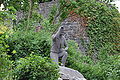
Mayener Jung , design by Mario Adorf
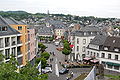
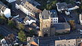
Market square from the Genoveva Castle

Genovevaburg

Sacred Heart Church

Anne's Chapel


Museums
- The Eifel Museum shows the development of the Eifel landscape and the everyday life of the residents.
- The German Slate Mine is a museum in the tunnel system under the Genoveva Castle.
- Adventure worlds Grubenfeld - The volcano park adventure center on the subject of basalt mining.
leisure
- Nettebad (outdoor pool - indoor pool - sauna) - a sports and leisure pool with a slope-laid water slide with a length of 140 m
- Tolli Park
- Kletterwald volcano park
Events

- Mayen was the venue for the 46th German Hiking Day in 1937.
- In 2016 the city of Mayen celebrated its 725th birthday.
- Lukasmarkt - annual fair in October with a week's rides as well as horse, sheep and junk market (already mentioned in a document at the beginning of the 15th century).
- Castle Festival - From May to August, different theater performances take place in the courtyard of the Genoveva Castle and on the small stage in the "Old Arrest House"
- Pentecost market (flea market)
- Roman festival on the pit field (on the 2nd weekend in July)
- Stone and castle festival with craftsmen and farmers market (on the 2nd weekend in September)
- Festival of Magic with witch and magician market (last weekend in October)
- Advent market on the Genovevaburg (on the 1st weekend in Advent)
- Mayen Book and Culture Week: Every year at the beginning of November there is a Book and Culture Week with author readings
Economy, transport and infrastructure

trade
In the city center is the pedestrian zone with mostly local retail. There are supraregional retail chains in the industrial park. The city is the seat of the Volksbank RheinAhrEifel eG and the Kreissparkasse Mayen .
Industry
Mayen has operations in the basalt lava, slate (e.g. Katzenberg mine , whose closure is announced for 2019) and cardboard industry (cardboard factory WEIG ), mechanical engineering and aluminum and plastics processing.
With Brohl Wellpappe , a traditional company (founded in 1778) has its headquarters in Mayen.
traffic
- Road traffic
Mayen is close to the A 61 ( Cologne - Ludwigshafen ) and the A 48 ( Trier - Koblenz ). The federal highways 256 , 258 and 262 also run through the city.
- Rail transport
Mayen has two train stations Mayen Ost and Mayen West on the Eifelquerbahn (Andernach-Mendig-Mayen-Kaisersesch). In addition, the construction of another stop at Mayen-Brückentor for 700,000 euros is planned at the level crossing over the street Auf der Eich. The SPNV Nord expects a daily demand of 500 travelers for Mayen-Brückentor . Since the timetable change on December 14, 2014, the regional train line RB 23 has provided a connection-free connection from Mayen via Andernach and Koblenz main station to Limburg (Lahn) , on which trains run every hour according to the Rhineland-Palatinate cycle. The line from Andernach via Mayen to Kaisersesch is run as the RB 38.
The next connections to long-distance traffic are in Andernach and Koblenz Hbf.
In the past there was also a direct rail connection via Polch and Ochtendung to Koblenz . On October 1, 1904, the Koblenz-Lützel-Polch section was opened. The section from Polch to Mayen Ost, which was originally supposed to be inaugurated on the same day, could only go into operation on November 12, 1904 due to a landslide on September 30, 1904. In 1916 Münstermaifeld could also be reached via the route from Polch . In the mid-1970s, the Polch – Mayen Ost section was closed to freight and passenger traffic because of the damage to the superstructure and the poor condition of the Hausen Viaduct and the Slope Viaduct between the two Hausen Tunnels. Today, a railway cycle path, the Maifeld cycle path , runs on the route between Mayen via Polch to Ochtendung or Münstermaifeld , after the rails were removed in the 1990s.
- Bus transport
Bus lines run from / to Koblenz / Neuwied / Maria Laach and Andernach , but also to the Eifel . The city belongs to the Rhein-Mosel transport association.
Educational institutions
- Five primary schools - two of them in the districts of Hausen and Kürrenberg
- Realschule plus Albert-Schweitzer - Realschule plus
- School Megina-Gymnasium Mayen
- Business high school
- Vocational school ( Carl Burger School with vocational high school I, economics / social affairs, dual vocational high school and technical schools for care for the elderly and for curative care)
- Three special schools (school in Bernardshof with FSP social-emotional development, Genoveva school with FSP holistic development and Elisabeth school with FSP learning)
- Waldorf School
- University of Public Administration Rhineland-Palatinate (HöV) with the Central Administrative School (ZVS) of the State of Rhineland-Palatinate
- Federal training center for the German roofing trade
- Specialist center for bees and beekeeping within the DLR Westerwald-Osteifel
Scientific institutions
- The Roman-Germanic Central Museum in Mainz maintains the research area volcanology, archeology and history of technology (VAT) and the laboratory for experimental archeology (LEA) in Mayen
Other facilities
- Mayen district court with, among other things, the joint dunning court of the states of Rhineland-Palatinate and Saarland
- ( Central Rhine Community Hospital , St. Elisabeth Mayen)
- Ambulance
- Oberst-Hauschild barracks with the operational communication center of the Bundeswehr , center and command post for the smallest branch of the Bundeswehr
- Radio Andernach , the Soldatensender the Bundeswehr .
Sports
- The soccer department of TuS Mayen plays in the Rhineland League.
- The oldest football club is SV Rheinland Mayen . The actor Mario Adorf trained in the former boxing department .
- The tennis club TuS Mayen 1886/1914 offered the opportunity to play tennis in Mayen in 1910. Dominik Meffert, the best-known member of the club, reached number 161 in the ATP world rankings in 2012.
- Tennis club TC am Kleeblatt Mayen from 1978 with six clay courts. The two tennis clubs merged in 2018.
- AC Mayen, motorsport clubs in the ADAC Gau Mittelrhein . He organizes almost all major events on the Nürburgring (Formula 1 World Championship - Grand Prix of Europe 1995–1996 and 1999–2007); previously the Grand Prix of Germany (1951–1976 with the exception of 1959 and 1970), ADAC 1000 km race, 24 hour race, etc. a.) The association was founded in 1927.
- The DLRG Mayen trains its members in the Gartenbad Mayen and carries out water rescue services at lakes and swimming pools.
- TuS Hausen football club from 1894
- Bushido-Club Mayen from 1985, emerged from the judo and karate club from 1972
Personalities
literature
- Ludwig Brink and Joseph Hilger: History of Mayen . Schreder, Mayen 1910, urn : nbn: de: 0128-1-3255 ( Dilibri Rhineland-Palatinate).
- Hans Schüller, Franz-Josef Heyen (Ed.): History of Mayen . History and Antiquity Association, Mayen 1991.
- Berthold Prößler: Mayen as a wine town in the Middle Ages and in the early modern period . In: Yearbook for West German State History . No. 35 , 2009, ISSN 0170-2025 , p. 203-213 .
- Hans Schüller: Mayen between destruction and reconstruction . Sutton, Erfurt 2011, ISBN 978-3-86680-825-6 ( digitized in the Google book search).
Web links
- Official Mayen website
- Link catalog on Mayen at curlie.org (formerly DMOZ )
- Literature about Mayen in the Rhineland-Palatinate State Bibliography
Individual evidence
- ↑ State Statistical Office of Rhineland-Palatinate - population status 2019, districts, communities, association communities ( help on this ).
- ↑ State Statistical Office Rhineland-Palatinate (ed.): Official directory of the municipalities and parts of the municipality. Status: January 2019 [ Version 2020 is available. ] . S. 38 (PDF; 3 MB).
- ↑ Population as of January 16, 2012
- ↑ Hans Schüller: Mayen between destruction and reconstruction . Sutton, Erfurt 2011, ISBN 978-3-86680-825-6 ( digitized in the Google book search [accessed on March 22, 2017]).
- ↑ Official municipality directory (= State Statistical Office of Rhineland-Palatinate [Hrsg.]: Statistical volumes . Volume 407 ). Bad Ems February 2016, p. 171 (PDF; 2.8 MB; footnotes 42 and 43).
- ↑ Kreisverwaltung Mayen Koblenz, accessed on March 7, 2013 ( Memento from March 11, 2013 in the Internet Archive )
- ↑ Free travel for the MY license plate. ( Memento from May 7, 2013 in the Internet Archive )
- ↑ State Statistical Office Rhineland-Palatinate: My village, my city. Retrieved October 16, 2019 .
- ↑ Wolfgang Treis appointed Lord Mayor. ( Memento of December 7, 2013 in the Internet Archive )
- ^ City of Mayen: Mayen election results. see 2019, mayor. Retrieved December 17, 2019 .
- ^ Main statute of the city of Mayen of July 8, 2009, last amended on June 9, 2011
- ↑ Eifelarchiv - GAV Mayen. Retrieved May 20, 2020 .
- ^ Werhahn Group Neuss: Werhahn defends Bergwerk-Aus report in the daily newspaper Rheinische Post from December 3, 2018, accessed on February 24, 2019
- ↑ Hilko Röttgers: Station idea for Mayen: Trains should stop on the Eich. In: Rhein-Zeitung . August 17, 2016. Retrieved September 23, 2016 .

Eight | Alkene | Andernach | Look | Arft | Baar | Bassenheim | Bell | Bendorf | Bermel | Boos | Brey | Brodenbach | Castles | Thieving | Ditscheid | Agree | Ettringen | Gappenach | Low | Gierschnach | Hatzenport | Hausten | Herresbach | Shepherds | Cold | Kaltenengers | Sweeping | Notches | Chained | Kirchwald | Kobern-Gondorf | Kollig | Kottenheim | Kretz | Kruft | Langenfeld | Langscheid | Clay | Lind | Löf | Lonnig | Luxem | Quirks | Mayen | Mendig | Mertloch | Monreal | Mülheim-Kärlich | Münk | Münstermaifeld | Night home | Naunheim | Nickenich | Niederfell | Niederwerth | Nörtershausen | Upper skin | Notice | Pillig | Plaidt | Polch | Reudelsterz | Rhens | Vineyards | Over | Saffy | Sankt Johann | Saint Sebastian | Siebenbach | Spay | Door | Trimbs | Urbar | Urmitz | Vallendar | Virneburg | People's field | Waldesch | Hamlet | Weißenthurm | Weitersburg | Welling | Welschenbach | Wierschem | Winningen | Clouds