
Mayen-Koblenz district
| coat of arms | Germany map |
|---|---|

|

Coordinates: 50 ° 20 ′ N , 7 ° 20 ′ E |
| Basic data | |
| State : | Rhineland-Palatinate |
| Administrative headquarters : | Koblenz |
| Area : | 817.25 km 2 |
| Residents: | 214,434 (Dec. 31, 2019) |
| Population density : | 262 inhabitants per km 2 |
| License plate : | MYK, MY |
| Circle key : | 07 1 37 |
| NUTS : | DEB17 |
| Circle structure: | 87 parishes |
| Address of the district administration: |
Bahnhofstrasse 9 56068 Koblenz |
| Website : | |
| District Administrator : | Alexander Saftig ( CDU ) |
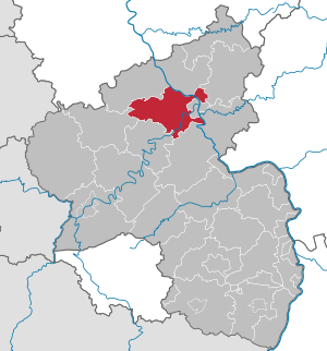
| Location of the Mayen-Koblenz district in Rhineland-Palatinate | |
  |
|
The Mayen-Koblenz district is a regional authority in the north-central part of Rhineland-Palatinate . The seat of the district administration is Koblenz , which as an independent city does not belong to the district. The most populous city in the Mayen-Koblenz district is Andernach , with around 30,000 inhabitants . With around 215,000 inhabitants, the district is the most populous in Rhineland-Palatinate.
geography
location
The Mayen-Koblenz district stretches along the Rhine ( Middle Rhine ) and Moselle ( Lower Moselle ). Most of it is part of the natural spatial unit of the Middle Rhine Basin .
The main area of the district is located on the left bank of the Rhine, but some communities northeast of Koblenz on the right bank of the Rhine also belong to the district area. Here are the foothills of the Westerwald . The area on the left bank of the Rhine includes the Maifeld , the Pellenz and the Hohe Eifel with the Hohe Acht on the north-western border of the district.
Important rivers besides the Rhine and Moselle are the Nette (Middle Rhine) , which flows into the Rhine at Weißenthurm , and the Elzbach, which flows into the Moselle at Moselkern .
Neighboring areas
The district borders clockwise in the northwest, beginning with the districts of Ahrweiler , Neuwied and Westerwaldkreis , the independent city of Koblenz and the districts Rhein-Lahn-Kreis , Rhein-Hunsrück-Kreis , Cochem-Zell and Vulkaneifel .
history
Before 1800, the area of today's Mayen-Koblenz district was split up into numerous domains, of which the Electors of Trier and Cologne had the largest shares. Mayen was the seat of an Electoral Trier office, Rhens and Andernach belonged to Kurköln , Bendorf to the County of Sayn-Altenkirchen . During the First French Republic and the consulate under Napoleon , the area was part of the Rhin-et-Moselle department with its seat in Koblenz. After the Congress of Vienna in 1815, the area became part of Prussia and in 1816 was divided into the newly formed districts of Mayen , Koblenz-Land , Adenau and St.Goar within the province of the Grand Duchy of Lower Rhine (from 1822 Rhine Province ). In 1932, the Adenau district was dissolved and divided between the Ahrweiler and Mayen districts. In 1946 the district came to the state of Rhineland-Palatinate as part of the Koblenz government district . On the occasion of the district reform on November 7, 1970, the Mayen district gave up several communities to the Ahrweiler and Daun districts. The district of Koblenz already lost communities to the independent city of Koblenz on June 7, 1969 and received the northern communities and the Moselle communities of the district of St. Goar. On November 7, 1970, he lost more communities to the independent city of Koblenz, but also four communities to the Rhein-Hunsrück district. The two districts of Mayen and Koblenz were merged on the same day. Finally, on March 16, 1974, the Stromberg community came from the Unterwesterwaldkreis to the district area.
Population development
| year | Residents | source |
|---|---|---|
| 1970 | 185,800 | |
| 1980 | 189,800 | |
| 1990 | 193,800 | |
| 2000 | 210,800 | |
| 2010 | 210.269 | |
| 2016 | 212,968 | |
| 2019 | 214,434 |
politics
District council
The district election on May 26, 2019 led to the following result:
| Parties and constituencies | % 2019 |
Seats 2019 |
% 2014 |
Seats 2014 |
% 2009 |
Seats 2009 |
% 2004 |
Seats 2004 |
|
|---|---|---|---|---|---|---|---|---|---|
| CDU | Christian Democratic Union of Germany | 35.5 | 17th | 44.6 | 22nd | 44.6 | 22nd | 52.6 | 26th |
| SPD | Social Democratic Party of Germany | 22.6 | 11 | 28.7 | 14th | 29.0 | 14th | 28.1 | 14th |
| FWG-MYK | Free group of voters of the Mayen-Koblenz district | 9.2 | 5 | 9.0 | 5 | 9.3 | 5 | 9.0 | 5 |
| GREEN | Alliance 90 / The Greens | 15.6 | 8th | 7.9 | 4th | 5.3 | 3 | 5.5 | 3 |
| AfD | Alternative for Germany | 7.4 | 4th | 3.4 | 2 | - | - | - | - |
| FDP | Free Democratic Party | 5.5 | 3 | 3.1 | 2 | 8.0 | 4th | 4.9 | 2 |
| THE LEFT. | THE LEFT. | 2.6 | 1 | 2.6 | 1 | 2.3 | 1 | - | - |
| FWM3 | Free voters Mayen-Mittelrhein-Mosel | 1.6 | 1 | - | - | - | - | - | - |
| I do | I do it - The Citizens' Initiative e. V. | - | - | 0.6 | 0 | 1.5 | 1 | - | - |
| total | 100.0 | 50 | 100.0 | 50 | 100.0 | 50 | 100.0 | 50 | |
| Voter turnout in% | 60.4 | 55.0 | 52.7 | 57.5 | |||||
District administrators
- 1970–1989: Georg Klinkhammer
- 1990–1991: Rudolf Schwan
- 1992-2008: Albert Berg-Winters (CDU)
- since 2009: Alexander Saftig (CDU)
In the direct election on June 12, 2016, Alexander Saftig was confirmed in his office for a further eight years with 88.3% of the votes. His second term began on January 1, 2017.
badges and flags

Hoist flag

Banner flag

The district of Mayen-Koblenz has a coat of arms as well as a hoist and banner flag .
|
|
Blazon : "In greena silver wavy bar , accompanied by a golden crown of leaves at the top and a silver may tree at the bottom." |
|
Justification of the coat of arms: The crown refers to the royal chair of Rhens , where the Roman-German kings were previously elected. The wavy bar symbolizes the Rhine and the Moselle, the Maienbaum as a so-called " talking symbol " stands for agriculture in a circle.
The coat of arms symbols were also part of the earlier district coats of arms, the district of Koblenz ("In green, a golden leaf crown set with red and blue stones over a lowered silver corrugated rafters .") And District of Mayen ("In silver, a silver millstone with a black grinding path in a perspective view, through the stone eye is a rooted five-leaf green may tree. "). The coat of arms was approved on April 27, 1971. |
Economy and Transport
In the Future Atlas 2016 , the Mayen-Koblenz district was ranked 134th out of 402 districts, municipal associations and independent cities in Germany, making it one of the regions with “future opportunities”.
rail
In Koblenz, the then capital of the Prussian Rhine Province, an important railway junction has been created, the basis of which was laid by the Rheinische Eisenbahn-Gesellschaft . Its first route came in 1858 on the left bank of the Rhine from Cologne to here and was continued in the direction of Bingen the following year. Before the new main station went into operation in 1902 , the Rheinbahnhof was used further north on the right bank of the Moselle. From 1869 trains ran on the right bank of the Rhine from Cologne via Neuwied-Koblenz-Ehrenbreitstein to Niederlahnstein ; From Ehrenbreitstein a section ran over the Pfaffendorfer Bridge to Koblenz Rheinischer Bahnhof until 1899 . The Urmitz railway bridge , over which a direct rail connection leads from Neuwied to Koblenz, was opened to traffic by the Prussian State Railways in 1918 .
This company also expanded the rest of the route network:
From 1879 the railway ran from Koblenz along the Moselle in the direction of Trier. At the same time, the Rhine crossing from Koblenz to Niederlahnstein and thus the direct connection to the Cologne – Wiesbaden railway on the right bank of the Rhine and the Lahn railway to Limburg – Gießen was created.
The old district of Mayen received its first rail connection with the Andernach – Niedermendig railway line in 1878; it reached Mayen East in 1880 and continued in the direction of Daun-Gerolstein from 1895. In 1904 there was the cross connection Koblenz – Mayen Ost with the Polch – Münstermaifeld junction in 1916. Rail traffic on this route between Ochtendung-Polch-Mayen and Ochtendung-Polch-Münstermaifeld was discontinued in 1989. In the same year, passenger traffic on the Koblenz – Bassenheim – Ochtendung section was also terminated. The Ochtendung – Mayen section and the Polch – Münstermaifeld connection have now been completely dismantled.
The Engers – Siershahn line, opened in 1884, only touched the district area in the Bendorf-Sayn station, similar to the Brohltal Railway with its narrow-gauge railway built in 1901. While the Brohltalbahn has meanwhile developed into an excursion train of great tourist importance, regular passenger traffic on the other route as well as on the Koblenz – Mayen route, including the branch to Münstermaifeld:
- 1961: Polch - Münstermaifeld 10 km
- 1983: Koblenz-Lützel - Polch - Mayen Ost 36 km
- 1989: Engers - Bendorf-Sayn - Grenzau - Siershahn 6 km
That is 55 km of route; after all, 134 km are still fully operational.
The Coblenzer Straßenbahn-Gesellschaft AG electrified the horse-drawn tram lines established in the provincial capital in 1887 and extended them to all suburbs as well as to Vallendar, Bendorf-Sayn, Höhr-Grenzhausen and Lahnstein.
Street

The federal highways 61 Koblenz – Cologne and 48 Ulmen – Koblenz run through the district . Furthermore, several federal and district roads run through the district, including the B 9 Koblenz-Bonn and the B 258 .
The Moselschiefer-Straße deserves to be mentioned as a tourist route .
Around the Laacher See are the stations of the volcano park , which didactically explain the volcanism of the Eifel.
The Nürburgring near Herresbach touches the district in the far west .
Castles and Palaces
The district has a number of castles and palaces:
- Eltz Castle , perhaps the most famous German castle
- Trutzeltz Castle near Eltz Castle
- Bürresheim Castle near Mayen
- Genovevaburg in Mayen
- Oberburg Kobern in Kobern with the Romanesque Matthias Chapel
- Niederburg Kobern in Kobern
- Liebieg Castle in Gondorf
- Oberburg in Gondorf, headquarters of the von der Leyen
- Thurant Castle near Alken (Mosel)
- Ehrenburg near Brodenbach
- Sayn Castle and Sayn Castle in Bendorf -Sayn
- Bischofstein Castle on the Moselle near castles
- Wernerseck Castle near Ochtendung
- Löwenburg and Philippsburg near Monreal
- Virneburg castle ruins
- Bassenheim Castle in Bassenheim
- Namedy Castle in Andernach
- Andernach city castle in Andernach
Churches and other cultural monuments
The outstanding sacred structure of the district is the Mariendom in Andernach . The previous building came into the possession of the Archbishop of Trier as a separate church in 1194 and was badly damaged in the destruction of the city in 1198. Therefore the bishop had the new church built, which was consecrated in 1220. It is considered one of the best examples of late Romanesque in the Rhineland.
In the parish church of Bassenheim is the nationally important Bassenheimer Reiter .
The legend of Genoveva von Brabant is linked to the Fraukirch standing alone in the open field .
A nationally known Catholic pilgrimage site is Schoenstatt near Vallendar .
One of the oldest churches in the Eifel is in Polch . It is the early Romanesque chapel of St. George . It is located away from the historical buildings on the walled cemetery of Polch with an ancient chestnut avenue. The first verifiable documentation about a church in Polch comes from a document from the year 1052. A predecessor building of the chapel is assumed to be in a Roman temple, evidence of this is a fall of the west pediment with the inscription Caio attio caro et eius suavissimae uxori amato patruo amatae aviane filii .
Perhaps the most important religious monument in the area is the Maria Laach Benedictine Abbey , which is already in the Ahrweiler district. Numerous architectural monuments are also located in the urban area of the independent city of Koblenz .
The most important ground monument in the district is the goloring from Celtic times .
One of the most important cultural monuments of the Maifeld is located in Münstermaifeld . The mighty defensive towers of the Gothic collegiate church of the former St. Martin and St. Severus Monastery, which has existed since at least the beginning of the 10th century, protrude from afar visible over the city of Münstermaifeld. In its current form, from the 11th century onwards in different construction phases, the Maifeldmünster shows architecturally in interesting succession the development of the architectural styles of all centuries of the Middle Ages.
The volcanic park reveals the evidence of the volcanic past in the Mayen-Koblenz district.
Cultural monuments with their own article
see list of churches and monasteries in the district of Mayen-Koblenz
- Sayn Abbey in Bendorf-Sayn , former Premonstratensian Abbey (1202–1803), today parish church Maria Himmelfahrt Sayn
- Parish Church of St. Nikolaus in Kottenheim
- Parish church of St. Clemens in Mayen , former collegiate church
- Parish Church of St. Cyriakus in Mendig (Niedermendig)
Folk festivals
The annual Moselfest Winningen is considered the oldest wine festival in Germany.
The Lukasmarkt , a fair and folk festival in downtown Mayen , has been held annually in October since 1405.
The Michelsmarkt in Andernach was first mentioned in a document in 1407. On June 8, 1407, the Archbishop of Cologne, Friedrich III. of Saar, the city will have this market until further notice.
The Kröbbelchesfest in honor of the earth fruit processed into potato pancakes (= Kröbbelche) has been taking place every two years (even year) at the end of August in Kottenheim since 1952 .
Nature reserves


There are (as of November 2002) 26 nature reserves in the district. Two other nature reserves belong mainly to the Ahrweiler district , but also partly to the Mayen-Koblenz district.
Mayen-Koblenz district
- Nettetal
- Namedyer Werth with the Andernach geyser
- Dr.-Heinrich-Menke-Park near Arft
- Heron shot island in the Moselle near Lehmen
- Hochsimmer in the districts of Ettringen and Sankt Johann
- Kleiner Bermel, a tertiary basalt cone near Bermel
- Ettringer Bellberg , Mayener Bellberg and Kottenheimer Büden
- Graswerth Island in the Rhine
- Michelberg near Ochtendung
- Nastberg in the Eich district of the city of Andernach
- Clay pit Hüttwohl in Bendorf
- Juniper heaths Raßberg and Heidbüchel near Arft
- Karmelenberg near Bassenheim
- The banks of the Moselle between Niederfell and Dieblich
- Ausonius stone in Lehmen
- Hut pond in Bendorf -Sayn
- Sulzbusch near Ettringen
- Thürer meadows
- Hochstein near Ettringen , Bell and Ober mendig
- Korretsberg near Kruft
- Wetlands in the Nothbachtal near Gappenach and Rüber
- Goose neck, Schorenberg, Burgberg and Schmitzkopf near Bell , Rieden and Obermendig
- Kuhstiebel (former quartz gravel pit) near Kobern
- Booser Maar
- Kurbüsch near Nickenich
- Hochbermel
District of Mayen-Koblenz and District of Ahrweiler
Communities
(Residents on December 31, 2019)

- 1. Andernach , large district town (29,922)
- 2. Bendorf , City (16,888)
- 3. Mayen , Great District City (19,162)
Associated municipalities , structured according to their administrative affiliation ( Verbandsgemeinde ):
(Seat of the municipal administration *)
|
|
|
- Former parishes
The following municipalities have lost their independence since the district was founded in 1970:
- Kattenes , December 31, 1975 to Löf
- Keld on December 31, 1975 at Münstermaifeld
- Küttig , on December 31, 1975 at Münstermaifeld
- Lasserg , on December 31, 1975 at Münstermaifeld
- Metternich , on December 31, 1975 at Münstermaifeld
- Mörz , on December 31, 1975 at Münstermaifeld
- Moselsürsch , to Lehmen on September 30, 1976
For lists of the term "area changes" see area reforms in Rhineland-Palatinate
License Plate
When the new district was formed, the distinctive signs KO and MY, which were introduced on July 1, 1956, were assigned to the districts of Koblenz and Mayen . From June 12, 1973, the KO license plate was issued in the entire district , as the district administration is located in Koblenz. This was replaced on February 12, 1979 by the new distinctive sign MYK, which is still valid today . Since May 6, 2013, the MY distinguishing mark has been available again.
Individual evidence
- ↑ State Statistical Office of Rhineland-Palatinate - population status 2019, districts, communities, association communities ( help on this ).
- ↑ Overview of the population of the State Statistical Office ( Memento from May 23, 2011 in the Internet Archive )
- ↑ Official municipality directory (= State Statistical Office of Rhineland-Palatinate [Hrsg.]: Statistical volumes . Volume 407 ). Bad Ems February 2016, p. 152 (PDF; 2.8 MB).
- ↑ Statistical Yearbook for the Federal Republic of Germany 1972
- ↑ Statistical Yearbook for the Federal Republic of Germany 1981
- ↑ Statistical Yearbook for the Federal Republic of Germany 1992
- ↑ Statistical Yearbook for the Federal Republic of Germany 2002
- ↑ State Statistical Office Rhineland-Palatinate: Data table: Population status December 31, 2019 (district level). Retrieved July 28, 2020 .
- ↑ Mayen-Koblenz district. Local elections 2019 - Results presented. Rhineland-Palatinate - State Returning Officer, 2019, accessed on July 8, 2019 .
- ^ District Mayen-Koblenz: District Administrator. Retrieved December 5, 2019 .
- ↑ Future Atlas 2016. Archived from the original on October 2, 2017 ; accessed on March 23, 2018 .
- ^ The art monuments of the Mayen district . Verlag von L. Schwann, Düsseldorf 1941, unaltered reprint 1983, ISBN 3-590-32143-1 .
- ↑ State Statistical Office of Rhineland-Palatinate - population status 2019, districts, communities, association communities ( help on this ).
Web links
- Website of the Mayen-Koblenz district
- Statistical data for the district of Mayen-Koblenz from the State Statistical Office of Rhineland-Palatinate
- Literature from and about the district of Mayen-Koblenz in the catalog of the German National Library
- Literature about the district of Mayen-Koblenz in the Rhineland-Palatinate state bibliography
Districts:
Ahrweiler |
Altenkirchen (Westerwald) |
Alzey-Worms |
Bad Dürkheim |
Bad Kreuznach |
Bernkastel-Wittlich |
Birkenfeld |
Cochem cell |
Donnersbergkreis |
Eifelkreis Bitburg-Prüm |
Germersheim |
Kaiserslautern |
Kusel |
Mainz-Bingen |
Mayen-Koblenz |
Neuwied |
Rhine-Hunsrück District |
Rhein-Lahn district |
Rhine-Palatinate District |
Southern Wine Route |
Southwest Palatinate |
Trier-Saarburg |
Vulkaneifel |
Westerwaldkreis
Independent cities:
Frankenthal (Pfalz) |
Kaiserslautern |
Koblenz |
Landau in the Palatinate |
Ludwigshafen am Rhein |
Mainz |
Neustadt an der Weinstrasse |
Pirmasens |
Speyer |
Trier |
Worms |
Zweibrücken