
Ahrweiler district
| coat of arms | Germany map |
|---|---|

|

Coordinates: 50 ° 33 ' N , 7 ° 6' E |
| Basic data | |
| State : | Rhineland-Palatinate |
| Administrative headquarters : | Bad Neuenahr-Ahrweiler |
| Area : | 786.98 km 2 |
| Resident: | 130,479 (Dec 31, 2020) |
| Population density : | 166 inhabitants per km 2 |
| License plate : | AW |
| Circle key : | 07 1 31 |
| NUTS : | DEB12 |
| Circle structure: | 74 parishes |
| Address of the district administration: |
Wilhelmstrasse 24–30 53474 Bad Neuenahr-Ahrweiler |
| Website : | |
| District Administrator : | Jürgen Pföhler ( CDU ) |
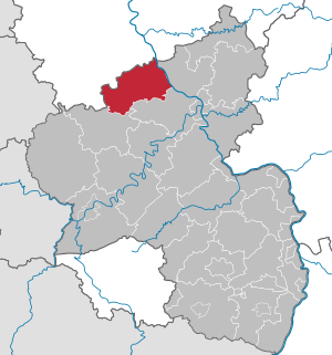
| Location of the district of Ahrweiler in Rhineland-Palatinate | |
  |
|
The district of Ahrweiler is a regional authority with 130,479 inhabitants (December 31, 2020) in the north of Rhineland-Palatinate . The seat of the district administration and at the same time the most populous municipality is the association-free city of Bad Neuenahr-Ahrweiler .
geography
location
The Rhine forms the eastern border of the district. The Ahr , a left tributary of the Rhine, crosses the district from southwest to northeast and flows into the district boundary.
The Ahrweiler district of Bad Neuenahr-Ahrweiler lies on the edge of the Eifel . The mountains north of the Ahr are called Ahrberge - but they are not as high as the Hohe Eifel in the south of the district.
The forests of the Eifel are a result of reforestation in the 19th century. The most common is the spruce , which was not originally typical of the region.
With the volcanic Laacher See , located on the border with the Mayen-Koblenz district , the largest lake in the state of Rhineland-Palatinate and the only caldera lake in Central Europe belongs entirely to the district area. The Rodder Maar , a water-filled shallow depression in the east of the district, was drained and reforested in the 1950s, but renatured in 1998. By closing a small dam, the maar was re-created as a water bird paradise with rare animals. It has not yet been proven that this depression is of volcanic origin.
The wine-growing area along the Ahr is one of the northernmost wine-growing areas in Germany, especially known for red wine . The Nordschleife and the Nürburgring , two well-known race tracks, are located in the Ahrweiler district around the Nürburg .
The highest point in the district and the entire Eifel is the Hohe Acht at 747 m above sea level. NHN , the deepest is north of the Remagen district of Rolandswerth on the border with the federal city of Bonn .
Neighboring districts
The district borders on five other districts (including three districts in Rhineland-Palatinate and two districts in North Rhine-Westphalia) and a city in North Rhine-Westphalia.
| District of Euskirchen | Federal city of Bonn | Rhein-Sieg district |
| Vulkaneifel district |
.svg)
|
Neuwied district |
| Mayen-Koblenz district |
Municipalities
The district of Ahrweiler consists of 74 municipalities, all but four of which belong to the four municipalities .
(Residents on December 31, 2020)
Association-free municipalities :
- Bad Neuenahr-Ahrweiler , City (28,634)
- County (10,912)
- Remagen , City (17,156)
- Sinzig , City (17,642)
Associated municipalities with their associated municipalities:


For lists of the term “territorial changes” see territorial reforms in Rhineland-Palatinate
The following communities in the district of Ahrweiler were incorporated into or left the district:
- Ahrweiler , on June 7, 1969 in Bad Neuenahr-Ahrweiler
- Bad Neuenahr , on June 7, 1969 in Bad Neuenahr-Ahrweiler
- Bad Niederbreisig , on June 7, 1969 in Bad Breisig
- Bengen , to the county on March 16, 1974
- Birresdorf , to the county on March 16, 1974
- Blasweiler , on March 30, 1971 in Heckenbach
- Blind , on November 7, 1970 at Hümmel
- Bodendorf , on June 7, 1969 in Sinzig
- Breidscheid , on October 1, 1952 in Adenau
- Brohl , on November 7, 1970 to Brohl-Lützing
- Brück a./Ahr , on June 7, 1969 in Ahrbrück
- Eckendorf , on March 16, 1974 to Grafschaft
- Engeln , on June 10, 1979 in Kempenich
- Franconia , on June 7, 1969 in Sinzig
- Gelsdorf , on March 16, 1974 to Grafschaft
- Gilgenbach , on November 7, 1970 in Leimbach
- Gimmigen , on June 7, 1969 in Bad Neuenahr-Ahrweiler
- Heimersheim , on June 7, 1969 in Bad Neuenahr-Ahrweiler
- Holzweiler , on March 16, 1974 to county
- Jammelshofen , on November 7, 1970 in Kaltenborn
- Karweiler , on March 16, 1974 to Grafschaft
- Kirchdaun , on June 7, 1969 in Bad Neuenahr-Ahrweiler
- Koisdorf , on June 7, 1969 in Sinzig
- Kreuzberg , on June 7, 1969 in Altenahr
- Lantershofen , on March 16, 1974 to Grafschaft
- Leimersdorf , on March 16, 1974 to Grafschaft
- Liers , on March 1, 1972 in Hönningen
- Löhndorf , on June 7, 1969 in Sinzig
- Lohrsdorf , on June 7, 1969 in Bad Neuenahr-Ahrweiler
- Lückenbach , on October 1, 1976 at Dümpelfeld
- Niederadenau , to Dümpelfeld on October 1st, 1976
- Niederlützingen , on November 7, 1970 to Brohl-Lützing
- Kidney Village , to the county on March 16, 1974
- Nohn , on November 7, 1970 in the Daun district
- Oberbreisig , on June 7, 1969 in Bad Breisig
- Oberwinter , on June 7, 1969 in Remagen
- Obliers , on March 30, 1971 at Lind
- Oedingen , on June 7, 1969 in Remagen
- Pitscheid , on November 7, 1970 at Hümmel
- Plittersdorf , on March 30, 1971 in Lind
- Pützfeld , on June 7, 1969 in Ahrbrück
- Ramersbach , on March 16, 1974 in Bad Neuenahr-Ahrweiler
- Rheineck , on June 7, 1969 in Bad Breisig
- Wrestle , on March 16, 1974 to the county
- Rolandswerth , on June 7, 1969 in Remagen
- Relay , March 1, 1972 to Kesseling
- Unkelbach , on June 7, 1969 in Remagen
- Vettelhoven , on March 16, 1974 to Grafschaft
- Westum , on June 7, 1969 in Sinzig
story
The region was conquered by the Romans under Julius Caesar around 50 BC. Conquered. A few years later the Castra Rigomagus legionary camp was founded, which later became the city of Remagen . The Vinxtbach , a nearby stream and tributary of the Rhine, was the border between the Roman provinces Germania superior and Germania inferior . The Roman Villa Museum of Bad Neuenahr- Ahrweiler is located in Ahrweiler , originally laid out as a Roman estate ( Villa Rustica ) , enlarged, rebuilt several times and abandoned as planned around 259/260 AD.
Ahrweiler was mentioned for the first time in 893 in the Prümer Urbar , the list of goods of the Prüm Abbey . In 1180, the Holy Roman Emperor of the German Nation , Frederick I (Barbarossa), chose Sinzig as the place to meet the rulers of France and Flanders . Another important place is the Maria Laach monastery on the Laacher See in the southeast of the Ahrweiler district.
From 1798 to 1814, the area belonged as Canton Adenau and Canton Ahrweiler to the Arrondissement Bonn in the Département de Rhin-et-Moselle . The districts of Ahrweiler and Adenau were formed in 1816 when Prussia divided its provinces, including the province of the Grand Duchy of Lower Rhine (part of the later Rhine province ), into administrative districts and districts. The district of Ahrweiler belonged to the administrative district of Koblenz (until 1999) and was initially administratively divided into seven mayor's offices ( Ahrweiler , Altenahr , Gelsdorf , Königsfeld , Niederbreisig , Remagen , Sinzig ). The district of Ahrweiler comprised a total of 141 localities in which 24,745 inhabitants lived around 1815.
On October 1, 1932, a large part of the disbanded Adenau district , essentially the area of the present-day association communities Adenau and Altenahr , was integrated into the Ahrweiler district.
The capture of the Ludendorff Bridge by the United States' armed forces in March 1945 is a well-known event. This event is portrayed in the movie Die Brücke von Remagen (1969).
On November 7, 1970, the communities of Brenk , Burgbrohl , Engeln , Galenberg , Glees , Hohenleimbach , Kempenich , Niederlützingen , Spessart , Wassenach , Wehr and Weibern were reclassified from the dissolved Mayen district to the Ahrweiler district. The Nohn community moved from the Ahrweiler district to the Daun district .
A treasure trove of local history and local knowledge about the Ahrweiler district is the Ahrweiler district's homeland yearbook, published by the Ahrweiler district administration and largely available on the Internet.
The floods in Central Europe in 2021 hit the Ahrweiler district hard. Heavy rain and floods caused severe damage to the infrastructure. More than 130 people were killed and around 760 were injured. Houses collapsed, parts of roads and railway lines, the new Ahr bridge on Bundesstrasse 9 near Sinzig, numerous road bridges, at least seven railway bridges and 20 kilometers of track were destroyed in the Ahr valley. The clean-up work will take months.
population
Population statistics
The development of the number of inhabitants in relation to the area of today's district of Ahrweiler; the values from 1871 to 1987 are based on censuses:
| year | resident |
|---|---|
| 1815 | 40.119 |
| 1835 | 50,317 |
| 1871 | 51,417 |
| 1905 | 63,914 |
| 1939 | 73.995 |
| 1950 | 82.996 |
| 1961 | 92,757 |
| year | resident |
|---|---|
| 1970 | 103,862 |
| 1987 | 111,232 |
| 1997 | 127,566 |
| 2005 | 130,467 |
| 2010 | 127,443 |
| 2015 | 127,770 |
| 2020 | 130,479 |
Denomination statistics
As of June 30, 2005, 66.7% of the population were Roman Catholic , 14.1% Protestant and 19.2% were non-denominational or belonged to another religious community . According to the 2011 census , in 2011 63.5% were Roman Catholic, 13.9% of the population were Protestant and 22.6% were non-denominational, belonged to another religious community or did not provide any information. The number of Protestants and Catholics has fallen since then. At the end of July 2021, 53.1% of the population had the Catholic denomination and 11.7% the Protestant. 35.2% either belonged to another religious community or were non-denominational. The number of Protestants and especially that of Catholics has therefore continuously decreased in the observed period, but Catholics in the Ahrweiler district form an absolute majority.
politics
District council
The district council of the district of Ahrweiler consists of 46 district council members elected in a personalized proportional representation and the district administrator as chairman. After the last district election on May 26, 2019 , the following distribution of seats results:
| choice | SPD | CDU | Green | FDP | left | AfD | Pirates | FWG 1 | total |
|---|---|---|---|---|---|---|---|---|---|
| 2019 | 7th | 17th | 9 | 3 | 1 | 3 | - | 6th | 46 seats |
| 2014 | 9 | 21 | 5 | 2 | 1 | 3 | 0 | 5 | 46 seats |
| 2009 | 9 | 21 | 4th | 5 | - | - | - | 7th | 46 seats |
| 2004 | 9 | 25th | 4th | 3 | - | - | - | 5 | 46 seats |
| 1999 | 12th | 26 | 3 | 2 | - | - | - | 3 | 46 seats |
District administrators
- 1816–1820: Franz von Gruben
- 1821–1822: Philipp von Hilgers
- 1822–1840: Carl von Gaertner
- 1841–1849: Peter Joseph Schraut
- 1850–1859: Wilhelm von Hoevel
- 1859–1889: Felix von Groote
- 1889–1923: Albert Heising
- 1923–1934: Paul Meyers-Platen
- 1934–1945: Peter Simmer
- 1945: Christian Ulrich
- 1945–1950: Hermann Schüling
- 1951–1965: Werner Urbanus
- 1965–1973: Heinz Korbach
- 1973–1976: Christoph Stollenwerk
- 1977–1988: Egon Plümer
- 1988–1999: Joachim Weiler
- from 2000: Jürgen Pföhler
Jürgen Pföhler (CDU) was confirmed in the direct election on May 10, 2015 with a share of the vote of 75.2 percent for a further eight years.
Sovereignty symbols

The district of Ahrweiler has a seal , a coat of arms and a flag.
|
|
Blazon : "Square: 1 in silver a continuous black cross, 2 in gold a red armed black eagle, 3 in gold a red armed black lion, 4 in green a silver diagonal wave bar."
The district has had the coat of arms since July 5, 1927 after approval by the Prussian State Ministry. |
| Justification of the coat of arms: The cross stands for the Electorate of Cologne , the eagle for the Counts of Are and the lion for the rule of Jülich-Berg , which in earlier times had a share in today's district area. The heraldic wave bar symbolizes the Rhine province to which the district area belonged from 1822. |
Regional cooperation
The Ahrweiler district cooperates with the Federal City of Bonn and the Rhein-Sieg district in the Regional Working Group for Development, Planning and Transport Bonn / Rhein-Sieg / Ahrweiler .
License Plate
On July 1, 1956, the district was assigned the distinctive sign AW when the vehicle registration number that is still valid today was introduced . It is issued continuously to this day.
Economy and Infrastructure
Economic structure
In the so-called Zukunftsatlas 2016 , the district of Ahrweiler was ranked 216 out of 402 districts, municipal associations and independent cities in Germany, making it one of the regions with a “balanced risk-opportunity mix” for the future. In the 2019 edition, it was ranked 141 out of 401.
traffic
- Road traffic
Through the circuit area, the lead motorways A 61 (Koblenz- Mönchengladbach ) and the non-continuous navigable A 1 ( Trier - Cologne ) and the feeder road A 571 and A 573 . Furthermore, numerous federal highways , including the B 9 , B 258 , B 267 and the B 412 , run through the district area.
- Rail transport
In the Rhine Valley, the Bonn-Cölner Eisenbahngesellschaft built a line upstream from Cologne via Bonn to Rolandseck in 1844/1856 , which was extended by the Rheinische Eisenbahngesellschaft in 1858/1859 via Remagen and Koblenz to Bingerbrück .
In Remagen, the Ahr Valley Railway to Ahrweiler joined in 1880 , which was continued by the Prussian State Railway to Altenahr in 1886 and to Adenau in 1888 . For strategic reasons , a branch from Dümpelfeld to Lissendorf was added in 1912 . The connection from the Ahr valley to the right bank of the Rhine via the Ludendorff Bridge and its access roads were not completed until 1919, a year after the end of the First World War . In the final phase of the Second World War , this, later known as the Remagen Bridge , played a decisive role.
Mining and industry in the Brohl Valley were opened up in 1901 by a narrow-gauge railway operated by Brohl Valley Railway Company , which ran from Brohl am Rhein - partly with cogwheel operation - to Kempenich for 20 kilometers through the district. Passenger traffic ceased there in 1960/61. In the state rail network, this affected further distances of 33 kilometers, so that the network is now halved:
| year | route | length |
|---|---|---|
| 1945 | Unkel - Ludendorff Bridge near Remagen - Bodendorf | 4 km |
| 1973 | Dümpelfeld - Müsch - Ahrdorf - Lissendorf | 16 km |
| 1985 | Ahrbrück - Hönningen - Dümpelfeld - Adenau | 13 km |
- Local public transport
Local traffic between the two then still independent cities of Bad Neuenahr and Ahrweiler was operated from 1906 to 1919 by the Ahrweiler Electric Trackless Railway , an early trolleybus line.
Honorary citizen
On June 15, 2005, Philipp Freiherr von Boeselager (1917–2008) was made the first and so far only honorary citizen of the district.
literature
- Rafters, chips and splinters of language, sayings and games picked up in the Ahr valley by P (eter) Joerres. P. Plachner's printing house / publishing house by P. Hanstein, Ahrweiler / Bonn 1888/1889.
- Werner Jüngling: On the trail of the past - Barweiler, Pomster, Wiesemscheid and Bauler through the ages. Printing and overall production: Mail & Print Thomas Probst, Daun 2012.
Web links
|
Further content in the sister projects of Wikipedia:
|
||
|
|
Commons | - Media content (category) |
|
|
Wikidata | - knowledge database |
- Web presence of the district of Ahrweiler
- Statistical data for the district of Ahrweiler from the State Statistical Office of Rhineland-Palatinate
- Literature from and about the district of Ahrweiler in the catalog of the German National Library
- Literature on the district of Ahrweiler in the Rhineland-Palatinate state bibliography
Individual evidence
- ↑ a b State Statistical Office of Rhineland-Palatinate - population status 2020, districts, municipalities, association communities ( help on this ).
- ^ Wilhelm Meyer: Unexplained origin of the Rodder Maars. ( Memento from June 10, 2011 in the Internet Archive )
- ↑ State Statistical Office of Rhineland-Palatinate - population status 2020, districts, municipalities, association municipalities ( help on this ).
- ↑ Horst Fehr: Roman villa. Guide through the excavations on the Silberberg in Bad Neuenahr-Ahrweiler. In: Archeology on the Middle Rhine and Moselle, Volume 7 , (2nd edition) Steffgen, Koblenz 2003, ISBN 3-929645-01-7 , p. 20.
- ^ The government district of Coblenz according to its location, limitation, size, population and division , Coblenz: Pauli, 1817, p. 49 ff. ( Online edition at dilibri )
- ↑ Official municipality directory (= State Statistical Office Rhineland-Palatinate [Hrsg.]: Statistical volumes . Volume 407 ). Bad Ems February 2016, p. 147 (PDF; 2.8 MB).
- ↑ Homeland yearbook of the Ahrweiler district
- ↑ Police: 110 dead in Ahrweiler and the surrounding area. In: tagesschau.de . The first , July 18, 2021, accessed July 18, 2021 .
- ↑ Julian Staib: Ahrweiler district was precisely warned of the flood. Frankfurter Allgemeine Zeitung, July 30, 2021, accessed on July 31, 2021 .
- ↑ Uli Adams, Frieder Bluhm, Jan Lindner, Beate Au, Christian Koniecki, Judith Schumacher, Silke Müller: Ahrweiler district. Places on the Mittelahr: cut off from the outside world. Rhein-Zeitung , July 2021, accessed on July 18, 2021 .
- ^ Judith Schumacher: Sinzig. Kinked lane on the B 9 near Sinzig: It could go on like this. Rhein-Zeitung, July 16, 2021, accessed on July 18, 2021 .
- ↑ State Statistical Office of Rhineland-Palatinate - regional data
- ^ Municipal statistics - Ahrweiler district
- ^ District of Ahrweiler Religion , 2011 census
- ^ Ahrweiler district statistics , accessed on August 9, 2021
- ^ The regional returning officer RLP: District Ahrweiler. Final result of the 2019 district assembly. Accessed August 10, 2019 .
- ↑ Horst Romeyk : The leading state and municipal administrative officials of the Rhine Province 1816–1945 (= publications of the Society for Rhenish History . Volume 69 ). Droste, Düsseldorf 1994, ISBN 3-7700-7585-4 , p. 281 .
- ^ Rhein-Zeitung: District election in the Ahrweiler district: Jürgen Pföhler confirmed in office. May 10, 2015, accessed December 2, 2019 .
- ↑ Future Atlas 2016. (No longer available online.) Archived from the original on October 2, 2017 ; accessed on March 23, 2018 .
- ↑ Future Atlas 2019. In: Handelsblatt. Retrieved December 10, 2019 .
| Counties: |
Ahrweiler | Altenkirchen (Westerwald) | Alzey-Worms | Bad Dürkheim | Bad Kreuznach | Bernkastel-Wittlich | Birkenfeld | Bitburg-Prüm, Eifelkreis | Cochem cell | Donnersbergkreis | Germersheim | Kaiserslautern | Kusel | Mainz-Bingen | Mayen-Koblenz | Neuwied | Rhein-Hunsrück-Kreis | Rhein-Lahn district | Rhine-Palatinate District | Southern Wine Route | Southwest Palatinate | Trier-Saarburg | Vulkaneifel | Westerwaldkreis |
|
| One district cities: |
Frankenthal (Palatinate) | Kaiserslautern | Koblenz | Landau in the Palatinate | Ludwigshafen am Rhein | Mainz | Neustadt an der Weinstrasse | Pirmasens | Speyer | Trier | Worms | Zweibrücken |
