
Wimbach
| coat of arms | Germany map | |
|---|---|---|

|
Coordinates: 50 ° 22 ' N , 6 ° 55' E |
|
| Basic data | ||
| State : | Rhineland-Palatinate | |
| County : | Ahrweiler | |
| Association municipality : | Adenau | |
| Height : | 380 m above sea level NHN | |
| Area : | 6.84 km 2 | |
| Residents: | 448 (Dec. 31, 2019) | |
| Population density : | 65 inhabitants per km 2 | |
| Postal code : | 53518 | |
| Area code : | 02691 | |
| License plate : | AW | |
| Community key : | 07 1 31 084 | |
| Association administration address: | Kirchstrasse 15 53518 Adenau |
|
| Website : | ||
| Local Mayor : | Detlev Goebel | |
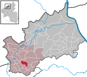
| Location of the local community of Wimbach in the Ahrweiler district | ||
  |
||


;_Breitenweg_b.jpg)
Wimbach is a municipality in the Ahrweiler district in Rhineland-Palatinate . It belongs to the Adenau community .
geography
Wimbach is located in the Hocheifel , two and a half kilometers southwest of the city of Adenau and one kilometer west of the Nürburgring . The place has the form of a settlement of a street village , which extends over a steeply sloping terrain in a northeast direction. The residential development covers altitudes between 350 m above sea level. NN and 450 m above sea level NN . The Wimbach , which gives the municipality its name and which drains to the Adenauer Bach , rises to the west of the village . A large part of the municipality is located in the Adenau state forest . Wimbach also owns the residential area In der Werft .
Neighboring communities are Honerath and Adenau in the north, Herschbroich in the west, Quiddelbach in the southeast and Kottenborn and Barweiler in the southwest.
history
Wimbach was first mentioned in a document from Count Gerhard von Are dated May 25, 1216. There, cash and non-cash benefits for Count Ulrich's foundation to the Adenauer Church are listed.
After iron ore had been tracked down near Wimbach at the beginning of the 19th century , a mine was set up, which began operations in 1829. Only a few years later, the production was stopped again in 1837.
In 1863 the upper part of the village was devastated by fire. A first chapel can be found as early as 1650. The school, first mentioned in 1826, was expanded in 1913. In the school that was newly occupied in 1964, a special needs school was set up after the village schools were closed .
- Population development
The development of the population of Wimbach, the values from 1871 to 1987 are based on censuses:
|
|
politics
Municipal council
The council in Wimbach consists of eight council members, who in the local elections on May 26, 2019 in a majority vote were elected, and the honorary mayor as chairman.
mayor
Detlev Goebel became the local mayor of Wimbach in 2009. In the direct election on May 26, 2019, he was confirmed in his office with a vote of 76.47%.
coat of arms
|
|
Blazon : “The head of the shield is in silver, the base of the shield has a black tip covered with a golden hammer and mallet. Above it two red stag antlers in the middle a black cross. " |
| Justification of the coat of arms: The hammer and mallet in the black tip represent the former lead mines of Wimbach. The red stag antlers indicate the earlier patronage of St. Hubertus. The coat of arms of the Archbishopric of Cologne , to whose territory Wimbach belonged since 1276, is reminiscent of the "Hubertus Cross" in black on a silver shield in the form of a floating cross . |
Culture and sights
;_St._Hubertus_a.jpg)
;_Peffersch%C3%B6ffskapelle_a.jpg)
Buildings
- Catholic branch church St. Hubertus , a neo-baroque hall building , built between 1923 and 1926. In the church there is a wooden figure of the hunter saint from around 1650.
- Pefferschöffskapelle , a hall from 1810.
- Former school, a plastered building, built in 1826 by Ferdinand Nebel , extension made of quarry stone from 1908 to 1910 (main street).
- A half-timbered Streckhof from the 19th century (plastered) and a plastered building from 1836 (both main street).
- Several grave and road crosses from the 17th and 18th centuries (main street).
- Schwedenkreuz: At the Nürburgring, still in the municipality, the so-called Schwedenkreuz from 1638.
See also: List of cultural monuments in Wimbach
Green spaces and recreation
- Hiking trails in and around Wimbach
- Mining monument and biotope in Wimbach
- Hubertushütte - a grill hut with a panoramic view ⊙
Regular events
- Annual fair or parish fair is celebrated on the Sunday after November 3rd (Hubertus).
Economy and Infrastructure
Due to the proximity of the Nürburgring motor racing track, there are several places to stay for visitors.
Wimbach has a country inn and guesthouse in the middle of town.
traffic
The community is accessed through the K 18 . The village is not crossed by any major thoroughfare; the federal roads 257 and 258 to the west and east can be reached via the district roads 18 and 19 .
Web links
- Internet presence of the local community Wimbach
- Page to the local community Wimbach
- SWR site portrait Wimbach
- Literature about Wimbach in the Rhineland-Palatinate state bibliography
Individual evidence
- ↑ a b State Statistical Office of Rhineland-Palatinate - population status 2019, districts, municipalities, association communities ( help on this ).
- ↑ State Statistical Office Rhineland-Palatinate (ed.): Official directory of the municipalities and parts of the municipality. Status: January 2020. S. 7 (PDF; 1 MB).
- ↑ State Statistical Office Rhineland-Palatinate - regional data
- ^ The Regional Returning Officer Rhineland-Palatinate: Local elections 2019, city and municipal council elections
- ↑ State Secretary Beate Reich hands over Medal of Merit of the State of Rhineland-Palatinate to Detlev Goebel from Wimbach. The state government of Rhineland-Palatinate, September 9, 2013, accessed on August 14, 2020 .
- ^ The Regional Returning Officer Rhineland-Palatinate: direct elections 2019. see Adenau, Verbandsgemeinde, 34th line of results. Retrieved August 14, 2020 .
- ↑ Description of coat of arms / justification. Wimbach parish, accessed on August 11, 2017 .
- ↑ Declaration of the coat of arms. Retrieved September 1, 2017 .
- ↑ Hiking in Wimbach. Retrieved September 1, 2017 .
- ↑ Hiking around Wimbach. Retrieved September 1, 2017 .
- ^ Mining and biotope. Retrieved September 1, 2017 .
- ^ Hubertushütte barbecue hut. Retrieved September 1, 2017 .
- ↑ Guest room in Wimbach. Retrieved September 1, 2017 .
- ↑ Meggis Landgasthaus Wimbach. Retrieved September 1, 2017 .

Cities: Adenau | Bad Breisig | Bad Neuenahr-Ahrweiler (seat of the district administration) | Niederzissen | Remagen | Sinzig
Municipalities: Ahrbrück | Altenahr | Antweiler | Aremberg | Barweiler | Bauler | Berg (near Ahrweiler) | Brenk | Brohl-Lützing | Burgbrohl | Dankerath | Dedenbach | Dernau | Dorsel | Dümpelfeld | Eichenbach | Fuchshofen | Galenberg | Glees | Gönnersdorf (near Bad Breisig) | County (Rhineland) | Harscheid (near Adenau) | Heckenbach | Herschbroich | Hoffeld (Eifel) | Hohenleimbach | Honerath | Hönningen | Bumblebee | Insul | Kalenborn (near Altenahr) | Kaltenborn | Kempenich | Kesseling | Kirchsahr | Königsfeld (Eifel) | Kottenborn | Leimbach (near Adenau) | Lind (near Altenahr) | Mayschoss | Meuspath | Müllenbach (near Adenau) | Müsch | Niederduerenbach | Nürburg | Oberduerenbach | Oberzissen | Ohlenhard | Pomster | Quiddelbach | Rech | Reifferscheid | Rodder | Schalkenbach | Guilt (Ahr) | Senscheid | Sierscheid | Spessart (Brohltal) | Trierscheid | Waldorf | Wassenach | Weir | Weibern (Eifel) | Wershofen | Wiesemscheid | Wimbach | Winnerath | Throws