
Kesseling
| coat of arms | Germany map | |
|---|---|---|

|
Coordinates: 50 ° 29 ′ N , 7 ° 1 ′ E |
|
| Basic data | ||
| State : | Rhineland-Palatinate | |
| County : | Ahrweiler | |
| Association municipality : | Altenahr | |
| Height : | 228 m above sea level NHN | |
| Area : | 31.17 km 2 | |
| Residents: | 587 (Dec. 31, 2019) | |
| Population density : | 19 inhabitants per km 2 | |
| Postal code : | 53506 | |
| Area code : | 02647 | |
| License plate : | AW | |
| Community key : | 07 1 31 039 | |
| Community structure: | 3 districts | |
| Association administration address: | Rossberg 3 53505 Altenahr, Germany |
|
| Website : | ||
| Local Mayor : | Guido Schmitz | |
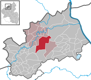
| Location of the local community of Kesseling in the Ahrweiler district | ||
  |
||

Kesseling is a municipality in the Ahrweiler district in Rhineland-Palatinate . It belongs to the community of Altenahr .
geography
Kesseling is located eight kilometers southwest of the city of Bad Neuenahr-Ahrweiler in the valley of the Kesselinger Bach . It arises in the middle of the village from the confluence of the Herschbach and Staffeler Bach and flows four kilometers west of Ahrbrück into the Ahr . In terms of natural space, the municipality can be assigned to the southern Ahrbergland , which is characterized by deeply cut, widely branched valleys. In the south, the municipality extends over the Kesselinger forest and reaches at 583 m above sea level. NHN high Hundsburgskopf its highest point on the ground . With an area of more than 31 km², Kesseling is the largest local community in the area within the Altenahr community.
The districts of Kesseling, Staffel and Weidenbach as well as the residential areas Thomich, Haus Sonnenhard and Steinerberghütte, as well as the deserted area of Kranscheid, belong to Kesseling .
history
The place was first mentioned in the year 762 in two documents on July 10, 762 and August 13, 762. These were donations from the Frankish King Pippin the Younger to the Abbey of Prüm . The Casleoca monastery cell was instrumental in the Christianization of the Ahr region and the northern Eifel . In addition, the monks introduced viticulture in the region. At that time the monastery cell Casleoca with a forest (Mellere = Mellerberg) is mentioned as the property of the abbey. In 772 the parish church of St. Petrus in Kesseling is mentioned for the first time.
Until the end of the 18th century, the Prüm Abbey was the only landlord in Kesseling, and Kurtrier had sovereignty since 1576 .
After the French troops marched into the Rhineland as a result of the French Revolution , Kesseling came to Mairie Brück in the canton of Ahrweiler in the Bonn district ( Rhine-Moselle department ).
Before the Second World War there were plans to give up the village for the expansion of the air force training area Ahrbrück . Due to the Second World War, these plans were abandoned.
On March 1, 1972, the two communities of Kesseling (509 inhabitants at the time) and Staffel (213 inhabitants) were merged to form the new Kesseling community.
- Population development
The development of the population of Kesseling in relation to today's municipality, the values from 1871 to 1987 are based on censuses:
| year | Residents |
|---|---|
| 1815 | 488 |
| 1835 | 582 |
| 1871 | 567 |
| 1905 | 601 |
| 1939 | 618 |
| 1950 | 601 |
| year | Residents |
|---|---|
| 1961 | 655 |
| 1970 | 718 |
| 1987 | 694 |
| 1997 | 659 |
| 2005 | 631 |
| 2019 | 587 |
politics
Municipal council


The local council in Kesseling consists of twelve council members, who were elected in the local elections on May 26, 2019 in a personalized proportional representation, and the honorary local mayor as chairman.
The distribution of seats in the municipal council:
| choice | CDU | FWG | total |
|---|---|---|---|
| 2019 | 3 | 9 | 12 seats |
| 2014 | 5 | 7th | 12 seats |
| 2009 | 4th | 8th | 12 seats |
| 2004 | 5 | 7th | 12 seats |
- FWG = FWG Kesseling-Staffel-Weidenbach e. V.
mayor
Guido Schmitz (FWG) became the local mayor of Kesseling on October 29, 2015. In the direct election on May 26, 2019, he was confirmed in his office for another five years with a share of 78.39% of the votes.
Schmitz's predecessor, Jürgen Flügge, resigned for personal reasons with effect from February 11, 2015. Until the appointment of the successor, the alderman Richard Surges and Klaus Winkler had alternated the official business.
Culture and sights
Buildings

- Steinerberghaus, hiking hut built in 1910–11 according to plans by the Bonn government master builder Karl Thoma , destroyed in the First World War and reopened after reconstruction in 1921, today "Landgasthof"
- Church of St. Peter and Maternus with a Romanesque choir tower
- St. Lüfthildis chapel in Staffel
See also: List of cultural monuments in Kesseling
Web links
- Internet presence of the local community Kesseling
- Kesseling, Altenahr Association
- Kesseling and the Prüm Monastery, 1962 homeland yearbook, Ahrweiler district
- Literature about Kesseling in the Rhineland-Palatinate State Bibliography
Individual evidence
- ↑ a b State Statistical Office of Rhineland-Palatinate - population status 2019, districts, municipalities, association communities ( help on this ).
- ↑ State Statistical Office Rhineland-Palatinate (ed.): Official directory of the municipalities and parts of the municipality. Status: January 2019 [ Version 2020 is available. ] . S. 8 (PDF; 3 MB).
- ^ Regesta Imperii RI I n.94 of July 10, 762 (online ; accessed July 30, 2017).
- ^ Regesta Imperii RI I n.95 of August 13, 762 (online ; accessed July 30, 2017).
- ↑ Official municipality directory 2006 ( Memento from December 22, 2017 in the Internet Archive ) (= State Statistical Office Rhineland-Palatinate [Hrsg.]: Statistical volumes . Volume 393 ). Bad Ems March 2006, p. 182 (PDF; 2.6 MB). Info: An up-to-date directory ( 2016 ) is available, but in the section "Territorial changes - Territorial administrative reform" it does not give any population figures.
- ↑ State Statistical Office Rhineland-Palatinate - regional data
- ^ The Regional Returning Officer Rhineland-Palatinate: Local elections 2019, city and municipal council elections
- ↑ a b Guido Schmitz elected unanimously. In: Blick Aktuell. Krupp Verlags GmbH, Sinzig, November 3, 2015, accessed on August 5, 2020 .
- ^ The Regional Returning Officer Rhineland-Palatinate: direct elections 2019. see Altenahr, Verbandsgemeinde, tenth line of the result. Retrieved August 5, 2020 .
- ↑ Local mayor has resigned. In: Blick Aktuell. Krupp Verlags GmbH, Sinzig, February 23, 2015, accessed on August 5, 2020 .
- ↑ Steinerberghaus has been bringing happiness to the summit high above the Ahr for 100 years. In: Rhein-Zeitung. February 28, 2011, accessed October 21, 2017 .

Cities: Adenau | Bad Breisig | Bad Neuenahr-Ahrweiler (seat of the district administration) | Niederzissen | Remagen | Sinzig
Municipalities: Ahrbrück | Altenahr | Antweiler | Aremberg | Barweiler | Bauler | Berg (near Ahrweiler) | Brenk | Brohl-Lützing | Burgbrohl | Dankerath | Dedenbach | Dernau | Dorsel | Dümpelfeld | Eichenbach | Fuchshofen | Galenberg | Glees | Gönnersdorf (near Bad Breisig) | County (Rhineland) | Harscheid (near Adenau) | Heckenbach | Herschbroich | Hoffeld (Eifel) | Hohenleimbach | Honerath | Hönningen | Bumblebee | Insul | Kalenborn (near Altenahr) | Kaltenborn | Kempenich | Kesseling | Kirchsahr | Königsfeld (Eifel) | Kottenborn | Leimbach (near Adenau) | Lind (near Altenahr) | Mayschoss | Meuspath | Müllenbach (near Adenau) | Müsch | Niederduerenbach | Nürburg | Oberduerenbach | Oberzissen | Ohlenhard | Pomster | Quiddelbach | Rech | Reifferscheid | Rodder | Schalkenbach | Guilt (Ahr) | Senscheid | Sierscheid | Spessart (Brohltal) | Trierscheid | Waldorf | Wassenach | Weir | Weibern (Eifel) | Wershofen | Wiesemscheid | Wimbach | Winnerath | Throws