
Kempenich
| coat of arms | Germany map | |
|---|---|---|

|
Coordinates: 50 ° 25 ' N , 7 ° 7' E |
|
| Basic data | ||
| State : | Rhineland-Palatinate | |
| County : | Ahrweiler | |
| Association municipality : | Brohl valley | |
| Height : | 460 m above sea level NHN | |
| Area : | 11.91 km 2 | |
| Residents: | 1877 (Dec. 31, 2019) | |
| Population density : | 158 inhabitants per km 2 | |
| Postal code : | 56746 | |
| Area code : | 02655 | |
| License plate : | AW | |
| Community key : | 07 1 31 502 | |
| LOCODE : | DE ZKE | |
| Community structure: | 2 districts | |
| Association administration address: | Kapellenstrasse 12 56651 Niederzissen |
|
| Website : | ||
| Local Mayor : | Dominik Schmitz (FWG) | |
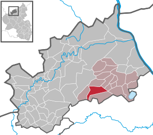
| Location of the Kempenich community in the Ahrweiler district | ||
  |
||


Kempenich is a municipality in the Ahrweiler district in Rhineland-Palatinate . It belongs to the Brohltal community , which has its administrative headquarters in Niederzissen . Kempenich is the largest town in the upper Brohl valley and a state-approved resort .
geography
The community is located on the eastern edge of the Hocheifel about eight kilometers northwest of Mayen . The Hohe Acht rises about seven kilometers southwest of Kempenich, and almost ten kilometers east is the Laacher See .
Community structure
The community consists of the two districts of Kempenich and Engeln . The Engeln district also forms a district.
The Kempenich district also includes the residential areas Burg Kempenich (villa), Heidnerhof, Hommeshof, Kreuzwäldchen, Lärchenhof, Rottlandhöfe and Stefanshof; The Appentalerhof and Buchhof residential areas to the Engeln district.
climate
The annual precipitation is 808 mm. The precipitation is in the middle third of the values recorded in Germany. Lower values are registered at 65% of the measuring stations of the German Weather Service . The driest month is February, with the most rainfall in July. In July there is 1.4 times more rainfall than in February. Precipitation varies only minimally and is extremely evenly distributed over the year. Lower seasonal fluctuations are recorded at only 4% of the measuring stations .
history
Kempenich was first mentioned in a document in 1093. Richwin von Kempenich is named as a witness in the deed of foundation of the Laach Abbey .
The history of the place is closely linked to the history of Kempenich Castle and the Kempenich rule . As an institution of the Kempenich rule, there was a regional court that was only dissolved at the end of the 18th century. Today's coat of arms of the local community, the "Kempenicher Bauer", goes back to the court seal of 1596 .
In the years 1348 and 1666 the plague raged in Kempenich and the surrounding area. Four major fires in 1661, 1753, 1847 and 1853 devastated the village. Many people were killed in a bomb attack on January 6, 1945, and numerous buildings were destroyed.
Territorial Affiliation
The rule and with it the town of Kempenich had been pledged to the Counts of Elz by the Elector Johann VII of Trier since 1581 , in 1777 Kempenich was incorporated into the Electorate of Trier under Clemens Wenzeslaus and the Electorate of Kempenich was established, but the administrative seat was in Mayen.
In connection with the First Coalition War , the region came under French administration in 1794 and from 1798 on, Kempenich came to the canton of Wehr in the arrondissement of Bonn , which belonged to the Rhine and Moselle department . Kempenich became the seat of a mairie .
After the Rhineland came to the Kingdom of Prussia in 1815 due to the treaties of the Congress of Vienna , Kempenich became the seat of the mayor's office in Kempenich in the newly created district of Adenau in the Koblenz administrative district . The municipalities Engeln, Hausten , Kempenich, Lederbach, Leimbach , Morswiesen, Spessart , Wabern and Weibern belonged to the mayor's office in Kempenich . After the district of Adenau was dissolved in 1932, the mayor's office Kempenich (from 1927 Amt Kempenich) came to the district of Mayen (from 1939 district Mayen ) and as part of the regional reform on November 7, 1970 to the district of Ahrweiler . The Kempenich community was temporarily created from the Kempenich office in 1968, which was also dissolved on November 7, 1970. The Kempenich local community was assigned to the newly formed Brohtal community.
The local community of Engeln, which had been independent until then, was incorporated into Kempenich on June 10, 1979 with 117 inhabitants at that time.
Parish Kempenich
The parish in Kempenich is very old and belonged to the Ochtendung land chapter in the Karden Archdeaconate in the Trier diocese . At the beginning of the 19th century, in addition to Kempenich, the villages of Engeln, Hannebach (now part of Spessart), the Heulingshof near Hannebach, Hausten with Morswiesen, Hohenleimbach, Lederbach, Spessart, Wabern and Weibern were parish. All parish places, except Hausten and Morswiesen, had chapels.
Today belong to the cath. Parish of St. Philippus and Jakobus, the subsidiary communities of Engeln, Hannebach, Heulingshof, Hohenleimbach, Lederbach and Spessart. Since April 1, 2004, the parish has belonged to the then newly created dean's office in Brohltal-Remagen in the diocese of Trier.
The Protestant Christians in Kempenich belong to the Protestant parish of Adenau, which has existed since the middle of the 19th century.
Population development
The development of the population of Kempenich in relation to today's municipality area; the values from 1871 to 1987 are based on censuses:

|
|
politics
Municipal council
The municipal council in Kempenich consists of 16 council members, who were elected in a personalized proportional representation in the local elections on May 26, 2019 , and the honorary local mayor as chairman.
Distribution of seats in the elected municipal council:
| year | CDU | FWG | Flat share 1 | Flat share 2 | total |
|---|---|---|---|---|---|
| 2019 | 8th | 9 | 2 | - | 16 seats |
| 2014 | 7th | 7th | 2 | - | 16 seats |
| 2009 | 7th | 7th | 2 | - | 16 seats |
| 2004 | 5 | 7th | 3 | 1 | 16 seats |
- FWG = Free Voting Group Citizens for Citizens e. V.
mayor
Dominik Schmitz (FWG) became local mayor of Kempenich on September 9, 2019. In the direct election on May 26, 2019, he was elected for five years with 77.88% of the vote.
Schmitz's predecessor, Stefan Friedsam (CDU), did not run again in 2019.
Engeln district
According to the main statute, the Engeln district has a mayor , but no local advisory board .
Michael Klein became the mayor of Engeln on September 9, 2019. In the direct election on May 26, 2019, he was elected for five years with a share of the vote of 86.09%.
coat of arms
|
|
Blazon : "In gold, a black-haired silver farmer with a red hat, red doublet , red trousers and black boots, with his left hand leadinga black cart plow and with his right hand wielding a slanting black whip, at the top right accompanied by a red ray of sunshine ."
The right to use a coat of arms was granted to the local community by the district of Ahrweiler on March 31, 1993 after a council decision by the local community council had preceded it. |
traffic
- Kempenich is on the B 412 between the A 61 and the Nürburgring .
- From 1902 to 1974 the Kempenich station was the Eifel-side terminus of the Brohltalbahn .
Cultural monuments
In Kempenich there are some listed cultural monuments:
- Kempenich district

- The Catholic parish church of St. Philip and James , with a late Romanesque four-storey west tower from the beginning of the 13th century, renovated in 1716 and 1923; the late Gothic nave, originally with two aisles, dates from the 15th century, extension from 1904 to 1906; in the church a Romanesque baptismal font made of basalt lava from the first half of the 13th century, and a tombstone from the 16th century; in the cemetery a number of grave crosses from the 18th century.
- The former rectory, a tuff-structured basalt block building, around 1900; the baroque parsonage portal is said to come from the castle (Marktstrasse).
- The former bell ringer's house, a half-timbered building, partly massive, from 1848 (Marktstrasse).
- The “Marienburg” old people's home, a three-storey neo-baroque mansard roof building from the 1920s (Beunstraße).
- The former Catholic youth home, a tuff square construction from 1927 (Goldbachstrasse).
- A basalt block construction from the early 19th century; a semicircular tower near the building, possibly from the medieval fortifications (Oberdorfstrasse).
- Kempenich district
- The ruins of Kempenich Castle .
- The Bernhardus Chapel from 1606 on the Burgberg. Half-timbered ceiling with a relief of St. Bernard made of tuff stone .
- Several wayside shrines and crosses , some from the 16th and 17th centuries.
- The Kreuzkapelle with a way of the cross from the 20th century.
- Engeln district
- The Chapel of the Fourteen Holy Helpers , a hall building from 1767.
- A chapel made of tuff blocks from 1857.
- Markings Engeln
- Several and way crosses, partly from the 16th and 17th centuries.
See also: List of cultural monuments in Kempenich
Web links
- Internet presence of the municipality of Kempenich
- History of the Kempenich rule ( Memento from June 23, 2013 in the Internet Archive )
- Literature about Kempenich in the Rhineland-Palatinate State Bibliography
Individual evidence
- ↑ State Statistical Office of Rhineland-Palatinate - population status 2019, districts, communities, association communities ( help on this ).
- ^ A b State Statistical Office Rhineland-Palatinate: My village, my city. Retrieved May 12, 2020 .
- ↑ a b main statute of the Kempenich community. (PDF; 2.222 kB) § 2 local districts. Kempenich community, September 9, 2019, accessed on August 3, 2020 .
- ↑ State Statistical Office Rhineland-Palatinate (ed.): Official directory of the municipalities and parts of the municipality. Status: January 2019 [ Version 2020 is available. ] . S. 10 (PDF; 3 MB).
- ^ History of Kempenich ( Memento from January 5, 2017 in the Internet Archive )
- ^ A b Karl Friedrich Wilhelm Dieterici: Communications of the Statistical Bureau in Berlin , 1856, page 9
- ^ A b Jakob Rausch: 150 years Ahrweiler district in the 1966 home yearbook of the Ahrweiler district
- ↑ a b Official municipality directory 2006 ( Memento from December 22, 2017 in the Internet Archive ) (= State Statistical Office Rhineland-Palatinate [Hrsg.]: Statistical volumes . Volume 393 ). Bad Ems March 2006, p. 158, 164, 181 (PDF; 2.6 MB). Info: An up-to-date directory ( 2016 ) is available, but in the section "Territorial changes - Territorial administrative reform" it does not give any population figures.
- ^ The Regional Returning Officer Rhineland-Palatinate: Local elections 2019, city and municipal council elections.
- ↑ a b Constituent meeting of the Kempenich municipal council. In: Council and Citizen Information System. Verbandsgemeindeverwaltung Brohltal, September 9, 2019, accessed on August 3, 2020 .
- ^ The State Returning Officer Rhineland-Palatinate: direct elections 2019. see Brohltal, Verbandsgemeinde, penultimate row of results. Retrieved August 3, 2020 .
- ↑ Some new local mayors elected in Brohl Valley. In: Blick Aktuell. Krupp Verlags GmbH, Sinzig, May 28, 2019, accessed on August 3, 2020 .
- ^ The Regional Returning Officer of Rhineland-Palatinate: direct elections 2019. see Brohltal, Verbandsgemeinde, last line of results. Retrieved August 3, 2020 .
- ^ Georg Dehio : Handbook of German Art Monuments - Rhineland-Palatinate, Saarland . Deutscher Kunstverlag, Munich 1984, ISBN 3-422-00382-7
- ^ General Directorate for Cultural Heritage Rhineland-Palatinate (ed.): Informational directory of cultural monuments - Ahrweiler district. Mainz 2020, p. 43 f. (PDF; 5.1 MB).
- ↑ Bernhardus Chapel ( Memento from January 4, 2017 in the Internet Archive )

Cities: Adenau | Bad Breisig | Bad Neuenahr-Ahrweiler (seat of the district administration) | Niederzissen | Remagen | Sinzig
Municipalities: Ahrbrück | Altenahr | Antweiler | Aremberg | Barweiler | Bauler | Berg (near Ahrweiler) | Brenk | Brohl-Lützing | Burgbrohl | Dankerath | Dedenbach | Dernau | Dorsel | Dümpelfeld | Eichenbach | Fuchshofen | Galenberg | Glees | Gönnersdorf (near Bad Breisig) | County (Rhineland) | Harscheid (near Adenau) | Heckenbach | Herschbroich | Hoffeld (Eifel) | Hohenleimbach | Honerath | Hönningen | Bumblebee | Insul | Kalenborn (near Altenahr) | Kaltenborn | Kempenich | Kesseling | Kirchsahr | Königsfeld (Eifel) | Kottenborn | Leimbach (near Adenau) | Lind (near Altenahr) | Mayschoss | Meuspath | Müllenbach (near Adenau) | Müsch | Niederduerenbach | Nürburg | Oberduerenbach | Oberzissen | Ohlenhard | Pomster | Quiddelbach | Rech | Reifferscheid | Rodder | Schalkenbach | Guilt (Ahr) | Senscheid | Sierscheid | Spessart (Brohltal) | Trierscheid | Waldorf | Wassenach | Weir | Weibern (Eifel) | Wershofen | Wiesemscheid | Wimbach | Winnerath | Throws