
Guilt (ahr)
| coat of arms | Germany map | |
|---|---|---|

|
Coordinates: 50 ° 27 ' N , 6 ° 53' E |
|
| Basic data | ||
| State : | Rhineland-Palatinate | |
| County : | Ahrweiler | |
| Association municipality : | Adenau | |
| Height : | 269 m above sea level NHN | |
| Area : | 5.93 km 2 | |
| Residents: | 667 (Dec. 31, 2019) | |
| Population density : | 112 inhabitants per km 2 | |
| Postal code : | 53520 | |
| Area code : | 02695 | |
| License plate : | AW | |
| Community key : | 07 1 31 074 | |
| Association administration address: | Kirchstrasse 15 53518 Adenau |
|
| Website : | ||
| Local Mayor : | Helmut Lussi | |
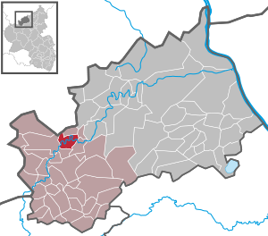
| Location of the local community in the district of Ahrweiler | ||
  |
||


;_Schornkapelle_a.jpg)
;_Ortskern_b.jpg)
Guilt is a local community in the Ahrweiler district in Rhineland-Palatinate . It belongs to the Adenau community .
Geographical location
Guilt lies directly on the border with North Rhine-Westphalia . The village is crossed twice by the Ahr past steep cliffs. In the mouth of the Armuthsbachs in the Ahr the branches country Straße 75 / 165 via Esch after Bad Münster Eifel from.
Neighboring communities are Insul , Harscheid , Fuchshofen and Winnerath .
history
A Roman settlement had long been known to the local residents through finds. When Roman building remains came to light in the course of land consolidation in 1962, the Roman estate "In the hamlet" was excavated .
In 1975, Schuld celebrated its 1000th anniversary and based this anniversary on the so-called "Reifferscheider deed" from 975. In this document, a boundary description of the Reifferscheid parish , guilt is mentioned as "... et inde usque terminationem scolta", from which it is concluded can be that even then, guilt was a separate parish . Another important source is the wisdom of the Schulder High Court of 1368. Here, the "four honors " are spoken of, which also includes the honors Dümpelfeld, Insul and Niederadenau. This was due to the administrative and judicial seat of these honors. The term "Honschaft" (hundreds) comes from Franconian times, so that one can assume that the place must have existed as early as the 7th and 8th centuries.
The villages of Dümpelfeld , Harscheld , Insul , Lückenbach , Niederadenau , Schuld, Sierscheid and Winnerath belonged to the “Schultheissenamt der Vier Honschaften”, as it was called at the end of the 18th century .
Guilt belonged to the county of Nürburg , later to the Cologne Electoral Office of the same name and was the seat of a mayor's office. The Schulder "Vier-Hundschaft" was obliged to get the necessary sand for construction work on the Nürburg . The Archbishop of Cologne was the sovereign. However, other landlords also owed property and rights.
The tenth of clearing ( Rottzins ) in the Schulder Forest belonged to the Cologne Cathedral Monastery in 1216 . Knight Rollmann von Sinzig was in debt to the Duke von Jülich's liege . Whose possessions took over in 1387, the Johanniter coming Adenau .
In 1791 the Schulder citizens gave themselves their own municipal code, in which the rights and duties of all residents of the place were regulated. The Schulder parish church dates back to the 13th century, although there must have been a church in the village as early as 975. In 1923/1924 a new building was built. However, the church was almost completely destroyed in 1944 and only painstakingly rebuilt after the war. In the 1970s this " Gertrudiskirche " was enlarged and renovated on a larger scale.
- Statistics on population development
The development of the population of Schuld, the values from 1871 to 1987 are based on censuses:
|
|
politics
Municipal council
The local council in debt consists of twelve council members, who were elected in the local elections on May 26, 2019 in a majority vote, and the honorary local mayor as chairman.
mayor
Helmut Lussi became mayor of Schuld in 2009. In the direct election on May 26, 2019, he was confirmed in his office with a share of the vote of 82.67%.
Lussi's predecessor as local mayor was Jürgen Hecken from 1990 to 2009.
coat of arms
|
|
Blazon : “In the golden head of the shield there is an oblique wave bar with four silver disks. In the lower right part of the shield a red lily and in the upper left part of the shield a black cross. " |
| Reasons for the coat of arms: The blue wave arch in the coat of arms symbolizes the Ahr, the four circles in the wave arch the four hunches that were part of guilt. The black cross points to the former affiliation to Kurköln and the lily to Maria , to whom the Schornkapelle is consecrated. |
Culture and sights
;_Freilichtb%C3%BChne_a.jpg)
Buildings
- Parish church of St. Gertrud around 1250.
- The Schornkapelle pilgrimage church ; it was a foundation of the Schorn family from 1879.
- Several half-timbered houses from the 19th century.
See also: List of cultural monuments in debt
Green spaces and recreation
- The place is characterized by a wooded, natural landscape.
- Numerous hiking trails in and around Schuld.
- The Ahr cycle path and the AhrSteig long-distance hiking trail , which goes over the heights, lead through Schuld .
- The Martinshütte with green areas, campground, barbecue hut, hiking meeting point and playground. ⊙
Regular events
- The open-air stage on Schorren is used for performances in summer (July – August).
- One-day race Cologne – Schuld – Frechen (until 2012), Cologne – Schuld – Cologne (from 2014).
- Village community festival “Ahrfelsen in Flammen in Schuld / Ahr” (in June).
- Car-free Sunday. The "Tour de Ahrtal" (end of June) leads from the source in Blankenheim to Altenahr.
Economy and Infrastructure
Business
The community has a general practitioner, four hotels and restaurants, a bakery, a grocery store, a hairdresser, two car repair shops and a campsite. An antique yard offers furniture restoration and sales.
The St. Franziskus kindergarten is located in the village of Schuld.
traffic

The community is served by the state roads 73 and 75 . The Schuld train station was on the now disused Dümpelfeld – Lissendorf railway line .
Web links
- Internet presence of the local church Schuld
- Internet presence of the tourist association guilt
- Location portrait to blame by the SWR
- Literature on guilt in the Rhineland-Palatinate state bibliography
Individual evidence
- ↑ State Statistical Office of Rhineland-Palatinate - population status 2019, districts, communities, association communities ( help on this ).
- ^ Wilhelm Fabricius : Explanations of the historical atlas of the Rhine province, 2nd volume: The map of 1789. Bonn 1898, p. 71.
- ↑ State Statistical Office Rhineland-Palatinate - regional data
- ^ The Regional Returning Officer Rhineland-Palatinate: Local elections 2019, city and municipal council elections.
- ↑ a b teacher and mayor. Tourist office Schuld an der Ahr, accessed on August 9, 2020 .
- ^ The Regional Returning Officer for Rhineland-Palatinate: direct elections 2019. see Adenau, Verbandsgemeinde, 28th line of results. Retrieved August 9, 2020 .
- ↑ Description of coat of arms / justification. Local Church Guilt, accessed August 1, 2017 .
- ↑ Hiking routes in Schuld ad Ahr. Retrieved August 11, 2017 .
- ↑ Martinshütte guilt. Retrieved September 1, 2017 .
- ↑ RTF “Köln – Schuld – Köln” is supposed to remind of the classic “Köln – Schuld – Frechen”. In: rad.net. February 14, 2014, accessed August 3, 2017 .
- ↑ Antikhof Timmer. Retrieved September 1, 2017 .

Cities: Adenau | Bad Breisig | Bad Neuenahr-Ahrweiler (seat of the district administration) | Niederzissen | Remagen | Sinzig
Municipalities: Ahrbrück | Altenahr | Antweiler | Aremberg | Barweiler | Bauler | Berg (near Ahrweiler) | Brenk | Brohl-Lützing | Burgbrohl | Dankerath | Dedenbach | Dernau | Dorsel | Dümpelfeld | Eichenbach | Fuchshofen | Galenberg | Glees | Gönnersdorf (near Bad Breisig) | County (Rhineland) | Harscheid (near Adenau) | Heckenbach | Herschbroich | Hoffeld (Eifel) | Hohenleimbach | Honerath | Hönningen | Bumblebee | Insul | Kalenborn (near Altenahr) | Kaltenborn | Kempenich | Kesseling | Kirchsahr | Königsfeld (Eifel) | Kottenborn | Leimbach (near Adenau) | Lind (near Altenahr) | Mayschoss | Meuspath | Müllenbach (near Adenau) | Müsch | Niederduerenbach | Nürburg | Oberduerenbach | Oberzissen | Ohlenhard | Pomster | Quiddelbach | Rech | Reifferscheid | Rodder | Schalkenbach | Guilt (Ahr) | Senscheid | Sierscheid | Spessart (Brohltal) | Trierscheid | Waldorf | Wassenach | Weir | Weibern (Eifel) | Wershofen | Wiesemscheid | Wimbach | Winnerath | Throws