
Wershofen
| coat of arms | Germany map | |
|---|---|---|

|
Coordinates: 50 ° 27 ' N , 6 ° 49' E |
|
| Basic data | ||
| State : | Rhineland-Palatinate | |
| County : | Ahrweiler | |
| Association municipality : | Adenau | |
| Height : | 465 m above sea level NHN | |
| Area : | 14.36 km 2 | |
| Residents: | 901 (Dec. 31, 2019) | |
| Population density : | 63 inhabitants per km 2 | |
| Postal code : | 53520 | |
| Area code : | 02694 | |
| License plate : | AW | |
| Community key : | 07 1 31 082 | |
| LOCODE : | DE WXN | |
| Association administration address: | Kirchstrasse 15 53518 Adenau |
|
| Website : | ||
| Local Mayor : | Torsten Raths | |
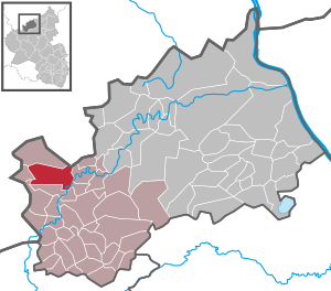
| Location of the local community of Wershofen in the Ahrweiler district | ||
  |
||


Wershofen is a municipality in the northwest of the Ahrweiler district in Rhineland-Palatinate . It belongs to the Verbandsgemeinde Adenau and is one of their largest municipalities.
geography
Wershofen is located in the Ahr Mountains . The municipality also includes residential places Daubiansmühle, Kottenbornerhof, Laufenbacherhof (zip code 53533) and Wennefeldermühle.
history
It was first mentioned in 1395 and celebrated its 600th anniversary in 1995. Until the end of the 18th century, Wershofen was part of the Duchy of Arenberg .
In 1794 French revolutionary troops occupied the left bank of the Rhine . Under French administration, Wershofen belonged to the canton of Adenau , which was assigned to the Rhine-Moselle department . After the treaties concluded at the Congress of Vienna , the region, including Wershofen, became part of the Kingdom of Prussia in 1815 . From 1816 on, Wershofen belonged to the Aremberg mayor's office in the Adenau district , which was part of the Coblenz administrative district and from 1822 to the Rhine Province .
Until 1839, the then independent communities Eichenbach and Ohlenhard belonged to Wershofen.
In 1932 the Adenau district was dissolved and the Wershofen community was assigned to the Ahrweiler district . The municipality has belonged to the state of Rhineland-Palatinate since 1946 and to the Adenau association since 1970 .
- Statistics on population development
The development of the population of Wershofen, the values from 1871 to 1987 are based on censuses:
|
|
politics
Municipal council
The municipal council in Wershofen consists of twelve council members, who were elected by a majority vote in the local elections on May 26, 2019 , and the honorary local mayor as chairman.
mayor
Torsten Raths became local mayor of Wershofen again on November 27, 2019, after he had already held this office from 2009 to 2014. The first deputy at the time was elected to the office by the council.
Raths' predecessor, Robert Zawada, was elected for the first time in 2014 and was confirmed in his office in the direct election on May 26, 2019 with a share of 65.59% of the votes, but resigned from his office with effect from October 31, 2019.
Parish partnership
traffic
The Wershofen / Eifel airfield is located two kilometers northwest of the town center .
See also
literature
- Rainer Justen: 600 years and more ... history and stories of Wershofen and Ohlenhard. Wershofen 1995.
Web links
- Website of the local community of Wershofen
- Literature about Wershofen in the Rhineland-Palatinate state bibliography
Individual evidence
- ↑ State Statistical Office of Rhineland-Palatinate - population status 2019, districts, communities, association communities ( help on this ).
- ↑ State Statistical Office Rhineland-Palatinate (ed.): Official directory of the municipalities and parts of the municipality. Status: January 2020. S. 7 (PDF; 1 MB).
- ^ The government district of Coblenz according to its location, limitation, size, population ... , Coblenz: Pauli, 1817, page 55
- ↑ State Statistical Office Rhineland-Palatinate - regional data
- ^ The Regional Returning Officer Rhineland-Palatinate: Local elections 2019, city and municipal council elections.
- ↑ a b Torsten Raths: Invitation to the meeting of the local council on November 27, 2019. Retrieved August 12, 2020 .
- ↑ a b Finally: Wershofen now also has a mayor. In: Rhein-Zeitung. Mittelrhein-Verlag GmbH, Koblenz, November 17, 2014, accessed on August 12, 2020 .
- ^ The Regional Returning Officer Rhineland-Palatinate: direct elections 2019. see Adenau, Verbandsgemeinde, 32nd line of results. Retrieved August 12, 2020 .
- ↑ Robert Zawada: Resignation as local mayor. Local community Wershofen, October 1, 2019, accessed on August 12, 2020 .

Cities: Adenau | Bad Breisig | Bad Neuenahr-Ahrweiler (seat of the district administration) | Niederzissen | Remagen | Sinzig
Municipalities: Ahrbrück | Altenahr | Antweiler | Aremberg | Barweiler | Bauler | Berg (near Ahrweiler) | Brenk | Brohl-Lützing | Burgbrohl | Dankerath | Dedenbach | Dernau | Dorsel | Dümpelfeld | Eichenbach | Fuchshofen | Galenberg | Glees | Gönnersdorf (near Bad Breisig) | County (Rhineland) | Harscheid (near Adenau) | Heckenbach | Herschbroich | Hoffeld (Eifel) | Hohenleimbach | Honerath | Hönningen | Bumblebee | Insul | Kalenborn (near Altenahr) | Kaltenborn | Kempenich | Kesseling | Kirchsahr | Königsfeld (Eifel) | Kottenborn | Leimbach (near Adenau) | Lind (near Altenahr) | Mayschoss | Meuspath | Müllenbach (near Adenau) | Müsch | Niederduerenbach | Nürburg | Oberduerenbach | Oberzissen | Ohlenhard | Pomster | Quiddelbach | Rech | Reifferscheid | Rodder | Schalkenbach | Guilt (Ahr) | Senscheid | Sierscheid | Spessart (Brohltal) | Trierscheid | Waldorf | Wassenach | Weir | Weibern (Eifel) | Wershofen | Wiesemscheid | Wimbach | Winnerath | Throws