Dorsel
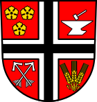
| coat of arms | Germany map | |
|---|---|---|

|
Coordinates: 50 ° 23 ' N , 6 ° 48' E |
|
| Basic data | ||
| State : | Rhineland-Palatinate | |
| County : | Ahrweiler | |
| Association municipality : | Adenau | |
| Height : | 390 m above sea level NHN | |
| Area : | 7.2 km 2 | |
| Residents: | 201 (Dec. 31, 2019) | |
| Population density : | 28 inhabitants per km 2 | |
| Postal code : | 53533 | |
| Area code : | 02693 | |
| License plate : | AW | |
| Community key : | 07 1 31 018 | |
| Association administration address: | Kirchstrasse 15 53518 Adenau |
|
| Website : | ||
| Local Mayor : | Günter Adrian | |
| Location of the local community of Dorsel in the Ahrweiler district | ||
Dorsel is a municipality in the southwestern district of Ahrweiler in Rhineland-Palatinate . It belongs to the Adenau community .
Geographical location
The place is located in the Hocheifel in the upper valley of the Ahr , about 80 kilometers south of Cologne . The western municipal border forms the state border between Rhineland-Palatinate and North Rhine-Westphalia .
Dorsel also includes the Dorselermühle, Heidehöfe, hunting lodges and steelworks residential areas .
history
The place was first mentioned in a document around 1149 in the name of Heinrich von Dorsel . From the 13th to the end of the 18th century, Dorsel was part of the Duchy of Arenberg .
In 1794 French revolutionary troops occupied the left bank of the Rhine . Under French administration, Dorsel belonged to the canton of Adenau , which was assigned to the Rhine-Moselle department . After the treaties concluded at the Congress of Vienna , the region, including Dorsel, became part of the Kingdom of Prussia in 1815 . From 1816 on, Dorsel belonged to the mayor's office in Aremberg in the Adenau district , which was part of the Coblenz administrative district and from 1822 to the Rhine Province . In 1932 the Adenau district was dissolved and the Dorsel community was assigned to the Ahrweiler district . The municipality has belonged to the state of Rhineland-Palatinate since 1946 and to the Adenau association since 1970 .
From the 17th century until the blast furnace was blown out in 1870, an ironworks was in operation at Stahlhütte, in the Ahr valley below Dorsel . In 1972 the village school was closed.
- Population development
The development of the population of the municipality of Dorsel, the values from 1871 to 1987 are based on censuses:
|
|
politics
Municipal council
The council in Dorsel consists of six council members, who in the local elections on May 26, 2019 in a majority vote were elected, and the honorary mayor as chairman.
mayor
Günter Adrian is the local mayor of Dorsel. In the direct election on May 26, 2019, he was confirmed in his office with 80.51% of the votes.
Attractions
The townscape is determined by the parish church of St. Sebastian , which was built from 1200.
Patron saints of Dorsel are St. Sebastian and St. Rochus.
See also: List of cultural monuments in Dorsel
traffic
Dorsel is located directly on the planned route to close the gap on Autobahn 1 between Blankenheim and Daun .
Web links
- Literature about Dorsel in the Rhineland-Palatinate State Bibliography
Individual evidence
- ↑ a b State Statistical Office of Rhineland-Palatinate - population status 2019, districts, municipalities, association communities ( help on this ).
- ↑ State Statistical Office Rhineland-Palatinate (ed.): Official directory of the municipalities and parts of the municipality. Status: January 2019 [ Version 2020 is available. ] . S. 6 (PDF; 3 MB).
- ↑ State Statistical Office Rhineland-Palatinate - regional data
- ^ The Regional Returning Officer Rhineland-Palatinate: Local elections 2019, city and municipal council elections
- ^ The State Returning Officer of Rhineland-Palatinate: direct elections 2019. see Adenau, Verbandsgemeinde, seventh line of results. Retrieved August 6, 2020 .
- ↑ Frieder Bluhm: Closing the gap A1: Does the new route make too much noise? Mittelrhein-Verlag GmbH, Koblenz, April 9, 2019, accessed on August 6, 2020 .


