
Wiesemscheid
| coat of arms | Germany map | |
|---|---|---|

|
Coordinates: 50 ° 20 ' N , 6 ° 54' E |
|
| Basic data | ||
| State : | Rhineland-Palatinate | |
| County : | Ahrweiler | |
| Association municipality : | Adenau | |
| Height : | 512 m above sea level NHN | |
| Area : | 5.6 km 2 | |
| Residents: | 242 (Dec. 31, 2019) | |
| Population density : | 43 inhabitants per km 2 | |
| Postal code : | 53534 | |
| Area code : | 02691 | |
| License plate : | AW | |
| Community key : | 07 1 31 083 | |
| LOCODE : | DE CHD | |
| Association administration address: | Kirchstrasse 15 53518 Adenau |
|
| Website : | ||
| Local Mayor : | Andreas Baur | |
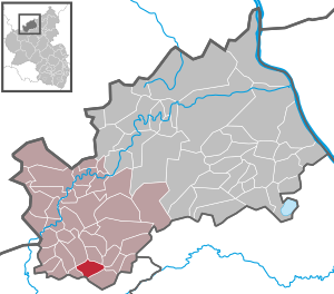
| Location of the local community of Wiesemscheid in the Ahrweiler district | ||
  |
||

Wiesemscheid is a municipality in the Ahrweiler district in Rhineland-Palatinate . It belongs to the Adenau community .
geography
Wiesemscheid is located six kilometers southwest of the city of Adenau on an area that shows comparatively little height differences for the Hocheifel . To the north, the municipality falls into the valley of the Wirftbach , to the south into that of the Trierbach , where it is about 405 m above sea level. NHN reaches its lowest ground point . The Schullandheim (children's home) residential area to the east of the main town belongs to Wiesemscheid .
history
Probably originated in the 13th century, the place belonged to the bailiwick of Barweiler in the electoral district of Nürburg until the end of the 18th century .
- Population development
The development of the population of Wiesemscheid, the values from 1871 to 1987 are based on censuses:
|
|
politics
Municipal council
The municipal council in Wiesemscheid consists of six members who were elected by a majority vote in the local elections on May 26, 2019 , and the honorary local mayor as chairman.
mayor
Andreas Baur is the local mayor of Wiesemscheid. Since there was no candidate for the direct election on May 26, 2019, the upcoming election of the mayor was incumbent on the council in accordance with municipal regulations. He confirmed Baur in his office on July 8, 2019.
Worth seeing
The Chapel of St. Barbara was first mentioned in 1590.
See also: List of cultural monuments in Wiesemscheid
economy
The place is only about four kilometers away from the Nürburgring and, with several guest houses, hotels and a school camp, makes use of the fact that it is part of the closer tourist catchment area of the racing events there.
traffic
Wiesemscheid is in the south of the Verbandsgemeinde on the federal highway 258 Aachen - Koblenz . The next train station, Monreal on the Pellenz-Eifel-Bahn Kaisersesch - Andernach , is about 25 km east of Wiesemscheid.
Web links
- Local community Wiesemscheid on the website of the Verbandsgemeinde Adenau
- Literature about Wiesemscheid in the Rhineland-Palatinate state bibliography
Individual evidence
- ↑ a b State Statistical Office of Rhineland-Palatinate - population status 2019, districts, municipalities, association communities ( help on this ).
- ↑ State Statistical Office Rhineland-Palatinate (ed.): Official directory of the municipalities and parts of the municipality. Status: January 2020. S. 7 (PDF; 1 MB).
- ↑ State Statistical Office Rhineland-Palatinate - regional data
- ^ The Regional Returning Officer Rhineland-Palatinate: Local elections 2019, city and municipal council elections
- ^ The Regional Returning Officer Rhineland-Palatinate: direct elections 2019. see Adenau, Verbandsgemeinde, 33rd line of results. Retrieved August 13, 2020 .

Cities: Adenau | Bad Breisig | Bad Neuenahr-Ahrweiler (seat of the district administration) | Niederzissen | Remagen | Sinzig
Municipalities: Ahrbrück | Altenahr | Antweiler | Aremberg | Barweiler | Bauler | Berg (near Ahrweiler) | Brenk | Brohl-Lützing | Burgbrohl | Dankerath | Dedenbach | Dernau | Dorsel | Dümpelfeld | Eichenbach | Fuchshofen | Galenberg | Glees | Gönnersdorf (near Bad Breisig) | County (Rhineland) | Harscheid (near Adenau) | Heckenbach | Herschbroich | Hoffeld (Eifel) | Hohenleimbach | Honerath | Hönningen | Bumblebee | Insul | Kalenborn (near Altenahr) | Kaltenborn | Kempenich | Kesseling | Kirchsahr | Königsfeld (Eifel) | Kottenborn | Leimbach (near Adenau) | Lind (near Altenahr) | Mayschoss | Meuspath | Müllenbach (near Adenau) | Müsch | Niederduerenbach | Nürburg | Oberduerenbach | Oberzissen | Ohlenhard | Pomster | Quiddelbach | Rech | Reifferscheid | Rodder | Schalkenbach | Guilt (Ahr) | Senscheid | Sierscheid | Spessart (Brohltal) | Trierscheid | Waldorf | Wassenach | Weir | Weibern (Eifel) | Wershofen | Wiesemscheid | Wimbach | Winnerath | Throws