
Oberzissen
| coat of arms | Germany map | |
|---|---|---|

|
Coordinates: 50 ° 27 ' N , 7 ° 12' E |
|
| Basic data | ||
| State : | Rhineland-Palatinate | |
| County : | Ahrweiler | |
| Association municipality : | Brohl valley | |
| Height : | 238 m above sea level NHN | |
| Area : | 2.73 km 2 | |
| Residents: | 1090 (Dec. 31, 2019) | |
| Population density : | 399 inhabitants per km 2 | |
| Postal code : | 56651 | |
| Area code : | 02636 | |
| License plate : | AW | |
| Community key : | 07 1 31 060 | |
| LOCODE : | DE OZ9 | |
| Association administration address: | Kapellenstrasse 12 56651 Niederzissen |
|
| Website : | ||
| Local Mayor : | Christof Bürger | |
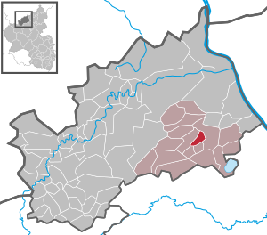
| Location of the local community Oberzissen in the Ahrweiler district | ||
  |
||

Oberzissen is a municipality in the Ahrweiler district in Rhineland-Palatinate . It belongs to the Brohltal community , which has its administrative headquarters in Niederzissen .
geography
The community lies in the conservation area "Rhein-Ahr-Eifel". The Margaretenhof residential area also belongs to Oberzissen .
history
The name Zissen is traced back to Celtic origins for various reasons.
Zissen is mentioned for the first time in a deed of donation from the copiarium of the Bonn monastery of St. Cassius and Florentius , which Levison dated to the eighth century. For the first time, the place name can be dated more precisely thanks to an exchange certificate from St. Stephan Abbey in Mainz from 1008.
Until the end of the 18th century, the two Zissen villages belonged to the rulership of Olbrück der Waldbott von Bassenheim .
- Statistics on population development
The development of the population of the municipality of Oberzissen, the values from 1871 to 1987 are based on censuses:
|
|
politics
Municipal council
The local council in Oberzissen consists of 16 council members, who were elected in the local elections on May 26, 2019 in a majority vote, and the honorary local mayor as chairman.
mayor
Christof Bürger became mayor of Oberzissen on August 28, 2019. In the direct election on May 26, 2019, he was elected for five years with 82.29% of the vote.
Bürger's predecessor Eugen Schmitt had held the office for ten years, but did not run again as a candidate for local mayor in 2019.
Attractions
The 5.5 km long steep section of the Brohltal railway via Brenk to Engeln , which was operated as a rack railway until the 1930s, begins in Oberzissen train station . The rack was later removed and the line switched to adhesion operation.
The Sauerbrunnen in Oberzissen is a drinking source that is open to the public and has been known since the Middle Ages with the characteristics of a sodium-alkaline-earth-hydrogen carbonate acid .
A hilltop castle with an eventful history is the ruin of Olbrück Castle above Oberzissen, probably founded around 1050 and first mentioned in 1112.
The blessing stone of 1599 is one of basalt lava created the Crossroads and was probably used as a stopping point for the spreading of the industrial blessing in Eucharistic processions .
See also the list of cultural monuments in Oberzissen
Web links
- Internet presence of the local community Oberzissen
- Literature about Oberzissen in the Rhineland-Palatinate state bibliography
Individual evidence
- ↑ State Statistical Office of Rhineland-Palatinate - population status 2019, districts, communities, association communities ( help on this ).
- ↑ State Statistical Office Rhineland-Palatinate (ed.): Official directory of the municipalities and parts of the municipality. Status: January 2019 [ Version 2020 is available. ] . S. 9 (PDF; 3 MB).
- ↑ Freidhelm Schnitker: Zissen and the Lordship of Olbrück. In: Heimatjahrbuch Kreis Ahrweiler 1969. Ahrweiler District Administration, p. 30 , accessed on May 26, 2019 .
- ↑ State Statistical Office Rhineland-Palatinate: Regional data.
- ^ The Regional Returning Officer Rhineland-Palatinate: Local elections 2019, city and municipal council elections
- ^ Constituent meeting of the Oberzissen municipal council. In: Council and Citizen Information System. Verbandsgemeindeverwaltung Brohltal, August 28, 2019, accessed on August 4, 2020 .
- ^ The Regional Returning Officer Rhineland-Palatinate: direct elections 2019. see Brohltal, Verbandsgemeinde, sixth result line. Retrieved August 4, 2020 .
- ↑ An impressive handover. In: localbook.de, from: Olbrück Rundschau 36/2019. Linus Wittich Medien GmbH, September 4, 2019, accessed on August 4, 2020 .

Cities: Adenau | Bad Breisig | Bad Neuenahr-Ahrweiler (seat of the district administration) | Niederzissen | Remagen | Sinzig
Municipalities: Ahrbrück | Altenahr | Antweiler | Aremberg | Barweiler | Bauler | Berg (near Ahrweiler) | Brenk | Brohl-Lützing | Burgbrohl | Dankerath | Dedenbach | Dernau | Dorsel | Dümpelfeld | Eichenbach | Fuchshofen | Galenberg | Glees | Gönnersdorf (near Bad Breisig) | County (Rhineland) | Harscheid (near Adenau) | Heckenbach | Herschbroich | Hoffeld (Eifel) | Hohenleimbach | Honerath | Hönningen | Bumblebee | Insul | Kalenborn (near Altenahr) | Kaltenborn | Kempenich | Kesseling | Kirchsahr | Königsfeld (Eifel) | Kottenborn | Leimbach (near Adenau) | Lind (near Altenahr) | Mayschoss | Meuspath | Müllenbach (near Adenau) | Müsch | Niederduerenbach | Nürburg | Oberduerenbach | Oberzissen | Ohlenhard | Pomster | Quiddelbach | Rech | Reifferscheid | Rodder | Schalkenbach | Guilt (Ahr) | Senscheid | Sierscheid | Spessart (Brohltal) | Trierscheid | Waldorf | Wassenach | Weir | Weibern (Eifel) | Wershofen | Wiesemscheid | Wimbach | Winnerath | Throws