
Pomster
| coat of arms | Germany map | |
|---|---|---|

|
Coordinates: 50 ° 21 ' N , 6 ° 51' E |
|
| Basic data | ||
| State : | Rhineland-Palatinate | |
| County : | Ahrweiler | |
| Association municipality : | Adenau | |
| Height : | 438 m above sea level NHN | |
| Area : | 5.81 km 2 | |
| Residents: | 157 (Dec. 31, 2019) | |
| Population density : | 27 inhabitants per km 2 | |
| Postal code : | 53534 | |
| Area code : | 02691 | |
| License plate : | AW | |
| Community key : | 07 1 31 065 | |
| NUTS : | DEB12 | |
| Association administration address: | Kirchstrasse 15 53518 Adenau |
|
| Website : | ||
| Local Mayor : | Siegfried Mueller | |
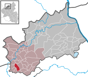
| Location of the local community of Pomster in the Ahrweiler district | ||
  |
||

Pomster is a municipality in the Ahrweiler district in Rhineland-Palatinate . It belongs to the Adenau community .
geography
Pomster is located seven kilometers southwest of the city of Adenau on a mountain ridge that slopes slightly to the north between the valleys of the Trierbach in the west and the Roßbach in the east. The residential areas Haus im Suhr, Kirmutscheidermühle and Steinbächerhof also belong to Pomster . At the Kirmutscheidermühle the community area reaches about 320 m above sea level. NHN its lowest point on the ground .
politics
Municipal council
The municipal council in Pomster consists of six council members, who were elected by a majority vote in the local elections on May 26, 2019 , and the honorary local mayor as chairman.
mayor
Siegfried Müller became the local mayor of Pomster on July 9, 2019. Since there was no candidate in the direct election on May 26, 2019, the upcoming election of the mayor was incumbent on the council, which decided in favor of Müller.
Müller's predecessor as local mayor was Siegfried Rausch.
Culture and sights

- Catholic branch church St. Barbara and Helena
- Outside the village there is a viewing platform ( location ) with a panoramic view as part of the “Dörferblick-Runde” hiking trail.

Economy and Infrastructure
Pomster is about one kilometer southwest of the federal highway 258 Koblenz - Aachen . The bus route 882 of the Verkehrsverbund Rhein-Mosel provides a connection to the next town, Adenau , which is primarily designed for school transport on weekdays .
Web links
- Literature about Pomster in the Rhineland-Palatinate State Bibliography
Individual evidence
- ↑ State Statistical Office of Rhineland-Palatinate - population status 2019, districts, communities, association communities ( help on this ).
- ↑ State Statistical Office Rhineland-Palatinate (ed.): Official directory of the municipalities and parts of the municipality. Status: January 2019 [ Version 2020 is available. ] . S. 7 (PDF; 3 MB).
- ^ The Regional Returning Officer Rhineland-Palatinate: Local elections 2019, city and municipal council elections
- ^ The Regional Returning Officer Rhineland-Palatinate: direct elections 2019. see Adenau, Verbandsgemeinde, 24th line of results. Retrieved August 9, 2020 .
- ↑ Siegfried Rausch: Announcement of the results of the election for the local council of the local community Pomster on May 26, 2019 (PDF; 8.2 KB) Verbandsgemeinde Adenau, June 3, 2019, accessed on August 9, 2020 .
- ↑ Village view loop in the major nature conservation project Obere Ahr-Hocheifel "Hiking in the Adenauer Land". In: www.outdooractive.com. Tourist-Information Hocheifel-Nürburgring, accessed on September 25, 2016 .

Cities: Adenau | Bad Breisig | Bad Neuenahr-Ahrweiler (seat of the district administration) | Niederzissen | Remagen | Sinzig
Municipalities: Ahrbrück | Altenahr | Antweiler | Aremberg | Barweiler | Bauler | Berg (near Ahrweiler) | Brenk | Brohl-Lützing | Burgbrohl | Dankerath | Dedenbach | Dernau | Dorsel | Dümpelfeld | Eichenbach | Fuchshofen | Galenberg | Glees | Gönnersdorf (near Bad Breisig) | County (Rhineland) | Harscheid (near Adenau) | Heckenbach | Herschbroich | Hoffeld (Eifel) | Hohenleimbach | Honerath | Hönningen | Bumblebee | Insul | Kalenborn (near Altenahr) | Kaltenborn | Kempenich | Kesseling | Kirchsahr | Königsfeld (Eifel) | Kottenborn | Leimbach (near Adenau) | Lind (near Altenahr) | Mayschoss | Meuspath | Müllenbach (near Adenau) | Müsch | Niederduerenbach | Nürburg | Oberduerenbach | Oberzissen | Ohlenhard | Pomster | Quiddelbach | Rech | Reifferscheid | Rodder | Schalkenbach | Guilt (Ahr) | Senscheid | Sierscheid | Spessart (Brohltal) | Trierscheid | Waldorf | Wassenach | Weir | Weibern (Eifel) | Wershofen | Wiesemscheid | Wimbach | Winnerath | Throws