
Hönningen
| coat of arms | Germany map | |
|---|---|---|

|
Coordinates: 50 ° 28 ' N , 6 ° 57' E |
|
| Basic data | ||
| State : | Rhineland-Palatinate | |
| County : | Ahrweiler | |
| Association municipality : | Altenahr | |
| Height : | 200 m above sea level NHN | |
| Area : | 10.02 km 2 | |
| Residents: | 1024 (Dec. 31, 2019) | |
| Population density : | 102 inhabitants per km 2 | |
| Postal code : | 53506 | |
| Primaries : | 02643, 02695 | |
| License plate : | AW | |
| Community key : | 07 1 31 029 | |
| Community structure: | 2 districts | |
| Association administration address: | Rossberg 3 53505 Altenahr, Germany |
|
| Website : | ||
| Local Mayor : | Jürgen Schwarzmann ( CDU ) | |
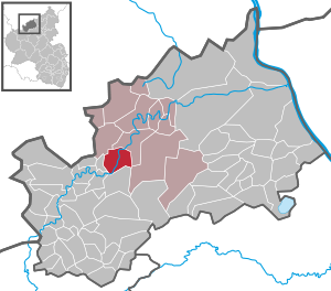
| Location of the local community of Hönningen in the Ahrweiler district | ||
  |
||

;_Panoramablick_b.jpg)

;_Hauptstra%C3%9Fe_a.jpg)
Hönningen is a municipality in the Ahrweiler district in Rhineland-Palatinate . It belongs to the community of Altenahr .
geography
The community is located in the Ahr Valley , in a loop of the river Ahr that runs to the northwest .
Hönningen is about seven kilometers southwest of Altenahr and 23 km southwest of Bad Neuenahr-Ahrweiler and twelve kilometers from Adenau and the Nürburgring . Hönningen can be reached via the B 257 Bonn – Bitburg or by bus from the Ahrbrück stop on the Lower Ahr Valley Railway .
The district Liers and the residential area Liersbachtal belong to Hönningen .
history
Hönningen
The name Hönningen indicates a Franconian settlement. It used to be called Hunighofen. The Metz Abbey of St. Arnulf in Hönningen has been wealthy since the middle of the 7th century . The dialect "Hünge" has its origin here. In 1084 the St. Arnulf Abbey ceded its property in Hönningen to the St. Kunibert Abbey in Cologne . For this reason, St. Kunibert the church patron of the parish of Hönningen. The Liber valoris named Hönningen in 1316 as the parish of Hönningen. The rights in Hönningen went to the Johanniter- Comende in Adenau in 1494 , who had been wealthy in Hönningen since 1291.
For over 300 years, Hönningen and its branches in Dümpelfeld , Niederadenau and Liers belonged to the Order of St. John. The extension of the church was inaugurated in 1896. On the keystone of the church is next to the Johanniterkreuz the coat of arms of those von Orsbeck, who as lords of the Wensburg were also landlords of Hönningen. Hönningen belonged to the county of Are until 1246; since that time to the Electoral Cologne Office Altenahr , in which it was its own bailiwick . In 1816 Hönningen came to the mayor's office in Brück in the Adenau district . In 1932 Hönningen came to the district of Ahrweiler with the mayor's office of Brück and in 1935 when the former mayor's offices of Altenahr and Brück were merged to form the Prussian office of Altenahr.
The later widely ramified noble family Hoyningen-Huene comes from Hönningen , first mentioned in 1176 with Erenbold de Hoingen.
Liers
The place, first mentioned in 1265, had a prayer house in front of the chapel, the bell of which was cast in 1633. In 1668 the current chapel was consecrated to St. Bartholomew . It is a small, simple, single-nave hall building made of quarry stone , 10.70 m long and 4.60 m wide. The altar from the second half of the 17th century has a wooden sculpture of Our Lady in the niche, on both sides wooden sculptures of St. Bartolomew and St. Dionysius . Inside there is a Vesper picture from around 1600 , a wooden reliquary and a gilded chalice, both from the 18th century.
The two bells were cast in 1633 and 1786. In 1743 relics of St. Bartolomäus, who were venerated on his feast, where a small sacrifice was made. The chapel was owned by a small foundation capital: 1743 = 142 thalers, 1835 = 291 thalers and 1900 = 730 marks. With funds from the chapel, renovations were carried out in 1684 and 1934, followed by painting by the Georg brothers from Prüm in 1865 . In 1830 there were 17 foundations, including St. Mass for Pastor Michael Simonis (1720–1760).
Merger
On March 1, 1972, the communities of Hönningen (741 inhabitants) and Liers (196 inhabitants) merged to form the local community of Hönningen.
Population development
The development of the population of Hönningen in relation to today's municipal area; the values from 1871 to 1987 are based on censuses:
|
|
politics
Municipal council
The local council in Hönningen consists of 16 council members, who were elected in the local elections on May 26, 2019 in a personalized proportional representation, and the honorary local mayor as chairman.
The distribution of seats in the municipal council:
| choice | CDU | FWG | total |
|---|---|---|---|
| 2019 | 9 | 7th | 16 seats |
| 2014 | 10 | 6th | 16 seats |
| 2009 | 11 | 5 | 16 seats |
| 2004 | 11 | 5 | 16 seats |
- FWG = Free Voters' Group Hönningen and Liers e. V.
mayor
Jürgen Schwarzmann (CDU) became local mayor of Hönningen in August 2019. In the direct election on May 26, 2019, he was elected for five years with 85.00% of the vote.
Schwarzmann's predecessor Hans-Josef Weber (CDU) did not run again after 30 years in office.
coat of arms
|
|
Blazon : "From silver to red, split by a wavy cut, a continuous black cross in front, a silver Johanniterkreuz at the back."
Since July 18, 1983, the local community of Hünningen has had the coat of arms shown above. |
|
Foundation of the coat of arms: During the feudal period, around 1800, Hönningen formed the bailiwick of the same name in the district of Altenahr in Cologne. The sovereign was thus the elector of Cologne. Its coat of arms showed a continuous black cross in silver. As early as 1494, the farm and the village of Hoynghen an der Ahr, together with the parish church, had belonged to the Johanniterkommende in Adenau, who had acquired property 200 years earlier, i.e. in 1290 and 1291, in what was then known as 'Hunighawen' or 'Hunighofen'.
As an indication of the connection and the importance that the Johanniter had in Hönningen, the Johanniter cross is in the second field of the municipality's coat of arms. The wave cut symbolizes the Ahr river, which gives Hönningen and its district the character of the landscape. |
Culture and sights
;_St._Kunibert_a.jpg)
;_Ehemalige_Schule_a.jpg)
Buildings
- Catholic parish church of St. Kunibert from the first half of the 13th century
- Hubertus Chapel from 1610
- Several half-timbered houses from the 17th and 18th centuries
- Catholic Chapel of St. Bartholomew, a hall from 1635
- Former school, a quarry stone building from 1886
Green spaces and recreation
- Hiking trails in and around Hönningen
- Cycle path along the Ahr
- Nature reserve An der Teufelsley
See also: List of cultural monuments in Hönningen
Economy and Infrastructure
There is a community kindergarten with two groups.
The federal highway 257 from Bonn to Bitburg runs through the municipality. The Hönningen (Ahr) station was on the Ahr Valley Railway , which now only runs to Ahrbrück .
Sons and daughters of the church
- Carl Erich Alken (1909–1986), first German professor for urology
- Johann Hubert Hoffmann (1889–1960), farmer, agriculture teacher, member of the German Bundestag
Web links
- Local community Hönningen
- Hönningen, Altenahr Association
- Local portrait of Hönningen
- Literature about Hönningen in the Rhineland-Palatinate state bibliography
Individual evidence
- ↑ a b State Statistical Office of Rhineland-Palatinate - population status 2019, districts, municipalities, association communities ( help on this ).
- ↑ State Statistical Office Rhineland-Palatinate (ed.): Official directory of the municipalities and parts of the municipality. Status: January 2019 [ Version 2020 is available. ] . S. 8 (PDF; 3 MB).
- ↑ Ignaz Görtz: Looking back on nine centuries of eventful history - Hönningen celebrated its 900th anniversary. 1985 homeland yearbook of the Ahrweiler district ( online edition )
- ↑ Official municipality directory 2006 ( Memento from December 22, 2017 in the Internet Archive ) (= State Statistical Office Rhineland-Palatinate [Hrsg.]: Statistical volumes . Volume 393 ). Bad Ems March 2006, p. 180 (PDF; 2.6 MB). Info: An up-to-date directory ( 2016 ) is available, but in the section "Territorial changes - Territorial administrative reform" it does not give any population figures.
- ↑ State Statistical Office Rhineland-Palatinate - regional data
- ^ The Regional Returning Officer Rhineland-Palatinate: Local elections 2019, city and municipal council elections
- ↑ a b Jürgen Schwarzmann: Hans-Josef Weber has been adopted - new local mayor Jürgen Schwarzmann sworn in. Local community Hönningen, August 16, 2019, accessed on August 5, 2020 .
- ^ The Regional Returning Officer Rhineland-Palatinate: direct elections 2019. see Altenahr, Verbandsgemeinde, eighth result line. Retrieved August 5, 2020 .
- ↑ Description of coat of arms / justification. Local community Hünningen, accessed on August 8, 2017 .
- ↑ Hönningen hiking route. (PDF) Retrieved August 6, 2017 .
- ↑ Hiking route Ahrtal - Hönningen - Teufelsley. Retrieved August 6, 2017 .

Cities: Adenau | Bad Breisig | Bad Neuenahr-Ahrweiler (seat of the district administration) | Niederzissen | Remagen | Sinzig
Municipalities: Ahrbrück | Altenahr | Antweiler | Aremberg | Barweiler | Bauler | Berg (near Ahrweiler) | Brenk | Brohl-Lützing | Burgbrohl | Dankerath | Dedenbach | Dernau | Dorsel | Dümpelfeld | Eichenbach | Fuchshofen | Galenberg | Glees | Gönnersdorf (near Bad Breisig) | County (Rhineland) | Harscheid (near Adenau) | Heckenbach | Herschbroich | Hoffeld (Eifel) | Hohenleimbach | Honerath | Hönningen | Bumblebee | Insul | Kalenborn (near Altenahr) | Kaltenborn | Kempenich | Kesseling | Kirchsahr | Königsfeld (Eifel) | Kottenborn | Leimbach (near Adenau) | Lind (near Altenahr) | Mayschoss | Meuspath | Müllenbach (near Adenau) | Müsch | Niederduerenbach | Nürburg | Oberduerenbach | Oberzissen | Ohlenhard | Pomster | Quiddelbach | Rech | Reifferscheid | Rodder | Schalkenbach | Guilt (Ahr) | Senscheid | Sierscheid | Spessart (Brohltal) | Trierscheid | Waldorf | Wassenach | Weir | Weibern (Eifel) | Wershofen | Wiesemscheid | Wimbach | Winnerath | Throws