Worms
| coat of arms | Germany map | |
|---|---|---|
|
Coordinates: 49 ° 38 ' N , 8 ° 22' E |
|
| Basic data | ||
| State : | Rhineland-Palatinate | |
| Height : | 100 m above sea level NHN | |
| Area : | 108.73 km 2 | |
| Residents: | 83,542 (Dec. 31, 2019) | |
| Population density : | 768 inhabitants per km 2 | |
| Postcodes : | 67547, 67549, 67550, 67551 | |
| Primaries : | 06241, 06242, 06246, 06247 | |
| License plate : | WHERE | |
| Community key : | 07 3 19 000 | |
| NUTS : | DEB39 | |
City administration address : |
Marktplatz 2 67547 Worms |
|
| Website : | ||
| Lord Mayor : | Adolf Kessel ( CDU ) | |
| Location of Worms in Rhineland-Palatinate | ||


Worms [ vɔʁms , in the dialect vɔms ] is a city in the southeast of Rhineland-Palatinate and is located directly on the left bank of the Rhine . The middle center with partial function of a regional center is located on the edge of the metropolitan regions Rhine-Neckar and Rhine-Main . Due to this location, it is simultaneously assigned to the Rheinhessen-Nahe planning region and the Rhine-Neckar metropolitan region (in which the Rheinpfalz planning region is incorporated).
Today's residents of the city founded by the Celts vie with Augsburg , Trier and Kempteners for the title of the oldest city in Germany . Worms is the German representative in the Most Ancient European Towns Network (working group of the oldest cities in Europe) .
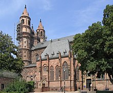
Worms is known as the Nibelungen and Luther City and for its cathedral , which is one of the three Romanesque imperial cathedrals alongside the Mainz and Speyer cathedral . Worms ( Yiddish ווירמייזא Wermajze ), one of the three ShUM cities , was also a center of Ashkenazi-Jewish culture in Germany.
geography
Geographical location
Worms is located in the eastern part of Rhineland-Palatinate in the Upper Rhine Plain . It is located in the south-east of the Rheinhessen region between Mainz (approx. 40 kilometers north) and Ludwigshafen (approx. 20 kilometers south) on the left, western bank of the Rhine . In the northern city area the Pfrimm flows into the Rhine, the southern parts of the city are traversed by the Eisbach (also called Altbach ), which also flows into this river. The lower reaches of the Eckbach , which also flows into the Rhine, runs in the extreme southeast of the city .
In the southwest, 15 km away, are the foothills of the Palatinate Forest , in the west the hilly landscape of the Wonnegau , on the other side of the Rhine the Hessian part of the Odenwald joins the plain .
The lowest point in Worms is 86.5 m above sea level. NHN near the northern district of Ibersheim on the former river island Ibersheimer Wörth , the highest point is at 167 m on the western city limit between the district of Pfeddersheim and the neighboring Nieder-Flörsheim directly on Nieder-Flörsheimer Strasse ( Landesstrasse 443).
Catchment area
As a middle center, Worms is directly assigned to Wonnegau with the municipalities of Eich , Monsheim and Wonnegau . The catchment area of the city also includes parts of the Hessian Ried and the northern Front Palatinate .
Worms is located in the north of the Rhine-Neckar metropolitan region or in the south-west of the Rhine-Main area and, due to its location, is also a link between these agglomerations. This is why the city is part of both the Rheinhessen-Nahe planning region and the Rheinpfalz planning region , which is supported by the Rhein-Neckar Region Association .
City structure
Worms is divided into eight districts with 19 districts. The 13 eingemeindeten areas (subdivisions of municipalities 4 to 7), at the same time apart from the central Gemarkung Worms Gemarkungen form, have as Ortsbezirke each Ortsbeirat , Ortsvorsteher and location management. They attach great importance to maintaining their typical character with great self-confidence. District-related wine festivals take place, for example, in the Herrnsheimer Schlosshof of the former princes of Dalberg or on the medieval city walls of Pfeddersheim.
| district | Area ha |
Residents | Location to the city center | incorporated |
Gemarkungs - key |
Post Code | Telephone code | |
|---|---|---|---|---|---|---|---|---|
| District 0 downtown | ||||||||
| 01 city center | 86 | 8,735 | - | 073911 | 67547 | 06241 | ||
| District 1 South area | ||||||||
| 11 downtown south | 261 | 5,283 | adjoining to the south | - | 073911 | 67547 | 06241 | |
| 12 Karl Marx settlement | 643 | 1,117 | south of the center (3 km) | - | 073911 | 67547 | 06241 | |
| District 2 North area | ||||||||
| 21 North city center | 723 | 9,725 | adjacent to the north | - | 073911 | 67547 | 06241 | |
| District 3 urban area southwest | ||||||||
| 31 downtown west | 155 | 10,001 | adjacent to the west | - | 073911 | 67549 | 06241 | |
| 32 downtown southwest | 176 | 2,057 | adjacent to the southwest | - | 073911 | 67549 | 06241 | |
| District 4 Western Suburbs | ||||||||
| 41 Pfiffligheim | 393 | 3,386 | west of the center | October 1, 1898 | 073913 | 67549 | 06241 | |
| 42 Hochheim | 242 | 3,538 | northwest of the center | October 1, 1898 | 073909 | 67549 | 06241 | |
| 43 Neuhausen | 185 | 10,508 | north of the center | April 1, 1898 | 073910 | 67549 | 06241 | |
| 44 Herrnsheim | 1217 | 6,270 | in the north of the city (5 km) | April 1, 1942 | 073903 | 67550 | 06241 | |
| 45 Leiselheim | 259 | 2,104 | outside in the west (4 km) | April 1, 1942 | 073914 | 67549 | 06241 | |
| District 5 suburbs southwest | ||||||||
| 51 Horchheim | 575 | 4,795 | southwest of the center (4.5 km) | April 1, 1942 | 073908 | 67551 | 06241 | |
| 52 Weinheim | 417 | 2,780 | in the southwest of the city (4 km) | April 1, 1942 | 073912 | 67551 | 06241 | |
| 53 Wiesoppenheim | 354 | 1,733 | outside in the southwest (5.5 km) | 7th June 1969 | 073907 | 67551 | 06241 | |
| 54 Heppenheim | 1126 | 2,207 | outside in the southwest (9 km) | 7th June 1969 | 073906 | 67551 | 06241 | |
| District 6 Western suburbs | ||||||||
| 61 Pfeddersheim | 1187 | 7,025 | outside in the west (7 km) | 7th June 1969 | 073905 | 67551 | 06247 | |
| 62 Abenheim | 1090 | 2,512 | outside in the northwest (10 km) | 7th June 1969 | 073904 | 67550 | 06242 | |
| Borough 7 Northern Suburbs | ||||||||
| 71 Rheindürkheim | 812 | 2,923 | outside in the north (8 km) | 7th June 1969 | 073902 | 67550 | 06242 | |
| 72 Ibersheim | 972 | 714 | outside in the north (13 km) | 7th June 1969 | 073901 | 67550 | 06246 | |
see also: List of places in the independent city of Worms
climate
Due to its location in the Upper Rhine Plain between the Palatinate Forest and Donnersberg in the west and Bergstrasse and Odenwald in the east, Worms is one of the warmest and driest places in Germany.
Air temperature
The long-term mean air temperature for the period 1951 to 1980 is 10.3 ° C. An increase in the annual mean air temperature has been observed in recent years. In 2008 the average air temperature at Hagenstrasse was 12.2 ° C, while in the same period five kilometers further west in Worms-Leiselheim an average air temperature of 11.3 ° C was measured. The air temperature for 2007 (averaged) at Hagenstrasse was 12.7 ° C and in Leiselheim 11.7 ° C. The higher average value of +1 K of the annual mean temperature on Hagenstrasse compared to the Worms-Leiselheim weather station is mainly based on the mostly warmer inner-city temperature values .
Precipitation
The mean amount of precipitation for the period from 1961 to 1990 is 608 mm. Precipitation falls mainly in May, June and July. In 2008 the annual precipitation at Hagenstrasse was 492.2 mm, while in the same period five kilometers further west in Worms-Leiselheim an annual precipitation of 529.4 mm was measured.
The amount of precipitation for 2007 was (averaged) - Hagenstrasse 545.8 mm - Leiselheim 622.6 mm. The rainfall is low. They are in the lower quarter of the values recorded in Germany. Lower values are registered at 23% of the measuring stations of the German Weather Service . The driest month is February, with the most rainfall in July. In July there is 2 times more rainfall than in February. The precipitation varies relatively strongly. Lower seasonal fluctuations are recorded at 69% of the measuring stations in Germany .
Sunshine duration
The long-term mean (1951–1980) is 1,709.7 hours. An increase in the annual mean number of hours of sunshine has been observed in Leiselheim in recent years. In 2007 there were 2007 hours of sunshine, a deviation from the long-term average of + 297.3 hours or + 17.4%; in 2008, 1886 hours were determined. This is a deviation from the long-term average of + 176.3 hours or + 10.3%. In 2009 and 2010, the deviations were even more striking, + 343.3 hours or + 20.1% (2009) and + 357.3 hours or + 20.9% in 2010.
history
Surname
The oldest traditional form of the place name ( Borbetomagus or Bormetomagus) is of Celtic origin and is traced back to a term for water or spring or the name of a god Bormo or a river derived from it . The Latinized ending -magus is the Celtic word for field, meadow, plain. The name would thus source field , field of Bormo or field at the Bormita mean. The later Worms became the capital of the semi-autonomous administrative district (lat. Civitas ) Civitas Vangionum . This was named after the Vangionen tribe, who had lived here since the first century AD . The Worms called themselves vangions until the 16th century. The name Wangengau for the area around Worms is derived from this name , which was then translated into the more understandable Wonnegau . The German name Worms , like the city since 6/7. Century is called, but goes back to the Gallo-Celtic Borbetomagus / Bormetomagus. Due to a later sound change, the initial B became W. So Borbetomagus in the language of the Germanic settlers in the early Middle Ages finally changed to Warmazfeld, Warmazia / Varmacia, Wormazia / Wormatia and finally to Worms . The Latin form Wormatia is in the old Hebrew name of the city, which had a significant Jewish community in the Middle Ages , as Warmaisa ( Hebrew וורמש) still received.
City development up to the 9th century
The urban area of Worms was first discovered in the Neolithic (Neolithic) around 5000 BC. Populated by farmers and ranchers. While older research postulated a very high settlement continuity for the area of Worms since that time, which was also reflected in an early functioning market and transport system, more recent publications assume a change between settled and settlement-free phases. The last time is for the middle of the 1st century BC. BC assumed that Worms and Rheinhessen would be largely empty of settlements for at least 60 years .
On the inconspicuous hill Adlerberg am Rhein in the south of Worms, a total of 25 graves from different times were discovered between 1896 and 1951. As far as we know today, eight of these graves date from the Adlerberg culture (around 2300/2200–1800 BC) from the Early Bronze Age . The Worms doctor Karl Koehl , to whom the term “Adlerbergkultur” goes back, has made a contribution to researching these finds .
Since Augustan times (31 BC to 14 AD), Worms and the surrounding area belonged to Roman rule. From the beginning of the 1st century AD until around 85 AD, a Roman military base existed on the soil of today's Worms. The associated civil settlement with the Celtic name Borbetomagus became the capital of the Civitas Vangionum and developed urban structures.
In Franconian times, the secure list of Worms bishops begins with Bishop Berchtulf, who attended the Paris Synod in 614 . The early bishops Amandus von Worms († 7th century) and Rupert von Salzburg († 718) are among the saints of the Roman Catholic Church. Amandus became the patron saint of the diocese and the city of Worms. Under the Carolingians, Worms was one of the centers of power, so that its bishops were close to the royal court in the 8th and 9th centuries.
middle Ages

In 829 and 926 the Reichstag of the Franconian and Eastern Franconian Empire took place in Worms. At that time, Worms, which was still one of the Carolingian centers of power in the 9th century, had already moved into a peripheral position due to the division of the Frankish empire. At the court conference in Worms in May 961, Otto the Great raised his seven-year-old son Otto II to be co-king. On February 2, 965 Otto I celebrated the anniversary of his coronation as emperor after his return from Italy in Worms and in August 966 he arranged for representation in Worms for the time of his recent absence. In 976 Otto von Worms received the newly created Duchy of Carinthia, which had previously been part of Bavaria.
With the Salians , the city began to flourish. In 1074 it was exempt from customs duties . Another court day took place here in 1076 , on which King Henry IV declared Pope Gregory VII deposed and was immediately banned from church - one of the consequences of these events was the trip to Canossa .
In 1122, the Worms Concordat named after the city was concluded in Worms . During this time, the city constitution was formed with an independently operating city council representing the citizens. After the fall of the Salians in 1125, the Hohenstaufen also became closely associated with the city. In 1184, Emperor Friedrich Barbarossa granted the city extensive freedoms, which can be seen as the foundation of the imperial city . The 12th century was marked by the beginning of the dispute between the bishop and the city council over de facto rule over the city - a conflict that would last into the 16th century.
Early modern age
In 1495 another Reichstag took place under King Maximilian , at which the imperial tax , the imperial chamber court and the ban on feuding of the perpetual peace were introduced. At this point the city had already passed the height of its economic boom. The civil uprising of 1512/13 and the feud with Franz von Sickingen 1515–1519 further shattered the city's financial situation. In fact, the city was a free imperial city, but the bishop and the clergy, who according to various estimates made up between 30 and 50% of the city's population (including servants and servants), succeeded in tough negotiations in enforcing so many special rights that the city council's room for maneuver was very limited. In addition, the influence of the Palatinate Rhine Counts on the city had increased significantly in the course of the 15th century . At times the Worms and Speyer bishops were occupied by the Count Palatine brothers.
As in many other cities, especially in the spiritually free urban climate, the new ideas of the Reformation spread early and quickly in Worms. This was accelerated by the Diet of Worms held in 1521 , at which Martin Luther defended his 95 theses published in Wittenberg against Emperor Charles V. Worms became a center and field of experimentation for the Reformation: in 1524 a German Protestant mass was printed here for the first time, and in 1526 William Tyndale published the first English version of the New Testament in Worms. The attempt of the Worms city council to end the episcopal tutelage during the Peasant War in 1525 failed. Worms became Protestant. The bishop and the clergy retained their special rights and the cathedral, but Roman Catholics could not become members of the city council.
In 1659, Elector Karl I Ludwig von der Pfalz submitted an offer to the city to make it the capital of the Electoral Palatinate and to relocate Heidelberg University to Worms. The city refused. Heidelberg , Mannheim and Frankenthal already had the title “Capital of the Electoral Palatinate” . The proposal was an attempt by the elector to gain increased influence in the city, which the traditionally authorized people there, especially the city council and the bishop, could hardly approve.
In 1689 the city was destroyed in the Palatinate War of Succession by the troops of King Louis XIV . A contemporary report on this comes from Elieser Liebermann, son of Juspa Schammes , which he added as a final chapter when he published his father's work Ma'asseh nissim . The population was displaced and it was about ten years before urban life got going again.
19th and 20th centuries
From 1792 to 1814 Worms belonged to the First French Republic and the First Empire , from 1815 to the Grand Duchy of Hesse as part of the province of Rheinhessen . The geometer Konrad Schredelseker worked out the first cadastral plan of Worms "Atlas géometrique de la ville de Worms" from 1809 to 1810. In 1835, the four districts of Mainz, Bingen, Alzey and Worms were established as state administrative districts in Rheinhessen.
In the course of the reform of the district constitution in the Grand Duchy of Hesse based on the Prussian model in 1874, there was also a new district division. The division of the province of Rheinhessen into five districts (Alzey, Bingen, Mainz, Worms, Oppenheim) created at that time lasted for more than six decades.
After the three provinces of Starkenburg, Upper Hesse and Rheinhessen were abolished in 1937, a radical regional reform was carried out in Hesse on November 1, 1938. In the vicinity of Worms, the Oppenheim and Bensheim districts were dissolved. The municipalities of Lampertheim , Bürstadt , Hofheim and Biblis on the right bank of the Rhine were incorporated into the newly created Worms district , which emerged from the Worms district. The cities of Mainz and Worms were made independent as urban districts . This administrative structure was created until the end of the war in 1945.
The city was largely destroyed by two Allied bombing raids on February 21 and March 18, 1945 . The British air raid of February 21, 1945 targeted the central station located on the edge of the city center and the chemical plants southwest of the city center, but also destroyed large parts of the city center, including the Trinity Church , which was built 1709–1725 as the “Reformation Memorial Church” , except for the Outer walls and parts of the tower burned out completely. The Worms Cathedral was also set on fire. 239 residents died. 141 people were killed in the US attack on March 18, 1945. The attacks left around 15,000 people homeless. 35% of the building stock was completely destroyed, another 29% damaged to varying degrees. The city center was rebuilt in a largely modern style after the war.
The former Hessian province of Rheinhessen became in 1946 the administrative district of Rheinhessen of the then newly founded state of Rhineland-Palatinate. From 1968 until the dissolution of the Rhineland-Palatinate administrative districts in 2000, Worms belonged to the administrative district of Rheinhessen-Pfalz .
Jews in Worms
The Jewish community held a prominent position, which was one of the most important in the Holy Roman Empire in the Middle Ages and early modern times and together with the Jewish community of Mainz and Speyer formed the so-called ShUM cities . Occupied in Worms from around 960 onwards, the Jewish merchants in Worms, who were particularly active in long-distance trade, enjoyed imperial duty exemptions from the 11th century and, like the Jews in Speyer, enjoyed freedom of trade throughout the Reich. A famous Talmud school was established in Worms , which was also attended by the important French Jewish scholar Rashi . A synagogue was inaugurated in 1034, the surviving Jewish cemetery , the oldest in Europe, has existed at least since 1058/59. Despite their privileged position, when the crusader army of the First Crusade reached Worms in 1096, all Jews who did not undergo compulsory baptism or who instead committed suicide were murdered. After the imperial protection was restored, Jews settled again in Worms and the forced baptized were allowed to return to Judaism. During the second crusade , the Worms Jews were able to get to safety in good time.
In the later 12th century a new synagogue was built and expanded. In the 13th century, the importance of Worms' Jewish scholars began to decline. A prayer book has been preserved, the Wormser Machsor from 1272, which also contains the oldest written testimony in Yiddish. During the persecution of the Jews at the time of the Black Death , the Jewish community in Worms was destroyed in 1349. In May 1353, Jews were again allowed to settle in Worms in the interests of the “city welfare” ; they were no longer allowed to acquire property outside the ghetto , the now established Judengasse around the synagogue . The Jewish community never regained its former importance. In 1615 the Jews were again expelled from the city, but were able to return the following year. Even with the destruction of the city by the French in 1689, the Jewish community had to flee Worms again and it took more than a decade before they could return.
In the 19th century, around 800 Jews lived in Worms, who achieved civil equality with the Christians in 1848, and in the following year Ferdinand Eberstadt was the first Jew to be elected mayor of the city after his predecessor Georg Friedrich Renz had resigned. Eberstadt ran for the office of mayor with two other candidates, but the government in Darmstadt found the wine merchant Johann Philipp Bandel to be too radical and the civil servant Ludwig Blenker too cocky without political foresight; whereupon the merchant Eberstadt was appointed mayor of the city of Worms by the Grand Duke at the beginning of 1849.
In 1933 the city had a good 1,000 Jews, the majority of whom moved away after the Nazis came to power and some of them emigrated. The old synagogue was largely destroyed during the November pogroms in 1938 , but the old Jewish cemetery Heiliger Sand was preserved. The 300 or so Jews remaining in Worms were deported to concentration camps, which only a few of them survived. The Levy Synagogue (also New Synagogue ) from 1875 opposite the old synagogue survived the pogroms of 1938 largely undamaged, but it was badly damaged in one of the air raids in 1945 and demolished in 1947. After the end of the Second World War, there were isolated Jews again in the city, but there was no longer any Jewish community life. The old synagogue was rebuilt by the state from 1958 to 1961, and in 1982 the Jewish Museum was opened in the Rashi House, whose cellar vaults date from the 14th century. At the beginning of the 21st century, more than a hundred Jews live in Worms, mostly immigrants from the former Soviet Union , who are members of the Jewish community in Mainz.
Incorporations
- April 1, 1898: Neuhausen
- October 1, 1898: Hochheim, Pfiffligheim
- April 1, 1942: Herrnsheim, Horchheim, Leiselheim, Weinsheim
- June 7, 1969: Abenheim, Heppenheim an der Wiese, Ibersheim, Pfeddersheim (city), Rheindürkheim, Wiesoppenheim; Reconstruction of a part of the city of Osthofen with 181 inhabitants to Worms
In October 1937, the Rosengarten heritage farmhouse on the right bank of the Rhine was formed from parts of the Bürstadt , Hofheim and Lampertheim districts and incorporated into the city of Worms. In 1945, when the border was drawn between the French and American occupation zones , it fell to the state of Greater Hesse .
population
Population development
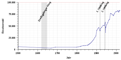
In its heyday around 1500, Worms had about 6,000 inhabitants. Due to the destruction in the Thirty Years' War (1618-1648) and a plague epidemic in 1666/67, the population fell to just 3,000. With industrialization in the 19th century, population growth accelerated. In 1800 only 5,000 people lived in the city, in 1900 there were already over 40,000. The incorporation of several places in 1969 brought an increase from 15,000 people to 78,000 inhabitants.
As of December 31, 2019, the official population of Worms was 83,542 according to figures from the State Statistical Office of Rhineland-Palatinate. This makes Worms the sixth largest city in Rhineland-Palatinate and the fourth largest in the Rhine-Neckar triangle . Worms has a foreign share of 16.3%. The proportion of pupils with a migration background in Worms at general schools was 22% (school year 2012/13). This leads the list in the comparison of cities in Rhineland-Palatinate, after Ludwigshafen and Mainz. At the beginning of 2015, over 49% of the children in the day-care centers had a migration background. In 2005, with an average age of 41.5 years, Worms was in second place among the independent cities behind Mainz (41.2 years). This means that Worms has a relatively young population in a nationwide comparison. The average age in Rhineland-Palatinate is 41.6 years and 41.8 years in Germany.
The following overview shows the number of inhabitants according to the respective territorial status. Until 1820 it is mostly an estimate, then census results (¹) or official updates from the State Statistical Office. From 1871, the information relates to the “local population”, from 1925 to the resident population and since 1987 to the “population at the location of the main residence”. Before 1871, the number of inhabitants was determined according to inconsistent survey procedures.
|
|
|
||||||||||||||||||||||||||||||||||||||||||||||||||||||||||||||||||||||||||||||||||||||||||||||||||||||||||||||||||||||||||||||
¹ census result
Denomination statistics
According to the 2011 census , 37.3% of the population in 2011 were predominantly Protestant, 27.9% Roman Catholic and 34.8% were non-denominational , belonged to another religious community or did not provide any information. The number of Protestants and Catholics has fallen since then. Currently (as of April 30, 2020) of the 86,503 inhabitants, 29.2% are Protestant, 24.0% Roman Catholic and 46.8% are non-denominational, belong to another religious community or have not provided any information.
politics
City council
The city council in Worms consists of its chairman and 52 honorary council members, who were elected in a personalized proportional representation in the local elections on May 26, 2019 .
Distribution of seats:
| choice | SPD | CDU | FDP | Green | left | FWG-BF | NPD | AfD | FLP | total |
|---|---|---|---|---|---|---|---|---|---|---|
| 2019 | 14th | 15th | 2 | 8th | 1 | 5 | - | 6th | 1 | 52 seats |
| 2014 | 18th | 17th | 3 | 6th | 2 | 5 | 1 | - | - | 52 seats |
| 2009 | 20th | 17th | 6th | 4th | 2 | 3 | - | - | - | 52 seats |
| 2004 | 19th | 21st | 3 | 4th | - | 5 | - | - | - | 52 seats |
- FWG-BF = Free Voting Community - Worms Citizens' Forum
- FLP = Free List Pfeddersheim
mayor
The directly elected Lord Mayor of the City of Worms has been Adolf Kessel ( CDU ) since July 1, 2019 . On November 18, 2018, he won the runoff election against Michael Kissel ( SPD ), who had been in office since 2003 . In the management of the municipal affairs of the mayor of one is mayor and three aldermen supported.
Seal and coat of arms
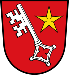
Description : "In red a slanted, silver key with a quatrefoil , accompanied by a golden five-pointed star at the top left."
Declaration of coat of arms: The oldest surviving city coat of arms appears as a seal in 1198 as a result of the freedom privileges of Emperor Friedrich I. Barbarossa from 1184. It contains in a niche the seated Saint Peter , patron of the Worms Cathedral, with the key in the right and the Bible in the left hand. Above him the architecture of the cathedral with a dome between two towers and a city gate on each side. This seal was used with various inscriptions as a city seal and court seal up to the year 1500. During this time, a new city seal was introduced due to the powers that the then king and later emperor Maximilian gave the city in 1488. From then on it showed a silver key on a red background. Since a city council resolution of 1890, the coat of arms has also been provided with a five-pointed star.
The city colors are red and white.
Town twinning
The city of Worms maintains friendly relationships with seven cities:
-
 St Albans , United Kingdom (since 1957)
 -
 Auxerre , Yonne Department , France (since 1968)
 -
 Parma , Italy (since 1984)
 -
 Tiberias , Israel (since 1986)
 -
 Bautzen , Free State of Saxony, Germany (since 1990)
 -
 Mobile , State of Alabama, USA (since 1998, first connections since 1976)
 -
 Ningde , Fujian Province, People's Republic of China (since 2014)
In addition, there are friendly relations with Kivumu as part of the Rhineland-Palatinate connections to Rwanda .
Three districts have independent partnerships with French municipalities:
- Pfeddersheim with Nolay in the Côte-d'Or department (since 1966)
- Heppenheim an der Wiese with Ampilly-le-Sec in the Côte-d'Or department (since 1968)
- Ibersheim with Chemellier in the Maine-et-Loire department (since 2006).
City friendships
There has been a friendship between Worms and Speyer since 1208 . On the occasion of the 800th anniversary, this friendship contract was renewed in November 2008 at a ceremony in Worms in the presence of numerous city councilors from both cities by the Lord Mayors Michael Kissel (Worms) and Werner Schineller (Speyer).
Memberships
The city of Worms is:
- only German member in the " Most Ancient European Towns Network " (working group of the oldest cities in Europe)
- Founding member of the "Federation of Luther Cities "
- Founding member of the "Working Group of the Nibelung Cities "
- since 2006 member of the worldwide " Climate Alliance "
- since 2012 member of the German section in the " Council of European Municipalities and Regions "
Sights and culture
Religious buildings
- St. Peter's Cathedral , in the cathedral district the expired parish and baptismal church of St. John
- Old Jewish cemetery Heiliger Sand (oldest preserved Jewish cemetery in Europe, since 1076)
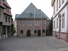
- Worms synagogue , first mentioned in 1034, last renovated between 1958 and 1961 after being destroyed several times (1096, 1146, 1349, 1615, 1689, 1938)
- Mikveh from 1185/86
- Luther monument
- Church of Our Lady
- Paul's Church and Dominican Monastery
- Martinskirche (Romanesque basilica)
- Magnuskirche , the smallest church in Worms, founded by Carolingian
- Andreas Church with St. Andreasstift (Museum of the City of Worms)
- Dreifaltigkeitskirche (market church)
- Luther Church (Art Nouveau)
- Lukaskirche , one of the last unchanged emergency church buildings
- Friedrichskirche
- Mennonite Church Ibersheim in Worms-Ibersheim
- Syrian Orthodox Church Mor Philoxinos von Mabug on Kaiser-Heinrich-Platz
- Veysel Karani Mosque
- Al-Arkam Mosque
- IGMG -Fatih Mosque
Secular structures
- Nibelungen Museum
- Raschi-Haus (Museum and City Archives Worms )
- Nibelungenmühle
- City wall, sections preserved
- Hagendenkmal
- Ludwigsmühle
- Nibelungen Bridge Worms (with Nibelung Tower ) along the B 47 over the Rhine
- Rheinbrücke Worms , railway bridge of the Nibelungen Railway over the Rhine
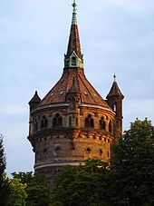
- Worms water tower
- Ludwig Monument
- Large fishing pasture (one of the oldest streets)
- Kiautschau , workers' settlement
- Town hall Worms
Parks
There are the following parks in Worms and on the outskirts :
- Albert-Schulte-Park - Park directly north of the city center (old cemetery)
- Hans-Dörr-Park - northeast continuation of the Albert-Schulte-Park
- Stadtpark and Bürgerweide - local recreation area south of the city center
- Herrnsheimer Schlosspark - Park in Worms-Herrnsheim
- Karl-Bittel-Park (Pfrimmpark) - between the districts of Pfiffligheim and Hochheim
- Worms Zoo - located within the Bürgerweide
theatre
- The Worms - cultural center and guest theater for plays, concerts, operettas, musicals, ballet and children's theater. After a renovation and expansion, it was reopened on January 29, 2011 under the name "Das Wormser", previously it was called the municipal play and festival house in Worms .
- Lincoln Theater Worms - venue for cabaret, cabaret, children's theater and concerts
- Small theater of the Volksbühne Worms - amateur theater with its own venue (since 1908)
- Nibelungen Festival Worms - open-air stage in front of the Worms Cathedral
Museums
- Ammeheisje , local history museum Worms-Ibersheim
- Bojemäschterei, Fischerwääder Museum
- Local history museum Worms-Abenheim
- Local history museum Worms-Herrnsheim
- Local history museum Worms-Horchheim
- Local history museum Worms-Weinsheim
- Heylshof
- Museum of the city of Worms in the Andreasstift
- Nibelungen Museum
- Raschi-Haus - Jewish museum of the city of Worms; named after Rabbi Rashi
- School Museum Worms-Pfeddersheim
Libraries and Archives
Regular events
Traditional events
- Worms Backfischfest , the largest wine and folk festival on the Rhine, with annual parade and evening fireworks.
- Worms Carnival, several carnival clubs show the audience the foolish sides of politics and society with political lectures and chocolates:
- Wormser Narrhalla from 1840 e. V.
- Wormser Liederkranz 1875 e. V.
- Worms Carneval Club 1974 e. V.
- Worms Whitsun Market , the oldest consumer fair in the region.
Cultural event
- Worms Nibelungen Festival, theater festival with various productions of the Nibelungenlied (since 2002).
- Blickachse, large open-air art exhibition in the Herrnsheimer Schlosspark
Music festivals
- Worms: Jazz & Joy, annual three-day jazz festival with five stages around the cathedral.
- Worms Rock Night, annual rock night with bands from Worms and the surrounding area.
- Worms Honky Tonk , pub festival in spring.
- Apostel-Openair, music festival in summer.
- Wormstock, annual rock festival, mostly in July.
Sports and clubs
Recreational facilities
- Heinrich-Völker-Bad (outdoor and indoor swimming pool)
- Worms-Pfeddersheim outdoor swimming pool
- Herrnsheim bathing lake
Events
- EWR Hockey-Days (tournament for the season preparation of the women's field hockey Bundesliga ; March / April)
- Nibelungenlauf (beginning of September)
- Tristar 111 Germany (2010-12)
- Football city championship (annually since 1968)
sports clubs

- VfR Wormatia Worms 08 ; Football club , six times southwest champion, founding member of the 2nd Bundesliga
- Turngemeinde 1846 Worms (TGW); with around 3000 members the largest sports club in Worms and one of the largest in Rhineland-Palatinate; 19 departments with TGW-Hockey e. V, four Olympians
- Black & White Racket Club ; Squash Bundesliga team since 2005
- TV 1863 Leiselheim ; most successful table tennis club in Rheinhessen
- Association for Indoor Cycling Worms (VfH); nationally known cycling club
- Worms Rowing Club Blau-Weiß from 1883 ; 2006 Merger of the Ruderclub Blau-Weiß, founded in 1947, and the Wormser Rudergesellschaft from 1883; most successful member: Peter Uhrig , world champion and two-time Olympian as well as multiple German champion
- TC Rot-Weiß Worms
- Rockin 'Wormel Worms eV , nationally and internationally successful rock' n 'roll dance sport club
Culture
- Worms Antiquities Association , founded in 1879, approx. 500 members.
- Kunstverein Worms, founded in 2001, around 250 members, exhibitions and promotion of contemporary art
Economy and Infrastructure
economy
| Largest wine-growing communities in the growing area |
Rank according to vineyard area (within RLP) |
Planted vineyards in 2017 |
Grape varieties | |
|---|---|---|---|---|
| White wine | red wine | |||
| Ha | % | |||
|
|
26,617 | 61 | 29 | |
| Worms | 3 | 1,564 | 63 | 37 |
| Westhofen | 7th | 787 | 75 | 25th |
| Alzey | 8th | 778 | 63 | 27 |
| Nierstein | 9 | 742 | 77 | 23 |
| Alsheim | 10 | 707 | 63 | 27 |
| Bechtheim | 11 | 660 | 73 | 27 |
| Flörsheim-Dalsheim | 12 | 646 | 68 | 32 |
| Ingelheim am Rhein | 13 | 642 | 51 | 49 |
| Bingen am Rhein | 15th | 566 | 74 | 26th |
| Saulheim | 16 | 523 | 76 | 24 |
| Source: Leaflet Viticulture 2018. State Statistical Office Rhineland-Palatinate, Bad Ems, May 2018 | ||||
In 2016, Worms generated , within the city limits, a gross domestic product (GDP) of 2.927 billion euros. The GDP per capita in the same year was € 35,545 (Rhineland-Palatinate: € 34,118, Germany € 38,180). The GDP per labor force is € 66,798. In 2016, the city's GDP grew nominally by 0.6%, in the previous year the growth was 2.4%. In 2016, around 43,800 people were employed in the city. The unemployment rate in December 2018 was 6.1% and thus above the average for Rhineland-Palatinate of 4.1%.
In Worms there are 2100 companies with 26,600 employees (as of June 2001). The number of commuters from the surrounding area corresponds to 45% of Worms employees.
In the future atlas 2016 , the independent city of Worms was ranked 189 out of 402 districts, municipal associations and independent cities in Germany and is one of the places with a "balanced risk-opportunity mix" [sic] for the future.
Business
In the manufacturing industry in Worms there are companies in the chemical industry and plastics production, metal production and mechanical engineering , manufacturers of EDP devices and optics as well as the wood processing industry. The leather industry in Worms , which used to be important , no longer plays a role today.
Services and trade have seen strong growth in recent years. Especially in the logistics industry , primarily in the industrial area of Worms-Nord , numerous companies have relocated due to the good traffic situation.
Agriculture
Traditional viticulture in and around Worms is internationally known thanks to the Wormser Liebfrauenmilch . With 1,564 hectares of vines, Worms is the third largest wine-growing community in Rhineland-Palatinate and the largest wine-growing community in the Rheinhessen wine-growing region . One of the largest malting houses in Europe is also located in Worms .
labour market
Unemployment in the city of Worms was 9.0% at the end of July 2010, higher than in the rest of Rheinhessen and higher than the national average. 45% of the employed inhabitants of Worms commute to the surrounding economic areas, in particular to Ludwigshafen and Mannheim, but also to Mainz and the Frankfurt area.
tourism
A total of 1,132 beds are available for tourism in 35 hotels and inns (as of 2014). There is also a youth hostel (opposite the cathedral), a group hostel in the Nibelungenturm on the Nibelungen Bridge and a mobile home station on the Rhine. In 2014, 68,880 guests were counted who spent an average of two days in Worms.
traffic
Road traffic
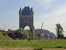
Worms is located on Autobahn 61 on the left bank of the Rhine and on federal road 9 , which has been expanded to four lanes to the south , via which there is also a connection to Autobahn 6 , and on federal road 47, which runs through the city . With the second Nibelungen Bridge completed in 2008 as part of the B 47, Worms has a four-lane connection to southern Hesse and the 5 and 67 motorways on the right bank of the Rhine . The "old" Nibelungen Bridge with its "Nibelung Tower" characterizes the Worms cityscape. The tower was built from 1897 to 1900 according to plans by city architect Karl Hofmann, it was built in the neo-Romanesque style and reaches a height of 53 meters. On the opposite side of the Rhine there was a structurally identical second tower, which was damaged shortly before the end of the war in 1945 and removed when the bridge was rebuilt.
Public transport
Worms is located on the main line Mainz – Worms – Ludwigshafen / Mannheim on the left bank of the Rhine . In addition to the dense regional transport on hold Wormser Hauptbahnhof individual long-distance trains in the direction of Cologne and Stuttgart and Munich . Worms is also an end point of the Rheinhessenbahn to Bingen and the Nibelungenbahn to Bensheim . Worms is connected to Frankfurt am Main via the Rhine Bridge Worms and the Riedbahn . Since June 2018, the Mainz – Worms – Ludwigshafen / Mannheim line has been integrated into the RheinNeckar S-Bahn network.
The urban area is served by nine city bus, seven regional bus and six night bus routes, which are mainly operated by DB Regio Bus Mitte (formerly the Rhein-Neckar bus service ). Call taxis serve the parts of the city with low traffic in late traffic. The Worms tram has been shut down since 1956.
Worms is integrated into the Rhein-Neckar transport association . Transitional regulations also enable the use of tickets for the Rhein-Main-Verkehrsverbund and the Rhein-Nahe-Nahverkehrsverbund .
Bicycle traffic
Worms is connected to regional, national and international cycle paths, including the EuroVelo route Rhine cycle path , the Zellertal cycle path , the Salier cycle path and the Rhine terrace route.
Ship and air traffic
The city of Worms owns the port of Worms with several port basins used for cargo handling or leisure as well as a power port on the left bank of the Rhine that extends to Rheindürkheim. To the south of the city lies the Worms airfield, which is mainly used for sport aviation .
education
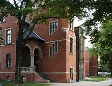
- BFU Theological Distance School
-
University of Worms
- ZTT Center for Technology Transfer and Telecommunications
General education schools
-
Comprehensive school
- Nelly-Sachs-IGS (Horchheim; previously: Kerschensteiner School)
-
Gymnasiums :
- Eleonor high school
- Gauss high school
- Rudi-Stephan-Gymnasium (old language, with all-day offer)
-
Realschulen :
- Pfrehtal-Realschule plus (previously: Diesterweg- / Paternus-Realschule plus)
- Karmeliter-Realschule plus (previously: Karmeliter- / Staudinger-Realschule plus)
- Nibelungen Realschule plus
- Westend Realschule plus
- 14 elementary schools
- Geschwister-Scholl special school
- Youth Music School of the City of Worms (JMS)
- Adult Education Center Worms
media
As a daily newspaper, the Wormser Zeitung appears as a regional edition of the Mainzer Allgemeine Zeitung . In addition, the free advertising newspapers Nibelungen-Kurier and Wormser Wochenblatt (each twice a week) are distributed to all Worms households. The WO! THE Worms city magazine .
Another institution is the Worms Open Canal ; his best-known broadcast is probably the Worms Monday magazine , which is often identified with the open channel because of its long existence and sustainability.
Other infrastructure
The Klinikum Worms (formerly Stadtkrankenhaus Worms), teaching hospital of the University of Mainz , is one of the five largest clinics in Rhineland-Palatinate with 696 beds, and there is also a day clinic of the German Red Cross .
Worms is the seat of several supraregional authorities:
- District Court of Worms
- Main office of the tax office Worms-Kirchheimbolanden
- Main office of the Worms-Alzey health department
- Branch office of the Rhineland-Palatinate Mobility Office
- Worms / Oppenheim suburb of the Mannheim Waterways and Shipping Office
- Office of the Rhine river basin community
- Youth detention center Worms
- Contact office for late resettlers and Jewish emigrants from the state of Rhineland-Palatinate
Important infrastructure projects
- From 2005 to 2008 the “new” Nibelungen Bridge was built; After the "old" Nibelungen Bridge was completely renovated, a total of four lanes have been available on both bridges since September 2013.
- The construction of a southern bypass as a bypass on the B 47 began in 2016. The gap in the western bypass between the B 9 and B 47n is still in the planning phase.
- The B 9 is being gradually expanded to four lanes in the north of the city and at the same time supplemented by parallel relief in the commercial area.
- The connection to the RheinNeckar S-Bahn was established in 2018.
- From 2007 to 2011 the culture and conference center Das Wormser was built on the site of the municipal play and festival house. A hotel is to be added.
- In the course of the conversion of areas used by the military, a hotel and several companies were located on the former barracks area of the Prinz-Carl-Anlage, and a retail park center was established on the former Bundeswehr site on Schönauer Straße. A new residential area has been created on the Liebenauer field formerly used by the American armed forces.
Personalities
Honorary citizen and holder of the ring of honor
Quotes about worms
"My Worms already delights me from afar, how will the delight be when I come to the shimmering evening stars in its moors with exultation."
"After that we stayed at Worms for five days ... We were funny."
"How could I ever forget Worms and its dear inhabitants?"
literature
-
History of the city of Worms. Ed. I. A. of the city of Worms by Gerold Bönnen . Theiss, Stuttgart 2005, ISBN 3-8062-1679-7 ; in this:
- Mathilde Grünewald : Worms from the prehistoric epoch to the Carolingian era , pp. 44-101.
- Fritz Reuter : Warmaisa: 1000 years of Jews in Worms . 3. Edition. Self-published, Worms 2009, ISBN 978-3-8391-0201-5 .
- Fritz Reuter: Worms between imperial city and industrial city 1800–1882. Observations and materials. City archive, Worms 1993.
- Hermann Schlösser (Ed.): Worms Fundstücke - A literary reading book . Worms Verlag, Worms 2014, ISBN 978-3-944380-16-2 .
- Irene Spille: Monument topography Federal Republic of Germany (= cultural monuments in Rhineland-Palatinate, 10: City of Worms ). Wernersche Verlagsgesellschaft , Worms 1992, ISBN 978-3-88462-084-7 .
Web links
- Official website of the city of Worms
- Data on the history of the city of Worms on worms.de (PDF file; 524 kB)
- Eichsfelder - History of the city of Worms on vimeo.com
- Michael Rademacher: German administrative history from the unification of the empire in 1871 to the reunification in 1990. City and district of Worms. (Online material for the dissertation, Osnabrück 2006).
- Bibliography on the history of the city of Worms (PDF file; 289 kB)
- Literature about Worms in the catalog of the German National Library
- Literature about Worms in the Rhineland-Palatinate State Bibliography
- Link catalog on worms at curlie.org (formerly DMOZ )
Individual evidence
- ↑ a b State Statistical Office of Rhineland-Palatinate - population status 2019, districts, municipalities, association communities ( help on this ).
- ↑ Residents by type of apartment in the city of Worms ( Memento from February 18, 2013 in the Internet Archive ) (PDF file; 15 kB) December 31, 2012.
- ↑ Stadtverwaltung Worms, area 1 - internal administration, department 1.01 municipal constitution, meeting service / statistics and elections.
- ↑ Residents by type of residence as of December 31, 2017.
- ↑ District register Rhineland-Palatinate (.zip) ( Memento from February 14, 2007 in the Internet Archive ) the district boundaries sometimes differ significantly from the district boundaries.
- ↑ Annual report - 2008 Sample component Temp (PDF file; 90 kB)
- ↑ Agricultural Meteorology - Weather Station Worms-Leiselheim
- ↑ Bernhard Maier : Small lexicon of names and words of Celtic origin. CH Beck OHG, Munich 2003, 122, ISBN 3-406-49470-6 . At Google Books
- ^ Gerhard Rasch: Ancient geographical names north of the Alps. Verlag Walter de Gruyter, 2005 [first printing of a dissertation from 1950]. ISBN 978-3-11-017832-6 , p. 140: "Feld am Flüßchen * Bormita".
- ^ Reuter: Warmaisa. 1000 years, p. 68 f.
- ↑ Alexander Shapiro and B. Mordechai Ansbacher: Shum. In: Encyclopaedia Judaica. P. 532 f. , Accessed 24 October 2011 (English, Volume 18, Macmillan Reference USA, Detroit 2007).
- ↑ Grünewald, pp. 45-101.
- ↑ Grünewald, p. 61.
- ^ Ernst Probst: Germany in the Bronze Age. Bertelsmann, Munich 1996, ISBN 3-570-02237-4 , p. 78.
- ↑ Grünewald, p. 63 f.
- ↑ Friedhelm Jürgensmeier : The Diocese of Worms from Roman times to its dissolution in 1801 . Echter Verlag, Würzburg 1997. ISBN 3-429-01876-5 , p. 261.
- ^ Reuter: Warmaisa. 1000 years, p. 121.
- ^ The destruction of the city in 1689 . In: Fritz Reuter and Ulrike Schäfer: Miracle stories from Warmaisa. Juspa Schammes, his Ma'asseh nissim and the Jewish Worms in the 17th century . Warmaisa, Worms 2007. ISBN 3-00-017077-4 , p. 64, as well as a lament for the destruction of Worms, written by Zekeli ben Liebermann Segal, grandson of Juspa Schammes and son of Elieser Liebermann; ibid., pp. 64-68.
- ^ Fritz Reuter: Worms between imperial city and industrial city 1800–1882. Worms 1993, p. 57 and p. 166, note 139. The Atlas géometrique is in the Worms City Archives under 01.Stadt Worms, 002 Munizipalität XXI. No. 167 stadtarchiv-worms.findbuch.net .
- ↑ Gerold Bönnen : From the blossom into the abyss. Worms from the First to the Second World War . In: Gerold Bönnen (Ed.): History of the city of Worms . Konrad Theis, Stuttgart 2005, ISBN 978-3-8062-1679-0 , p. 605 .
- ↑ a b c d e Zvi Avneri: Worms. In: Encyclopaedia Judaica. P. 226 f. , accessed October 24, 2011 (English, Volume 21, Macmillan Reference USA, Detroit 2007).
- ^ Fritz Reuter: Der Wormsgau - Supplement 32 . Worms between imperial city and industrial city 1800–1882. Stadtarchiv Worms, 1993, p. 76 f .
- ^ Otto Böcher : dagger stitches in a van Dyck. in: Wonnegauer Heimatblätter, November 1968.
- ↑ Irene Spille and Otto Böcher : Building history and architectural monuments. In: History of the City of Worms. Ed. I. A. of the city of Worms by Gerold Bönnen . Theiss, Stuttgart 2005, ISBN 3-8062-1679-7 , p. 777.
- ↑ Official municipality directory (= State Statistical Office of Rhineland-Palatinate [Hrsg.]: Statistical volumes . Volume 407 ). Bad Ems February 2016, p. 147 (PDF; 2.8 MB; see also p. 183 and p. 185, footnote 76).
- ↑ Inhabitants of the city of Worms (only HAW) ( Memento from January 29, 2016 in the Internet Archive ) As of December 31, 2015.
- ↑ Independent cities and districts in Rhineland-Palatinate A comparison in numbers ( Memento from August 10, 2014 in the Internet Archive ) with reference to general education schools, status: school year 2012/2013.
- ↑ http://www.statistikportal.de/Statistik-Portal/kita_regional.pdf page 41. Status: March 1, 2015.
- ↑ Demography report for the city of Worms - June 2006 ( Memento from May 10, 2012 in the Internet Archive ) (PDF file; 218 kB)
- ^ City of Worms Religion , 2011 census
- ^ Municipal statistics for the district-free city of Worms , accessed on May 19, 2020
- ↑ Inhabitants by religious affiliation As of: December 31 , 2019 , accessed on February 22, 2020
- ^ Adolf Kessel new Lord Mayor in Worms , Mannheimer Morgen , November 18, 2018
- ↑ Impressions from the new twin city Ningde. ( Memento from February 5, 2015 in the web archive archive.today )
- ↑ 800-year city contract Speyer-Worms: Agreements for future cooperation made Speyer-Aktuell, January 28, 2011.
- ^ Veysel Karani Mosque
- ↑ Al-Arkam Mosque
- ^ Mosques in Worms
- ↑ cf. the club homepage
- ^ Art Association Worms. In: worms.de. Retrieved February 15, 2017 .
- ↑ Current results - VGR dL. Retrieved January 7, 2019 .
- ^ Federal State of Rhineland-Palatinate. Federal Employment Agency, accessed on January 7, 2019 .
- ↑ Future Atlas 2016. Archived from the original on December 4, 2018 ; accessed on March 23, 2018 .
- ↑ Commercial and industrial development Worms-Nord. Worms city administration, September 2014, accessed on August 21, 2014 .
- ↑ Statistics on the business location Worms. Retrieved September 17, 2018 .
- ↑ The Nibelung Tower. ( Memento from August 19, 2013 in the web archive archive.today ) on the website of the city of Worms
- ↑ admin: From Karlsruhe past vineyards to Bingen - EuroVelo. Retrieved June 22, 2017 .
- ↑ Bike tours & bike tours> City of Worms. Retrieved June 22, 2017 .
- ^ Johann Nikolaus Götz : Poems from the years 1745–1765 in their original form . Göschen, Stuttgart 1893, p. 8–11 (first printing in an attempt by a Wormser in poems. 1745).


