
Federal highway 67
| Bundesautobahn 67 in Germany | |||||||||||||||||||||||||||||||||||||||||||||||||||||||||||||||||||

|
|||||||||||||||||||||||||||||||||||||||||||||||||||||||||||||||||||
| |
|||||||||||||||||||||||||||||||||||||||||||||||||||||||||||||||||||
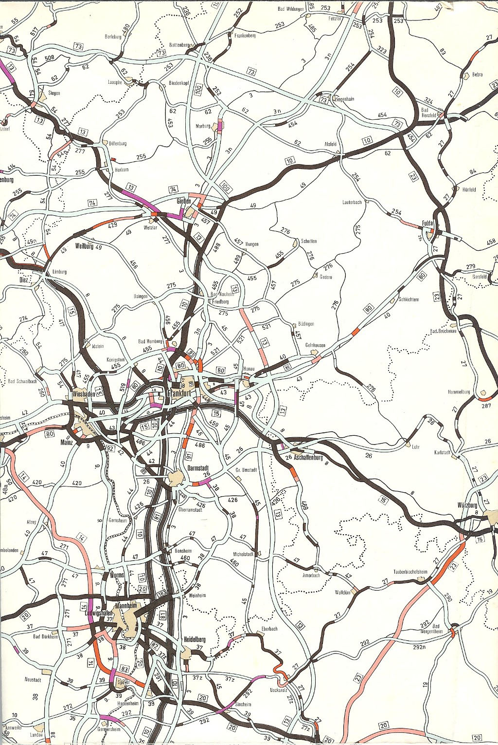
| map | |||||||||||||||||||||||||||||||||||||||||||||||||||||||||||||||||||
 |
|||||||||||||||||||||||||||||||||||||||||||||||||||||||||||||||||||
| Basic data | |||||||||||||||||||||||||||||||||||||||||||||||||||||||||||||||||||
| Operator: |
|
||||||||||||||||||||||||||||||||||||||||||||||||||||||||||||||||||
| Start of the street: |
Mönchhof triangle ( 50 ° 2 ′ N , 8 ° 30 ′ E ) |
||||||||||||||||||||||||||||||||||||||||||||||||||||||||||||||||||
| End of street: |
Viernheimer Dreieck ( 49 ° 33 ′ N , 8 ° 33 ′ E ) |
||||||||||||||||||||||||||||||||||||||||||||||||||||||||||||||||||
| Overall length: | 58 km | ||||||||||||||||||||||||||||||||||||||||||||||||||||||||||||||||||
|
State : |
|||||||||||||||||||||||||||||||||||||||||||||||||||||||||||||||||||
 |
|||||||||||||||||||||||||||||||||||||||||||||||||||||||||||||||||||
| Federal motorway 67 near Darmstadt | |||||||||||||||||||||||||||||||||||||||||||||||||||||||||||||||||||
|
Course of the road
|
|||||||||||||||||||||||||||||||||||||||||||||||||||||||||||||||||||
The federal motorway 67 (abbreviation: BAB 67 ) - short form: Autobahn 67 (abbreviation: A 67 ) - is a 58 kilometer long motorway in the German state of Hesse , which leads from the Mönchhof triangle near Rüsselsheim via Darmstadt to the Viernheim triangle near Mannheim . Essentially, it runs parallel to the BAB 5 and thus serves as an alternative route between the Rhine-Main and Rhine-Neckar areas .
The southern part of the motorway between Darmstadt and Mannheim was opened in 1935 and was part of the oldest Reichsautobahn in Germany; the northern part between the Mönchhof triangle and Darmstadt was built in the 1960s as a corner connection to today's BAB 3 in the direction of Cologne , bypassing the Frankfurter Kreuz . Except for the section south of Lorsch , which has six lanes, most of the BAB 67 can be used with four lanes.
Route
The BAB 67 branches off at the Mönchhof triangle west of Frankfurt Airport from the BAB 3 in a southerly direction and runs through the Mönchbruch east of Rüsselsheim. The BAB 60 from Mainz joins the Rüsselsheimer Dreieck and the BAB 67 leads in a south-easterly direction via Groß-Gerau and Büttelborn towards Darmstadt . At the Griesheimer Dreieck , the 2.5 km long BAB 672 branches off, which leads to the B 26 and forms a connection to the Darmstadt city area. Immediately afterwards, the Darmstädter Kreuz follows with the BAB 5 . Both motorways change route at this junction, which due to the parallel position of the routes only has direct ramps in north-south and south-north direction - the BAB 5 leads to Heidelberg on the route built in the 1960s , the BAB 67 changes to the more straight line to Mannheim, which was completed in 1935.
South of Darmstadt, the route is marked by long straight lines, with the BAB 5 only a few kilometers further east on the immediate edge of the Bergstrasse , the transition between the Upper Rhine Graben and Odenwald . While the latter connects the towns on the Bergstrasse, the towns on the Rhine to the west of it can be reached via the BAB 67 . Passing Pfungstadt , Gernsheim and Lorsch , it mostly goes through forest areas before the motorway merges into the BAB 6 at the Viernheimer Dreieck . The route coming from Saarbrücken joins the route of the BAB 67 and continues on this south, past Mannheim , and swings to the Walldorf junction , where the BAB 5 is crossed, to the east in the direction of Heilbronn .

At the Rüsselsheimer Dreieck, the BAB 60 branches off to Mainz

Distance table on the section northwest of Darmstadt

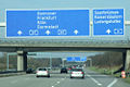
LED signpost ( dWiSta ) at the Darmstädter Kreuz

Between Darmstadt and Mannheim, north of the Pfungstadt junction
Southern end of the motorway at the Viernheimer Dreieck

.jpg)


history
First plans, HaFraBa
The Darmstadt – Mannheim section of the autobahn originally goes back to a road plan by the Association for the Preparation of the Hansestädte – Frankfurt – Basel ( HaFraBa ) road, which, under the impression of increasing motorization , started a trunk road connection between the northern Germans at the end of 1926, during the Weimar Republic Hanseatic cities of Lübeck , Hamburg and Bremen via Frankfurt am Main to Basel . In 1929 the term autobahn , coined by the club's founder Robert Otzen - analogous to the railway - was used for the project for the first time. In the course of time, an extension of the road through Switzerland via Zurich and Lugano to Genoa in Italy was part of the plans.
Among other things, because the use of the road was to be financed through a route-dependent toll , the project met with strong rejection from the NSDAP represented in the Reichstag , which they described as the “luxury roads of the rich”. Inspired by the Italian Autostrada dei Laghi built by the fascists in 1924 , studies were also carried out elsewhere on the construction of roads reserved for car traffic, the only project realized until 1932 was the Cologne – Bonn route in the Prussian region , which was built as a job creation measure Rhine Province .
Construction of the first Reichsautobahn

Despite the initially strong rejection, it was the National Socialists, who came to power on January 30, 1933, who forced the construction of the motorway for propaganda purposes. Officially praised as a measure against the then widespread unemployment, reasons of prestige also played a role - the National Socialists claimed the invention of the autobahn for themselves, although Italy had had such roads since 1924 and the Cologne – Bonn route, which was downgraded to a state road, already had had separate lanes and crossroads with no elevation . Taken were of Fritz Todt , since July, 1933 as the Inspector General for the Road Administration in charge of the kingdom of highway construction, this is the since 1932 regarded as ready for construction plans of the association HaFraBa, the renamed the Nazis in Gezuvor ( "Company to prepare the Reichsautobahnen").
Construction of the Frankfurt – Mannheim line began on September 30, 1933 with the groundbreaking ceremony, which Adolf Hitler personally broke during the so-called First Labor Battle near Frankfurt. At the beginning, the use of construction machinery was prohibited for reasons of job creation, which is why all earthworks had to be carried out by hand. Only for the compaction of single carriageway layers were steamroller , construction of concrete pavements paver used. Although it was claimed that 700 workers were employed on the line after the groundbreaking ceremony, in reality there were only around 450. At peak times, around 7000 workers were employed in the catchment area of the Oberste Bauleitung Kraftfahrbahnen Frankfurt (OBK). Nevertheless, these numbers were negligible compared to the unemployment rate prevailing at the time.
At that time, the main focus of the autobahn was not yet on its use by the then very limited individual traffic, but more on trucks and express buses of the Deutsche Reichsbahn . These frequented the route between Darmstadt and Frankfurt six times a day in both directions.
After almost two years of construction, the section between Frankfurt and Darmstadt went into operation on May 19, 1935, and the section from Darmstadt to Mannheim on October 3, 1935, including the continuation to Heidelberg. Typical for the entire route between Frankfurt and Darmstadt, as well as between Darmstadt and Mannheim, is the dead straight route through the Frankfurt city forest and the Hessian state forest on the shortest connection between the cities. The street width was only 20 meters, of which 7.50 m per lane without hard shoulder and 5 m median. The roadway consisted in sections of concrete, paving and bitumen of different thicknesses - the aim was to test different road surfaces. The northern end point (name Frankfurt-Süd ) was at the height of today's Frankfurter Kreuz , the Darmstadt junction , which marked the transition between the two construction sections, led to today's B 26 . In between there was only one other junction ( Mörfelden ).
Between Darmstadt and Mannheim there was also only one other junction near Lorsch , which connected to Reichsstraße 47 , today's B 47 , and - as in Darmstadt - included a gas station. At the southern end point near Mannheim, the line ended in a height-free crossing structure on a direct route Mannheim-Heidelberg. This can be seen as the first realized motorway triangle in Germany.
Architecturally interesting were the bridges with which roads of lower order and dirt roads were led over the Reichsautobahn. The structures first completed in 1934/35 still had a massive appearance, which was reinforced by the use of exposed concrete. The standards used by the Deutsche Reichsbahn formed the basis for their dimensioning. Later they went over to building freeway overpasses "slimmer", that is, with less material consumption and a less massive appearance. Later, for aesthetic reasons, the abandonment of exposed concrete and the increased use of clinker followed .
In contrast to today's autobahns and the Reichsautobahn routes built from the mid-1930s onwards, the Frankfurt – Mannheim route had no hard shoulder, and the route was very straight and flat, as a direct route was chosen. Racing drivers who set speed records on the track on behalf of Nazi propaganda took advantage of this, such as Bernd Rosemeyer on October 25, 1937. Motorways built later under the Nazi regime often follow narrow curve combinations and promising inclines around the surrounding areas in mountainous regions Include the landscape as part of the propaganda.
After the war
As a result of the Second World War , construction of the Reichsautobahn was initially partially interrupted and then completely interrupted from 1942. After the end of the war, numerous structures that had been destroyed in the war had to be repaired or rebuilt. The former Reichsautobahn on the territory of the three Western Allied occupation zones became the property of the Federal Republic of Germany, founded in 1949. With the onset of the economic miracle in the 1950s, individual traffic on the West German roads then increased significantly, so that the completion of routes that were no longer completed before the war began.
Lorsch was the only junction between Darmstadt and Mannheim that offered a transition from the autobahn to the subordinate road network and thus also the surrounding cities and communities. Another junction was built between Darmstadt and Lorsch in the 1950s near Gernsheim . In addition, with the completion of the Theodor Heuss Bridge in 1950, the Mannheim – Saarbrücken motorway was connected to the Frankfurt – Mannheim line. A new numbering system gave the Flensburg – Basel connection (at that time still partly planned or under construction), which also included the Frankfurt – Mannheim route, the number A 10 .
Pfungstadt service area

After a petrol station had been integrated into the eastern area of the Darmstadt junction since 1936, the strong increase in traffic, which also included shuttle traffic by the US Army between its headquarters in Heidelberg and the Rhein-Main Air Base , offered rest areas at the Operate highway. On November 1, 1950, the Eschollbrücken municipality received a building application for the first time to operate a serviced rest area on the motorway on the municipality's premises. There have been (unmanaged) parking spaces here since 1939.
With the establishment of the Gesellschaft für Nebenbetriebe as a federally owned company on July 6, 1951, the design of rest areas on motorways according to uniform standards - the experience with the petrol stations and rest areas from the era of the Reichsautobahn led to a rethinking, so that large parking lots, petrol stations, rest houses and Sometimes motels were combined. The architect Ernst Neufert , who had held a professorship at the Technical University in Darmstadt since 1946 , was commissioned in 1952 to design the system at kilometer 30 of the Frankfurt – Mannheim motorway near Eschollbrücken . For his projects he founded his own architecture office in Darmstadt, so that in 1953 the motorway filling stations he designed could go into operation in both directions. Compared to previous petrol stations on motorways, they were much larger and had separate tank areas for cars and trucks. The most striking feature of the buildings were the slender, mushroom-shaped columns.
The rest stops attached to the site were built from until 1954 and inaugurated by Federal Transport Minister Hans-Christoph Seebohm . The rest stop on the west side was housed in a temporary building for almost two years from February 1954, before the building designed by Neufert was completed in 1955. On July 30, 1957, the motel finally opened . At the time of construction, the rest area was the first on a German motorway to be built according to modern criteria.
In the 1960s and 1970s, the parking lots of the rest area were expanded and some buildings were renovated. The gas station on the east side was demolished in 1996 and replaced by a contemporary new building. The gas station on the west side, however, is how well the fortified with paving stones driveways, under monument protection .
During the construction of the Reichsautobahn in 1934/35 in the Eschollbrücker Wald, south of today's service area, a pedestrian bridge with stairs on both sides was built to connect the two parts of the forest section cut up by the autobahn - this bridge was called the Jägersteg . The parking lots created in 1939 were not only used as a resting place for motorists, but also to reach the bridge and walk to the parking lot opposite. After the rest area was completed, the crossing continued to operate until it was demolished in the 1980s due to its dilapidation. As a replacement, a pedestrian bridge was built north of the facility, which was designed as a wooden structure with concrete pillars. After 2009, however, this bridge was also demolished, but the concrete pillars are still at the edge of the road.
The Main-Neckar expressway
The traffic load on the Frankfurt – Mannheim autobahn, built in 1935, was already around 41,000 vehicles per day in the 1950s, which made it the busiest autobahn in Germany at the time. Due to the lack of hard shoulder, it was also considered a hotspot for accidents early on. Since the old route was no longer able to cope with the increasing volume of traffic, there were plans to build a second motorway connection between the Rhine-Main and the Rhine-Neckar region. This should serve as a relief route according to the standards newly developed by Hans Lorenz, among others , such as curved lines and continuous hard shoulders. The route from the Cologne – Frankfurt motorway northeast of Rüsselsheim via Darmstadt , Bensheim and Weinheim to Heidelberg means that traffic coming from Cologne can also bypass the Frankfurter Kreuz .
The first talks between the Hessian and Baden-Wuerttemberg transport ministries took place in 1956. While in the section south of Darmstadt the route between the old HaFraBa route and the B 3 along the towns and municipalities on Bergstrasse was quickly determined, the route between Raunheim and Darmstadt developed a total of three variants, which differed in a route along the old B 26 (today's L 3482) or a guided tour through the forest east of Nauheim . When the planning was completed at the end of the 1950s, it was decided to run east past Nauheim and north past Groß-Gerau . A route west of Griesheim was also considered, but a route east of Griesheim was preferred in favor of a better connection to Darmstadt.
In 1961, construction began on this new motorway, which was known as the Main-Neckar Schnellweg because of the densely populated river landscapes it connected . Construction progressed step-by-step from north to south - the aim was to complete the motorway all the way to Heidelberg by the summer of 1970. By 1964, the northernmost part of the Mönchhof triangle, where it branches off from the Cologne – Frankfurt motorway, was completed up to the Büttelborn junction. Since large quantities of sand and gravel were required for the construction, numerous quarry ponds were created through excavation in the flat Rhine plain, for example near Raunheim and Nauheim.
Construction of the section from Büttelborn to the Frankfurt – Mannheim motorway began on July 19, 1963. After two years of construction, it was completed on June 30, 1965 just before Griesheim. It essentially follows the former B 26 , which at that time had a different route - it originally began in Mainz-Kastel and led via Bischofsheim and Groß-Gerau from the north-west to its current route to Darmstadt. After the completion of the motorway between the Mönchhof triangle and Darmstadt, the western course was changed, since then it has started on the B 42 at Riedstadt - Wolfskehlen and follows the former L 3096 to behind Griesheim.
The provisional connection to the former B 26 existed for about a year, so that coming from Darmstadt or the Frankfurt – Mannheim autobahn, you had to exit at the Darmstadt junction on the B 26 in order to reach the end of the expansion of the new expressway after almost 2 km. which was then completed by the junction with the Cologne – Frankfurt motorway. Only on June 2, 1966, when the Darmstadt Cross was put into operation, this vacant lot was removed. In the course of the construction of the 2.5 km long Rhine road feeder, via which a connection to the B 26 was established from both the new and the old autobahn, the old junction, which originated from the era of the Reich autobahn, was no longer available.
The continuation of the Main-Neckar Schnellweg from Darmstadt to Heidelberg was completed at the end of the 1960s - the first section between the Pfungstadt and Zwingenberg junctions was opened to traffic as early as 1967, followed a year later by the sections from the Darmstädter Kreuz to the Pfungstadt junction and from Junction Zwingenberg and the Kreuz Weinheim. The official opening ceremony of the 37 km long section between Darmstadt and Weinheim took place on August 23, 1968 on both the northern and southern new sections. Present at the northern end was the Hessian Minister of Economic Affairs and Transport, Rudi Arndt , and at the southern end, the then Federal Transport Minister Georg Leber .
The last missing section between Weinheim and Heidelberg was completed in 1970 and opened to traffic in two stages: First, from June 26th, traffic in a southerly direction on the western carriageway was able to use the section, and it was only used from July 31st the eastern lane to the north is possible. This was a compromise with the Federal Ministry of Transport to give summer travel to the south the opportunity to use the recently completed route at an early stage. Traffic to the north therefore had to use the old route between Mannheim and Darmstadt temporarily during the holidays. According to the Federal Ministry of Transport, the completion of the northern section to Weinheim in 1968 relieved the traffic of the old Frankfurt – Mannheim motorway by 40%.
Introduction of motorway numbering
On January 1, 1975, a new, uniform numbering scheme was introduced for the motorways in the Federal Republic of Germany and West Berlin. Initially, only internally managed numbering was used and only the numbers of the European roads running along the route were indicated on the signposts, but the new national numbering was brought forward. A previously in demand plan national highways 1971-1985 described system, the by Berliner Ring the digit numbers A 1 zuordnete branching routes to A 6, could, also in view of the then still existing German division , not prevail.
Up until then, the Flensburg – Hamburg – Frankfurt a. M. – Basel referred to as Autobahn 10 , whereby this numbering was carried out to Mannheim via the old HaFraBa route, then switched to the route to Heidelberg and finally on the Autobahn, which was partially completed before the war until Weil am Rhein at the beginning of the 1960s led south to the end of the autobahn just before the Swiss border. The Main-Neckar expressway between the Mönchhof triangle and Heidelberg had the internal number A 81 .
With the introduction of the current system, the most important long-distance routes, most of which were already planned as main routes during the Weimar Republic , were assigned single-digit numbers, national two-digit numbers and regional or local three-digit numbers. A great advantage of the system, that also the leading number of two- and three-digit motorways assigned to a certain region, was that in the event of reunification , numbers could already be assigned for the motorway routes in the former GDR without any problems (these were essentially the ones previously for the West Berlin city highways assigned numbers in the 10 range).
The Kassel ( Hattenbacher Dreieck ) –Frankfurt a. M. – Basel along the old HaFraBa route was given the number BAB 5 - in order to avoid double numbering with the now BAB 6 route Saarbrücken – Mannheim– Nuremberg - Amberg , the numbers along the respective route to the south were exchanged at the Darmstädter Kreuz so that the BAB 5 leaves the HaFraBa route and runs on the route of the Main-Neckar expressway built in the 1960s in the direction of Heidelberg, where it merges seamlessly into the former Reichsautobahn route to Basel. The northern part of the Main-Neckar expressway and the HaFraBa section between Darmstadt and Mannheim were given the two-digit number BAB 67 - an odd number due to the north-south course. The Rheinstrasse feeder to Darmstadt was given the number BAB 672, which was guided by the BAB 67.
European roads
Since the introduction of today's European road numbering scheme in 1985, the Mönchhof-Dreieck – Darmstädter Kreuz section has been part of the E 35 ( Amsterdam - Rome ), the Darmstädter Kreuz – Viernheimer Dreieck section of the E 451 ( Gießen – Mannheim).
List of traffic clearances
| section | year | km |
|---|---|---|
| Mönchhof triangle - Büttelborn | 1964 | 16 km |
| Büttelborn - Griesheim (connection B 26) | 1965 | 6.3 km |
| Griesheim (connection B 26) - Darmstädter Kreuz | 1966 | 2.0 km |
| Darmstadt Cross - Viernheim Triangle | 1935 | 34 km |
Expansion / planning
According to the current Federal Transport Infrastructure Plan 2030, a six-lane expansion is planned along the entire route. The section between the Lorsch junction and the Viernheimer Dreieck was expanded to six strips before the year 2000. The overall project is divided into three sub-projects on the remaining 42.7 km of four-lane route: Mönchhof-Dreieck – Rüsselsheimer Dreieck, Rüsselsheimer Dreieck – Darmstädter Kreuz, Darmstädter Kreuz – Lorsch.
In the federal traffic route plan , the six-lane expansion between Mönchhof triangle and Rüsselsheim triangle is included in the "urgent need", and between the Rüsselsheim triangle and Darmstadt in the "further need". After completing all measures, the A 67 would then have six lanes over its entire length.
Darmstädter Kreuz – Lorsch

Some preparations for the extension of the Autobahn between Darmstadt and Lorsch to six lanes began in the 2000s - at that time, some bridges from the time of the Reichsautobahn construction in the 1930s were still in operation in this area. Since these are too narrow for the widening of the motorway, in some cases there was not even space for hard shoulders, these had to be torn down.
- The bridge structure for the road between Pfungstadt and Eschollbrücken from 1935 was demolished in October 2006 and replaced by a new building, which was opened to traffic on July 30, 2007. This bridge was made entirely of exposed concrete.
- A structurally identical bridge ( building number 6217687), which was also completed in 1935 together with the motorway section, was located a few kilometers further south and crossed an agricultural path over the motorway at Allmendfeld . Later piers were erected to avoid a collision with the pillar on the central reservation of the motorway. The bridge was demolished on May 2, 2015.
- Also near Allmendfeld was a steel bridge from 1934, which was used for agricultural traffic. This bridge, one of the oldest of its kind along the former Reichsautobahn, was torn down on the night of September 14th to 15th, 2013 and replaced by a new building by August 2014. This bridge was also extended on both sides with piers on the median. A special feature of the replacement building is that it looks like the old bridge, but no longer has a central pillar.
A new ICE line is also planned between Darmstadt and Viernheimer Dreieck, parallel to the motorway . The six-lane expansion between Darmstadt and Lorsch is therefore being planned together with the new ICE line.
Trivia
At the beginning of the 1970s, traffic signs were increasingly the victims of target practice, for example the sign Rüsselsheim-Ost (1000 m) was hit with 15 bullets. Thereupon the Autobahn Directorate placed a target above .
Individual evidence
- ↑ Archive for Autobahn and Road History: Reichsautobahn relicts in the Rhine-Main area. Retrieved October 28, 2018 .
- ↑ Headlines from Bensheim on the 175th anniversary of the “Bergsträßer Anzeiger” 2007. (PDF; 8.61 MB) The “old” and the “new” autobahn. P. 49 , archived from the original on October 5, 2016 ; accessed on December 28, 2014 .
- ↑ eautobahn.de: Frankfurt - Darmstadt. Retrieved October 25, 2018 .
- ↑ a b c eautobahn.de: BAB A67: The oldest bridge of its kind - how much longer ? Retrieved June 26, 2020 .
- ^ Autobahn numbering before 1974 , autobahn-online.de
- ↑ geschichtsspuren.de: Gas station history in Germany. Retrieved June 26, 2020 .
- ↑ a b c Archive for motorway and road history: Tank and rest areas Pfungstadt-West and -Est on the BAB A67. Retrieved June 26, 2020 .
- ↑ Archive for motorway and road history: The 'barrack' only stood for two years - A brief history of the Pfungstadt-West service station. Retrieved June 26, 2020 .
- ^ Archives for motorway and road history: Reichsautobahn relics in the Rhine-Main area: construction line 34 Frankfurt - Darmstadt - Mannheim / Heidelberg. Retrieved June 26, 2020 .
- ↑ a b c Since 1969: Main-Neckar expressway between Darmstadt and Weinheim. In: Museum of the City of Weinheim. Retrieved June 28, 2020 .
- ↑ Special exhibition "50 Years Hegbachsee and Autobahn A 67". In: Heimatmuseum Nauheim. Retrieved June 28, 2020 .
- ^ The Riedbahn from Darmstadt to Goddelau - Post 79 near Griesheim. In: Walter Kuhl. Retrieved June 28, 2020 .
- ↑ Compilation of the traffic clearances 1967. In: autobahn-online.de. Retrieved November 6, 2018 .
- ↑ Compilation of the traffic clearances 1968. In: autobahn-online.de. Retrieved November 6, 2018 .
- ↑ Compilation of the traffic clearances 1970. In: autobahn-online.de. Retrieved November 6, 2018 .
- ^ W. Gödde: Adaptation to trends or initiation of change ?: Concept of reform and reform policy of the grand coalition 1966-1969 . Dissertation, Ruhr University Bochum, 2009, p. 322.
- ↑ Network plan 1972
- ↑ see route numbers A 10, A 81 on www.autobahn-online.de
- ↑ List of traffic clearances
- ↑ Motorway openings in 1964. In: autobahn-online.de. Retrieved June 30, 2020 .
- ↑ Motorway openings in 1965. In: autobahn-online.de. Retrieved June 30, 2020 .
- ↑ Motorway openings 1966. In: autobahn-online.de. Retrieved June 30, 2020 .
- ↑ Part of the approximately 45 km long Reichsautobahn route Darmstadt – Mannheim run today as BAB 67
- ^ Motorway openings in 1935. In: autobahn-online.de. Retrieved June 30, 2020 .
- ↑ The bridge structure from the 1930s, which spans the A67 motorway southwest of the city of Pfungstadt and crosses the Gernsheimer Weg (field path), has to be replaced by a new building due to its inadequate state of preservation. ( Memento of July 9, 2015 in the Internet Archive ) Hessen Mobil press release of April 23, 2015
- ↑ Demolition of the bridge on the A67 ( memento from March 22, 2015 in the Internet Archive ) on hr-online.de, May 3, 2015
- ^ Hessen Mobil - Road and Traffic Management: Construction of a new bridge over the A 67 near Pfungstadt ( memento from December 19, 2013 in the Internet Archive ), October 17, 2007, accessed on September 20, 2013
- ↑ Archive for motorway and road history: BAB A67: The first sheet steel road crossing over the (Reich) motorway - and its renovation in 2013/14, unnoticed by the public. Retrieved July 4, 2020 .
- ↑ Recently in the archive (issue 8/1973) in: auto motor und sport , issue 8/2013, from April 4, 2013, p. 202
