
Federal motorway 102
| Bundesautobahn 102 in Germany | ||||||||||

|
||||||||||
| Basic data | ||||||||||
| Operator: |
|
|||||||||
| Overall length: | 1 km (historical) | |||||||||
|
State : |
||||||||||
| Status: | Reclassification to a branch of the |
|||||||||
|
Course of the road
|
||||||||||
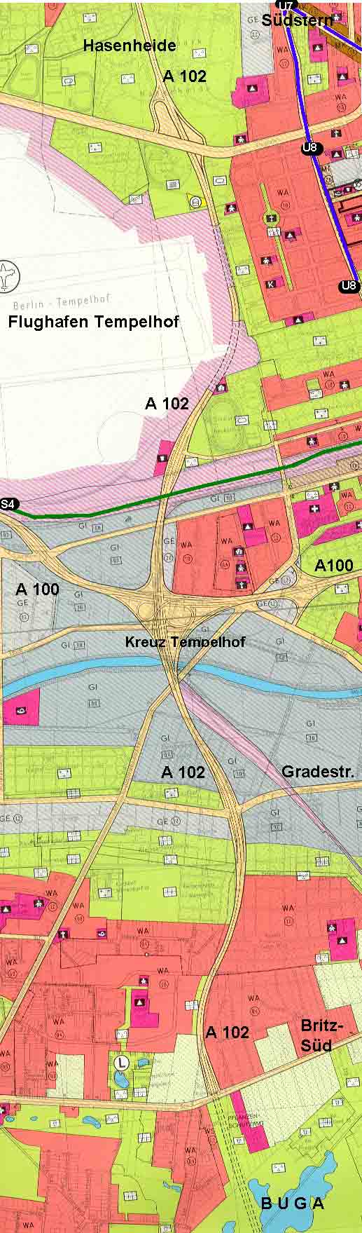
Bundesautobahn 102 (abbreviation: BAB 102 ) - short form: Autobahn 102 (abbreviation: A 102 ) - is the former name of a German federal autobahnthat was downgradedfor access to the Berlin city ring, the A 100 . It leads about one kilometer from the Gradestrasse driveway to the Tempelhof intersection . After the downgrading, the language used based on the former number changed to the designation feeder 102 or, based on the last junction, to the term feeder Gradestrasse .
According to the original plan as the Osttangente Süd in the Berlin zoning plan from 1965, the later so-called A 102 was to branch off at the level of the Fichtestrasse from the Hasenheide and lead through the Volkspark of the same name to the Columbiadamm and cross it at the level of the Neukölln summer pool. The former Tempelhof airport would have been bypassed to the east and would have reached the A 100 at the Tempelhof interchange . To the south, the A 102 would have crossed the Teltow Canal and should follow the current district boundary to the south and lead on Mohriner Allee through Britzer Garten (partly in the tunnel) to Marienfelder Chaussee.

Further plans envisaged further construction in the south to the Berlin Süd-Ring ( A 10 ) at the Rangsdorf junction . To the north, the A 102 was to be led through Urbanstrasse to Oranienplatz , where a cross with the southern bypass (planned A 106 ) was to be created. The motorway would have led over the Engelbecken and Michaelkirchstrasse to the United Nations Square , where a cross with the A 107 was planned. Via Ernst-Thälmann-Park , the Nordring A 100 would have been reached at the Prenzlauer Berg junction , only to come across today's A 114 in Pankow .
From 1975 until German reunification , the autobahn was named A 12 .
See also
Web links
- History and pictures of the A 102
- Detailed route description of the federal motorway 102
- Map of the planned route
Coordinates: 52 ° 27 ′ 23.1 ″ N , 13 ° 24 ′ 45.5 ″ E
