Federal motorway 25
| Bundesautobahn 25 in Germany | |||||||||||||||||||||||||||||||||||||||||||||||||||||||||||||||||||

|
|||||||||||||||||||||||||||||||||||||||||||||||||||||||||||||||||||
| map | |||||||||||||||||||||||||||||||||||||||||||||||||||||||||||||||||||
| Basic data | |||||||||||||||||||||||||||||||||||||||||||||||||||||||||||||||||||
| Operator: |
|
||||||||||||||||||||||||||||||||||||||||||||||||||||||||||||||||||
| Start of the street: |
Hamburg ( 53 ° 30 ′ N , 10 ° 5 ′ E ) |
||||||||||||||||||||||||||||||||||||||||||||||||||||||||||||||||||
| End of street: |
Escheburg ( 53 ° 27 ′ N , 10 ° 20 ′ E ) |
||||||||||||||||||||||||||||||||||||||||||||||||||||||||||||||||||
| Overall length: | 21.4 km | ||||||||||||||||||||||||||||||||||||||||||||||||||||||||||||||||||
| of which in operation: | 18.4 km | ||||||||||||||||||||||||||||||||||||||||||||||||||||||||||||||||||
| of which in planning: | 3 km | ||||||||||||||||||||||||||||||||||||||||||||||||||||||||||||||||||
|
State : |
|||||||||||||||||||||||||||||||||||||||||||||||||||||||||||||||||||
| Development condition: | four-lane | ||||||||||||||||||||||||||||||||||||||||||||||||||||||||||||||||||
| Local map of Hamburg | |||||||||||||||||||||||||||||||||||||||||||||||||||||||||||||||||||
|
Course of the road
|
|||||||||||||||||||||||||||||||||||||||||||||||||||||||||||||||||||
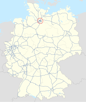
The federal motorway 25 (abbreviation: BAB 25 ) - short form: Autobahn 25 (abbreviation: A 25 ) - leads from the motorway triangle Hamburg-Südost via Bergedorf to Geesthacht .
The A 25 is also known as the Marschenautobahn because it runs exclusively through the flat marshland of the Hamburg Vier- und Marschlande as well as the march of two communities in the Duchy of Lauenburg .
history
The first considerations for building a Marschenstraße were made by the Hamburg city council as early as 1925 and taken up again in the 1960s when the B 5 , which ran further north, was increasingly reaching its capacity limits. After five possible routes had been examined in the preliminary planning, construction work began in 1978 and completion was scheduled for 1981.
Originally the A 25 was supposed to be extended southwards via Lauenburg / Elbe , Dannenberg (Elbe) , Klietz and Wustermark to the A 10 .
In Hamburg there were plans for a continuation via the Horner Kreisel ( A 24 ), City Nord and Hamburg Airport to the A 7 at Norderstedt . The plans for this so-called "Osttangente" have largely been abandoned, but there are still some preliminary construction work such as the bridge of the Jahnring and Hebebrandstrasse over the route that is still kept free. The Osttangente should run here as an extension of Sengelmannstrasse roughly parallel to the S-Bahn to the Barmbeck branch canal. This would have been built over for the A 25, as well as parts of the Osterbek Canal. Land areas along the planned motorway route were mainly kept free by allotment gardens. Large residential areas are to be built along the city park on these areas in the next few years. Parts of the planning can still be seen in the old but still valid development plans of the city of Hamburg. An example of this is the “Development plan Eilbek5 / Marienthal3”. In this there are still detailed plans for the course of the route as well as individual approaches.
With the Fuhlsbüttel bypass , a separate two-lane federal road was built in the 1990s along part of the A 25 plan. Along the southern extension in the Alsterdorf district, along the originally planned route, Sengelmannstrasse was expanded to two strips in each direction as far as Hebebrandstrasse .
A new residential area ( Pergolenviertel ) is currently being built on the areas to the east of City Nord , so that the originally planned continuous connection between Sengelmannstrasse and Saarlandstrasse can no longer be realized in the future.
Planning
In the course of the future Geesthacht bypass, it is planned to extend the A 25 to the B 404 near Hohenhorn and continue in the direction of Lauenburg / Elbe as a two-lane B 5 . The A 25 is to cross the Geesthang between its current end of the autobahn and the future Geesthacht-Nord junction. To do this, it is to be led over a 530 meter long road bridge and through a 75 meter long tunnel in order to overcome a height difference of 30 meters. This 90 million euro project is very controversial in the region due to the critics feared destruction of the natural area in the Bistal and the expected increase in traffic in the surrounding communities.
designation
Although the motorway runs mainly in a west-east direction, contrary to the usual system, it is numbered with an odd number, which otherwise only carries motorways in a north-south direction. The reason for this could be the planned route of the south-eastern section to the A 10 , which was later deleted from the planning.
See also
Web links
Individual evidence
- ↑ Birte Kaiser: Vier- und Marschlande. hamburg.de, accessed on June 19, 2011 .
- ↑ Timo Jann: Greatest danger on the construction site. In: Bergedorfer Zeitung. July 26, 2009. Retrieved June 19, 2011 .
- ^ The federal highway Hamburg – Geesthacht . In: Lichtwark-Heft No. 41 (1978), pp. 30-34.
- ↑ State Office Geoinformation and Surveying Hamburg: Planning law, development plan Eilbek5 / Marienthal3. (PDF) In: CITY AND LANDSCAPE PLANNING ONLINE (PLANPORTAL). May 23, 1966. Retrieved April 9, 2019 .
- ↑ Small inquiry - printed matter 15/2135. (PDF; 23 kB) Schleswig-Holstein State Parliament, accessed on January 30, 2013 .


