
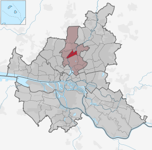
Hamburg-Alsterdorf
|
district of Hamburg |
|
|---|---|
  |
|
| Coordinates | 53 ° 36 '39 " N , 10 ° 0' 47" E |
| surface | 3.1 km² |
| Residents | 15,204 (Dec. 31, 2019) |
| Population density | 4905 inhabitants / km² |
| Post Code | 20251, 22297, 22335, 22337 |
| prefix | 040 |
| district | Hamburg North |
| Transport links | |
| Federal road |
|
| Subway |
|
| Source: Statistical Office for Hamburg and Schleswig-Holstein | |
Alsterdorf ( Low German : Alsterdbod ) is a district in the Hamburg-Nord district of the Free and Hanseatic City of Hamburg .
geography
Geographical location
Alsterdorf is located on the eponymous Alster , which flows through the district from northeast to southwest. Clockwise, Alsterdorf borders the Ohlsdorf district in the east, Winterhude and Eppendorf in the south and Groß Borstel in the west .
history
Alsterdorf was first mentioned in a document in 1219 as "Alsterthorpe" and since the 14th century it belonged alternately to the Harvestehude monastery (later St. Johannis monastery) and the Holstein office of Trittau, and in 1773 came under Danish administration. In 1803, in exchange for Bilsen near Quickborn, it finally came into Hamburg ownership, with which the city was able to close the last gap in its Alster ownership. Since 1830 it belonged to the rulership of the Geestlande .
Until the middle of the 19th century, Alsterdorf was a pure farming and craft village with fewer than 150 inhabitants. Around 1860 the pastor Heinrich Matthias Sengelmann , after whom a street in the district was later named, bought a cottage in the village and founded a home for the handicapped, today's Evangelical Foundation Alsterdorf . Since the 1870s, several bleachers and laundries have settled here, as well as Vera-Filmwerke in 1919 . From 1920 onwards the first residential quarters were built on Brabandstrasse and Inselstrasse, and from 1935–38 the garden city between Heilholtkamp and the elevated railway line .
Population development
| 1987 | 1988 | 1989 | 1990 | 1991 | 1992 | 1993 | 1994 | 1995 | 1996 | 1997 | 1998 | 1999 | 2000 | 2001 | 2002 | 2003 | 2004 | 2005 | 2006 |
| 12,455 | 12,487 | 12,551 | 12,563 | 12,520 | 12,449 | 12,622 | 12,577 | 12,476 | 12,209 | 12,027 | 11,847 | 11,827 | 12,180 | 12,379 | 12,480 | 12,723 | 12,825 | 12,872 | 12,955 |
statistics
- Minor quota: 16.5% [Hamburg average: 16.3% (2017)].
- Elderly rate: 18.9% [Hamburg average: 18.2% (2017)].
- Proportion of foreigners: 13.5% [Hamburg average: 17.1% (2017)].
- Unemployment rate: 3.9% [Hamburg average: 5.2% (2017)].
The average income per taxpayer in Alsterdorf is 52,426 euros annually (2013), the Hamburg average is 39,054 euros.
politics
For the election to Hamburg citizenship , Alsterdorf belongs to the constituency of Fuhlsbüttel-Alsterdorf-Langenhorn . In the 2015 general election , the SPD in the district came in at 48.0% (+0.2), the CDU at 15.0% (-7.5), the Greens at 12.4% (+0.4), FDP to 9.7% (+0.9), Die Linke to 5.9% (+1.4) and the AfD, who appeared for the first time, to 5.6%. All other parties together received 3.4% (–1.0).


Culture and sights
Buildings
The “ old crematorium ” of the main cemetery in Ohlsdorf is located in the Alsterdorf district on Alsterdorfer Strasse ( → Lage ). With the year of construction 1890/91 it is the oldest modern crematorium building in Germany. This included an urn grove that has now been leveled . It was replaced in 1933 by the " New Crematorium " on the nearby cemetery area of the main cemetery. After the threat of decay, the old crematorium was converted into a restaurant in 2000. In 2007 the building was sold and the conversion into a school began. The school concept was developed by the heads of Kinderwelt Hamburg e. V. developed. In September 2009 the bilingual future school Flachsland opened with rooms for 120 primary children and 60 elementary children.
Cemeteries in Alsterdorf
Urn cemetery of the cremation association in Hamburg :
Between 1904 and 1955, the burial area on the premises of the so-called old crematorium was used for urn burials . The operating company, the Hamburg Cremation Association, handed over the management of the cemetery area to the main cemetery in Ohlsdorf in 1915.
Parks
Part of the Alster hiking trail runs through Alsterdorf. This section, which is located directly on the Alster river, belongs to the upper Alster (also: Streek).
Sports
The SC Sperber Hamburg from 1898 is the local sports club. His soccer team played from 1966 to 1969 and from 1970 to 1972 in the North Regional Football League .
Economy and Infrastructure
traffic
With the Sengelmannstraße and Alsterdorf stops, there are two stops on Hamburg's subway line 1 in the district. The journey time with the U1 to the station of Hamburg Central Station (south) is 18 to 20 minutes. The track of the freight bypass runs parallel to the underground line .
In addition, the district is diverse buses of HVV developed. In particular, the city bus route 109 , also known as Alsterdorfer , crosses large parts of the district and offers connections to the neighboring Winterhude (Lattenkamp, Winterhuder Marktplatz, Sierichstraße) and further via Harvestehude and Rotherbaum towards the city center. In addition, the Metrobus 23 connects Alsterdorf with Fuhlsbüttel and continues to Niendorf on the one hand and Barmbek on the other. The Metrobus 26 also provides a cross connection to Barmbek as well as Winterhude and Eppendorf .

Alsterdorf underground station

Alsterdorf underground station

Sengelmannstrasse underground station


Public facilities

literature
- From Altona to Zollenspieker. The Haspa manual for all districts of the Hanseatic city , Hoffmann and Campe, Hamburg 2001. ISBN 3-455-11333-8 . Article about Alsterdorf.
See also
Due to administrative reform, areas of Alsterdorf went to Winterhude:
further:
- List of streets and bridges in Hamburg-Alsterdorf
- List of cultural monuments in Hamburg-Alsterdorf
- List of stumbling blocks in Hamburg-Alsterdorf
Web links
Alsterdorf | Barmbek-North | Barmbek-Süd | Dulsberg | Eppendorf | Fuhlsbüttel | Groß Borstel | Hoheluft-Ost | Hohenfelde | Langenhorn | Ohlsdorf | Uhlenhorst | Winterhude
Individual evidence
- ↑ Quota of minors in the Hamburg districts in 2017
- ↑ Proportion of 65-year-olds and older in the Hamburg districts in 2017
- ↑ Proportion of foreigners in the Hamburg districts in 2017
- ↑ Unemployment rate in the Hamburg districts in 2017
- ↑ Statistical Office for Hamburg and Schleswig-Holstein (ed.): Hamburg District Profile 2016 (= NORD.regional . Volume 19 ). 2018, ISSN 1863-9518 ( Online PDF 6.6 MB [accessed February 12, 2018]).
- ↑ http://www.wahlen-hamburg.de/wahlen.php?site=left/gebiete&wahltyp=3#index.php?site=right/result&wahl=973&gebiet=2&typ=4&stimme=1&gID=5&gTyp=2
- ^ Hermann Hipp , Free and Hanseatic City of Hamburg, History, Culture and Urban Architecture on the Elbe and Alster , DuMont Buchverlag, Cologne 1990, p. 401, ISBN 3-7701-1590-2 .
- ^ Website of the future school Flachsland . Retrieved October 1, 2011
- ↑ http://www.hvv.de/pdf/plaene/hvv_tarifplan_sum.pdf