
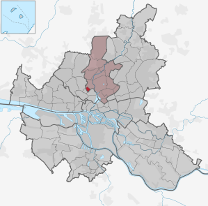
Hamburg-Hoheluft-Ost
|
district of Hamburg |
|
|---|---|
  |
|
| Coordinates | 53 ° 35 '5 " N , 9 ° 58' 34" E |
| surface | 0.6 km² |
| Residents | 9694 (Dec. 31, 2019) |
| Population density | 16,157 inhabitants / km² |
| Post Code | 20144, 20249, 20251, 20253 |
| prefix | 040 |
| district | Hamburg North |
| Transport links | |
| Federal road |
|
| Subway |
|
| Source: Statistical Office for Hamburg and Schleswig-Holstein | |
Hoheluft-Ost is a district of the Free and Hanseatic City of Hamburg , which is characterized by its largely preserved Wilhelminian style architecture. With around 16,200 inhabitants per square kilometer (end of 2013), the district, together with the neighboring Hoheluft-West, is one of the most densely populated districts in Germany.
geography
Hoheluft-Ost is located in the Hamburg-Nord district . The district has the shape of a square , with sides between 600 and 700 meters (east-west sides) and 900–1000 meters (north-south sides). The district is bordered to the south-east by the Isebek Canal , on the other side of which Harvestehude begins. To the southwest, the Hoheluftchaussee forms the border of the district with Hoheluft-West , more precisely with its general district . To the northwest, Hoheluft-Ost extends to Martinistraße, on the other side of which Lokstedt ( Hoheluft Stadium ) or Eppendorf ( UKE ) begins. To the northeast, Curschmannstrasse and Eppendorfer Baum are the border with Eppendorf.
Within these very narrow limits, the busy Breitenfelder Straße ( B5 , Ring 2 ) is the main traffic axis, while Eppendorfer Weg and Lehmweg are also larger streets.
history
→ For the development of the district before 1951, see : History of Hoheluft

In 1951, Hoheluft-Ost became an independent district in the Hamburg-Nord district. He was previously part of Eppendorf and its structure is influenced by developments there. The residential development is determined by houses from the Wilhelminian era , a well-known residential area are the Falkenried terraces , which are in the tradition of the Hamburg residential terraces .
The vehicle workshops in Falkenried emerged from the depot of the street railway company (SEG) built in 1892 on the street of the same name and produced from 1894 a. a. Tram vehicles initially for Hamburg, a short time later for all over the world. In 1999 the subsidiary of Hamburger Hochbahn moved from Hoheluft to Hamburg-Hummelsbüttel . The vacated area was redeveloped and today houses living space, shops and offices on the newly created street Tram Ring, which reminds of the previous use of the site. Some of the old offices, garages, and halls have been preserved; However, a number of new buildings were also built on the site.
statistics
- Minor quota: 13.4% [Hamburg average: 16.3% (2017)].
- Elderly rate: 15.5% [Hamburg average: 18.2% (2017)].
- Proportion of foreigners: 10.5% [Hamburg average: 17.1% (2017)].
- Unemployment rate: 3.0% [Hamburg average: 5.2% (2017)].
The average income per taxpayer in Hoheluft-Ost is 52,006 annually (2013), the Hamburg average is 39,054 euros.
Politics and election results
For the election to the Hamburg citizenship and the district assembly , Hoheluft-Ost belongs to the constituency of Eppendorf-Winterhude .
| Citizenship election |
Hoheluft-Ost | ||||||
|---|---|---|---|---|---|---|---|
| SPD | Green 1 | CDU | FDP | Left 2 | AfD | Rest | |
| 2015 | 42.7% | 18.6% | 13.6% | 10.8% | 8.4% | 2.1% | 3.8% |
| 2011 | 47.4% | 17.1% | 15.8% | 9.8% | 5.7% | - | 4.2% |
| 2008 | 34.8% | 14.6% | 39.4% | 5.3% | 4.8% | - | 1.0% |
| 2004 | 33.8% | 21.7% | 37.4% | 2.9% | - | - | 4.2% |
| 2001 | 39.5% | 21.8% | 17.9% | 5.9% | 0.4% | - | 14.5% 3 |
| 1997 | 35.3% | 25.7% | 24.3% | 4.6% | 0.6% | - | 9.5% |
| 1993 | 39.2% | 26.8% | 17.8% | 4.5% | - | - | 11.7% |
| 1991 | 50.8% | 14.8% | 24.9% | 5.7% | 0.7% | - | 3.1% |
| 1987 | 49.7% | 14.1% | 28.6% | 6.3% | - | - | 1.3% |
| 1986 | 41.9% | 20.1% | 31.6% | 5.3% | - | - | 1.1% |
| December 1982 | 52.7% | 13.5% | 30.2% | 2.6% | - | - | 1.0% |
| June 1982 | 44.6% | 14.2% | 34.7% | 4.6% | - | - | 1.9% |
| 1978 | 50.6% | 8.0% | 30.8% | 6.5% | - | - | 4.1% |
| 1974 | 45.7% | - | 37.0% | 12.5% | - | - | 3.8% |
| 1970 | 55.3% | - | 31.8% | 7.4% | - | - | 4.5% |
| 1966 | 57.0% | - | 30.8% | 7.6% | - | - | 4.6% |
1) 1978 as a colorful list - defend yourself , 1982 to 2011 as Greens / GAL
2) 1991 and 1997 as PDS / Left List, 2001 as PDS
3) Including 10.2% for the Schill Party
Economy and Infrastructure
education

The district school Eppendorf (former Lyzeum Curschmannstrasse and elementary school Löwenstrasse) and the elementary school Eppendorf are despite their name on the northeast corner of the district, bordered by Curschmannstrasse, Martinistrasse, Breitenfelder Strasse and Löwenstrasse. The district school building, which is now a listed building, was built in 1926–1928 according to plans by Fritz Höger .

The upper school building of the Ida-Ehre-Schule (formerly Jahnschule) has been housed at Lehmweg 14 since 1984 . The school building was built in 1898 according to plans by Carl Johann Christian Zimmermann for the Lehmweg elementary school and is a listed building.
traffic
At the intersection of the Hoheluftchaussee with the Gärtnerstraße - Breitenfelder Straße (part of the Ring 2 ), the federal road 447 branches off from the federal road 5 . Both major streets have two lanes in each direction.
On May 5, 1870, a horse-drawn tram was laid through the Hoheluftchaussee to the former border house (at Martinistraße) and electrified in 1894. In 1900 this line was given the number 2, and as 2 or from 1925 to 1953 also as 22 and later also with the amplifier line 4, the tram ran there until 1978.
There are no longer any facilities for rail traffic in Hoheluft-Ost since the last tram line 2 was closed in 1978. The existing since 1912 Hoheluftbrücke the underground - U3 (Ring Line) is beyond the Isebekkanals in Harvestehude . The former tram route in the middle of the Hoheluftchaussee is now used as a bus lane; Metrobus line 5, which runs there, is one of the busiest bus routes in Germany with around 60,000 passengers a day (as of 2007).
There are few parking spaces in the district as no underground car parks were built when the Wilhelminian style houses were built. However, with 0.287 vehicles per resident (as of 2017), the residents of Hoheluft also have significantly fewer vehicles than the average in the district or in the city.
Buildings
- St. Markus at Heider Strasse 1, Protestant church
- Eben-Ezer-Kirche at Abendrothsweg 43, an Evangelical Methodist church
- New Apostolic Church on Abendrothsweg 18
- Das Onkel Pö , a former jazz club on the corner of Lehmweg and Eppendorfer Weg
- Ensemble of former vehicle workshops in Falkenried Hallen, administration and porter building on today's tram ring
- The Falkenried terraces , former workers' apartments of the Falkenried vehicle workshops
literature
- Karin Kuppig: Eppendorfbuch: with Grindelviertel, Harvestehude, Rotherbaum, Hoheluft-Ost and Groß Borstel . Junius, Hamburg 2014, ISBN 978-3-88506-045-1 .
See also
- List of streets in Hamburg-Hoheluft-Ost
- List of cultural monuments in Hamburg-Hoheluft-Ost
- List of stumbling blocks in Hamburg-Hoheluft-Ost
Web links
Individual evidence
- ^ Matthias Iken : Eppendorf on the water . In: Hamburger Abendblatt from September 29, 2011.
- ↑ Statistical Office for Hamburg and Schleswig-Holstein (ed.): Area structure Hamburg . (Spatial breakdown from January 1, 2011)
- ↑ Quota of minors in the Hamburg districts in 2017
- ↑ Proportion of 65-year-olds and older in the Hamburg districts in 2017
- ↑ Proportion of foreigners in the Hamburg districts in 2017
- ↑ Unemployment rate in the Hamburg districts in 2017
- ↑ Statistical Office for Hamburg and Schleswig-Holstein (ed.): Hamburg District Profile 2016 (= NORD.regional . Volume 19 ). 2018, ISSN 1863-9518 ( Online PDF 6.6 MB [accessed February 12, 2018]).
- ↑ Matthias Iken: Lots of people - little space . In: Hamburger Abendblatt from December 16, 2017
Alsterdorf | Barmbek-North | Barmbek-Süd | Dulsberg | Eppendorf | Fuhlsbüttel | Groß Borstel | Hoheluft-Ost | Hohenfelde | Langenhorn | Ohlsdorf | Uhlenhorst | Winterhude