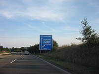
Federal motorway 65
| Bundesautobahn 65 in Germany | ||||||||||||||||||||||||||||||||||||||||||||||||||||||||||||||||||||||||||||||||||||||||||||||||||||||||||||||||

|
||||||||||||||||||||||||||||||||||||||||||||||||||||||||||||||||||||||||||||||||||||||||||||||||||||||||||||||||
| map | ||||||||||||||||||||||||||||||||||||||||||||||||||||||||||||||||||||||||||||||||||||||||||||||||||||||||||||||||
| Basic data | ||||||||||||||||||||||||||||||||||||||||||||||||||||||||||||||||||||||||||||||||||||||||||||||||||||||||||||||||
| Operator: |
|
|||||||||||||||||||||||||||||||||||||||||||||||||||||||||||||||||||||||||||||||||||||||||||||||||||||||||||||||
| Start of the street: |
Mutterstadt ( 49 ° 27 ′ N , 8 ° 22 ′ E ) |
|||||||||||||||||||||||||||||||||||||||||||||||||||||||||||||||||||||||||||||||||||||||||||||||||||||||||||||||
| End of street: |
Wörther Kreuz ( 49 ° 2 ′ N , 8 ° 16 ′ E ) |
|||||||||||||||||||||||||||||||||||||||||||||||||||||||||||||||||||||||||||||||||||||||||||||||||||||||||||||||
| Overall length: | 59 km | |||||||||||||||||||||||||||||||||||||||||||||||||||||||||||||||||||||||||||||||||||||||||||||||||||||||||||||||
|
State : |
||||||||||||||||||||||||||||||||||||||||||||||||||||||||||||||||||||||||||||||||||||||||||||||||||||||||||||||||
| The motorway in front of the AS Kandel-Nord | ||||||||||||||||||||||||||||||||||||||||||||||||||||||||||||||||||||||||||||||||||||||||||||||||||||||||||||||||
|
Course of the road
|
||||||||||||||||||||||||||||||||||||||||||||||||||||||||||||||||||||||||||||||||||||||||||||||||||||||||||||||||
The federal highway 65 (abbreviation: BAB 65 ) - short form: Autobahn 65 (abbreviation: A 65 ) - leads from the Autobahn triangle Ludwigshafen- Süd (connection to federal highway 9 ) via Neustadt an der Weinstrasse , Landau in der Pfalz , Kandel to Wörth am Rhein , where it ends just before the Wörther Kreuz . From Wörth it goes over to the Südtangente (Karlsruhe) . The further course of the road to Karlsruhe is dedicated as B 10 or K 9657 and K 9652.
Closing the gap in the motorway between Kandel or Wörth am Rhein and the French Lauterburg is controversial , especially because of the ecological consequences for the Bienwald . From the border, the French A 35 continues to Strasbourg . The route is no longer included in the draft of the Federal Transport Infrastructure Plan 2030.
The last missing section between Wörth and Ludwigshafen am Rhein was the Neustadt – Landau line, which was opened in the early 1990s.
Connections to federal highways:
Federal motorway 652
The so-called federal motorway 652 (abbreviation: BAB 652 ) - short form: Autobahn 652 (abbreviation: A 652 ) - was planned from Ludwigshafen am Rhein via Wörth am Rhein , Karlsruhe , Grötzingen to Walzbachtal . The section from Ludwigshafen to Wörther Kreuz has been implemented so far and was renumbered as A 65 as early as 1980.
Between Kandel and Wörth, the A 65 was designated as the A 652 for several years, but was not signposted as such.
Trivia
Although the Maximiliansau junction is part of the B 10, it is officially listed as AS no. 25 is signposted and takes up the numbering of the A 65.
Individual evidence
Web links
- Detailed route description of the federal motorway 65
- Detailed route description of the section of the motorway that was previously signposted as the 652 federal motorway


