Bundesstrasse 39
| Bundesstrasse 39 in Germany | ||||||||||||||||||||||||||||||||||||||||||||||||||||||||||||||||||||||||||||||||||||||||||||||||||||||||||||||||||||||||||||||||||||||||||||||||||||||||||||||||||||||||||||||||||||||||||||||||||||||||||||||||

|
||||||||||||||||||||||||||||||||||||||||||||||||||||||||||||||||||||||||||||||||||||||||||||||||||||||||||||||||||||||||||||||||||||||||||||||||||||||||||||||||||||||||||||||||||||||||||||||||||||||||||||||||
| map | ||||||||||||||||||||||||||||||||||||||||||||||||||||||||||||||||||||||||||||||||||||||||||||||||||||||||||||||||||||||||||||||||||||||||||||||||||||||||||||||||||||||||||||||||||||||||||||||||||||||||||||||||
| Basic data | ||||||||||||||||||||||||||||||||||||||||||||||||||||||||||||||||||||||||||||||||||||||||||||||||||||||||||||||||||||||||||||||||||||||||||||||||||||||||||||||||||||||||||||||||||||||||||||||||||||||||||||||||
| Operator: |
|
|||||||||||||||||||||||||||||||||||||||||||||||||||||||||||||||||||||||||||||||||||||||||||||||||||||||||||||||||||||||||||||||||||||||||||||||||||||||||||||||||||||||||||||||||||||||||||||||||||||||||||||||
| Start of the street: |
Frankenstein ( 49 ° 26 ′ N , 7 ° 59 ′ E ) |
|||||||||||||||||||||||||||||||||||||||||||||||||||||||||||||||||||||||||||||||||||||||||||||||||||||||||||||||||||||||||||||||||||||||||||||||||||||||||||||||||||||||||||||||||||||||||||||||||||||||||||||||
| End of street: |
Mainhardt ( 49 ° 4 ′ N , 9 ° 33 ′ E ) |
|||||||||||||||||||||||||||||||||||||||||||||||||||||||||||||||||||||||||||||||||||||||||||||||||||||||||||||||||||||||||||||||||||||||||||||||||||||||||||||||||||||||||||||||||||||||||||||||||||||||||||||||
| Overall length: | 143 km | |||||||||||||||||||||||||||||||||||||||||||||||||||||||||||||||||||||||||||||||||||||||||||||||||||||||||||||||||||||||||||||||||||||||||||||||||||||||||||||||||||||||||||||||||||||||||||||||||||||||||||||||
|
State : |
||||||||||||||||||||||||||||||||||||||||||||||||||||||||||||||||||||||||||||||||||||||||||||||||||||||||||||||||||||||||||||||||||||||||||||||||||||||||||||||||||||||||||||||||||||||||||||||||||||||||||||||||
| Requirement for use: | partly truck toll | |||||||||||||||||||||||||||||||||||||||||||||||||||||||||||||||||||||||||||||||||||||||||||||||||||||||||||||||||||||||||||||||||||||||||||||||||||||||||||||||||||||||||||||||||||||||||||||||||||||||||||||||
| Development condition: | two-lane | |||||||||||||||||||||||||||||||||||||||||||||||||||||||||||||||||||||||||||||||||||||||||||||||||||||||||||||||||||||||||||||||||||||||||||||||||||||||||||||||||||||||||||||||||||||||||||||||||||||||||||||||
| The motorway-like B 39 near Hockenheim | ||||||||||||||||||||||||||||||||||||||||||||||||||||||||||||||||||||||||||||||||||||||||||||||||||||||||||||||||||||||||||||||||||||||||||||||||||||||||||||||||||||||||||||||||||||||||||||||||||||||||||||||||
|
Course of the road
|
||||||||||||||||||||||||||||||||||||||||||||||||||||||||||||||||||||||||||||||||||||||||||||||||||||||||||||||||||||||||||||||||||||||||||||||||||||||||||||||||||||||||||||||||||||||||||||||||||||||||||||||||

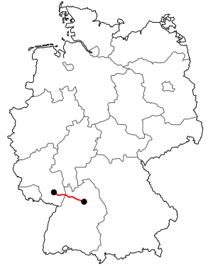
The federal highway 39 (abbreviation: B 39 ) leads from Frankenstein in the Palatinate Forest with interruptions by downgrading to Mainhardt in Baden-Württemberg . The road runs in Rhineland-Palatinate via Lambrecht , Neustadt an der Weinstrasse , Speyer and in Baden-Württemberg via Hockenheim and ends south of Schwetzingen at the Schwetzingen / Hockenheim intersection. The second section leads from the Rauenberg cross via Sinsheim and Heilbronn to Mainhardt. It crosses the A 65 , A 6 and A 81 motorways and the Rhine at Speyer via the Salier Bridge .
The length is 143 km.
history
origin
The origins of the road lie in the Roman road from Speyer via Wiesloch to the Limes to Bad Wimpfen . In the Middle Ages, the Hohe Straße from Heidelberg to Heilbronn existed on approximately this route, which gained in importance and traffic due to the construction of a road between Steinsfurt and Fürfeld that was changed in detail from 1780-89 . Fürfeld was important because of its post office in the Ritter inn , and from the early 19th century onwards as a border town to Baden in Württemberg. The customs office was also located there until the German Customs Association was founded .
In 1812, the western section between Altlußheim and Wiesloch was also expanded to become a Chaussee.
Previous routes and names
With the original numbering in 1932, the then long-distance road 39 (FVS 39), called Reichsstraße 39 (R 39) from 1934, only ran from Frankenstein to Neustadt an der Weinstraße. The section between Speyer and Heilbronn consisted of numerous side streets (as of 1901):
| country | State road | length | course |
|---|---|---|---|
| Württemberg | No. 15 | 30.4 km | Mainhardt – Heilbronn |
| Württemberg | No. 122 | 15.1 km | Heilbronn – state border (–Sinsheim) |
| to bathe | No. 3 | 18.9 km | (Heilbronn–) State border – Sinsheim (–Heidelberg) |
| to bathe | No. 77 | approx. 8 km | (Aglasterhausen–) Sinsheim – Langenbrücken (today's federal highway 292 ) |
| to bathe | # 172 | 8.9 km | (Elsenz–) Eichtersheim – Wiesloch |
| to bathe | No. 141 | 14.3 km | Wiesloch-Altlußheim |
| to bathe | No. 78 | 5.9 km | Hockenheim – Speyer |
These side streets were only combined to form Reichsstraße 39 in 1937. The B 39 runs together with the B 292 between Sinsheim and Angelbachtal-Eichtersheim.
Substitutions and gradations
Between Neulußheim and the Wiesloch / Rauenberg junction of the A 6, the B 39 was downgraded to a state road (L 723) in 2004.
As part of the gradation of the B 36 between Graben-Neudorf and Neulußheim on January 1, 2016, the remainder of the B 36 from the Schwetzingen / Hockenheim junction to Neulußheim was added to the B 39.
See also
Web links
Individual evidence
- ↑ westernacher.com: Location Münchäckerweg 1, 69168 Wiesloch, Germany . (No longer available online.) Archived from the original on December 2, 2013 ; Retrieved November 23, 2013 .
- ^ Reilingen.de: Bundesstrasse 39 becomes state road . Retrieved November 23, 2013 .

