
Speyerbach
|
Speyerbach lower section: Gießhübelbach |
||
 Course of the Speyerbach through the Palatinate Forest and the Rhine plain to the Rhine |
||
| Data | ||
| Water code | EN : 2378 | |
| location |
Palatinate Forest
|
|
| River system | Rhine | |
| Drain over | Rhine → North Sea | |
| origin | at Speyerbrunn 49 ° 20 ′ 59 ″ N , 7 ° 52 ′ 13 ″ E |
|
| Source height | approx. 300 m above sea level NHN slope source near Speyerbrunn |
|
| muzzle | in Speyer from the left into the Rhine Coordinates: 49 ° 19 '10 " N , 8 ° 26' 58" E 49 ° 19 '10 " N , 8 ° 26' 58" E |
|
| Mouth height | 92 m above sea level NHN | |
| Height difference | approx. 208 m | |
| Bottom slope | approx. 3.5 ‰ | |
| length | 60.1 km (with Erlenbach ) | |
| Catchment area | 595.806 km² | |
| Discharge at the Neustadt Weinstraße A Eo gauge : 312 km² Location: 25.6 km above the mouth |
NNQ (07/20/1976) MNQ 1946/2009 MQ 1946/2009 Mq 1946/2009 MHQ 1946/2009 HHQ (05/25/1978) |
870 l / s 1.29 m³ / s 2.22 m³ / s 7.1 l / (s km²) 7.71 m³ / s 19.5 m³ / s |
| Outflow A Eo : 595.58 km² |
MNQ MQ Mq MHQ |
970 l / s 3.03 m³ / s 5.1 l / (s km²) 13.3 m³ / s |
| Left tributaries | see section Inflows and branches | |
| Right tributaries | see section Inflows and branches | |
| Medium-sized cities | Neustadt , Speyer | |
| Small towns | Lambrecht | |
| Communities | Elmstein , Esthal , Frankeneck , Hanhofen , Dudenhofen | |
| Residents in the catchment area | 130,000 | |
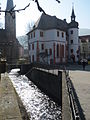
 Speyerbach in the local area of Speyer |
||
 Speyerbach in the center of Neustadt |
||
The Speyerbach is a left tributary of the Rhine in the Palatinate ( Rhineland-Palatinate ) coming from the west . It is classified as a second order water body . On the municipal side, the Rehbach-Speyerbach water association , which was founded in 1985 and is based in Ludwigshafen , is responsible for its support .
The Speyerbach forms one of the four major drainage systems in the Palatinate Forest . The upper course and its tributaries divide the middle part of this mountain range with a branched valley system . On its south-east facing lower course in the Upper Rhine Plain , the Speyerbach is then the strongest flowing water in the Vorderpfalz , although it loses part of its water volume with three large river bifurcations , which it only receives back in the third case. Smaller branches and returns, which in the past were mostly created for the purpose of agricultural irrigation and are of minor importance, are only mentioned in this article as an exception.
overview

From the source to the mouth , the Speyerbach is a good 60 km long, its catchment area covers 596 km². At the gauge in Neustadt an der Weinstrasse , i.e. when it exits the mountains, it has an average of around 2.4 m³ / s of water ( MQ ); the peak value measured so far was 19.5 m³ / s on May 25, 1978.
In Neustadt the Rehbach branches off to the left in an artificially created bifurcation, the Winzinger Wassergescheid , with only two thirds of the water channel remaining to the Speyerbach. In the Neustadt district of Speyerdorf it loses water again at the Ranschgraben branching off to the left . At Hanhofer Wassergescheid , the Woogbach , also called Nonnengraben , is diverted to the left (water division ratio 1: 1), which, however, flows back just before the confluence with the Speyerbach. Due to this return flow and smaller tributaries, the mean discharge of the Speyerbach increases to a good 3 m³ / s up to the mouth.
In general, the western tributaries of the Rhine in the Rhine plain follow their natural gradient by flowing to the northeast. Deviating from this, the lower Speyerbach runs in a south-easterly direction on the southern edge of its large alluvial fan made of sediments ; because possibly since Roman times , but at least since the Carolingian era 1200 years ago, the brook has been led to Speyer in an artificially created bed . Where a section is also called Gießhübelbach , it flows into the Upper Rhine .
geography
course

"Speyerbach-Ursprung" with Ritterstein 254
Gießhübelbach estuary under the Speyer old town


The Speyerbach rises nominally at around 300 m above sea level. NHN in the center of the Palatinate Forest directly east of the Palatinate main watershed near Speyerbrunn , which is part of the Elmstein community . The surrounding mountains of the Middle Franconian Pasture are up to 608 m high ( Eschkopf ). Right next to its alleged spring pond, which is marked by Ritterstein 254, the Speyerbach takes up the much stronger Erlenbach , which emerges 5 km further south on the Eschkopf massif in the 460 m high Husarenbrunnen and hydrologically is considered the actual Speyerbach spring.
Initially mainly in an easterly direction, later in a north-easterly direction, the Speyerbach initially winds through the relatively narrow Elmsteiner Valley , where it also flows through the municipality's main town, Elmstein. 5 km downstream from Elmstein, the strong Helmbach tributary flows from the right at the hamlet of the same name . The Speyerbach receives its most important water supplier, the 21 km long Hochspeyerbach , from the left below Frankeneck , where the wider Lambrecht valley begins. There the Speyerbach turns to the southeast and flows through the small town of Lambrecht .
Shortly before Neustadt an der Weinstrasse, the Speyerbach emerges from the Palatinate Forest, whose striking eastern edge, the Haardt , towers over the valley by around 300 m . The nature reserve on Wolfsberg extends to the left above the valley cut .
In Neustadt, the Speyerbach crosses the narrow, vine -covered hill country on both sides of the German Wine Route . In the northeast of the Winzingen district , the Rehbach, which becomes an estuary of the Speyerbach, is diverted to the left at the Winzinger Wassergescheid, which was laid out before 1551.
The Speyerbach flows through the Upper Rhine Plain in a south-easterly direction. He touches the Neustadt district of Speyerdorf, where the Ranschgraben branches off to the left, as well as the communities Hanhofen and Dudenhofen . Shortly before Hanhofen the Kropsbach flows from the right , immediately afterwards the Woogbach separates to the left with half the amount of water. In the course of the next 3 km the right main arm Speyerbach crosses the short Altwiesenbach , then the Modenbach flows towards it from the right ; the Hainbach, on the other hand, crosses under the Speyerbach from right to left in a dole in southern Dudenhofen. After taking up the Hainbach, the Woogbach, now called Nonnenbach , joins the Speyerbach, which is also called Gießhübelbach here, at the Holzmarkt in Speyer . This flows into the Rhine at the Speyer harbor at 400.3 km / 92 m above sea level.
Tributaries and branches
Data according to the following table
- GeoExplorer of the Rhineland-Palatinate Water Management Authority ( information ) and
- Map service of the landscape information system of the Rhineland-Palatinate Nature Conservation Administration (LANIS map) ( notes )
Altitude information mostly based on the contour lines on the map service with the accuracy that can be expected. The water code number (GKZ), in Germany the official river code number , if possible according to the Geoexplorer. For the bodies of water that were not recorded there, instead of the water body number that was probably not assigned at all, their prefix, which can be reliably determined according to the system, was written and ended with "?". A separator was always inserted after the prefix “2378”, which stands for the Speyerbach itself and its upper course Erlenbach and is the prefix of the river code numbers of all tributaries for easier readability. Length and catchment area also measured according to the Geoexplorer if possible, otherwise on the map service.
| Stat. (km) |
GKZ | Surname | from / to |
Length (km) |
EZG (km²) |
Mouth | Mouth height (m above sea level ) |
Source location | Source height (m above sea level) |
comment |
|---|---|---|---|---|---|---|---|---|---|---|
| 56.5 | 2378-112 | (Stream from the front hole ) | right | 1.4 | 1.2 | Elmstein - Erlenbach , down before Elmstein- Speyerbrunn | 317 | Schüllermannsbrunnen , north of the Schindhübel | 435 | |
| 55.2 | 2378-119? | (Inflow from the Speyerbach "source") | Left | 0.0 | 0.0 | Elmstein-Speyerbrunn, "source pond" | 293 | Elmstein-Speyerbrunn, spur of the Erlenbach and Schwarzbachtal valleys | 300 | From here name Speyerbach |
| 55.2 | 2378-12 | Schwarzbach | Left | 3.8 | 6.2 | Elmstein-Speyerbrunn, outskirts | 293 | Elmstein- Schwarzbach , southern edge | 405 | |
| 54.7 | 2378-14 | Enkenbach | Left | 2.6 | 2.6 | Elmstein-Speyerbrunn, down before Elmstein- Mückenwiese | 284 | Elmstein, forest corridor, under Riesenberg | 468 | |
| 53.6 | 2378-152 | (Stream from the Mückental ) | Left | 0.9 | 1.3 | Elmstein-Mückenwiese, location | 273 | Elmstein-Mückenwiese, northwestern valley floor | 321 | |
| 53.0 | 2378-16 | Weltersbach | Left | 2.8 | 3.1 | Elmstein-Mückenwiese, east-down | 264 | Elmstein, southeast under the Weltersberg | 352 | |
| 52.4 | 2378-171? | (Stream from the Klaffental ) | right | 0.8 | 0.8 | Elmstein, opposite. the Lower Oselkopf | 258 | Elmstein, northeast under the Elector's Chair | 350 | |
| 51.6 | 2378-172 | Oselbach | Left | 2.1 | 2.3 | Elmstein, halfway from Elmstein-Mückenwiese | 248 | Elmstein, east foot of the Hohe Oselkopf | 347 | |
| 50.0 | 2378-18 | Legelbach | Left | 4.2 | 9.8 | Elmstein, little oh. Start of location | 232 | Elmstein, indulgence of the large hermitage | 345 | |
| 49.4 | 2378-192 | Möllbach | right | 1.1 | 0.9 | Elmstein, after the first houses on the Ehrenfels | 227 | Elmstein, north foot Möllberg | 362 | A branch at the right foot of the slope only ends about 0.3 km further down over a pond |
| 48.3 | 2378-194 | Haselbach | right | 3.2 | 3.4 | Elmstein, location, near Neue Forststraße | 220 | Bloskülb , northeast foot , at Stamminger Brunnen | 380 | |
| 43.9 | 2378-2 | Helmbach | right | 11.0 | 53.6 | Elmstein- Helmbach , stopping point | 198 | Landau city forest , northwest in the Teufelstal | 385 | |
| 42.1 | 2378-32 | Argenbach | right | 5.5 | 10.9 | Esthal - Breitenstein | 193 | Schafkopf , western slope | 497 | |
| 42.0 | 2378-34 | Breitenbach | Left | 6.7 | 13.2 | Esthal-Breitenstein | 192 | Esthal, Heidenkopf , Südfuß | 337 | |
| 40.2 | 2378-352 | (Stream from the Erfensteiner valley ) | Left | 1.5 | 1.8 | Esthal- Erfenstein | 186 | Esthal, Mittlerer Gleisberg , southeast foot | 294 | |
| 40.1 | 2378-36 | Hellish valley brook | right | 2.7 | 4.3 | Esthal-Erfenstein | 185 | Neustadt an der Weinstrasse , Hellerhütte , west below | 310 | |
| 37.1 | 2378-38 | Esthalbach | Left | 4.4 | 7.8 | Frankeneck , south end | 174 | Esthal, Mollenkopf , Südostfuß | 330 | |
| 35.3 | 2378-4 | Hochspeyerbach | Left | 21.3 | 119.3 | Frankeneck, Ostend | 169 | Hochspeyer , northwest in the forest at Hundsbrunnen | 295 | Hydrological source branch |
| 33.9 | 2378-52 | Luhrbach | Left | 2.1 | 2.3 | Lambrecht , near Friedrich-Ebert-Platz | 166 | Deidesheim , north of Forsthaus Luhrbach | 310 | |
| 31.9 | 2378-54 | Schlangentalbach | Left | 3.8 | 6.1 | Lindenberg , opposite. Settlement area New machine | 159 | Deidesheim, east foot of the Stoppelkopf | 308 | |
| 29.7 | 2378-56 | Heidenbrunnertalbach | right | 4.1 | 5.3 | Neustadt an der Weinstrasse | 150 | Neustadt an der Weinstrasse, Ostfuß Überzwerchberg | 360 | |
| 28.8 | 2378-58 | Kaltenbrunnertalbach | right | 6.6 | 10.9 | Neustadt, Wolfsburgstrasse | 148 | Kalmit , west foot | 405 | |
| 25.3 | 2378-591? | Floßbach | Left | 1.6 | 2.5 | Neustadt- Winzingen , northern edge | 131 | Departure: Neustadt, west of the city center | 135 | Branch off to the left from the Speyerbach directly below the Casimirianum |
| 25.1 |
(23798) |
→ Rehbach / Rehgraben | → left | 38.0 | 149.9 | Departure: Neustadt, northeast edge ( Winzinger Wassergescheid ) | 130 | Estuary: Ludwigshafen - Rheingönheim | 90 | Branch to the left from the Speyerbach, confluence with the Rhine |
| 20.2 | 2378-591? | Bürgergraben / Enggraben | right | 2.4 | ? | Neustadt- Speyerdorf , northwest | 122 | Neustadt, eastern edge | 127 | |
| 19.7 | 2378-591? | Central ditch | right | 1.8 | ? | Neustadt-Speyerdorf, northern edge | 121 | Neustadt, A 65, Untere Benzenwiese | 123 | |
| 17.1 | 2378-592 | Pea dig | Left | 3.9 | 3.0 | Neustadt-Schlittern | 116 | Departure: Neustadt-Speyerdorf, northwest | 122 | Turn left from the Speyerbach just before the Bürgergraben |
| 16.3 |
(237988) |
→ Ranschgraben | → left | 18.4 | 62.1 | Departure: Haßloch - Fronmühle | 113 | Estuary: Limburgerhof- Rehhütte | 95 | Branch off to the left from the Speyerbach, confluence with the Rehbach. Name segments: Waldgraben → Bruchgraben / Bruchbach → Ranschgraben |
| 13.3 |
(2379882) |
→ Kandelgraben | → left | 5.5 | 2.9 | Departure: Haßloch- Bruchhof , southwest | 111 | Estuary: Böhl-Iggelheim , Lehenbruch nature reserve | 105 | Branch to the left from the Speyerbach, confluence with the Ranschgraben, see. O. |
| 9.1 | 2378-6 | Kropsbach | right | 22.0 | 105.0 | Hanhofen , western edge | 107 | Schafkopf , east slope, church spring | 460 | Section names: → Krebsbach → Mühlbachgraben → Schlaggraben |
| 7.7 | 2378-8 | Modenbach | right | 28.8 | 84.1 | Hanhofen, southern boundary of the district | 106 | Hermerskopf , east slope | 428 | |
| 0.8 | 2378-96 | Woogbach / Nonnenbach | Left | 9.1 | 63.7 | Speyer , on the middle bridge | 94 | Departure: Hanhofen , western edge | 107 | Branch to the left from the Speyerbach immediately after the Kropsbach inlet, take u. a. in Dudenhofen the 33.6 km long Hainbach from the right |
| n / A | 2378 | Speyerbach with upper course Erlenbach |
- | 60.1 | 595.8 | Speyer , in front of the raft harbor | 92 | Eschkopf , northwest | 460 | Section names: Erlenbach → Speyerbach → Gießhübelbach → Speyerbach |
Legend
- The color light blue highlights the data of the Speyerbach itself that are also set
- The color green highlights the branches that branch off and run back into the Speyerbach (classification on the return flow).
- The branching branches that flow into foreign rivers are highlighted in blue (classification at the outlet).
Notes on the table
- ↑ Stationing, the distance from the mouth of the river up to this tributary. The values were measured on the map, resulting in a deviation of the total length compared to the official information of about +2%. The measured values were then normalized to the official length.
- ↑ Place of departure for branches to foreign rivers
- ↑ Place of confluence with branches to foreign rivers
history
Conversion and expansion
Today's Speyerbach is largely human work, especially on the middle and lower reaches. The lower course was first created from scratch; later his bed, which in some parts still followed old depressions, was straightened further and partly channeled in modern times . The risks that were created in the open terrain by the removal of the earlier bends in the water (meanders) are manifested again and again through flooding , because there is a lack of appropriate retention areas. On the other hand, on November 15, 1703, at the Battle of the Speyerbach during the War of the Spanish Succession, the meanders of the French and imperial troops still existing at that time were fatal.
The renovation and expansion began in the Middle Ages at the latest . The lower course, which leads the Speyerbach from Neustadt to the southeast in the direction of Speyer and runs up to 3 m above the surrounding area in a dam position, was probably artificially created in Roman times around Noviomagus Nemetum , the Germanic settlement forerunner of Speyer, with firewood from the Palatinate Forest to supply. It is less likely that the new plant only began around the year 800 under the Carolingians , when Speyer gradually became one of their administrative centers.
Before it was relocated, the Speyerbach had followed the geological drainage line of the current Ranschgraben , which meets the Rehbach at Limburgerhof-Rehhütte, in a northeastern direction from about south of today's municipality of Haßloch ; this now continues to flow along the old drainage line and reaches the Rhine in the south of Ludwigshafen .
The already mentioned branching watercourses Rehbach (from Neustadt) and Woogbach (from Hanhofen) are also not original, they were established in the late Middle Ages .
Freight transport
Goods from the western area were transported to the Rhine via the Speyerbach . The sandstone for the construction of the Speyer Cathedral was quarried in the quarries of Haardtrand in the 1020s and shipped via the Speyerbach to Speyer, 40 km away.
The river was also important as a transport route for wood. Firewood or pieces of wood up to about 1.40 m in length were drifted , while the water flow was too low for rafts made from tree trunks. Before the drift, the wood was collected in artificially created reservoirs; from these, the Woogen or Klausen , it was brought on the way when the snowmelt caused the water level to rise. Timing was necessary because during the Trift the water could not be used to operate the mills , sawmills and hammer mills located on the stream , so that failure fees had to be paid. In 1832, according to a contemporary report by the main teacher, Wendelin Johann Häge, there were three grain mills, five sawmills, a hammer mill and a paper mill in the Elmstein Valley alone , which Trift had to take into account. In order to regulate operations, there were already raft regulations for the Speyerbach in 1320 . According to this, the Trift had to end on April 23, the “Jörgetag” ( Georgstag ). As with the rest of the Palatinate waters, the Speyerbach was properly expanded after the Palatinate came under Bavarian rule in 1816 . Since 1822 there was an in Neustadt drift office , and as 1852 in Elmstein a Triftmeisterei was established, the region Neustadt had more than 140 km drift waters. But from 1882 on, the Trift was gradually abandoned. It lasted on the Speyerbach until 1902, but only above Frankeneck. The last drift at that time produced 6193 stere wood.
Piping and renaturation
In the built-up areas, the piping mainly affected the aesthetics. In Neustadt in particular, the Speyerbach and its tributaries almost completely disappeared from the cityscape during the second half of the 20th century. In the first decade of the 21st century, renaturation measures were carried out as a green corridor in Wallgasse and in the area of the festival meadow , which affected the Speyerbach and its left tributary, the Floßbach , which ran parallel there ; they were completed in June 2010. The work cost 2.7 million euros, the majority of which was borne by the state of Rhineland-Palatinate.
At the end of 2012 it was found that Nutrias had settled in the renatured green corridor and from there also in the other Neustadt brook areas. The European inventory of these from South America coming rodents can be attributed to individuals who have escaped from fur farms prior periods or were deliberately reintroduced. Nutrias are the second largest rodents found in Europe after the beaver and can weigh up to 10 kg. In contrast to the beaver, they do not build dams , but prefer to dig their structures in the banks of watercourses.
Sights and culture

Erfenstein Castle
Historical University Casimirianum in Neustadt

Fronmühle in the south of Haßloch

Steam locomotive of the cuckoo train
Holiday Park Haßloch


Castles and Palaces
The ruins of Elmstein Castle , located above the village of the same name on the southwest flank of the 458 m high Schlossberg , are privately owned and can only be viewed from the outside. The ruins of the castle of the same name are located near the hamlet of Breitenstein . Connected via the legend of the Lederne Brücke are the ruins of Erfenstein (left of the Speyerbach) and Spangenberg (right) near the hamlet of Erfenstein . In the area of Neustadt lying Wolfsburg , the castle Winzingen that Haardter and the Hambach Castle , a symbol of German democracy movement that there with the Hambach Festival had in 1832 an early peak.
Other historical buildings
In Neustadt the Speyerbach flows past the Casimirianum , where a university of the Calvinist direction of the Reformation was temporarily operated in the 16th century .
The Fronmühle am Speyerbach between Haßloch and the Neustadt district of Geinsheim offers, in addition to its forest restaurant, a mill that is still in operation and a huge weeping willow as a natural monument . The Aumühle between Haßloch and Hanhofen has a restaurant and a functioning mill wheel .
Heraldic forge and Trift hiking trail
The coat of arms forge Elmstein , operated by the last coat of arms blacksmith Heinrich Haag (1901–1980) until 1975 and opened as a museum in 1990, provides comprehensive information on work in the forest, including the Trift on the Speyerbach. The former forester Otto Feyock from the Elmstein district of Appenthal started the Elmstein Trift hiking trail with its large information boards.
Museum train
The Kuckucksbähnel museum railway runs between Neustadt and Elmstein with historic steam locomotives and wagons. The reactivated section of the route from Lambrecht to Elmstein leads along the Speyerbach and measures just under 13 km.
Leisure facilities
The Haßloch Holiday Park and a pony farm with a stud are located near the Speyerbach .
Economy and Infrastructure
economy
Because the raw material wood and the energy supplier water were available close together, large paper mills were built in the Lambrecht Valley, especially in the 19th century. Because of the very labor-intensive work, they were of great importance for the regional labor market. This continues today, although technical progress has resulted in job cuts.
traffic
The federal highway 39 (Speyer-Neustadt- Frankenstein ) is largely guided along the lower reaches up to the Holiday Park in close proximity to Speyerbach; then it moves away to Neustadt a few kilometers to the south, in order to accompany the Speyerbach again in the Lambrecht valley to the mouth of the Hochspeyerbach.
The Mannheim – Saarbrücken railway line runs parallel in the valley . The already mentioned cuckoo train from Neustadt to Elmstein has been reactivated as a museum railway since 1984; the section in the upper Speyerbach valley between Lambrecht and Elmstein is only used for tourist purposes.
literature
- Attempt of a geographical-historical-statistical description of the court district of Frankenthal in the royal. bayer. Rhine districts . tape 2 . Speyer 1836, p. 2–5 ( p. 2 in Google Book Search).
Web links
- speyerbach.info: online project "Speyerbach" (since 2005)
- Course of the Speyerbach on the war theater of the Teutschen und Franzoesischen Graenzlanden between the Rhine and the Mosel In the year 1794 / Ed. ... by ILC Rheinwald.
Individual evidence
- ↑ a b c Map service of the landscape information system of the Rhineland-Palatinate nature conservation administration (LANIS map) ( notes )
- ↑ a b c d e f g h i j k l m n o p q r s t u v w x y z aa ab ac Length and catchment area queried on: GeoExplorer of the Rhineland-Palatinate water management authority ( information ).
- ^ German Hydrological Yearbook Rhine Region, Part I 2009 State Institute for Environment, Measurements and Nature Conservation Baden-Württemberg, p. 99, accessed on January 22, 2016 (PDF, German, 1.85 MB).
- ↑ Data from the Neustadt / Weinstrasse water management office.
- ↑ Amendment of the ordinance of the floodplain of the waters of 2nd order Rehbach and Speyerbach. (No longer available online.) Haßloch municipal administration, February 29, 2012, archived from the original on August 14, 2012 ; accessed on January 12, 2015 . Info: The archive link was inserted automatically and has not yet been checked. Please check the original and archive link according to the instructions and then remove this notice.
- ^ The Winzinger Wassergescheid near Neustadt. speyerbach.info, accessed February 10, 2015 .
- ↑ a b c d e Length and catchment area measured on: Map service of the landscape information system of the Rhineland-Palatinate nature conservation administration (LANIS map) ( notes ).
- ↑ Premiere at the Landesfest: Beck opens Wallgasse . In: Die Rheinpfalz , local edition Mittelhaardter Rundschau . Ludwigshafen June 14, 2010.
- ↑ Neustadt: Beaver rats on Wallgasse should not be fed. ecoguide.de, January 18, 2013, accessed on February 2, 2015 .