Breitenbach (Speyerbach)
| Breitenbach | ||
|
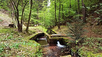
The Breitenbach near the mill well |
||
| Data | ||
| Water code | DE : 237834 | |
| location | Germany | |
| River system | Rhine | |
| Drain over | Speyerbach → Rhine → North Sea | |
| source | in the central Palatinate Forest in the Dreibrunnental 49 ° 23 ′ 26 ″ N , 7 ° 58 ′ 22 ″ E |
|
| Source height | 336 m above sea level NN | |
| muzzle | near Breitenstein in the Speyerbach Coordinates: 49 ° 20 '42 " N , 8 ° 0' 7" E 49 ° 20 '42 " N , 8 ° 0' 7" E |
|
| Mouth height | 194 m above sea level NN | |
| Height difference | 142 m | |
| Bottom slope | 21 ‰ | |
| length | 6.7 km | |
| Catchment area | 13.228 km² | |
The Breitenbach is an almost seven kilometer long left and northwest tributary of the Speyerbach .
geography
course
The Breitenbach rises in the central Palatinate Forest in the Dreibrunnental and flows south. It almost continuously forms the boundary of the municipalities of Elmstein and Esthal . On the way he passes, among other things, the gold fountain . After about ten kilometers, it flows into the Speyerbach at the level of the hamlet of Breitenstein . The trifts there are classified as cultural monuments; The ruins of Breitenstein Castle are also in the immediate vicinity of the estuary .
Tributaries
- Finster-Breitenbach ( right ), 1.3 km
- Big Schwaben Bach ( right ), 1.7 km

