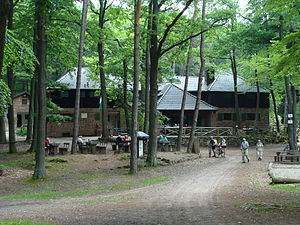
Hellerplatzhaus
| Hellerplatzhaus PWV hut |
||
|---|---|---|
| location | Haardt ; Neustadt an der Weinstrasse ( Rhineland-Palatinate ) | |
| Mountain range | Palatinate Forest | |
| Geographical location: | 49 ° 20 '10 " N , 8 ° 3' 13" E | |
| Altitude | 474 m above sea level NHN | |
|
|
||
| owner | Palatinate Forest Association | |
| Built | 1910 (timber construction 1903) | |
| Construction type | Hut; Sandstone | |
| Usual opening times | Wednesday to Sunday and public holidays | |
| Web link | Hellerplatzhaus | |
The Hellerplatzhaus (also called Hellerhütte or Neustädter Hütte ) is a refuge in the Palatinate Forest ( Rhineland-Palatinate ) managed by the Neustadt local association on the Weinstrasse of the Palatinate Forest Association . It is located on Hellerplatz 3.5 km south of Lambrecht and 5 km west of Neustadt in der Haardt , the eastern edge of the Palatinate Forest.
geography
location
The hut on the forest boundary of Neustadt stands at a height of 474 m on a mountain saddle between Platte ( 560.6 m ) in the northeast and Oberscheid ( 582 m ) in the south. To the northwest, the Höllisch valley branches off towards Erfenstein . In the east lies the Hellertal , which after a short distance turns into the Finstertal ; this in turn flows into the Kaltenbrunner valley .
Waters
All of the valleys mentioned drain over the Höllischtalbächlein or the Kaltenbrunnertalbach from the right to the Speyerbach , a left tributary of the Rhine .
Surroundings
The huts of the Palatinate Forest Association in the vicinity are the Totenkopfhütte , the Hohe-Loog-Haus , the Haus an den Fichten and the Kalmithaus .
history
The names of Hellerplatz and Hellerhütte are derived from the Hellertal beginning there, the name of which is classified as unclear.
A wooden structure named Neustädter Hütte was erected in 1903 and replaced by a massive structure in 1910. The first major expansion took place in 1922 with the construction of the main house, with the original hut being redesigned as a porch. In 1924 a pump system was installed for the water supply. The second major expansion was made in 1931 with the addition of the left wing. After the Second World War, the hut fell to the children's and youth association Die Falken . When it was returned to the Palatinate Forest Association in 1949, extensive repair work was necessary. In 1967 the water line was relocated. A power supply was only established in 1974/75. The third expansion by adding the right wing took place in 1982/83. There are no overnight accommodations.
The hut gained nationwide attention through the criminal activities of the Kimmel gang , when their member Lutz Cetto shot and killed the hut keeper Karl Wertz on New Year's Eve 1960/61. In memory of the murder victim , the knight stone 190 was erected near the hut . Another memorial stone and the knight stone 247 from the time before the murder are also in the area of the hut.
Accessibility and walks
The hut can only be reached on foot via hiking trails. It is centrally located in a hiking area that is bounded in the north and north-west by the state road 499 between Neustadt via Lambrecht to Breitenstein , in the south and south-west by the Totenkopfstraße and in the east by the Haardtrand. The next path leads from the hiking car park at Totenkopf to the hut. It can also be reached from Neustadt via the Kaltenbrunner Tal and Finstertal or the Heidenbrunner Tal, from Erfenstein via the Höllischtal or the Kropfsberg, from Breitenstein via the Argenbachtal and from Lambrecht via the mountains Hoher Kopf , Kaisergarten and Überzwerchberg.
Picture gallery
literature
- AK Doerr: Palatinate Hüttenbuch - The guide to 99 rest houses and hikers' homes . Pfälzische Verlagsanstalt Ludwigshafen GmbH, 4th edition June 2018, ISBN 978-3-87629-341-7 , p. 127.
- State Office for Surveying and Basic Geographic Information Rhineland-Palatinate: Topographic map 1: 25,000 - Palatinate Forest Nature Park, sheet 6 Oberhaardt from Neustadt an der Weinstrasse to the Queichtal . 2010, ISBN 978-3-89637-402-8 .
- Pietruska hiking map: Edenkoben - the holiday region between Landau and Neustadt. 1: 25,000, 3rd edition, Pietruska Verlag, Rülzheim 2018, ISBN 978-3-945138-04-5 .
Web links
Individual evidence
- ↑ a b c The story of the Hellerhütte. www.hellerplatzhuette.de, accessed on April 26, 2016 .
- ↑ Topographic map. LANIS, accessed January 26, 2017 .
- ↑ Ritterstein Hellerplatz (No. 247). www.outdooractive.com, accessed August 13, 2018 .
- ↑ Hiking routes. www.hellerplatzhaus.de, accessed on August 13, 2018 .


