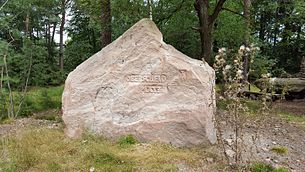
Oberscheid (Palatinate Forest)
| Oberscheid | ||
|---|---|---|
|
View from Hahnenschritt to Oberscheid |
||
| height | 582.3 m above sea level NHN | |
| location | near Neustadt an der Weinstrasse ; Rhineland-Palatinate ( Germany ) | |
| Mountains | Palatinate Forest ( Middle Palatinate Forest ) | |
| Coordinates | 49 ° 19 '36 " N , 8 ° 3' 17" E | |
|
|
||
The Oberscheid is 582.3 m above sea level. NHN high mountain in the Middle Palatinate Forest , part of the Palatinate Forest . The mountain lies within the boundaries of the urban district Neustadt an der Weinstrasse in Rhineland-Palatinate .
geography
location
The Oberscheid is located in the Palatinate Forest-Vosges du Nord biosphere reserve and in the Palatinate Forest Nature Park . Its summit rises as the crow flies 3.0 km southwest of the Hohen Loog ( 618.7 m ), 2.2 km northwest of Kalmit ( 672.6 m ) and 6.7 km southwest of Neustadt an der Weinstrasse. Together with the Kropfsberg ( 517.1 m ), the Studerbildkopf ( 478.9 m ) and the Hohe Kopf ( 464.7 m ) , the mountain is part of a ridge located between the Argenbachtal in the southwest and Höllischtal in the northeast. In the north, the mountain borders the Platte over the Hellerplatz pass , and in the south over the Totenkopf on the Rotsohlberg .
The mountain is completely wooded with mixed forest mainly of pine and beech.
Natural allocation
The Oberscheid belongs to the Palatinate Forest natural area, which is classified in the systematics of the handbook of the natural structure of Germany published by Emil Meynen and Josef Schmithüsen and its follow-up publications as a Greater Region 3rd order. If you consider the internal structure of the natural area , it belongs to the Middle Palatinate Forest.
In summary, the natural spatial allocation of the Oberscheid follows the following system:
- Greater region 1st order: Layer level land on both sides of the Upper Rhine Rift
- Greater region 2nd order: Palatinate-Saarland layer level land
- Greater region 3rd order: Palatinate Forest
- 4th order region (main unit): Middle Palatinate Forest
Access and hiking
Various hiking trails lead over the Oberscheid between the pass heights Totenkopf and Hellerplatz, on which there are huts managed by the Palatinate Forest Association , the Totenkopfhütte and the Hellerplatzhaus . There are two parking spaces for hikers on Totenkopfstraße at Totenkopf . In the east you can descend into the Finstertal. There is no hiking trail leading to the summit. A narrow hiking path leads past the summit.
Individual evidence
- ↑ a b LANIS: Topographical Map. Retrieved December 26, 2016 .
- ^ Federal Institute for Regional Studies: Geographical Land Survey. The natural space units in single sheets 1: 200,000 . Bad Godesberg 1952–1994. → Online maps , sheet 160: Landau i. d. Palatinate (Adalbert Pemöller, 1969; 47 pages)
- ↑ Helmut Beeger u. a .: The landscapes of Rheinhessen-Pfalz - naming and spatial delimitation. In: Reports on German regional studies , Volume 63, Issue 2, Trier, 1989, pp. 327–359


