Frau Holle path
| Frau Holle path | |
|---|---|
 Goldmarie from Grimm's fairy tale Frau Holle |
|
| Data | |
| length | approx. 185 km |
| location | North Hesse , South Lower Saxony |
| Markers | X4 |
| Starting point |
Bad Karlshafen 51 ° 38 '32.8 " N , 9 ° 27' 4.4" E |
| Target point |
Schenklengsfeld 50 ° 49 ′ 5.5 ″ N , 9 ° 50 ′ 39.5 ″ E |
| Type | Long-distance hiking trail |
| The highest point |
Hoher Meißner (approx. 753.6 m above sea level ) |
| Lowest point |
Bad Karlshafen (approx. 99 m above sea level ) |
| Level of difficulty | easy, normal |
| season | all year round |
| Viewpoints | u. a. Bilstein , High Meissner |
| particularities | named after Mrs. Holle |

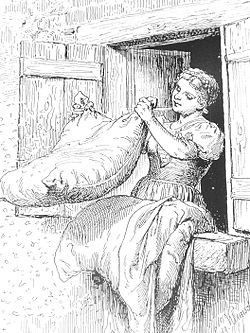
The Frau-Holle-path ( hiking sign X4 ) is an approximately 185 km long through or long-distance hiking trail in northern Hesse and southern Lower Saxony ( Germany ), which starts from Bad Karlshafen in the Reinhardswald , Bramwald , Kaufunger Wald , Stölzinger Gebirge , Richelsdorf mountains and in the Kuppenrhön runs to Schenklengsfeld . It connects numerous cities and communities in the districts and districts of Kassel , Northeim , Werra-Meißner and Hersfeld-Rotenburg . The path is named after Frau Holle , the title and main character of one of the well-known fairy tales from Grimm's fairy tales .
History and interesting facts
The Frau-Holle-path was developed by the Hessisch-Waldeckischer Gebirgs- und Heimatverein (HWGHV). With the help of display boards along the path you can find out more about fairy tales and legends of the Brothers Grimm . In addition, homeland and history associations contributed a lot of information about local events on display boards. In some places you come across sculptures.
course
Stage 1 (Bad Karlshafen → Gieselwerder; 19 km) :
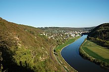
The Frau-Holle-path begins in Bad Karlshafen in northern Hesse (approx. 99 m above sea level ), the lowest point of the path. At the beginning it shares the route with the Märchenlandweg and leads above the Upper Weser Valley in the direction of Gewissenruh through the northern part of the Reinhardswald . On this leg of the views of the other side of the falls Weser located Wahmbeck with thereat of Kahlenberg ( 224.7 m ) and on located on this side of the river diversion to greed rope ferry tales ferry which, across the river to the village Lippold mountain drives. A little south of Gewissenruh he reaches the open-air exhibition Der Mühlenplatz (approx. 3,000 m²; miniature replicas of, for example, castles, mills and palaces) Gieselwerder on the Trumbach (also called Lumbach) tributary of the Weser .
Stage 2 (Gieselwerder → Veckerhagen; 25 km) :
From Gieselwerder the path leads over the Weser and shortly thereafter through Oedelsheim , which is on the riverbank , where it crosses the Märchenlandweg. From then on it runs through the northern foothills of the Bramwald , where it changes to southern Lower Saxony and runs through Bursfelde , which lies at the confluence of the Nieme in the Weser. Then it leads through the actual Bramwald and at the same time in the Münden Nature Park past the Bramburg ( 210 m ) and reaches the village of Hemeln . There, for a short detour, you take the Veckerhagen yaw ferry to Veckerhagen on the west bank of the Weser. At the ferry dock there, information from the North Hessian world of fairy tales and legends about the giant daughters Brama (→ Bramburg), Saba (→ Sababurg ), Trendula (→ Trendelburg Castle ) can be found on a text board .
Stage 3 (Veckerhagen → Hann. Münden; 19 km) :
After the detour to Veckerhagen, take the ferry back to Hemeln on the east bank of the Weser, and the path runs upwards past the Röhrmühle forester's house into the Bramwald. In it it leads past the Vaaker Berg ( 380.1 m ) past Starmke's little house, a refuge next to the source pond of the Weser tributary Stramker Bach, and continues roughly south. Then it leads in the Schede valley through Volkmarshausen and beyond it on the 13-Brückenweg past the Weserliedanlage on the Questenberg , where the student path also passes. From there you can see Hann in southern Lower Saxony . Münden . Then the path leads through the town below the facility at the confluence of the Werra and Fulda rivers to the Weser - marked by the Weser stones .
Stage 4 (Hann. Münden → Trubenhausen; 29 km) :
From Hann. Münden, the path leads up into the Kaufunger Wald , where it crosses the federal highway 7 . It then leads past the junction to the Rinderstall game reserve , the Hühnerfeld , the Großer ( 541.8 m ) and the Kleinen Steinberg ( 541.9 m ), the Steinbergskopf (approx. 532 m ) and the junction to the Steinberghaus nature reserve over the Haferberg ( 580 , 4 m ) to the summit Umschwang ( 446 m ). In the area of Haferberg and Umschwang, the borders of the Münden Nature Park and the Frau-Holle-Land Geo-Nature Park (Werra Valley, Meissner, Kaufunger Forest) meet. Beyond the pass, the path finally reaches the last-named nature park, while near the summit it passes the Mühlenstein ( 607.2 m ). Leading over the Bilstein ( 641.2 m ; with observation tower) and passing the Red Lake ( 520 m ), it arrives at Trubenhausen in the Gelster valley .
Stage 5 (Trubenhausen → Hoher Meißner; 16 km) :
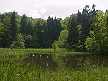
From Trubenhausen the path runs across the Gelstertal up to Weißenbach , over the Bühlchen ( 537.2 m ) and the mountain saddle on the Heiligenberg ( 583.4 m ), past the opencast mine Bransrode. From here you can make a detour to the Frau-Holle-Teich ( 623 m ). Then the path reaches the Kasseler Kuppe ( 753.6 m ), the highest elevation of the Hohem Meißner and Frau-Holle-path.
Stage 6 (Hoher Meißner → Sontra; 27 km) :
From the Hoher Meißner the path leads past the village of Rodebach . Here it leaves the Geo-Nature Park Frau-Holle-Land and runs in sections in the Rodebach valley . It then leads to Waldkappel an der Wehre . Beyond the weirs it extends in Stölzinger mountain comes on top of the mice Bergs ( 415.4 m ) to the observation tower pioneer tower . Then the path leads down into the valley of the Hosbach to Kirchhosbach . It then runs over the Alpstein ( 399 m ) and past Gut Urlettig to Sontra in the Sontra valley .
Stage 7 (Sontra → Hönebach; 23 km) :
From Sontra the path extends Richelsdorfer mountains by the former training area of Husaren barracks according Lindenau . Then it leads in the direction of Nentershausen to the junction of Tannenberg Castle ( 351 m ), which is a little off the path . There he crosses the Wartburg path . Circumnavigating the Herzberg ( 478.2 m ), the highest elevation of the Richelsdorf Mountains, in a semicircle, the path leads through the small village of Bauhaus . Further south, it runs in sections along the Suhl -Quellbach Pfaffengraben, past the Bellers farm and the ruins of the Blumenstein hunting lodge ( 350 m ), crossing under the federal motorway 4 to Hönebach .
Stage 8 (Hönebach → Schenklengsfeld; 27 km) :
From Hönebach the path in the Seulingswald leads roughly parallel to the A4 to the deserted Hammundeseiche ( 440 m ). Then it continues to Friedewald and from there past the Dreienberg ( 524 m ) to Lautenhausen . The Lullus path crosses in this region . After passing the Landeck castle ruins ( 470 m ) on the slope of the Landecker Berg ( 510.9 m ) in the former Landecker Amt , the path reaches the core of the community of Schenklengsfeld .
Stage overview
The Frau-Holle-Path consists of a total of 8 stages - each with an approximate length in kilometers (km):
|
|
from | to | length |
|---|---|---|---|
| 1 | Bad Karlshafen | Gieselwerder | 19 km |
| 2 | Gieselwerder | Veckerhagen | 25 km |
| 3 | Veckerhagen | Hann. Münden | 19 km |
| 4th | Hann. Münden | Trubenhausen | 29 km |
| 5 | Trubenhausen | High Meissner | 16 km |
| 6th | High Meissner | Sontra | 27 km |
| 7th | Sontra | Hönebach | 23 km |
| 8th | Hönebach | Schenklengsfeld | 27 km |
| Total: | 185 km |
Web links
- Frau-Holle-path , course on openstreetmap.org
References and comments
- ↑ a b Total length of the Frau-Holle-Path according to the above table of stages
- ↑ a b Map services of the Federal Agency for Nature Conservation ( information )
- ↑ Length of the stages according to the Frau-Holle -pfad, on ferien-ganz-nah.de


