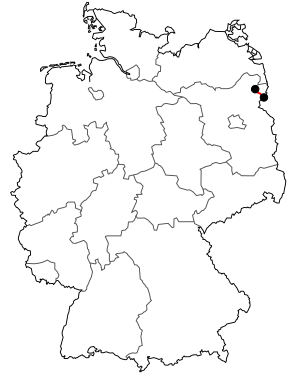
Bundesstrasse 166
| Bundesstrasse 166 in Germany | ||||||||||||||||||||||||||||||||||||||||

|
||||||||||||||||||||||||||||||||||||||||
| map | ||||||||||||||||||||||||||||||||||||||||
| Basic data | ||||||||||||||||||||||||||||||||||||||||
| Operator: |
|
|||||||||||||||||||||||||||||||||||||||
| Start of the street: |
Uckerfelde ( 53 ° 15 ′ N , 14 ° 1 ′ E ) |
|||||||||||||||||||||||||||||||||||||||
| End of street: |
Schwedt / Oder ( 53 ° 2 ′ N , 14 ° 19 ′ E ) |
|||||||||||||||||||||||||||||||||||||||
| Overall length: | 34.5 km | |||||||||||||||||||||||||||||||||||||||
|
State : |
||||||||||||||||||||||||||||||||||||||||
| Development condition: | two-lane | |||||||||||||||||||||||||||||||||||||||
| Bundesstraße 166 in Schwedt / Oder Bridge over the Hohensaaten-Friedrichsthaler Wasserstraße |
||||||||||||||||||||||||||||||||||||||||
|
Course of the road
|
||||||||||||||||||||||||||||||||||||||||
The national highway 166 (abbreviation: B 166 ) is a German federal highway in the state of Brandenburg .
overview
- Length: 34.5 km
- Starting point: Autobahn triangle Kreuz Uckermark
- End point: Schwedt / Oder , border crossing
course
- Autobahn triangle Kreuz Uckermark ( A 11 / A 20 ) near Gramzow (0.0 km)
- Passow (14.5 km)
- Schwedt / Oder (28.0 km) → B 2
- Border crossing to Poland Oder bridge before Krajnik Dolny (Nieder-Kränig) (34.5 km)
The southern bypass of Passow has existed since the end of 2006. This means that this federal highway is a feeder road for the tanker trucks from the Schwedt / Oder oil refinery ( PCK-Raffinerie ) GmbH with no through-town traffic.
additional
Until the end of the German Reich in 1945, what was then Reichsstraße 166 had a length of 84.3 km and led to Zorndorf, today's Sarbinowo. The history:
- Koenigsberg / Nm. (Polish Chojna ) (42.3 km) → Reichsstrasse 158
- Vietnitz (Polish Witnica Chojenska) (53.9 km)
- Bärwalde / Nm. (Polish Mieszkowice ) (63.5 km)
- Zorndorf (Polish Sarbinowo ) (84.3 km) → Reichsstraße 112
See also
Web links
Commons : Bundesstrasse 166 - Collection of pictures, videos and audio files
Individual evidence
- ↑ in Schwedt / Oder expanded to four lanes

