Federal Highway 181
| Federal highway 181 in Germany | ||||||||||||||||||||||||||||||||||||||||||||||||||||||||||||||||||||||||||||

|
||||||||||||||||||||||||||||||||||||||||||||||||||||||||||||||||||||||||||||
| map | ||||||||||||||||||||||||||||||||||||||||||||||||||||||||||||||||||||||||||||
| Basic data | ||||||||||||||||||||||||||||||||||||||||||||||||||||||||||||||||||||||||||||
| Operator: |
|
|||||||||||||||||||||||||||||||||||||||||||||||||||||||||||||||||||||||||||
| Start of the street: |
Merseburg ( 51 ° 21 ′ N , 11 ° 59 ′ E ) |
|||||||||||||||||||||||||||||||||||||||||||||||||||||||||||||||||||||||||||
| End of street: |
Leipzig ( 51 ° 21 ′ N , 12 ° 24 ′ E ) |
|||||||||||||||||||||||||||||||||||||||||||||||||||||||||||||||||||||||||||
| Overall length: | 29 km | |||||||||||||||||||||||||||||||||||||||||||||||||||||||||||||||||||||||||||
|
State : |
||||||||||||||||||||||||||||||||||||||||||||||||||||||||||||||||||||||||||||
| Development condition: | two-lane | |||||||||||||||||||||||||||||||||||||||||||||||||||||||||||||||||||||||||||
|
Course of the road
|
||||||||||||||||||||||||||||||||||||||||||||||||||||||||||||||||||||||||||||
The federal highway 181 (abbreviation: B 181 ) is a German federal highway in the federal states of Saxony-Anhalt and Saxony .
course
The federal highway 181 begins in the south of Merseburg as Naumburger Straße and then runs east in the south past the city center of Merseburg. Then it crosses the Saale , crosses Neumarkt and then crosses the Mittelkanal. Then Meuschau is affected to the south. From here the street runs as Leipziger Straße. After 2 km the federal road runs past Tragarth in the south and then crosses under the tracks of a railway line to Ammendorf via Lochau . From here the road runs parallel to the disused Merseburg – Leipzig-Leutzsch railway line . After one kilometer Wallendorf (Luppe) is on the way, after another two kilometers Zöschen follows . Here the road makes a bend to the south-east, crosses the Merseburg – Leipzig railway line and then runs through Göhren. Then three kilometers later it crosses the Elster-Saale Canal for the first time and then runs around Zschöchergen in the south. Then Günthersdorf follows . Here the road runs north past the Nova shopping center , then the junction of the A 9 comes as a clover leaf cross and behind it the state border with Saxony. Here the federal highway 181 has been expanded to four lanes over a length of 2 km. Then it runs south past Dölzig , where it crosses the B 186 . Now the road reaches the city limits of Leipzig and behind it the Rückmarsdorf district . Here the street runs first as Sandberg and then as Merseburger Straße. Next, the Elster-Saale Canal is crossed for the second time and then the Leipzig – Großkorbetha railway line . Then it runs to the B 87 .
history
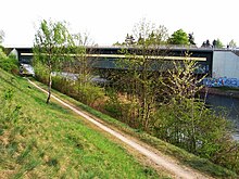
Today's B 181 was built between 1816 and 1831 as part of the Prussian Staatschaussee No. 68 , which ran from Leipzig via Merseburg, Lauchstädt and Artern / Unstrut to Berga . The eastern section of the route between Leipzig and Merseburg was elevated to Reichsstraße around 1937 . One of the forerunners was the Poststrasse Leipzig – Merseburg . Until 1974, all traffic between Merseburg and Leipzig ran through the narrow old town of Merseburg. Only with the socialist reconstruction was a new two-lane expressway built on the area of the southern old town. In 1976 the new bridge over the Saale was completed.
Since the 1990s, some expansion and rerouting have been under discussion. So far, the section between the Leipzig-West junction of the A 9 and Dölzig has been expanded. New constructions on the Saxony-Anhalt side would be technically difficult (bridge over an arm of the Saale in Merseburg, disused railway line Merseburg – Leutzsch, abandoned open-cast mine Wallendorf, Elster-Saale Canal , local situation Günthersdorf).
See also
Web links
Individual evidence
- ^ Area AS Leipzig West and in Leipzig (partially) four lanes
- ↑ Merseburger Kunstverein eV arps Verlag Weißenfels (2013), p. 110.

