
Artern
| coat of arms | Germany map | |
|---|---|---|

|
Coordinates: 51 ° 22 ′ N , 11 ° 17 ′ E |
|
| Basic data | ||
| State : | Thuringia | |
| County : | Kyffhäuserkreis | |
| Fulfilling municipality : | for Borxleben for Gehofen for Kalbsrieth for Mönchpfiffel-Nikolausrieth for Reinsdorf |
|
| Height : | 121 m above sea level NHN | |
| Area : | 45.05 km 2 | |
| Residents: | 6688 (Dec. 31, 2019) | |
| Population density : | 148 inhabitants per km 2 | |
| Postal code : | 06556 | |
| Area code : | 03466 | |
| License plate : | KYF, ART, SDH | |
| Community key : | 16 0 65 086 | |
| LOCODE : | DE ARE | |
| City structure: | Core city; 4 districts | |
City administration address : |
Market 14 06556 Artern |
|
| Website : | ||
| Mayor : | Torsten Blümel (left) | |
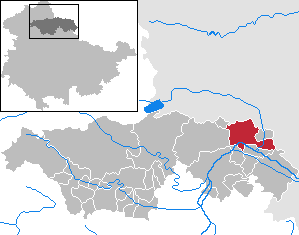
| Location of the city of Artern in the Kyffhäuserkreis | ||
  |
||

The small town of Artern (until 2018: City of Artern / Unstrut ) is a rural community in the Thuringian Kyffhäuserkreis . The city on the Unstrut is located in the extreme northeast of the country on the border with Saxony-Anhalt .

geography
Artern lies on an arch of the Unstrut, which flows through the city from southwest to southeast. Below Artern, the helmets flow into the Unstrut. Due to its location on these rivers, the area around Artern is very flat and fertile. The basin between the Goldener and Diamantener Aue is surrounded by mountains, namely the Harz in the north, the Kyffhäuser in the west, Hoher Schrecke in the south and another mountain range in the east. This is where most of the clouds rain down before they reach Artern. Artern is therefore one of the driest and warmest areas in Thuringia. The annual precipitation is only 457 mm; the average temperature at 8.5 ° C. With 30 mm of summer precipitation, Artern was the third driest weather station of the German Meteorological Service in Germany in 2018 . In 2018 only 273 millimeters of precipitation fell in Artern, hardly more than in the Mongolian steppe town of Ulan Bator. It was similar during the heat wave in Germany in 2019 .
The Artern Saline, founded by Johann Gottfried Borlach around 1733, was closed in the 20th century. The brine spring (salt content 2.25%) still feeds the brine swimming pool and the brine ditch. The Solgraben is a small nature reserve in which a flora has settled that resembles coastal flora .
City structure
The old town of Artern is on the north side of the Unstrut. It consists of two settlement centers: the city of Artern in the west and the village of Artern in the east. They were not united until 1832. Since the 19th century, the city grew mainly to the east towards the train station, where the main industrial area was created. Later it expanded northwards along the road to Sangerhausen, where a second industrial area was created around the Westbahnhof.
In addition to the city center, Artern also has the districts of Heygendorf , Kachstedt , Schönfeld and Voigtstedt .
Climate table
| Artern | ||||||||||||||||||||||||||||||||||||||||||||||||
|---|---|---|---|---|---|---|---|---|---|---|---|---|---|---|---|---|---|---|---|---|---|---|---|---|---|---|---|---|---|---|---|---|---|---|---|---|---|---|---|---|---|---|---|---|---|---|---|---|
| Climate diagram | ||||||||||||||||||||||||||||||||||||||||||||||||
| ||||||||||||||||||||||||||||||||||||||||||||||||
|
Average monthly temperatures and rainfall for species
Source: wetterkontor.de
|
|||||||||||||||||||||||||||||||||||||||||||||||||||||||||||||||||||||||||||||||||||||||||||||||||||||||||||||||||||||||||||||||||||||||||||||||||||||||||||||||||||||
history
At the beginning of the 9th century Artern was mentioned in a document as "Aratora" in a list of the goods of the Hersfeld Monastery built by Archbishop Lullus († 786) of Mainz . The Artern moated castle was built as early as the 10th century. It served to secure the Unstrut crossing to the Thuringian Gate and in the direction of Schmücke and Sangerhausen . In 1252 a "Ulrich von Artern" was named who was safely connected to the moated castle. In 1346 the archbishops of Magdeburg became liege lords. In the 16th century the castle was rebuilt as a palace. Most of this building was demolished in the 18th century. Now there is a bank building there.

The Marienkirche was built in 1200, the Veitskirche followed in 1250. The Arterner castle settlement received the city charter in 1323 . Artern received its own jurisdiction in 1463 . The city of Artern belonged to the Electorate of Saxony after an area swap in 1579 . The city was completely destroyed by fire in 1683 and the village partially destroyed. A new, technically improved salt works was built by the mining engineer Johann Gottfried Borlach from 1728 to 1733. Artern came under Prussian rule in 1815 and was incorporated into the Province of Saxony . The town and village of Artern were united in 1832. The town hall was rebuilt in the neo-baroque style in 1906 and renovated in 1993/94.
Second World War : 47 prisoners of war from Poland and France had to do forced labor in local companies from 1939/40 : on the Weidlich manor, on the domain and at the Unstrutwerke. Over 400 foreign forced laborers were employed in the Kyffhäuserhütte machine factory in 1941. In addition, there were at least 1,124 foreign forced laborers, mainly from the Soviet Union, who had to do forced labor in the sugar factory, the brewery, the saltworks, the Reichsbahn, in agriculture (also in the Schönfeld district) and in the Kachstedt Vorwerk. 1944 was in Artern camp Rebstock new of the Buchenwald concentration camp . In 1944, hundreds of prisoners, including those from other camps, had to assemble the electrics for V2 rockets in the Artern subcamp with the code name A-Dorf of the Mittelbau-Dora concentration camp . In April 1945 hundreds of concentration camp prisoners were sent on a death march on various routes . The numerous deaths of forced labor and the last deportations were buried in the park cemetery, as a memorial stone that was removed in 1975 commemorates.
Artern was occupied by US troops around April 12, 1945 , and by the Red Army in July . This made it part of the Soviet Zone and, from 1949, of the GDR.
From 1952 to 1994 Artern was the district town of the Artern district in the Halle district , which was formed from the southern parts of the Sangerhausen district and the eastern part of the Sondershausen district. In 1994 the Artern district was merged with the Sondershausen district to form the Kyffhäuserkreis based in Sondershausen. As a replacement for the loss of the district town status, Artern received the central fines office in Thuringia.
In 1998 the former Artern association brewery, renamed in 1990 as Barbarossa Brewery, was finally closed. In 2002/2003, the produced Endemol production there for the MDR television the docu-soap Artern - City of Dreams , which ran and from 6 February to 25 December the lives of people in the city with the highest unemployment in Thuringia documented. At times the press ( Der Spiegel , Der Standard , Vienna) spoke of an East German " Truman Show ".
Incorporations
Schönfeld was incorporated on November 17, 1995.
On January 1, 2019, the city of Artern / Unstrut and the communities of Heygendorf and Voigtstedt merged to form the new city and rural community of Artern. At the same time, the administrative community Mittelzentrum Artern , whose seat was Artern / Unstrut, was dissolved and Artern became a fulfilling community for the other member communities Borxleben , Gehofen , Kalbsrieth , Mönchpfiffel-Nikolausrieth and Reinsdorf .
Population development
Development of the population (from 1960 to December 31st):
|
|
|
- Data source from 1994: Thuringian State Office for Statistics
- * City of Artern newly formed from 2019
politics
City council
The Artern City Council was re-elected in the local elections on May 26, 2019 . The result shown opposite led to the following allocation of seats:

| Party / list | Seats | +/- |
| CDU | 5 | - 4th |
| The left | 6th | - 1 |
| SPD | 2 | - 2nd |
| NPD | 1 | New |
| PU | 3 | New |
| Women and Sport (S / S) | 2 | New |
| Sports club (SV) | 1 | New |
mayor
Christine Zimmer (CDU) was elected mayor in September 2015 to succeed Wolfgang Koenen (Die Linke). Koenen had held the office for 18 years. In the local elections on May 26, 2019, Ms. Zimmer lost the election, her successor is Torsten Blümel (Die Linke). At the same time, the city council was re-elected.
coat of arms
Blazon : "In blue two vertically standing, outwardly curved pieces of silver wheel rim."
Artern's coat of arms was adopted on the basis of historically documented circumstances. At the same time, the previously existing uncertainty about the applicable city coat of arms and its informative value was eliminated. In the form indicated, the coat of arms was carved into a block of limestone on the old town hall, which was replaced by a new building in 1906. In 1850 the stone, which had previously been covered with plaster, was exposed. It is the coat of arms of the von Hake ministerial family, who held fiefdoms in Artern and the surrounding area. The initial dispute about whether it shows rainbow, crescent moon or wheel rims has been decided in favor of the latter, because wheel rims fit meaningfully to the city lying on the edge of the Golden Aue , which was established as a settlement very early in the 8th century Hersfeld's list of tithe is mentioned as Aratora; the place name could be derived from the Middle High German word art = agriculture.
Town twinning
The city has three twin cities:
- Einbeck in Lower Saxony (since July 2, 1990)
- Topoľčany in Slovakia (since 1982, renewed on October 2, 1992)
- Mazingarbe in France (since May 11, 1996)
Culture and sights
Buildings

St. Vitus Church 1990, before restoration

The renovated St. Vitus Church


St. Vitus Church from the 13th century
The St. Vitus Church in the north of the old town of Artern is one of the oldest remaining medieval buildings in the city. The building in its current appearance dates from the middle of the 13th century and thus falls into the late Romanesque or early Gothic period . The church tower, which is located above the crossing of the aisles, and the cross-shaped floor plan of the church are worth seeing . Until the time of the Reformation, the St. Vitus Church was used sacred by the residents.
The church had been empty since around the middle of the 16th century and was only used sporadically for services. As a result, the building fell into disrepair over the next few years. In the 18th and 19th centuries it served as a barn, equipment shelter and once as a prison. Around 1895 there was a gym inside the church, since the mid-1930s a local museum. From 1990 the St. Vitus Church was extensively restored as a landmark of the city of Artern and received its present appearance. During the construction work inside the church, the remains of three previous buildings came to light, which were also archaeologically documented. The restoration of the church was completed in August 1999. Today the building is used for exhibitions, concerts and civil marriages.
Marienkirche from the 12th century

The town church of St. Marien was built in the 12th century. The church was dedicated to Mother Mary. Red sandstone, limestone, conglomerate and gypsum were used as material. The tower was built after 1150 and the later choir room, now the winter church , around 1225 . With the Reformation in 1540, the Marienkirche became a church of the Protestant parish of Artern. In 1607/08 the west aisle was torn down after a fire. In 1615 the reconstruction of the nave began. The inauguration of the new nave took place on May 25, 1620 on Ascension Day. Construction work began again in 1654 and the first galleries were built two years later. On June 8, 1669 the tower button was put on and the roof was completed a year later. The church was consecrated again on St. Andrew's Day at the end of November 1685. Over the next 150 years, a half-timbered tower room was built over the tower bells.
In 1837 the old galleries were expanded and new double galleries were built. A total restoration lasted until 1859. In 1860 the fresco Transfiguration by Sörensen from Merseburg was installed inside the church. Ten years later the organ was installed by Strobel from Bad Frankenhausen . After a few bells had to be handed in during the Second World War, the inauguration of a new bell was celebrated in 1955. The winter church was consecrated in 1964. In 1994 the church got a new roof covering.
Natural and herb garden
The natural and herb garden at the former Westbahnhof was opened in May 2001. The focus is on the herbalist “ Artemis ”, who planted some medicinal plants according to their areas of application on the respective parts of the body. You can visit the German garden, monastery garden, dye garden, the herb snail and orchard meadow, the wild flower meadow, the realm of Artemisia, the garden of special features and the Feng Shui garden via natural paths .

The Upper Court

Artern town hall built in 1906

City hall Artern historical view 1908


Other structures
- The neo-baroque town hall was built in 1906 by Gustav Wolff and Theodor Lehmann as a free-standing plastered building on a low sandstone plinth with three floors. In terms of style, it should follow the rest of the 18th century buildings on the market square. The tower is set in the middle, the facade design appears asymmetrical. A painting by Otto Engelhard-Kyffhäuser from 1929 is on display in the ballroom, it shows a historical view of the place.
- Oberer Hof, a half-timbered house from the 17th century in the former manor with an exhibition on the history of the Kyffhäuserhütte
- Jüngkens observation tower (12.5 m) also called "Rapunzelturm", built in 1863 at 190.8 m above sea level. NHN high vineyard
- Goetheahnenhaus, the former smithy is the ancestral home of the Goethe family. A memorial plaque above the front door commemorates Goethe's great-grandfather Hans Christian Göthe.
Parks
Saline Park
The Saline Park on the Unstrut is almost 6.5 hectares and is mostly home to native tree species such as maple, beech, chestnut, linden, willow and also two rare primeval sequoia trees ; Trees of gods, trumpet trees and Chinese redwood. In 1865, the beautification association began laying out the park. Saline directors Wapler, Schröcker and Fischer were already committed to the park. Saline director Oberbergrat Constantin Wonnerberg had the graduation tower, tennis park, inhalatorium, brine drinking hall and the “Cäcilienheim” children's sanatorium built in the 20th century, but only a part of it is still there. The park is also home to an open-air stage where events and film screenings take place regularly.
Park cemetery
The park cemetery is located northwest of the old town on Sangerhäuser Chaussee, directly on federal road 86 . It is a botanical attraction: On approx. 1.63 hectares there is one of the smallest nature reserves in Germany along the brine, with some very rare plants that only grow on salty soils ( halophytes ).
The Prussian King Friedrich Wilhelm III. donated the land to the city in 1828 for the construction of a cemetery, which was laid out like a park and inaugurated in 1833. In addition to old tombs, remains of the old Salztalm wall can be seen. The park invites visitors to take a walk and linger on the brine.
Brine source
The brine spring, which was used economically until 1964, now feeds the brine ditch and the brine swimming pool and is located in the park cemetery. The brine comes from a 300 m deep salt store and has a temperature of 11.5 ° C all year round. One liter of water contains 22-25 g of salt, as well as potassium and magnesium salts. The annual salt output is 22,400 m³. The Solgraben is the smallest nature reserve of its kind in Europe (size approx. 1.63 ha) and the most important inland salt station in Central Europe. It offers rare fauna and flora in the smallest of spaces. Plants such as As samphire , salt vermouth , salt Aster , purslane , salt rush and subterranean clover and animals such. B. typical salt beetles , salt bugs and salt flies can be found here. The three-pronged stickleback is the only fish still living in the brine ditch.
leisure

The brine swimming pool in the Saline Park was renovated in 1994/95 and received a new pool landscape, a 50 m slide, flow channel and paddling pool as well as an outdoor area with volleyball fields, streetball courts, adventure playground and catering. The salinity of the water is 3.25%.
The bowling and skittle alleys in the Saline Park have been used in the Saline Park since the 1970s. After several renovations and extensions, the bowling club and various teams consolidated its sporting position in the Kyffhäuserkreis and its lanes in the city's leisure activities. In addition to the club, the sports facility can also be used for company and private celebrations.
The Aratora Gallery, founded in 1990, presents contemporary fine and applied art in its three exhibition rooms (primarily by artists from the new federal states). In her temporary exhibition activities, four special exhibitions take place annually. In addition, artist talks, writer readings, lectures and cabaret events are part of the gallery's offer.
Unstrut lock Artern , largest Unstrut lock : 50 m long, 5.50 m wide, drop height 1.90 m. In the years 1791–1795 the Unstrut was expanded as a waterway. To this end, twelve locks were built on the Unstrut. Seven locks are currently operational, which are available for recreational paddlers and motor boats in the season from April to October.
Events
- May 1st: Street basketball tournament
- Beginning of August: Fountain Festival
- October: onion market
- December: Nikolausmarkt
- other concerts and open-air parties
Economy and Infrastructure

Before reunification, the local sugar factory was the third largest in the GDR and VEB Kyffhäuserhütte had 3,000 employees. They were the largest factories in town. After 1990 the typical economic structure of many small towns in the east developed with more small and craft businesses and some trading companies. The number of unemployed was at times well above the national average. Two large industrial areas were created on the brownfield sites of the former large companies.
traffic
Road traffic
Artern is on Landesstraße 3086 (until 2015 Bundesstraße 86 ), which runs through the town in the western part of the city. The federal motorway 38 runs about twelve kilometers to the north and connects the Kassel / Göttingen conurbation in the west with the Leipzig / Halle (Saale) area in the east.
Artern is connected directly to the motorway network through the federal motorway 71 . The construction of this motorway stretching from Sangerhausen to Schweinfurt began in the Arterner area at the end of 2006. In nearby Oberröblingen , the two motorways are linked by the southern Harz motorway triangle, which was released on April 29, 2013 .
In 2008 a northern bypass road was opened on the L 1172, which bypasses the eastern urban area to the north and connects to the A 71. Further construction in a westerly direction is planned and partially implemented.

Rail transport
In the eastern part of the city, the station is on the Sangerhausen – Erfurt railway line , which is served by regional and regional express trains to Erfurt Hbf and Magdeburg Hbf . The branch lines to Sondershausen and Naumburg were discontinued when the timetable changed on December 10, 2006. There has been no traffic on the Berga-Kelbra-Artern railway since 1966.
education
There are three state schools in Artern: a primary school, a Thuringian community school and a regional support center (support focus on learning, emotional and social development, intellectual development). There is also a city library, an adult education center and three independent educational institutions.
Personalities
Web links
Individual evidence
- ^ Population of the municipalities from the Thuringian State Office for Statistics ( help on this ).
- ↑ Climate diagram of Artern
- ^ Mirko Krüger: The driest place in Germany. In: Thuringian General. 4th September 2018.
- ↑ zeit.de: The weather forecast
- ↑ Michael Köhler: Thuringian castles and fortified prehistoric and early historical living spaces. Jenzig-Verlag, 2001, ISBN 3-910141-43-9 .
- ↑ Thuringian Association of the Persecuted of the Nazi Regime - Association of Antifascists and Study Group of German Resistance 1933–1945 (Ed.): Heimatgeschichtlicher Wegweiser to places of resistance and persecution 1933–1945 (= Heimatgeschichtliche Wegweiser. Volume 8: Thüringen. ) Erfurt 2003, ISBN 3-88864-343-0 , p. 166.
- ↑ hwph.de
- ↑ Destatis.de: Area changes from January 1st to December 31st, 1995 (year) (XLS file; 142 kB).
- ^ Thuringian State Office for Statistics, 2019 municipal council elections in Thuringia - final result for Artern , accessed on October 25, 2019
- ↑ artern.thueringer-allgemeine.de
- ↑ Mayoral election 2019 in Thuringia - preliminary result. Thuringian State Office for Statistics, May 25, 2019, accessed on May 26, 2019 .
- ^ Arbeitsgemeinschaft Thüringen e. V. (Ed.): New Thuringian Wappenbuch. Volume 2, 1998, ISBN 3-9804487-2-X , p. 22.
- ↑ a b «Artern» . In: Sparkassen-Kulturstiftung Hessen-Thüringen (Hrsg.): Cultural discoveries. Eichsfeld district, Kyffhäuserkreis, Nordhausen district, Unstrut-Hainich district . tape 1 : Thuringia . Schnell & Steiner, Regensburg 2009, ISBN 978-3-7954-2249-3 , pp. 13-14 .
- ↑ Zentralblatt der Bauverwaltung. Volume 28, Ernst & Korn, 1908 p. 606 ( digital.zlb.de accessed April 20, 2020).
- ↑ Dehio Thuringia 2003, ISBN 3-422-03095-6 , p. 61.
- ↑ Online map of the Competence Center Geodata Infrastructure Thuringia (GDI-Th) at the State Office for Surveying and Geoinformation Thuringia ( notes )
- ↑ School portrait - Thuringian school portal. In: www.schulportal-thueringen.de. Retrieved April 7, 2016 .
- ^ City of Artern: City of Artern. In: artern.de. Retrieved April 7, 2016 .
Artern | Heygendorf | Kachstedt | Schaafsdorf | Schönfeld | Voigtstedt
Abtsbessingen | On the jewelry | Artern | Bad Frankenhausen / Kyffhäuser | Bellstedt | Borxleben | Clings | Revival | Etzleben | Freienbessingen | Farmyard | Greetings | Großenehrich | Helbedündorf | Holzsußra | Kalbsrieth | Kyffhäuserland | Mönchpfiffel-Nikolausrieth | Niederbösa | Upper Evil | Oberheldrungen | Reinsdorf | Rockstedt | Roßleben-Wiehe | Sondershausen | Topfstedt | Trebra | Wasserthaleben | West Greussia | Wolferschwenda