
Oberheldrungen
| coat of arms | Germany map | |
|---|---|---|
 Help on coat of arms |
Coordinates: 51 ° 17 ' N , 11 ° 15' E |
|
| Basic data | ||
| State : | Thuringia | |
| County : | Kyffhäuserkreis | |
| Fulfilling municipality : | On the jewelry | |
| Height : | 150 m above sea level NHN | |
| Area : | 12.46 km 2 | |
| Residents: | 796 (Dec. 31, 2019) | |
| Population density : | 64 inhabitants per km 2 | |
| Postal code : | 06577 | |
| Area code : | 034673 | |
| License plate : | KYF, ART, SDH | |
| Community key : | 16 0 65 052 | |
| Community structure: | 2 districts | |
| Association administration address: | At the train station 43 06577 Heldrungen |
|
| Website : | ||
| Mayoress : | Susann Weber (BfOH (Citizens for Oberheldrungen / Harras)) | |
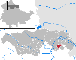
| Location of the municipality of Oberheldrungen in the Kyffhäuserkreis | ||
  |
||

Oberheldrungen is a municipality in the Kyffhäuserkreis in Thuringia . The district of Harras belongs to the municipality of Oberheldrungen .
geography
Oberheldrungen lies between the Schmücke and the Hohe Schrecke . The Helderbach flows through the village.
1.5 km southeast of Harras is on the main mountain of the Schmücke in the north on the upstream ridge of the Bonifatiusberg. On this hill there is a rampart in which bronze finds were recovered. The wealth of finds in the graves and burial mounds on the ridge of the Schmücke can be compared with that of the Kleiner Seeberg in the Thuringian Basin.
history
Oberheldrungen was first mentioned in a document in 874. Later the place belonged to the office of Heldrungen .
The earlier mining of potash salts is significant in industrial history . The disused potash mine of the Heldrungen II union , also known as the “Anna” mine, is located immediately south of Oberheldrungen (see map below).
In 1902 the sinking of the “Anna” shaft began. It took two years to complete.

Location of the "Anna" shaft

Remains of mining times

Outdoor swimming pool in the district of Harras


The extraction of carnallite was made from 1905. The mining mining method was the room and pillar method. The thickness of the potash seam Staßfurt fluctuated due to the deposits tectonics , reaching places more than 30 m. The extracted salts were processed in the company's own factories, ruins of which are still preserved today (see photos on the right). In 1924, the Heldrungen II mine was finally shut down in accordance with Section 83a of the Decommissioning Ordinance.
Since January 1, 2019, An der Schmücke has been a fulfilling municipality for Oberheldrungen, previously Oberheldrungen belonged to the administrative community of An der Schmücke .
Population development


Development of the population (December 31) :
|
|
|
|
|
Culture and sights
- Bonifaziuskirche (from 1714)
- rare plants such as gentian, silver thistle , fossil finds in limestone
Personalities
- Franz David Christoph Stoepel (born November 14, 1794 in Oberheldrungen, † December 19, 1836 in Paris ), musician of a dubious reputation, but who caused a lot of dust at the time
- Cathlen Gawlich (born March 11, 1970 in Sömmerda , Erfurt district ), German actress and radio play and voice actress
References and comments
- ^ Population of the municipalities from the Thuringian State Office for Statistics ( help on this ).
- ↑ Michael Köhler: Pagan sanctuaries. Jenzig-Verlag, 2007, ISBN 978-3-910141-85-8 , pp. 123 and 232.
- ↑ After the First World War and the loss of the Alsatian potash mines, the German potash monopoly was broken. In order to curb the overproduction of potash salts, on October 22, 1921, the Reichstag issued the “Ordinance on the Amendment of the Regulations of the Law on the Regulation of the Potash Industry” of July 18, 1919, briefly referred to as the “Decommissioning Ordinance”. With this ordinance, the potash plant operators were offered to voluntarily shut down less profitable plants by the end of December 31, 1953.
- ^ Robert Eitner: Stoepel, Franz David Christoph . In: Allgemeine Deutsche Biographie (ADB). Volume 36, Duncker & Humblot, Leipzig 1893, pp. 433-435.
Web links
Abtsbessingen | On the jewelry | Artern | Bad Frankenhausen / Kyffhäuser | Bellstedt | Borxleben | Clings | Revival | Etzleben | Freienbessingen | Farmyard | Greetings | Großenehrich | Helbedündorf | Holzsußra | Kalbsrieth | Kyffhäuserland | Mönchpfiffel-Nikolausrieth | Niederbösa | Upper Evil | Oberheldrungen | Reinsdorf | Rockstedt | Roßleben-Wiehe | Sondershausen | Topfstedt | Trebra | Wasserthaleben | West Greussia | Wolferschwenda