
Clings
| coat of arms | Germany map | |
|---|---|---|

|
Coordinates: 51 ° 14 ' N , 10 ° 56' E |
|
| Basic data | ||
| State : | Thuringia | |
| County : | Kyffhäuserkreis | |
| Management Community : | Greetings | |
| Height : | 185 m above sea level NHN | |
| Area : | 10.75 km 2 | |
| Residents: | 1068 (Dec. 31, 2019) | |
| Population density : | 99 inhabitants per km 2 | |
| Postal code : | 99718 | |
| Area code : | 03636 | |
| License plate : | KYF, ART, SDH | |
| Community key : | 16 0 65 012 | |
| LOCODE : | DE CGE | |
| Association administration address: | Am Markt 1 99718 Greußen |
|
| Website : | ||
| Mayor : | Harald Keitel | |
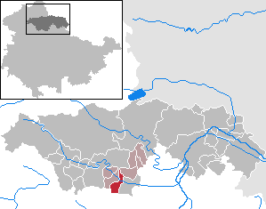
| Location of the city of Clingen in the Kyffhäuserkreis | ||
  |
||

Clingen is a country town in the Kyffhäuserkreis in northern Thuringia . It lies on the Helbe and forms with the neighboring towns of Westgreußen and Greußen a geographical settlement unit with around 5400 inhabitants.
geography
Clingen lies in the valley of the Helbe, which runs in three arms: through the city the Saxon Helbe, a little to the north of it the Schwarzburger Helbe. The Steingraben runs between the two streams as the original river. The area is characterized by a flat, undulating, very fertile, poorly forested basin landscape, the Thuringian Basin . The Hainleite , a low mountain range, runs ten kilometers to the north .
Clingen is a regular medieval town complex with the elongated market square in the center. Later the city expanded north to the banks of the Helbe. Immediately adjacent is the town of Greussen down the helbe and the village of Westgreußen up the helbe. The name "Clingen" means "artificial watercourses".
history
Clingen was first mentioned in a document around 900 and received city rights in 1282 . It grew out of two town centers around two churches. St. Andreas no longer exists, St. Gumperti is today's town church. In the 13th century, Prince Heinrich von Hohnstein built a castle in Clingen. It was on the site of the later domain and served as the seat of the bailiff . The moat and remains of the wall are still there. 1356 came Clingen (with Greußen ) to the Counts of Schwarzburg . In 1576 a new castle was built. Until 1918, Clingen belonged to the subordinate rule of the Principality of Schwarzburg-Sondershausen .
| Population development | |||||||||||||
|---|---|---|---|---|---|---|---|---|---|---|---|---|---|
| year | 1994 | 1996 | 1998 | 2000 | 2002 | 2004 | 2006 | 2008 | 2010 | 2012 | 2014 | 2016 | 2018 |
| Residents | 1239 | 1259 | 1242 | 1222 | 1178 | 1138 | 1013 | 1084 | 1072 | 1059 | 1035 | 1021 | 1063 |
December 31st each
Data source: Thuringian State Office for Statistics
politics
The city has been part of the Greußen administrative community since 1993 .
City council
The city council consists of twelve elected volunteer citizens. The local elections on May 26, 2019 led to the following result:

| Party / list | Share of votes | Seats |
| CDU | 73.3% | 9 |
| The left | 17.8% | 2 |
| NPD | 5.6% | 1 |
| SPD / GfC | 3.3% | 0 |
coat of arms
Blazon : “In blue a growing bishop in regalia. In the right hand the crook, in the left holding a book. "
The bishop is St. Gumbert , the patron saint of a monastery church in Clingen. His bust was probably included in the coat of arms when it was granted city rights at the end of the 13th century.
Culture and sights

Buildings
- The Protestant town church St. Gumberti is a three-aisled complex with a west tower and a polygonal choir . The core was probably built at the beginning of the 13th century (tradition speaks of 1208). In the original basilica , the wide, rectangular tower is included in the west facade. The upper floor with a pointed helmet was redesigned in 1840. The nave walls have an irregular structure with ogival windows. On the east wall of the north aisle there are tracery windows with a three-pass from the 14th century. Inside, the flat-roofed aisles are separated by pointed arches . A wooden barrel with stitch caps (before 1680) is located above the central nave and the choir, which closes on three sides . The southern wall of the choir contains a box built in from the 17th century. The chancel contains stained glass windows from W. Franke (Naumburg) , the north aisle stained glass by Ernst Kraus . In the cemetery you can find gravestones from the 18th and 1st half of the 19th century, including a sandstone grave for Georg Ernesti Bachrodt with relief busts and angel figures.
- Domain, part of the castle from 1576
- Remains of the city wall
- Several stately and well-renovated half-timbered buildings
Others
- Local recreation center Kleine Wartburg (only one model) with mini zoo and playground
Economy and Transport
Viticulture was practiced in Clingen until the 19th century . The cultivation of flax, combined with the linen weaving, retained the greatest importance for the predominantly rural population until the middle of the 19th century. On May 30, 1868, the first train on the newly built Sondershausen – Erfurt railway entered the Greußen station. The operation of passenger and freight trains was initially in deficit, even with the military transports of 1870 and 1871 only minimal profits could be made. The transport of agricultural products, brickworks and house bricks gained importance in the late 19th century. When a Wilhelm Scheller from Gröningen near Halberstadt took over the domain farm from Oberamtmann Lindstedt around 1870 , he introduced the sugar beet cultivation that had been taken over from his home in Clingen. The industrial processing could be made possible with the sugar factory AG Clingen, which opened in December 1873 , because the required fuel (lignite) could be transported cheaply by rail. It was the beginning of the industrialization of the place.
Clingen had been a center of travertine stone processing since the middle of the 19th century. In subterranean fractures east of the city - the so-called "Clinger Grottos", large-format stones were mined, processed in workshops near the train station and sold as building stones (for example to Erfurt ). Some stone carvers used suitable quarry stones to create monuments, fences and cemetery walls. The rock garden with the “Little Wartburg” on the western edge of the village gained a certain fame. At the turn of the century, the rare craft of cave building emerged thanks to strong demand in stately parks and villas in the area . Today mainly medium-sized companies are based in the industrial park west of the city center, including a malt house .
Clingen is not far from the federal highway 4 from Erfurt to Nordhausen . The state road Greußen - Großenehrich - Ebeleben runs north of the city . Greußen station is about 600 meters in front of the Welkertor southwest of Clingen on the Nordhausen – Erfurt railway line .
Personalities
sons and daughters of the town
- Benjamin Christoph Gimmerthal (1769–1837), senior pastor in Greußen
- Rudolf Boese (1839–1912), member of the state parliament
- Günter Grüner (1942–2016), member of the state parliament
People who worked on site
- Johann Gottfried Keßler (1754–1830), mining and building advisor
- Rudolf Höttermann (1881–1943), master builder
literature
- Kurt Zorn (pastor): Chronicle of Clingen and the surrounding area . Self-published, Clingen 1932, p. 214 .
- Apfelsstedt, HFTh .: Home studies for the residents of the Principality of Schwarzburg-Sondershausen . First issue. The subordination. FA Eupel, Sondershausen 1854, description of the four market towns (Clingen, Ebeleben, Marktsußra and Keula), p. 115-118 .
- ALJ Michelsen: Legal monuments from Thuringia . Ed .: Thr. Association for history and archeology. 1st edition. Friedrich Frommann, Jena 1862, IV. Old statutes of the city of Clingen, p. 179-198 .
- FW Sternickel: Chronicle of the city of Greußen . 1st edition. E. Fleck & Sohn, Sondershausen 1829, p. 152 . (also contains a lot of information about the history of clings)
- "Clingen" in H.Patze and P.Aufgebauer (eds.): Handbook of the historical sites of Germany - Thuringia. Stuttgart: Kröner-Verlag 1989. ISBN 3-520-31302-2
Individual evidence
- ^ Population of the municipalities from the Thuringian State Office for Statistics ( help on this ).
- ^ New Thuringian Wappenbuch, volume 2. Editor: Arbeitsgemeinschaft Thüringen eV 1998, page 24. ISBN 3-9804487-2-X
- ^ Dehio, Georg , edited by Stephanie Eißling, Franz Jäger and other specialist colleagues: Handbuch der deutschen Kunstdenkmäler, Thuringia . Deutscher Kunstverlag , 2003, ISBN 3-422-03095-6 , pp. 187 ff.
- ↑ https://www.kleine-wartburg.de/
Web links
Abtsbessingen | On the jewelry | Artern | Bad Frankenhausen / Kyffhäuser | Bellstedt | Borxleben | Clings | Revival | Etzleben | Freienbessingen | Farmyard | Greetings | Großenehrich | Helbedündorf | Holzsußra | Kalbsrieth | Kyffhäuserland | Mönchpfiffel-Nikolausrieth | Niederbösa | Upper Evil | Oberheldrungen | Reinsdorf | Rockstedt | Roßleben-Wiehe | Sondershausen | Topfstedt | Trebra | Wasserthaleben | West Greussia | Wolferschwenda