
Trebra
| coat of arms | Germany map | |
|---|---|---|

|
Coordinates: 51 ° 17 ' N , 10 ° 59' E |
|
| Basic data | ||
| State : | Thuringia | |
| County : | Kyffhäuserkreis | |
| Management Community : | Greetings | |
| Height : | 260 m above sea level NHN | |
| Area : | 7.94 km 2 | |
| Residents: | 286 (Dec. 31, 2019) | |
| Population density : | 36 inhabitants per km 2 | |
| Postal code : | 99718 | |
| Area code : | 036379 | |
| License plate : | KYF, ART, SDH | |
| Community key : | 16 0 65 075 | |
| Association administration address: | Bahnhofstrasse 13a 99718 Greussen |
|
| Website : | ||
| Mayor : | Michael Höxtermann | |
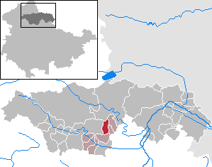
| Location of the municipality of Trebra in the Kyffhäuserkreis | ||
  |
||

Trebra is a municipality in the Kyffhäuserkreis in Thuringia . It belongs to the administrative community Greußen . The vortex stream flows in an arc around the village from north to south-east.
history

At the beginning of the 9th century Trebra was mentioned for the first time as a Dribure in a list of the goods of the Hersfeld Monastery built by Archbishop Lullus († 786) of Mainz . In 874, monks of the Benedictine order built a large estate in the immediate vicinity of the first settlements. An old barn still bears witness to the old cloister courtyard, with secco paintings on clay and depictions of biblical motifs. 1000 gave King Otto III. the village of Trebra to the Archdiocese of Magdeburg . Later there was a noble family there who named themselves after the town of Trebra .
In the following period Trebra belonged to the subordinate rule of the Principality of Schwarzburg-Sondershausen until 1918 .
Population development
Development of the population (December 31) :
|
|
|
|
|
- Data source: Thuringian State Office for Statistics
politics
coat of arms
The coat of arms was approved on March 10, 1992.
Blazon : "In black, two slanted golden bars."
The local coat of arms was based on the family coat of arms of those of Trebra , whose name goes back to the place.
Attractions
- Saint Peter Church
- War memorial for the local soldiers who fell in World War I, sandstone with the names heavily weathered. In front of it a plaque from the time after the "Wende" with the names of the 21 soldiers from Trebra who fell and went missing in World War II. Since 2011 a new memorial for those who fell in both world wars.
- Remnants of the former monastery: sparse and difficult to access
- well-preserved village ensemble, some beautiful and well-restored archways and half-timbered houses
economy
Agrar GmbH Trebra is the largest company in the municipality .
traffic
Trebra is five kilometers east of federal highway 4 , roughly halfway between Nordhausen and Erfurt .
The nearest train station is Greußen on the Nordhausen – Erfurt railway line , about eight kilometers south of Trebra. On weekdays there is a bus connection with line 444 of the regional bus company Unstrut-Hainich- und Kyffhäuserkreis . Line 442 also runs to the district town of Sondershausen, especially on school days .
Individual evidence
- ^ Population of the municipalities from the Thuringian State Office for Statistics ( help on this ).
- ↑ New Thuringian Wappenbuch Volume 2, page 31; Publisher: Arbeitsgemeinschaft Thüringen eV 1998 ISBN 3-9804487-2-X
Web links
Abtsbessingen | On the jewelry | Artern | Bad Frankenhausen / Kyffhäuser | Bellstedt | Borxleben | Clings | Revival | Etzleben | Freienbessingen | Farmyard | Greetings | Großenehrich | Helbedündorf | Holzsußra | Kalbsrieth | Kyffhäuserland | Mönchpfiffel-Nikolausrieth | Niederbösa | Upper Evil | Oberheldrungen | Reinsdorf | Rockstedt | Roßleben-Wiehe | Sondershausen | Topfstedt | Trebra | Wasserthaleben | West Greussia | Wolferschwenda