Harras (Oberheldrungen)
|
Harras
Community Oberheldrungen
Coordinates: 51 ° 16 ′ 21 ″ N , 11 ° 14 ′ 9 ″ E
|
|
|---|---|
| Height : | 185 m |
| Residents : | 70 (2012) |
| Postal code : | 06577 |
| Area code : | 034673 |
|
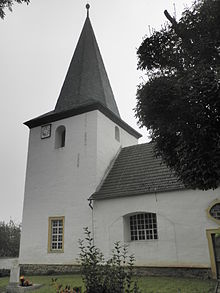
View of Harras
|
|
Harras is a district of Oberheldrungen in the Kyffhäuserkreis in Thuringia .
location
Harras is located southwest of Oberheldrungen between the Schmücke and the Hohe Schrecke . The Bonifatiusberg is 1.5 kilometers from the district . It is the main mountain of jewelry. A section of the newly built federal motorway 71 with a tunnel under the Schmücke runs northwest .
history
The village was first mentioned in a document on April 3 or 5, 1252. There is a rampart on the Bonifatiusberg , in which excavations were made. The finds from the burial mounds are comparable to other burial grounds such as Kleiner Seeberg and Ranis . In 2012 the rural town had 70 inhabitants.
The aristocratic family von Harras probably emerged from the place and belonged to the office of Heldrungen since the end of the 16th century at the latest . The Viereckhof (see pictures) on the northern outskirts is partly the rest of the former manor. In GDR times, the property housed the village's LPG . The former manor house has been greatly simplified and alienated.
According to the villagers, the church was ripe for demolition at the turn of 1990. This was prevented by the strong personal and financial commitment of Wilhelm Schneider, through whom the church rose again. He died at the age of 98 and is buried in the Harras churchyard.
Web links
Individual evidence
- ^ Wolfgang Kahl : First mention of Thuringian towns and villages. A manual. Rockstuhl Verlag, Bad Langensalza, 2010, ISBN 978-3-86777-202-0 , p. 110
- ↑ Michael Köhler: Pagan sanctuaries-pre-Christian cult sites and suspected cult sites in Thuringia Jenzig Verlag, 2007, ISBN 978-3-910141-85-8 , pp. 123 + 232


