
Bundesstrasse 11
| Bundesstrasse 11 in Germany | |||||||||||||||||||||||||||||||||||||||||||||||||||||||||||||||||||||||||||||||||||||||||||||||||||||||||||||||||||||||||||||||||||||||||||||||||||||||||||||||||||||||||||||||||||||||||||||||||||||||||||||||||||||||||||||||||||||||||||||||||||||||||||||||||||||||||||||||||||||||||||||||||||||||||||||||||||||||||||||||||||||||||||||||||||||||||||||||||||||||||||||||||||||||||||||||||||||||||||||||||||||||||||||||||||||||||||||||||||||||||||||||||||||||||||||||||||||||||||||||||||||||||||||||||||

|
|||||||||||||||||||||||||||||||||||||||||||||||||||||||||||||||||||||||||||||||||||||||||||||||||||||||||||||||||||||||||||||||||||||||||||||||||||||||||||||||||||||||||||||||||||||||||||||||||||||||||||||||||||||||||||||||||||||||||||||||||||||||||||||||||||||||||||||||||||||||||||||||||||||||||||||||||||||||||||||||||||||||||||||||||||||||||||||||||||||||||||||||||||||||||||||||||||||||||||||||||||||||||||||||||||||||||||||||||||||||||||||||||||||||||||||||||||||||||||||||||||||||||||||||||||
| |
|||||||||||||||||||||||||||||||||||||||||||||||||||||||||||||||||||||||||||||||||||||||||||||||||||||||||||||||||||||||||||||||||||||||||||||||||||||||||||||||||||||||||||||||||||||||||||||||||||||||||||||||||||||||||||||||||||||||||||||||||||||||||||||||||||||||||||||||||||||||||||||||||||||||||||||||||||||||||||||||||||||||||||||||||||||||||||||||||||||||||||||||||||||||||||||||||||||||||||||||||||||||||||||||||||||||||||||||||||||||||||||||||||||||||||||||||||||||||||||||||||||||||||||||||||
| map | |||||||||||||||||||||||||||||||||||||||||||||||||||||||||||||||||||||||||||||||||||||||||||||||||||||||||||||||||||||||||||||||||||||||||||||||||||||||||||||||||||||||||||||||||||||||||||||||||||||||||||||||||||||||||||||||||||||||||||||||||||||||||||||||||||||||||||||||||||||||||||||||||||||||||||||||||||||||||||||||||||||||||||||||||||||||||||||||||||||||||||||||||||||||||||||||||||||||||||||||||||||||||||||||||||||||||||||||||||||||||||||||||||||||||||||||||||||||||||||||||||||||||||||||||||
 |
|||||||||||||||||||||||||||||||||||||||||||||||||||||||||||||||||||||||||||||||||||||||||||||||||||||||||||||||||||||||||||||||||||||||||||||||||||||||||||||||||||||||||||||||||||||||||||||||||||||||||||||||||||||||||||||||||||||||||||||||||||||||||||||||||||||||||||||||||||||||||||||||||||||||||||||||||||||||||||||||||||||||||||||||||||||||||||||||||||||||||||||||||||||||||||||||||||||||||||||||||||||||||||||||||||||||||||||||||||||||||||||||||||||||||||||||||||||||||||||||||||||||||||||||||||
| Basic data | |||||||||||||||||||||||||||||||||||||||||||||||||||||||||||||||||||||||||||||||||||||||||||||||||||||||||||||||||||||||||||||||||||||||||||||||||||||||||||||||||||||||||||||||||||||||||||||||||||||||||||||||||||||||||||||||||||||||||||||||||||||||||||||||||||||||||||||||||||||||||||||||||||||||||||||||||||||||||||||||||||||||||||||||||||||||||||||||||||||||||||||||||||||||||||||||||||||||||||||||||||||||||||||||||||||||||||||||||||||||||||||||||||||||||||||||||||||||||||||||||||||||||||||||||||
| Operator: |
|
||||||||||||||||||||||||||||||||||||||||||||||||||||||||||||||||||||||||||||||||||||||||||||||||||||||||||||||||||||||||||||||||||||||||||||||||||||||||||||||||||||||||||||||||||||||||||||||||||||||||||||||||||||||||||||||||||||||||||||||||||||||||||||||||||||||||||||||||||||||||||||||||||||||||||||||||||||||||||||||||||||||||||||||||||||||||||||||||||||||||||||||||||||||||||||||||||||||||||||||||||||||||||||||||||||||||||||||||||||||||||||||||||||||||||||||||||||||||||||||||||||||||||||||||||
| Start of the street: |
Bayerisch Eisenstein ( 49 ° 7 ′ N , 13 ° 12 ′ E ) |
||||||||||||||||||||||||||||||||||||||||||||||||||||||||||||||||||||||||||||||||||||||||||||||||||||||||||||||||||||||||||||||||||||||||||||||||||||||||||||||||||||||||||||||||||||||||||||||||||||||||||||||||||||||||||||||||||||||||||||||||||||||||||||||||||||||||||||||||||||||||||||||||||||||||||||||||||||||||||||||||||||||||||||||||||||||||||||||||||||||||||||||||||||||||||||||||||||||||||||||||||||||||||||||||||||||||||||||||||||||||||||||||||||||||||||||||||||||||||||||||||||||||||||||||||
| End of street: |
Krün ( 47 ° 30 ′ N , 11 ° 16 ′ E ) |
||||||||||||||||||||||||||||||||||||||||||||||||||||||||||||||||||||||||||||||||||||||||||||||||||||||||||||||||||||||||||||||||||||||||||||||||||||||||||||||||||||||||||||||||||||||||||||||||||||||||||||||||||||||||||||||||||||||||||||||||||||||||||||||||||||||||||||||||||||||||||||||||||||||||||||||||||||||||||||||||||||||||||||||||||||||||||||||||||||||||||||||||||||||||||||||||||||||||||||||||||||||||||||||||||||||||||||||||||||||||||||||||||||||||||||||||||||||||||||||||||||||||||||||||||
| Overall length: | originally 312 km of which 155 km graduated |
||||||||||||||||||||||||||||||||||||||||||||||||||||||||||||||||||||||||||||||||||||||||||||||||||||||||||||||||||||||||||||||||||||||||||||||||||||||||||||||||||||||||||||||||||||||||||||||||||||||||||||||||||||||||||||||||||||||||||||||||||||||||||||||||||||||||||||||||||||||||||||||||||||||||||||||||||||||||||||||||||||||||||||||||||||||||||||||||||||||||||||||||||||||||||||||||||||||||||||||||||||||||||||||||||||||||||||||||||||||||||||||||||||||||||||||||||||||||||||||||||||||||||||||||||
|
State : |
|||||||||||||||||||||||||||||||||||||||||||||||||||||||||||||||||||||||||||||||||||||||||||||||||||||||||||||||||||||||||||||||||||||||||||||||||||||||||||||||||||||||||||||||||||||||||||||||||||||||||||||||||||||||||||||||||||||||||||||||||||||||||||||||||||||||||||||||||||||||||||||||||||||||||||||||||||||||||||||||||||||||||||||||||||||||||||||||||||||||||||||||||||||||||||||||||||||||||||||||||||||||||||||||||||||||||||||||||||||||||||||||||||||||||||||||||||||||||||||||||||||||||||||||||||
| Development condition: | two-lane | ||||||||||||||||||||||||||||||||||||||||||||||||||||||||||||||||||||||||||||||||||||||||||||||||||||||||||||||||||||||||||||||||||||||||||||||||||||||||||||||||||||||||||||||||||||||||||||||||||||||||||||||||||||||||||||||||||||||||||||||||||||||||||||||||||||||||||||||||||||||||||||||||||||||||||||||||||||||||||||||||||||||||||||||||||||||||||||||||||||||||||||||||||||||||||||||||||||||||||||||||||||||||||||||||||||||||||||||||||||||||||||||||||||||||||||||||||||||||||||||||||||||||||||||||||
|
Course of the road
|
|||||||||||||||||||||||||||||||||||||||||||||||||||||||||||||||||||||||||||||||||||||||||||||||||||||||||||||||||||||||||||||||||||||||||||||||||||||||||||||||||||||||||||||||||||||||||||||||||||||||||||||||||||||||||||||||||||||||||||||||||||||||||||||||||||||||||||||||||||||||||||||||||||||||||||||||||||||||||||||||||||||||||||||||||||||||||||||||||||||||||||||||||||||||||||||||||||||||||||||||||||||||||||||||||||||||||||||||||||||||||||||||||||||||||||||||||||||||||||||||||||||||||||||||||||
The federal highway 11 (abbreviation: B 11 ) is a German national highway in the Free State of Bavaria . It begins on the border with the Czech Republic near Bayerisch Eisenstein and runs via Deggendorf , Landshut , Freising , Munich and the Kesselberg to Krün . It originally had a length of 312 kilometers, of which 155 kilometers have now been graded.
history
On January 17, 1932, trunk road 17 (FVS 17) was introduced. In 1934 the German Reich took responsibility (construction load) for the route and ran it as Reichsstraße 17 (R 17). At the end of the 1940s it was given its current name. The number 11 is thus the first number of the “regional” high-ranking roads after the motorways in Germany.
In the 1960s, the through-roads between Landshut and Freising were replaced by local bypasses due to the sharp increase in traffic, from Eching (Ndb) to Tiefenbach even free of intersections. Only in Moosburg was the Isar bridge from 1949 used by the B 11 until 2018, in order to then bypass the historically narrow inner city in a southern bypass completed in 1965 to the Moosburg-West roundabout. The clearance of the Freising-Ost to Moosburg-Nord section of the A 92 was brought forward by a few months in 1987 after a truck damaged the Isar bridge of the B 11 so badly that it had to be closed.
Originally, the B 11, like all other federal highways leading through Munich, ran through the center of Munich via the Altstadtring ; the transfer to the B 2R was carried out at the end of the 1980s.
In 1979 the route was relocated in the Bavarian Forest , as the previous route over the Rusel , a pass road up to 850 m above sea level. NHN , especially in winter was too steep for heavy traffic. The B 11 now leads further west to Patersdorf , where it joins the federal highway 85 in the direction of Regen . The two district towns of Deggendorf and Regen are no longer directly connected by the B11. Over the next few years, the B 11 between Deggendorf and Bayerisch Eisenstein will be expanded to three lanes in order to cope with the increased volume of traffic. In addition, the municipality of Ruhmannsfelden is to receive a bypass.
On November 5, 2010, a 1.6 km long expansion section was put into operation between Regen and Zwiesel . 1.1 km of this route were carried out in three lanes.
From the Czech border near Bayerisch Eisenstein to Deggendorf, where it joins the A 92, the B 11 is part of the European route 53 . From 1938 to 1945, Reichsstraße 11 in the Sudetenland continued via Klattau and Pilsen to Podersam in the Egerland . Today this road is run in the Czech Republic as Silnice I / 27 and runs via Klatovy to Pilsen and Dubí.
The first serpentine road (Wolfratshauser Berg) is located on the northern city limits of Wolfratshausen . In the 1990s, the B 11 between Geretsried and Wolfratshausen was expanded into a motorway-like road .
Traffic volume
The traffic load in the Landshut area is 14,000 vehicles per day. The traffic volume in the area of the Isar bridge near Moosburg is 23,500 vehicles per day.
Construction progress / planning status
Tunnel near Deggendorf
In Deggendorf, coming from the direction of Munich, after the end of the A 92, the road was expanded to four lanes, including through the first of the two tunnels (with tubes separated from the direction of travel). However, the following tunnel was only built as a tube and the road in this tunnel is now only three lanes. The annual one-week closure of these tunnels for regular maintenance repeatedly causes displeasure in the region. The region around Deggendorf was particularly hard hit by the more than one-year renovation and closure of these tunnels that began in November 2014.
Substitutions and downgrades
After the completion of the Bundesautobahn 92 , the section between Deggendorf and Ergolding was rededicated as State Road 2074, as the A 92 runs parallel to the former Bundesstraße 11 on the same side of the Isar . On January 1, 2016, the section between the Moosburg -Nord and Munich exits, including the B 11 in the urban area (northern section), was downgraded to State Road 2350 . Instead, the section between Freising and Marzling was rededicated as Bundesstraße 301 .
Conservation measures
Landshut area
In May 2015, preparations for the rehabilitation of the existing federal road due to damaged bituminous road surface between Landshut and Weixerau began on a length of approx. 10 km . The preparatory work was completed between May 18th and 22nd. A period of three weeks from May 26th was estimated for the renewal of the road surface under full closure and the construction costs estimated at 1.7 to 2 million euros.
gallery

Access to federal road 11 in Königsdorf
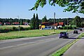
Bundesstrasse 11 near Baierbrunn

Between Zwiesel and Theresienthal


Trivia
Until June 30, 2015, there was generally no toll for trucks under the Federal Trunk Road Toll Act (BFStrMG) on the B11. Since July 1, 2015, tolls have been imposed on the 0.8 km section between the Deggendorf junction and the Deggendorf-Mitte junction . Since July 1, 2018, the B 11, like all federal highways, is generally subject to tolls for trucks over 7.5 tons.
With the downgrading of sections to the state road, tolls no longer apply on the sections concerned.
See also
Web links
Individual evidence
- ↑ in the urban area of Munich partly with four lanes with median
- ↑ reichsstrassen.de.vu: The federal and former Reichsstraßen in Germany ( Memento from September 7, 2012 in the web archive archive.today )
- ↑ a b State Building Authority Landshut: Projects in the district and in the city of Landshut - B 11; Repair Landshut - Weixerau ( Memento from July 6, 2015 in the Internet Archive ). Online at www.stbala.bayern.de. Retrieved May 24, 2015.
- ↑ B 11 tunnel in Deggendorf: renovation will start shortly. Deggendorfer Zeitung , November 5, 2014, accessed on November 13, 2014 .
- ↑ Bavarian State Gazette . No. 36 , 2015.
- ↑ Merkur: The B11 is a thing of the past in the Freising district . January 15, 2016. Online at www.merkur.de. Retrieved January 17, 2016.
- ↑ Staatliches Bauamt Landshut: Current status of the construction work on the repair of the B11 between Landshut and Weixerau ( memento from July 6, 2015 in the Internet Archive ). May 22, 2015. PDF. Online at www.stbala.bayern.de. Retrieved May 24, 2015.
- ↑ Staatliches Bauamt Landshut: Description of the repair work on the B11 between Landshut and Weixerau ( memento from July 6, 2015 in the Internet Archive ). May 20, 2015. PDF. Online at www.stbala.bayern.de. Accessed May 24th. 2015.
- ↑ Federal Highway Research Institute: The toll table 4.1 (federal roads) . PDF. Online at www.mauttabelle.de, accessed on March 30, 2015.
- ↑ Federal Highway Research Institute: The toll table 4.4 (federal roads) . PDF. Online at www.mauttabelle.de, accessed on July 26, 2016.
- ↑ heute.de: Truck tolls from 2018 on all federal highways ( memento from July 29, 2016 in the Internet Archive ). May 11, 2016, online at www.heute.de, accessed on May 24, 2016.