Reichsstrasse 329
| Reichsstrasse 329 in the German Empire | |
| 329 | |
| map | |
| Basic data | |
| Operator: | German Empire |
| Start of the street: | Richeval (Reichental) |
| End of street: | Brumath |
| Overall length: | 73 km historical, on French territory placed under civil administration during the Second World War |
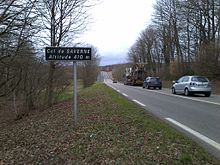
The national highway 329 ( R 329 ) was established in 1940 in what was then placed under civil administration CdZ area Lorraine and CdZ area Alsace as Reichsstraße of the German Reich established. It ran from the border to the Meurthe-et-Moselle département in occupied France near Richeval (Reichental) on the route of the French route nationale 4 in a north-easterly direction via Héming (Hemingen), where the then Reichsstraße 57 was crossed, on via Sarrebourg (Saarburg ) and Phalsbourg (Pfalzburg) and further over the Zaberner Steige (Col de Saverne) and Saverne (Zabern), where the then Reichsstraße 28 , which was extended from Strasbourg to Saarbrücken in 1940, was crossed, and from there in an easterly direction approximately parallel to the Canal de la Marne au Rhin (Rhine-Marne Canal) via Hochfelden to Brumath , where it met what was then Reichsstraße 38 .
The length of the former Reichsstraße was around 73 kilometers.
Individual evidence
- ↑ The German Automobile Club (Ed.): Road map of Germany, scale 1: 1,250,000, 1941, indicates the course east of Hochfelden to Haguenau (Hagenau).
- ^ The German Automobile Club (ed.): Road map of Germany, scale 1: 1,250,000, 1941
