Reichsstrasse 331
| Reichsstrasse 331 in the German Empire | |
| 331 | |
| map | |
| Basic data | |
| Operator: |
|
| Start of the street: | Salzburg |
| End of street: | Spittal an der Drau |
| Overall length: | 164 km historical |
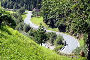
| The road in the Carinthian Liesertal | |
The national highway 331 ( R 331 ) was from 1938 to 1945, a state road of the German Reich , the Austrian completely in today's provinces of Salzburg and Carinthia passed. The road started in the city of Salzburg , followed the valley of the Salzach to the south via Hallein to Bischofshofen , from there led together with the former Reichsstraße 318 to Radstadt , from there on today's Katschberg Straße B 99 over the Radstädter Tauernpass to Mauterndorf and on over the Katschberg to Spittal an der Drau , where it ended at what was then Reichsstraße 336 .
Their total length was around 164 kilometers.
Individual evidence
- ^ The German Automobile Club (ed.): Road map of Germany, scale 1: 1,250,000, 1941
