
Salzach


The Salzach is a right tributary of the Inn and with a length of 225 km it is the longest and richest in water. It flows in the state of Salzburg ( Austria ) and in Bavaria ( Germany ), is one of the great Alpine rivers and drains the eastern Hohe Tauern to the north.
etymology
The ancient Latin name of the Salzach was Iuvarus or Ivarus . The name came from the Celtic river deity Iuvavo , the divine personification of the Salzach. The Romans later adopted the name of this god for the Roman city of Iuvavum , slightly Latinized .
Ivarus , however, was only called the lower reaches and the Saalach flowing into the Salzach , since the upper reaches had its own name, Isonta .
The Salzach owes its current name to the salt shipping that operated on the river until the 19th century; the historical center of salt shipping was Laufen . Until after 1800 the river was generally called Salza (i.e. the same as a Lower Austrian-Styrian river ).
Course of the river
Sections of the Salzach Valley
Salzachtal describes the entire course of the Salzach river. The upper course stretches characteristically between the Hohen Tauern and the Salzburg Slate Alps as part of the northern longitudinal valley furrow in a west-east direction. Then it describes a knee, breaks through flowing northward in the middle course of the slate and northern Alps , and in the lower course forms several valley troughs in the Alpine foreland (breakthrough valleys through the hilly ranges of the subalpine and foreland molasses ).
The sections are named as follows, whereby the more frequent terms referring to the Salzburger Gaue can also designate the secondary talents more generally:
-
Salzachpinzgau , also Pinzgauer Salzachtal , the valley section of the upper reaches to Lend
- Source valley of the Salzach, from the source at the Salzachgeier to Vorderkrimml
- Oberpinzgau , the Trogtal from Gerlospass to the Niedernsill / Kaprun - Piesendorf area
- Zeller Becken , a widening around Lake Zell , in which the valley opens entirely to the north for a few kilometers (part of the Mitterpinzgau or Saalfelden-Zeller basin )
- Unterpinzgau from Bruck / Taxenbach to Lend
- Salzachpongau , Pongauer Salzachtal , Bischofshofen – St.-Johanner Basin or Pongauer Basin , to the limestone gorge at Pass Lueg (Berchtesgaden Alps / Tennengebirge)
-
Salzburg – Halleiner basin , one of the most densely populated edge alpine basins
- Salzachtennengau , Tennengauer Salzachtal , also Hallein Basin , Golling-Hallein Basin , Halleiner Weitung , or Tennengauer Weitung , the following valley of the lower reaches around Hallein
- Salzburg Basin , also Salzburg-Freilassing Basin , the rim-alpine basin landscape around the city of Salzburg
-
extra- alpine valleys of the Alpine foothills until reaching the Lower Inn Valley (Salzach as the border river between Austria and Germany)
- Laufener Salzachtal , near Laufen
- Tittmoninger Salzachtal , lower section between the breakthroughs at Laufen and St. Radegund
- Burghausener Salzachtal , Engtal near Burghausen until reaching the Öttinger Inn Valley
- Upper Austrian Salzach Valley , the right bank spatial unit in Upper Austria between the state border at Bürmoos / St. Pantaleon and reaching the Upper Austrian Inn Valley (part of the Upper Innviertel )
The southern side valleys of the upper Salzach, in the main Alpine ridge , are called Tauern valleys .
Upper course


The Salzach rises in the Kitzbühel Alps in the west of Salzburg. The source streams drain several alpine pastures at around 2300 m above sea level. A. between Krimml and the Tyrolean border, 3 to 5 km north of the Gerlospass on the slopes of the Salzachgeier ( 2466 m above sea level ) and the Schwebenkopf (2354 m). Although some of these tributaries are longer, the Salzach is the main river due to its greater abundance of water. The Kare or Almböden are named Salzachboden, -Ursprung and Schwebenalm , where one of the springs forms a small mountain lake (Schwebenlacke). About 5 km south of Vorderkrimml, the young Salzach joins the Krimmler Ache , which is, however, more than half longer and, with almost three times the mean water flow, is hydrologically the main source of the Salzach system.
In the approximately 90 km long upper course , the catchment area of which almost coincides with the Pinzgau region , the Salzach follows a distinctive longitudinal valley furrow in a west-east direction to Schwarzach , where it gradually turns north. The longitudinal valley furrow, which is geologically related to the folding of the Alps , continues far to the east, where it forms the upper Ennstal .
The border between the Pinzgau (political district of Zell am See) and the Pongau (district of St. Johann) below the industrial town of Lend is considered the transition from the upper to the middle reaches . A little earlier, the Zeller / Saalfeldner basin opens to the north , which is separated by a valley watershed between the Zeller See and the catchment area of the Saalach , the largest tributary of the Salzach that flows into Salzburg. In earlier prehistoric times, its course was the lower course of the Salzach.
From Krimml to beyond the beginning of the middle course, the south-north running side valleys , which come from the main Alpine ridge (Venediger and Glockner groups of the Hohe Tauern ) flow from the south in a regular, almost parallel sequence . Almost all of these 15 water-rich southern tributaries flow into the Salzach as hanging valleys , because the ice age main glacier following the Salzach valley could deepen more deeply than the less powerful side glaciers. The mouths rise increasingly higher above the valley floor to the east and close with almost vertical, deep gorges . The best known are the Kitzlochklamm (Raurisertal), the Gasteiner Klamm (Gasteinertal) and the Liechtensteinklamm (Grossarltal).
Middle and lower reaches


At Schwarzach and St. Johann the middle course swings to the north and widens to a valley basin, the Pongauer basin , in which beside St. Johann also Bischofshofen is located. The Salzach breaks through the northern limestone Alps between the Hochkönig / Hagengebirge and the Tennengebirge at the Lueg Pass in the Salzachöfen gorge .
In the lower reaches the Salzach leaves the Alps in the Salzburg Basin , flows through the lower Tennengau with Golling , Kuchl and Hallein and the Flachgau with the city of Salzburg and Freilassing an der Saalach. It then breaks through the Laufener Enge near Oberndorf , flows through the Tittmoninger Basin and the Nonnreiter Enge and flows into the Überackern Basin between Burghausen an der Salzach and Braunau am Inn at an altitude of 344 m above sea level. NN near Haiming in the Inn coming from the west .
It forms the border between Germany and Austria over a length of about 59 km and has a catchment area of 6,704 km². The mean water discharge at the river mouth is 252 m³ / s.
Tributaries
There are the following tributaries in the state of Salzburg:
In the upper and middle reaches: Wenger Bach , Trattenbach and Dürnbach of the Kitzbühel Alps, Krimmler Ache , Obersulzbach , Untersulzbach , Habach , Hollerbach , Felber Bach , Stubache , Kaprun Ache from the Hohe Tauern, Pinzga from Lake Zell , Fuscher Ache , Rauriser Ache from the Hohe Tauern, Dientener Bach from the Schieferalpen, Gasteiner Ache , Großarlbach , Kleinarlbach from the Hohe Tauern, Fritzbach from the Dachstein massif, Mühlbach and Blühnbach from the Hochkönig.
In the lower reaches: Lammer from the east, Torrener Bach ( Bluntautal ) from the Berchtesgaden Alps, Tauglbach and Almbach from the Hintersee , both from the Osterhorn group, Königsseeache from Königssee , Kehlbach , Fischach from Wallersee , Klausbach , Saalach as the largest feeder, Sur and Götzinger Achen on Bavarian side, Oichten near Oberndorf and Moosach in the Salzburg-Upper Austrian border area.
Orographically on the left (from the origin to the mouth):
- Pinzgau: Nadernachbach Dürnbach near Neukirchen am Großvenediger, Trattenbach near Wald im Pinzgau, Walcherbach near Walchen, Friedensbach, Fürthbach, Pinzga (outflow of Lake Zell near Bruck ad Glocknerstrasse), Steinbach near Steinbach, Fischbach near Gries im Pinzgau.
- Pongau: Dientener Bach near Lend, Seebach near Schwarzach im Pongau, Wenger Bach from the Putzengraben in Schwarzach im Pongau, Reinbach near St. Johann im Pongau.
- Tennengau: Imlaubach near Pfarrwerfen, Blühnbach (Salzach) near Tenneck, Torrener Bach ( Bluntautal ) near Golling, Weißenbach between Golling and Kuchl, Steigbach near Stockach. Schrambach, Kotbach in Hallein, Königsseeache from Königssee near Taxach.
- City of Salzburg: Glanbach, Saalach (largest feeder).
- Flachgau: Sur on the Bavarian side, Götzinger Achen on the Bavarian side.
Orographically on the right (from the origin to the mouth):
- Pinzgau: Krimmler Ache , Obersulzbach , Untersulzbach , Habach , Hollersbach , Felberbach , Stubache , Mühlbach , Kapruner Ache from the Hohe Tauern, Fuscher Ache , Wolfbach , Rauriser Ache .
- Pongau: Gasteiner Ache , Großarlbach , Kleinarlbach from the Hohe Tauern, Fritzbach from the Dachstein massif.
- Tennengau: Lammer from the east, Tauglbach .
- Flachgau (south): Kehlbach near Elsbethen, Klausbach , near Glasenbach.
- City of Salzburg: Almbach from Hintersee .
- Flachgau (north): Fischach vom Wallersee , Oichten near Oberndorf , Moosach near Riedersbach.
Municipalities and cities


The Salzach flows through the following communities and cities (viewed downstream); the G identifies those that the river touches as a border river and the D those that are in Upper Bavaria , Bavaria ( Germany ):
|
|
bridges

In the city of Salzburg there are 13 Salzach bridges for motorized and non-motorized traffic. Down the river there are only cross-border bridges, namely the listed bridge between Laufen and Oberndorf and the Europasteg, also located there, as well as a bridge between Tittmoning and Ettenau (Ostermiething municipality) and two between Burghausen and Hochburg-Ach (Wanghausen: Neue Brücke and Oh on the Salzach: Old Bridge ). There are numerous bridges on the upper and middle reaches of the river.
Many of these bridges were destroyed several times by floods. The flood of August 13, 1959 with 2100 m³ / s meant the end of the newly built motorway bridge below Salzburg, which collapsed due to a bottom breakthrough .
The construction of an additional bridge for cross-border car traffic in the Laufen area is being discussed. So far, no agreement has been reached despite the determination of a corresponding need. Resident protests and a large, protected riparian forest belt are proving to be obstacles.
In addition, the construction of a pedestrian bridge just before the mouth of the Salzach between Haiming and Überackern is being considered.

First bridge over the Salzach on the way to the Salzachgeier

Small bridge in the Niedernsill area

Bridge in Hallein with art installation
Mozart footbridge in Salzburg

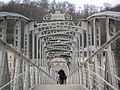
Oberndorf – Laufen bridge

Ach – Burghausen bridge

Makartsteg in Salzburg


Hydropower plants
There are currently 12 hydropower plants on the Salzach. Looking downstream, these are:
| Surname | Power (MW) | Annual generation (million kWh) |
|---|---|---|
| Schwarzach | 120 | 482 |
| Wallnerau | 13 | 38 |
| St. Vitus | 16 | 67 |
| St. Johann | 16 | 71 |
| Urreiting | 16 | 76 |
| Bischofshofen | 16 | 70 |
| Stegenwald power plant | (planned) | |
| Kreuzberg toll | 18th | 80 |
| Throwing Parish Throwing | 16 | 81 |
| Gamp | 8th | 53 |
| Hallein floor level | 16 | 81 |
| Urstein | 22nd | 120 |
| Floor level fief | 13 | 81 |
Verbund Hydro Power and Salzburg AG are planning the new construction of the Stegenwald power plant between Bischofshofen and Golling at river kilometer 100.791 and to the southwest next to a driving technology center. By damming and deepening underwater by 3 m, a fall height of 9 m should be achieved. At the Graz University of Technology, a 22 m long model on a scale of 1:40 was built in March 2020 to optimize the construction project with two weir fields on the left and two fields on the right, each with a Kaplan turbine. 14.5 MW bottleneck capacity, 72 GWh annual working capacity, expansion flow 203 m³ / s, HQ100 1005 m³ / s.
Hydrology
Amount of water and flood
At eight gauges in Austria and two in Germany, data on water levels and runoff are continuously collected. The mean flow rate increases downstream through the tributaries of the Salzach:
| Golling | Salzburg | To run | Burghausen | |
|---|---|---|---|---|
| River kilometers | 93.41 | 64.35 | 47.50 | 11.40 |
| Average discharge in m³ / s | 140 | 176 | 239 | 251 |
This makes the Salzach one of the largest rivers in Bavaria and Austria . As an Alpine river, the Salzach has to absorb large volumes of water in unfavorable weather conditions and prolonged rain. In the period from June to September this regularly leads to flooding, rarely also in winter. Probably the largest flood in the history of the city of Salzburg on June 25, 1786 is evidenced by a high water mark in the old town. The memorial plaque on the Haus der Natur Salzburg states that the Salzach killed 2,226 people in May 1571 and carried away 13 houses and barns in July of the following year. The largest amount of water in recent times flowed through the city of Salzburg at 2,300–2,500 m³ / s on September 14, 1899 , and almost 2,200 m³ / s on September 7, 1920. On August 12, 2002 the Salzach reached a water level of 8.30 m in the city of Salzburg and was only 10 centimeters below the critical mark that would have flooded large parts of the old town. The maximum flow rate of the Salzach on that day in the city of Salzburg was 2,300 cubic meters per second. Below the mouth of the Saalach, the 100-year flood discharge is then over 3,100 m³ / s. Winter floods are very rare, on March 21, 2002 the Salzach in Salzburg carried 1,060 m³ / s, a quantity that occurs approximately every two years, but represents at least a 100-year flood for the month of March.
On February 23, 1899, the kuk provincial government in Salzburg introduced a “provisional regulation for the flood intelligence service in the Herzogthume Salzburg”. Today in Austria, the Hydrological Information System for Flood Forecasting (HYDRIS) developed by the Vienna University of Technology is responsible for warning of floods. Both meteorological and hydrological data are incorporated here, which permit advance warning and, through flood coordination, enable a backwater with the help of the Mittlere Salzach power plant chain.
Regulation of the river bed

Since the Middle Ages, small parts of the Salzach in the urban area of Salzburg, Laufen and Hallein have been fortified with willow fascines and wooden shoring. The first attempts to regulate the Salzach in the form of a continuous trapezoidal profile began in 1823 in Pinzgau, secured by stone inserts. As a result of the regulations, building ground and cultivated land were gained, but valuable, vital riparian forest and the rich structure of the river with gravel islands and countless tributaries as space for animals and people were also lost. After the first contract concluded between Bavaria and Austria in Munich in April 1816, the old border lines were precisely measured. In December 1820 in Salzburg, the new state border was determined by mutual agreement.
The Brucker Schwelle was blown up in 1852, thereby lowering the Salzach. This enabled arable land near the river to be gradually gained in the Pinzgau and boggy and boggy meadows drained.
In the city of Salzburg itself, the first heavy blocks of the city walls next to the Klausentor were also removed in 1852 and used to regulate the Salzach. The once spacious bastions of the Neustadt and the vast majority of the fortifications on the old town side were used as raw material for regulating the Salzach, just like the Linzertor. The painter and councilor Josef Mayburger implemented a more elegant swinging structure within the urban area. Schwarz also wanted to use the material from the Müllner Schanze for regulating the Salzach, but Mayburger was able to prevent this. The regulation work between the city bridge and the railway bridge was completed in 1862, and that between the city bridge and the Karolinen bridge by 1873.
Initially, the Salzach below the city of Salzburg was planned to be 80 Vienna fathoms (152 m) wide . The self-deepening of the Salzach, which was initially very desirable, was largely omitted. Therefore, in a further step, the total width of the Salzach was reduced to 60 fathoms (114 m). It was only after 1900 that the considerable removal of bed load led to a significant deepening. To this day, the Salzach dug itself deeper and deeper into its bed. This deepening has been a problem for decades. In the meantime it has reached an extent at which the layers of fine sand and sea clay, which are particularly prone to erosion, are only insufficiently or not at all covered. Even a medium-sized flood event can lead to uncontrollable consequences and sudden further deepening of several meters (bottom breakthrough). Considerable damage to buildings and the surrounding area would be the result. Particularly for bridge piers and abutments, an acute hazard could arise within a very short time and bring all inner-city traffic to a standstill. There is therefore a need for action. A Bavarian-Austrian working group has worked out possible solutions and is currently carrying out the first measures of the “Redevelopment of the Lower Salzach” project. Among other things, widening of the river bed and the installation of dissolved base ramps and so-called open revetments are planned . The main aim of the measures is to prevent further deepening and to raise the river bed again in a dynamic process and to bring this state into a dynamic equilibrium. This means that valuable, vital alluvial forest can develop on a small scale. This indispensable work to rehabilitate the Salzach over a length of 60 km is associated with a cost of around 300 million euros.
In 2009, the first section began with the gradual widening of the lower Salzach below Weitwörth, combined with an elevation of the middle Salzach sole. In 2010 the broadening of the river towards Oberndorf will be continued.
Water quality

Due to a paper and pulp mill built in Hallein in 1895 and greatly expanded in the 1960s, the Salzach was the most polluted in 1977. It was not until 1979 that the amount of wastewater to be discharged was restricted (1979: 84 t BOD5 per day (which corresponds to around 1.4 million inhabitants); 1985: 54 t; 1988: 20 t; 1990: 15 t; 1999: 8 t; 2002: 2 t) and with the installation of a chlorine-free bleaching system in 1991, the quality improves suddenly.
Until 1999, the water quality was from the factory with water quality class II-III (critically polluted) until 1987 even only III-IV. Through the installation or improvement of the wastewater treatment in autumn 1999, the continuous water quality class II ("low pollution" according to the EU water framework directive) below Hallein was achieved for the first time, or quality class I-II up to Salzburg, so that the water quality is sufficient for swimming. The rehabilitation of the paper mill's wastewater technology was successfully completed at the end of 2002, but the daily amount of wastewater that has been discharged since then still corresponds to around 25% of the total pollution load of the Salzach.
In 1987, the use of the Siggerwiesen sewage treatment plant in the city of Salzburg, which is designed for over 600,000 residents, resulted in a further improvement in water quality by half a level. In addition to the wastewater from Salzburg, the wastewater treatment plant also cleans that from the surrounding area and from Ainring in Bavaria .
Tourism / leisure

- In the House of Nature there is the permanent exhibition Salzach Life Line
- The well-signposted Tauern Cycle Path begins at the Krimml Waterfalls in the Hohe Tauern National Park and leads along the Salzach, Saalach and Inn, partly on old towpaths ( towpaths ) to Passau.
- A riverside path leads from Laufen via Tittmoning to Burghausen (approx. 40 km in total), which is very easy to walk on the German side.
- Based on the salt shipping, so-called flat trips can be booked at the local tourist offices in the lowest section of the river, which take place several times a month in summer.
See also
- The Upper Austrian spatial unit Salzachtal am Unterlauf
literature
- Austrian Federal Ministry for Agriculture, Forestry, Environment and Water Management: The Salzach - a river moves! (PDF, 5.91 MB)
- Norbert Winding and Dieter Vogel (eds.): The Salzach. Wild river in the cultivated landscape. Verlag Kiebitz Buch, Vilsbiburg 2003, ISBN 3-9807800-1-5
- Manfred Straberger (arrangement): "The river area of the Salzach." Steiner, Stuttgart 1974. (Hydronymia Germaniae, Series A, Lfg. 9), ISBN 3-515-01913-8
Web links
Hydrography and hydraulic engineering:
- Hydrographic service - water level
- Water level graph of Laufen an der Salzach from the Bavarian State Office for the Environment
- Data sheet on the Salzach from the Traunstein Water Management Authority, archived December 9, 2011 ( Memento from December 9, 2011 in the Internet Archive )
- The 100-year flood on August 12, 2002 ( Memento from July 25, 2009 in the Internet Archive )
- sanierung-salzach.info , information on the renovation project
- Chronology of the load on the Salzach from the paper and pulp mill in Hallein
- Model test border section Salzach (border section Bavaria - Austria)
Tourism and documentation:
Individual evidence
- ↑ Leksikografski zavod Miroslav Krleža: Hrvatska enciklopedija , 2016, ISBN 978-953-268-038-6 ; accessed on November 29, 2016
- ^ German Hydrological Yearbook Danube Region 2006 Bavarian State Office for the Environment, p. 253, accessed on October 4, 2017, at: bestellen.bayern.de (PDF, German, 24.2 MB).
- ↑ a b c the Salzach takes on its second largest feeder after the Lueg pass with the Lammer, and from there it has the character of a pre-Alpine river; other sources, especially Bavarian ones, only give the lower reaches from the mouth of the Saalach, since only from there does Bavaria have a share in the Salzach. The latter delimitation also corresponds to the rough delimitation of the Alps, the former to the finer, natural spatial definition.
- ↑ a b c Pinzgau, Pongau as well as Tennengau each characteristically disintegrate into two parts of two rivers: terms customary in the country to differentiate from the Saalachpinzgau (upper reaches of the Saalach with side valleys ), the Ennspongau with side valleys and the Lammertal of the Tennengau
- ↑ Talung also unnamed in the ÖK
- ↑ a b c d e planning region according to the Salzburg state development plan
-
↑ a b together small production area Ober- and Unterpinzgau , according to Klaus Wagner: New delimitation of agricultural production areas in Austria. In: Series of publications by the Federal Agricultural Institute. No. 62, 1991 → Agricultural Production Areas , statistik.at;
also forestry region 115; Federal Ministry of Agriculture and Forestry: Der Förderungsdienst , Volume 39, 1991, p. 50 -
^ Small production area, after Wagner, 1991;
Forestry Region 116; The Funding Service , 1991 - ^ Small production area, after Wagner, 1991
- ↑ e.g. Austrian statistical region TOTO; Austrian Central Statistical Office: The Territorial Foundations of Austrian Federal Statistics , Volume 863 of Contributions to Austrian Statistics , 1987, p. 53
-
^ Small production area, according to Wagner, 1991
Forestry Region 603; The Funding Service , 1991 - ^ Ancient, for example in Albrecht Penck: Geographische Abhandlungen , Volume 1, 1887, p. 92
-
↑ Bavarian natural space unit 909.1, as the Bavarian State Forests also have forest rights in Austria; cf. Various authors: Geographical land survey: The natural space units in single sheets 1: 200,000 . Federal Institute for Regional Studies, Bad Godesberg 1952–1994:
Sheet 182/183: Burghausen (Peter Weichhart 1979) → online map (PDF, 6.2 MB);
Sheet 190/196: Salzburg (Klaus Hormann 1978) → online map (PDF, 6.3 MB) - ↑ Our City: Geography , hallein.gv.at
-
↑ common practice; So the large landscape of Salzburg after Erich Seefeldner: Salzburg and its landscapes: a geographical study of the country . Society for Salzburg Regional Studies, 1961.
Bavarian Natural Space Unit 901.0 / 039.0, Geographical Land Survey , Sheet 182/183 and 190/196 - ↑ rarer, more modern term in the context of the common European region; for example with Karin Lorenzato: Salzburger Land: From Salzburg to the Großglockner , 2009, p. 15
- ↑ rarer, local designation, see Wilhelm Neu: Monuments in Bavaria , Volume 1, 1986, p. 135
- ↑ Bayerische natural spatial unit 039.3, Geographical Landesaufnahme , Journal 182/183 and 190/196
- ↑ Bavarian natural space unit 053.5, Geographical land survey , sheets 182/183 and 190/196
- ^ Office of the Upper Austrian State Government, Nature Conservation Department (Ed.): Raumeinheit Inntal , Volume 27, Linz, 2007; Nature and landscape in Upper Austria (NALA) , land-oberoesterreich.gv.at
- ↑ Archived copy ( memento of the original from April 16, 2017 in the Internet Archive ) Info: The archive link was inserted automatically and has not yet been checked. Please check the original and archive link according to the instructions and then remove this notice. (accessed on April 16, 2017)
- ↑ Citizens' Initiative Reason Instead of Salzach Bridge (accessed on January 31, 2013)
- ↑ Katharina Woyczenko: Salzachbrücke - a nature experience that connects countries ( page no longer available , search in web archives ) Info: The link was automatically marked as defective. Please check the link according to the instructions and then remove this notice. , in: Passauer Neue Presse , October 22, 2011, p. 33, accessed on August 2, 2015.
- ↑ a b c d e f g The Salzach. Verbund , accessed on September 3, 2016 .
- ↑ Gamp power station. Salzburg AG , accessed on September 6, 2016 .
- ↑ Sohlstufe Hallein power plant. Salzburg AG, accessed on September 6, 2016 .
- ↑ Urstein power plant. Salzburg AG, accessed on September 6, 2016 .